Boston by T
Your Ultimate Guide to Mastering Public Transportation in the Hub
Picture yourself gliding through Boston's historic streets on a sleek subway car, effortlessly hopping from one iconic landmark to another.
269 pages13 chaptersJan 21, 2025Boston Travel Guide
About this book
Imagine the satisfaction of bypassing traffic jams while you sit comfortably on a bus, taking in the city's vibrant atmosphere. With "Boston by T: Your Ultimate Guide to Mastering Public Transportation in the Hub," you'll turn this vision into reality. This comprehensive guide is your ticket to unlocking the full potential of Boston's renowned public transportation system. Whether you're a curious traveler or a local looking to optimize your daily commute, you'll discover insider tips and tricks to navigate the T like a true Bostonian. From decoding route maps to mastering the CharlieCard system, this book equips you with the knowledge to confidently explore every corner of the city. You'll learn how to seamlessly connect between subway lines, buses, and commuter rails, making your journey as efficient as it is enjoyable. Packed with practical advice on trip planning, money-saving strategies, and hidden gems accessible by public transit, "Boston by T" ensures you'll never miss a beat in this dynamic city. Embrace the freedom of car-free travel and immerse yourself in Boston's rich culture, history, and neighborhoods. With this guide in hand, you'll not only save time and money but also reduce your carbon footprint while experiencing the best of what the Hub has to offer. Get ready to navigate Boston like a pro and uncover the city's treasures, one T stop at a time.
Table of contents
- IntroductionWhy Public Transit is the Best Way to Experience Boston, What You'll Learn from This Book, A Brief History of Boston's Public Transportation, Overview of the MBTA SystemRead below
- Chapter 1: Getting Started with the TMBTA Basics: Subway, Bus, Commuter Rail, and Ferry, Understanding the CharlieCard and CharlieTicket, Fare Options and How to Choose the Best One for You, Downloading and Using the MBTA App, Planning Your First Trip
- Chapter 2: Mastering the Subway SystemUnderstanding the Different Subway Lines, Reading and Interpreting the Subway Map, Key Transfer Points and How to Navigate Them, Rush Hour Tips and Tricks, Subway Etiquette: Do's and Don'ts
- Chapter 3: Navigating the Bus NetworkUnderstanding Bus Routes and Schedules, Finding and Using Bus Stops, Real-time Bus Tracking and Alerts, Late Night and Early Morning Services, Bus Etiquette and Safety
- Chapter 4: Exploring Greater Boston: The Commuter RailCommuter Rail Basics and Route Map, Ticket Types and Zones Explained, Navigating North Station, Navigating South Station, Using the Commuter Rail for Weekend Getaways
- Chapter 5: Boston by Sea: Ferry ServicesMBTA Ferry Routes and Schedules, Exploring the Boston Harbor Islands, The Charlestown Ferry Experience, Seasonal Ferry Services
- Chapter 6: Accessibility on the TElevator Locations and Alternatives, MBTA Accessibility Programs and Services, Navigating Accessible Stations and Vehicles, Understanding The RIDE Paratransit Service
- Chapter 7: Money-Saving Strategies for T RidersChoosing the Right Pass for Your Needs, Group and Family Travel Discounts, Student and Senior Citizen Fare Options, Understanding Transfer Rules to Maximize Savings, Employer Transit Programs and Tax Benefits
- Chapter 8: Exploring Boston's Neighborhoods by TBack Bay and Copley Square, The North End and Charlestown, Cambridge and Somerville, Jamaica Plain and Roxbury, South Boston and the Seaport District
- Chapter 9: Must-Visit Attractions Accessible by TThe Freedom Trail, Fenway Park, Museum of Science, Harvard Square and Harvard University, Shopping on Newbury Street
- Chapter 10: Hidden Gems Off the Beaten PathArnold Arboretum, Castle Island, Mount Auburn Cemetery, Institute of Contemporary Art, Blue Hills Reservation
- Chapter 11: Seasonal Travel on the TWinter Travel Tips and Snow Route Information, Navigating Summer Events and Festivals, Fall Foliage Trips Using Public Transit, Holiday Service Changes and Special Events
- Chapter 12: Tech Tools for T RidersBest Transit Apps for Real-time Updates, Using the MBTA Online Trip Planner, Following MBTA Social Media for Updates, Wi-Fi and Cellular Coverage in the T System, Contactless Payment Options
- Chapter 13: The Future of the TThe Green Line Extension Project, The Red-Blue Connector, South Coast Rail Expansion, MBTA Sustainability Initiatives, Future Technologies and Improvements
- Conclusion
- Glossary of T Terms
- Further Reading and Resources
Introduction
Welcome to "Boston by T: Your Ultimate Guide to Mastering Public Transportation in the Hub." This comprehensive guide is designed to transform your experience of navigating Boston's renowned public transportation system, known affectionately as "the T." Whether you're a curious traveler eager to explore every nook and cranny of this historic city, or a local resident looking to optimize your daily commute, this book will equip you with the knowledge and confidence to traverse Boston's intricate network of subway lines, buses, commuter rails, and ferries like a seasoned pro.
Boston's public transportation system is more than just a means of getting from point A to point B; it's a gateway to the city's rich culture, vibrant neighborhoods, and hidden gems. By mastering the T, you'll not only save time and money but also gain a unique perspective on the city that you simply can't get from behind the wheel of a car. Throughout this book, you'll discover insider tips, money-saving strategies, and little-known facts that will enhance your journey and deepen your appreciation for this remarkable city.
As we embark on this exploration of Boston's transit system, you'll learn how to decode route maps, navigate transfer points, and make the most of the CharlieCard system. We'll delve into the intricacies of each mode of transportation, from the iconic subway lines to the scenic ferry routes. You'll gain insights into accessibility features, seasonal travel considerations, and even get a glimpse into the future developments that will shape Boston's public transportation landscape.
By the time you finish this guide, you'll be equipped to glide through Boston's historic streets with ease, bypassing traffic jams and parking woes while immersing yourself in the city's unique atmosphere. Whether you're heading to a Red Sox game at Fenway Park, exploring the Freedom Trail, or venturing out to the picturesque Harbor Islands, the T will be your trusted companion on countless adventures.
So, grab your CharlieCard, put on your walking shoes, and get ready to discover Boston in a whole new way. Let's dive in and uncover the secrets of navigating the Hub, one T stop at a time.
Why Public Transit is the Best Way to Experience Boston
Boston, with its rich history, world-renowned universities, and vibrant cultural scene, is a city best experienced through immersion. While there are many ways to explore the Hub, public transportation stands out as the most efficient, cost-effective, and environmentally friendly option. The Massachusetts Bay Transportation Authority (MBTA) system, affectionately known as "the T," offers an unparalleled opportunity to dive deep into the heart of Boston and its surrounding areas.
One of the primary advantages of using public transit in Boston is its extensive coverage. The T's network of subway lines, buses, commuter rails, and ferries reaches far and wide, connecting you to every corner of the city and beyond. From the historic streets of Beacon Hill to the innovative Seaport District, from the leafy suburbs to the bustling downtown, the T provides access to a diverse array of neighborhoods and attractions. This comprehensive coverage allows you to explore areas that might be challenging or expensive to reach by car, opening up a world of possibilities for your Boston adventure.
Cost-effectiveness is another compelling reason to choose public transit. Parking in Boston can be notoriously expensive and difficult to find, especially in popular areas or during major events. By opting for the T, you eliminate the need for parking fees and reduce fuel costs. The MBTA offers various fare options, including daily and weekly passes, which can result in significant savings, particularly for frequent riders or those planning to explore multiple areas of the city. Moreover, the money you save on transportation can be better spent on experiences, dining, or shopping, enhancing your overall enjoyment of the city.
Environmental consciousness is increasingly important in today's world, and using public transportation is one of the most impactful ways to reduce your carbon footprint while traveling. The T moves millions of passengers each day, significantly reducing the number of individual vehicles on the road. This not only helps to alleviate traffic congestion but also contributes to improved air quality and reduced greenhouse gas emissions. By choosing the T, you're participating in a collective effort to make Boston a more sustainable and livable city for residents and visitors alike.
Perhaps one of the most underappreciated aspects of using public transit is the unique perspective it offers on the city and its inhabitants. As you ride the subway or bus, you'll find yourself immersed in the daily rhythms of Boston life. You'll observe locals going about their routines, overhear snippets of conversation in multiple languages, and witness the diversity that makes Boston such a vibrant metropolis. This authentic experience provides insights into the city's culture and character that you simply can't get from the isolated environment of a car or taxi.
The T also serves as a living museum of Boston's history and development. Many stations, particularly on the Green Line (the oldest subway line in America), feature historical plaques, artwork, and architecture that tell the story of the city's evolution. For example, the mosaic tile work at the Park Street station or the stained glass at Back Bay offer glimpses into different eras of Boston's past. By using the T, you're not just traveling through the city; you're traveling through time, connecting with the generations of Bostonians who have relied on this system for over a century.
Accessibility is another key advantage of Boston's public transit system. The MBTA has made significant strides in ensuring that its services are available to all, regardless of physical abilities. Many stations are equipped with elevators, ramps, and other features to accommodate passengers with mobility challenges. This commitment to accessibility ensures that everyone can experience the best of Boston without limitations.
Using public transit also encourages a more active lifestyle. Most T trips involve some walking, whether it's to and from stations or between transfers. This incidental exercise not only contributes to better health but also allows you to discover hidden gems along the way – a quaint café, a charming bookstore, or a beautiful park that you might have missed if driving. The act of walking through Boston's neighborhoods provides a tactile connection to the city, allowing you to appreciate its architecture, street art, and urban landscapes up close.
Finally, the T offers unparalleled flexibility in your travel plans. With frequent service on most lines, especially during peak hours, you're not bound to rigid schedules or the whims of traffic. If you decide to stay longer at a museum or spontaneously join a walking tour, you can do so without worrying about parking meters or rental car return times. This flexibility allows for a more relaxed and enjoyable exploration of the city, where your curiosity, rather than transportation logistics, can guide your journey.
In conclusion, public transit is not just a means of getting around Boston; it's an integral part of the city's identity and a key to unlocking its many treasures. By choosing the T, you're opting for a more sustainable, cost-effective, and immersive way to experience the Hub. As you navigate the city's extensive network of trains, buses, and boats, you'll gain a deeper appreciation for Boston's history, culture, and community. So, as you embark on your Boston adventure, remember that the journey itself – aboard the T – is an essential part of the experience, offering unique perspectives and opportunities that no other mode of transportation can match.
What You'll Learn from This Book
"Boston by T: Your Ultimate Guide to Mastering Public Transportation in the Hub" is designed to be your comprehensive companion for navigating Boston's intricate public transit system. This book is packed with valuable information, practical tips, and insider knowledge that will transform you from a novice T rider to a confident urban explorer. As you progress through the chapters, you'll gain a deep understanding of how to make the most of Boston's public transportation, enabling you to experience the city like a true local.
First and foremost, you'll learn the fundamentals of the MBTA system. This includes a thorough overview of the different modes of transportation available – subway lines (often referred to as "the T"), buses, commuter rail, and ferries. You'll become familiar with the color-coded subway lines (Red, Blue, Orange, Green, and Silver) and understand how they interconnect. The book will guide you through the process of reading and interpreting transit maps, a crucial skill for navigating the system efficiently. You'll also learn about the extensive bus network that complements the subway, providing access to areas not served by rail.
A key aspect of mastering the T is understanding the fare system, and this book will demystify it for you. You'll learn all about the CharlieCard and CharlieTicket – the MBTA's primary fare media – including how to obtain them, how to add value, and how to use them across different modes of transportation. We'll explore the various fare options available, from single rides to daily and monthly passes, helping you choose the most cost-effective option for your travel needs. You'll also discover money-saving strategies, such as transfer rules and special programs for students, seniors, and persons with disabilities.
Navigating any public transit system requires some insider knowledge, and this book is full of practical tips and tricks. You'll learn how to plan your trips effectively using both traditional maps and modern smartphone apps. We'll cover strategies for dealing with rush hour crowds, weekend service changes, and seasonal variations in service. You'll also gain insights into the unwritten rules of T etiquette, ensuring that you travel comfortably and considerately alongside Boston's diverse commuters.
Accessibility is a crucial consideration for many travelers, and this book dedicates significant attention to this topic. You'll learn about the accessibility features of the MBTA system, including elevator locations, assistance programs, and the RIDE paratransit service. This information will be invaluable not only for travelers with disabilities but also for those traveling with heavy luggage, strollers, or bicycles.
Beyond the mechanics of using the T, this book will show you how to leverage public transportation to explore Boston's rich tapestry of neighborhoods and attractions. Each chapter focusing on a specific area of the city will provide detailed information on which T services to use, where to alight, and what to see and do in the vicinity. From the historic sites of the Freedom Trail to the cutting-edge museums of the Seaport District, from the leafy campuses of Cambridge to the diverse communities of Jamaica Plain and Roxbury, you'll learn how to use the T as your gateway to Boston's many facets.
You'll also discover how to use the T to access some of Boston's hidden gems and off-the-beaten-path attractions. We'll reveal transit-accessible locations that many tourists (and even some locals) overlook, such as the serene Arnold Arboretum, the picturesque Harbor Islands, and the panoramic views from the top of the Bunker Hill Monument. These insights will help you craft unique and memorable experiences that go beyond the typical tourist itinerary.
For those interested in the broader context of Boston's public transportation, the book provides fascinating historical insights. You'll learn about the T's evolution from the nation's first subway system to the comprehensive network it is today. This historical perspective will deepen your appreciation for the system and help you understand some of its quirks and characteristics.
Looking to the future, you'll gain insights into upcoming expansions and improvements to the MBTA system. From the Green Line Extension project to plans for improved bus networks, you'll be informed about how Boston's public transportation landscape is set to evolve in the coming years.
Technology plays an increasingly important role in navigating public transit, and this book will bring you up to speed on the latest digital tools. You'll learn about real-time tracking apps, online trip planners, and how to leverage social media for service updates. We'll also cover the MBTA's progress in implementing contactless payment systems and other technological advancements that are making the T more user-friendly.
Seasonal considerations are crucial when using public transportation in a city with weather as variable as Boston's. This book will prepare you for navigating the T in all conditions, from summer heat waves to winter nor'easters. You'll learn about weather-related service changes, how to dress appropriately for subway-to-street transitions in different seasons, and how to make the most of the T during Boston's many seasonal festivals and events.
Finally, this book aims to instill in you a sense of confidence and adventure when it comes to using public transportation. By the time you finish reading, you'll have the knowledge and skills to spontaneously hop on a bus to a new neighborhood, seamlessly transfer between subway lines during rush hour, or take a scenic ferry ride to the Harbor Islands. You'll understand how to use the T not just as a means of transportation, but as a tool for urban exploration and discovery.
In essence, "Boston by T" is more than just a guide to public transportation – it's a key to unlocking the full potential of your Boston experience. Whether you're visiting for a weekend or living in the city for years, the knowledge you gain from this book will empower you to navigate Boston with ease, save money on transportation, and discover aspects of the city that you might otherwise miss. So prepare to embark on an exciting journey through Boston's veins and arteries – its public transit system – and discover the beating heart of this remarkable city.
A Brief History of Boston's Public Transportation
The story of Boston's public transportation is a fascinating journey through time, reflecting the city's growth, technological advancements, and changing urban landscape. As you navigate the T today, you're participating in a system with roots stretching back to the 19th century, making it one of the oldest and most historically significant public transit networks in the United States. Understanding this rich history not only enhances your appreciation of the system but also provides context for its current structure and future developments.
Boston's public transportation story begins in the early 1630s with the establishment of the first ferry service between Boston and Charlestown. This rudimentary form of public transit was crucial for the growing colonial settlement, facilitating trade and communication across the Charles River. As the city expanded, so did the need for more comprehensive transportation options. In 1793, the first stagecoach line began operation between Boston and Cambridge, marking the start of organized land-based public transportation in the area[1].
The mid-19th century saw a significant leap forward with the introduction of horse-drawn streetcars. The first line, operated by the Cambridge Railroad Company, began service in 1856, running between Harvard Square and Union Square in Somerville. This innovation quickly gained popularity, and by the 1880s, a network of horse-drawn streetcar lines crisscrossed the city, operated by various private companies. These streetcars dramatically improved mobility for Boston's residents and contributed to the city's outward expansion, allowing people to live further from the city center while still commuting to work.
The late 19th century brought another revolutionary change: electrification. In 1889, the first electric streetcar line in Boston began operation in Brookline. The success of this new technology led to the rapid electrification of the entire streetcar network. This transition not only made the system faster and more efficient but also cleaner, as it eliminated the need for thousands of horses and the associated waste management issues.
Perhaps the most significant milestone in Boston's transit history came on September 1, 1897, when the Tremont Street Subway opened. This was the first subway tunnel in North America, predating New York City's subway by seven years. The tunnel, which ran from the Public Garden to Park Street, was built to alleviate congestion on the streets above by moving streetcar lines underground. This innovative solution to urban crowding set a precedent for subway construction across the continent and marked the beginning of Boston's rapid transit system[2].
The success of the Tremont Street Subway led to further expansion. The East Boston Tunnel (now part of the Blue Line) opened in 1904, providing a crucial link between East Boston and the city center. The Washington Street Tunnel (now part of the Orange Line) followed in 1908. These early tunnels formed the backbone of what would become Boston's modern subway system.
As the network grew, so did the need for unified management. In 1897, the Boston Elevated Railway Company was formed to consolidate and operate the city's various transit lines. This marked a shift towards a more integrated and coordinated public transportation system. The "El," as it was known, would play a crucial role in shaping Boston's transit landscape for the next half-century.
The early 20th century saw continued expansion of the subway system, including the extension of lines to Cambridge and the construction of elevated railways. The iconic elevated section of the Orange Line along Washington Street, which stood from 1901 to 1987, became a defining feature of Boston's urban landscape. While these elevated structures improved transit efficiency, they also had significant impacts on the neighborhoods they traversed, often casting shadows and creating noise that affected local residents.
The mid-20th century brought new challenges and changes to Boston's public transportation. The rise of the automobile led to declining ridership and financial struggles for the system. In response, the Massachusetts Legislature created the Metropolitan Transit Authority (MTA) in 1947 to take over the Boston Elevated Railway Company. This public agency was tasked with operating and improving the region's public transportation.
A major turning point came in 1964 with the creation of the Massachusetts Bay Transportation Authority (MBTA). This new entity, which replaced the MTA, had a broader mandate to serve not just Boston but the entire eastern Massachusetts region. The MBTA, quickly nicknamed "the T," embarked on an ambitious program of modernization and expansion. This included the extension of rapid transit lines into the suburbs, the modernization of stations and rolling stock, and the reintroduction of commuter rail service on former railroad lines.
The late 20th century saw both triumphs and challenges for the T. The extension of the Red Line to Alewife in the 1980s and the relocation of the Orange Line in the same decade were major accomplishments. However, the system also faced ongoing financial difficulties and maintenance backlogs. The infamous "Big Dig" project, while primarily a highway initiative, had significant impacts on public transit, including the creation of the Silver Line bus rapid transit service and the relocation of the Green Line at North Station.
In recent years, the MBTA has focused on modernization, accessibility improvements, and expansion projects. The introduction of the CharlieCard in 2006 brought the system into the digital age, streamlining fare collection. Ongoing projects like the Green Line Extension to Somerville and Medford demonstrate the T's continued evolution and its crucial role in shaping regional development.
As you ride the T today, you're part of a living history that spans nearly two centuries. The system you experience is the result of countless innovations, policy decisions, and the hard work of generations of transit workers and planners. From horse-drawn streetcars to high-tech subway cars, from private companies to public agencies, Boston's public transportation system has continuously adapted to meet the changing needs of the city and its inhabitants.
Understanding this history enriches your experience of using the T. As you pass through the nation's oldest subway stations or ride along routes that once carried horse-drawn carriages, you're not just traveling through space but through time. The quirks and characteristics of the system – the sharp turns of the Green Line, the unique station designs, the mix of ancient and modern infrastructure – all tell the story of a city that has always been at the forefront of urban transportation innovation.
As we look to the future, Boston's public transportation system continues to evolve. New technologies, changing urban dynamics, and environmental concerns are shaping the next chapter of the T's history. By understanding where the system has come from, you can better appreciate where it's going and your role in its ongoing story as a rider and a part of the Boston community.
Overview of the MBTA System
The Massachusetts Bay Transportation Authority (MBTA) system, affectionately known as "the T," is a comprehensive network of public transportation services that forms the lifeline of Greater Boston. As one of the oldest and most extensive public transit systems in the United States, the MBTA provides a diverse array of transportation options designed to meet the needs of both city dwellers and suburban commuters. This overview will provide you with a solid foundation for understanding the various components of the MBTA system, how they interconnect, and how you can leverage them to explore Boston and its surrounding areas efficiently.
At the heart of the MBTA system are its rapid transit lines, commonly referred to as "the subway" or simply "the T." These consist of four color-coded lines that form the backbone of Boston's public transportation:
- The Red Line: Running from Alewife in Cambridge to Braintree and Ashmont in the south, with a branch to Mattapan
- The Blue Line: Connecting Bowdoin in downtown Boston to Wonderland in Revere
- The Orange Line: Stretching from Oak Grove in the north to Forest Hills in the south
- The Green Line: A light rail system with four branches (B, C, D, and E) extending from downtown Boston to various points in the western suburbs
Complementing the subway system is the extensive bus network operated by the MBTA. With over 170 bus routes, this network provides crucial connections between subway lines and serves areas not directly accessible by rail. Bus routes range from frequent urban services to longer-distance express routes connecting suburbs to the city center. The Silver Line, a bus rapid transit (BRT) service, occupies a unique position between traditional bus and rail service, offering dedicated lanes and subway-like stations on some portions of its routes.
For those traveling from more distant suburbs, the MBTA Commuter Rail system provides an essential link to the city. With 12 lines radiating out from Boston to points as far as Worcester, Providence (Rhode Island), and Newburyport, the Commuter Rail serves over 140 stations across eastern Massachusetts and Rhode Island. This network is particularly vital for daily commuters and for accessing more distant attractions and communities in the Greater Boston area.
Water transportation is another key component of the MBTA system, reflecting Boston's maritime heritage. The MBTA operates several ferry routes, including services to Charlestown, East Boston, Hull, and Hingham. These ferries not only provide practical transportation but also offer scenic views of Boston Harbor, making them popular with both commuters and tourists.
The MBTA's paratransit service, known as The RIDE, provides door-to-door transportation for people who are unable to use the fixed-route transit system due to physical, cognitive, or mental disabilities. This service plays a crucial role in ensuring that public transportation is accessible to all members of the community.
Connecting all these modes of transportation is the MBTA's integrated fare system, centered around the CharlieCard and CharlieTicket. These smart cards allow for easy transfers between different services and offer various fare options to suit different travel needs. The system includes single-ride fares, daily and weekly passes, and monthly passes, with discounts available for students, seniors, and persons with disabilities.
To help riders navigate this complex system, the MBTA provides a range of tools and resources. These include detailed maps of the subway and bus networks, real-time service alerts, and a trip planner available on the MBTA website and mobile app. Digital displays at stations and on vehicles provide up-to-date information on arrivals and service status.
The MBTA system operates on a hub-and-spoke model, with downtown Boston serving as the central hub. Key transfer points within this hub include:
- Park Street Station: A major interchange between the Red and Green Lines
- Downtown Crossing: Connecting the Red and Orange Lines
- State Street: Linking the Orange and Blue Lines
- Government Center: Providing transfers between the Blue and Green Lines
- South Station: A major transportation hub connecting the Red Line, Silver Line, Commuter Rail, and intercity bus and train services
The MBTA system is continually evolving to meet the changing needs of the region. Recent and ongoing projects include the Green Line Extension to Somerville and Medford, improvements to accessibility across the system, and the gradual introduction of new vehicles across various modes of transport. Future plans include potential expansions of the Red and Blue Lines, as well as improvements to bus services and the commuter rail network.
It's important to note that while the MBTA provides extensive coverage, it doesn't operate in isolation. It connects with other regional transit systems, such as the Rhode Island Public Transit Authority (RIPTA) and the Lowell Regional Transit Authority (LRTA), allowing for seamless travel across a wider area. Additionally, the MBTA system integrates with bike-sharing services and provides bike parking at many stations, encouraging multi-modal transportation.
Understanding the MBTA system as a whole allows you to appreciate how its various components work together to create a comprehensive transportation network. Whether you're commuting to work, exploring Boston's neighborhoods, or venturing out to the suburbs, the T provides a multitude of options to suit your needs. As you delve deeper into this guide, you'll gain more detailed insights into each aspect of the system, empowering you to navigate Greater Boston with confidence and ease.
This is the end of the free sample. The full book has 13 chapters.
Want this book written for you?
Tell us your goals and background, and get your own version of this book, tailored by AI to you.


Benefits of AI-tailored books
- Read one book, not ten:
- all the Boston Travel Guide knowledge you need, gathered into a single book.
- Save days of learning:
- tell us your goals, choose your topics, and the whole book is built around them.
- Learn effortlessly:
- Boston Travel Guide book written for your specific background and expertise.
- Understand at a glance:
- includes charts, tables, timelines, checklists, decision trees, and more.
- Stay current:
- written the day you order it, not years ago.
- Trust what you read:
- every book is checked for accuracy, with real research when your subject needs it.
Create your unique book in 3 steps
- 1. Select your focus
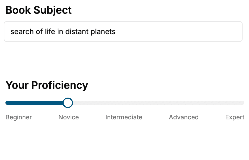
Select the focus of your Boston Travel Guide book and share your background
- 2. Personalize your book
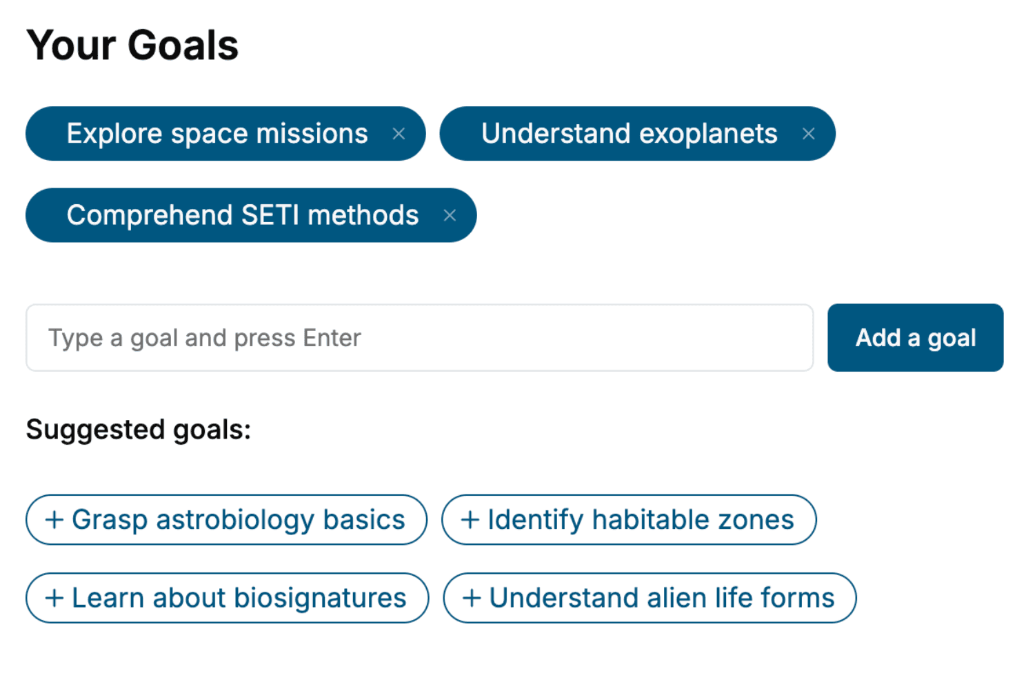
Specify your goals and choose sub-topics to include
- 3. Get your tailored book
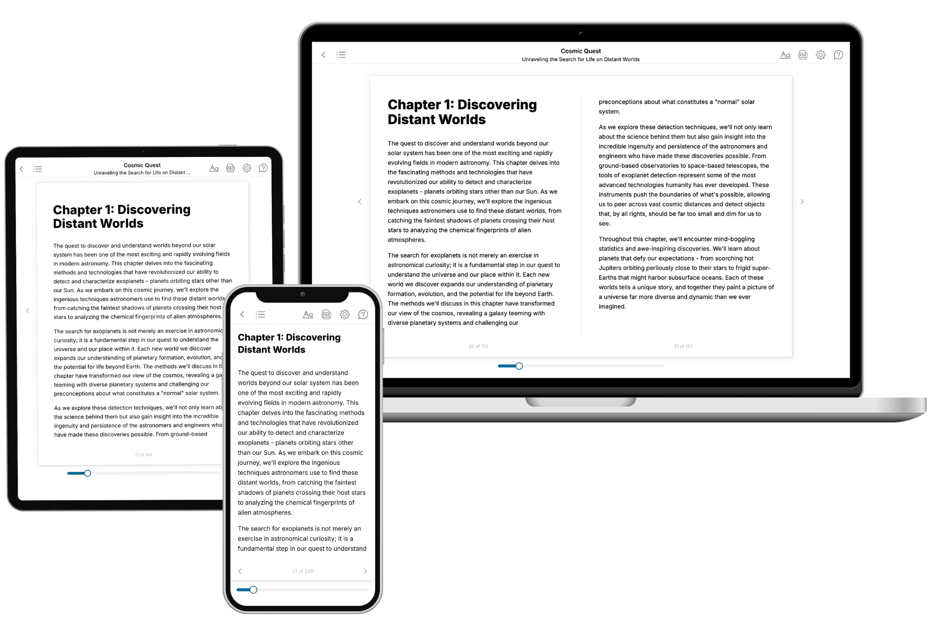
Your book is ready in 10 minutes. Read it online, download as EPUB or PDF, or send to Kindle.
Frequently asked questions
- What is TailoredRead?
TailoredRead creates complete, full-length nonfiction ebooks, written specifically for you. Tell us what you want to learn and why, and TailoredRead writes you a complete ebook on it, with charts, tables, and diagrams throughout. Read it online, on Kindle, or on any e-reader, or download it as a PDF or EPUB. Every book is written fresh the day you order it.
- How is the book tailored to me?
Before anything is written, you answer a few short questions about your goals, your background, and the topics you care about. Your book is then planned around your answers: written at your level, focused on your goals, and covering the topics you chose, instead of the one-size-fits-all book a store sells everyone.
- Will it read like generic AI content?
No. Your book isn't a chat transcript: it's planned chapter by chapter before a single word is written, told in a clear book voice, and explains ideas visually with charts, tables, and diagrams. After writing, every book goes through an editorial pass that polishes chapters so the book reads consistent from start to finish. Judge for yourself: browse thousands of sample books on our Explore Books page.
- How accurate is the content?
Our AI first checks whether your subject needs live research. Niche and fast-moving subjects are researched before writing, and the book plan and chapters are grounded in what it finds. After writing, every book goes through a quality pass that checks its facts and consistency, and researched books list their sources in a Notes section at the back.
- How long is the book?
You choose the length: Comprehensive (250-300 pages), Detailed (150-200 pages), Essential (70-100 pages), or Short (30-50 pages).
- Does the book include visuals?
Yes. Every book includes charts, tables, and diagrams: timelines, checklists, step-by-step guides, decision trees, comparison tables, matrices, and bar charts. A typical book includes dozens of these visual elements.
- Can I read it on Kindle? What formats can I download?
Yes. Every book can be read in our online reader or downloaded as a PDF or EPUB. The EPUB can be opened with Kindle, Apple Books, Kobo, and any e-reader. The Commercial and Author licenses also include an editable Word (DOCX) and Markdown download.
- How much does it cost?
About the price of a regular ebook. The exact price depends on your book's length and complexity, from $2 for the shortest books to $35 for the most comprehensive, and it's shown when you review your book, before you commit to anything. Each book is a one-time purchase, yours to keep, no subscription. Licenses that let you share, teach, or publish your book range from $35.99 to $49.99.
- Can I preview the book before purchasing?
Before you pay, you'll see what your book will cover: the title, a detailed description, the estimated length, and the complete chapter-by-chapter table of contents, so you know what you're getting before you decide. The full text itself is written after you purchase.
- How long does it take to create a book?
About 10 minutes. You can start reading the opening chapters while the rest is still being written.