Building Resilient Landscapes
How Smart Land Use and Ecological Design Reduce Disaster Risk
Discover how the places where we live, work, and build are either protecting us or putting us at risk.
191 pages9 chaptersMar 2, 2026Environmental Engineering
About this book
Your community's resilience to floods, landslides, wildfires, and droughts depends largely on decisions about land use and ecological health—choices that are often made without considering disaster risk. This book reveals the direct connections between how land is developed, how ecosystems function, and how vulnerable your region becomes to natural hazards. You'll learn why wetlands are nature's flood barriers, how forest management prevents catastrophic fires, and why building on steep slopes or in floodplains guarantees future disaster. More importantly, you'll discover practical strategies for redesigning landscapes to work with nature rather than against it. Whether you're a planner, property owner, or concerned citizen, this guide shows you how ecological restoration and thoughtful land use create communities that thrive even when disasters strike.
Table of contents
- IntroductionWhy Land Use Decisions Shape Disaster Risk, The Hidden Connections Between Ecology and Hazards, What You'll Learn in This BookRead below
- Chapter 1: Understanding Disaster Risk in the LandscapeDefining Disaster Risk: Hazard, Exposure, and Vulnerability, The Role of Land Use in Creating Vulnerability, Understanding Your Region's Ecological Baseline
- Chapter 2: Natural Hazards and Landscape CharacteristicsFlood Dynamics: How Terrain and Vegetation Control Water, Slope Stability and Landslide Risk, Wildfire Ecology and Landscape Flammability, Drought, Water Cycles, and Ecosystem Resilience
- Chapter 3: Wetlands, Riparian Zones, and Flood ProtectionHow Wetlands Absorb and Store Floodwaters, Riparian Buffers: Nature's Flood Barriers, Restoring Wetlands for Disaster Risk Reduction
- Chapter 4: Forest Management and Fire Risk ReductionForest Structure and Fire Behavior, Fuel Management and Thinning Strategies, Prescribed Burning and Ecological Recovery
- Chapter 5: Soil Health and Landscape StabilitySoil Structure and Water Infiltration, How Vegetation Stabilizes Slopes, Soil Degradation and Increased Hazard Exposure
- Chapter 6: Green Infrastructure and Urban ResilienceGreen Infrastructure: Definition and Benefits, Rain Gardens, Bioswales, and Permeable Surfaces, Urban Forests and Heat Mitigation
- Chapter 7: Land Use Planning and Zoning for ResilienceHazard Mapping and Risk-Based Zoning, Identifying Development Constraints and Sensitive Areas, Crafting Land Use Policies That Reduce Risk
- Chapter 8: Ecosystem Restoration as Risk ReductionPrinciples of Ecological Restoration, Case Studies: Restoration Projects That Reduced Disasters, Measuring Restoration Success and Long-Term Outcomes
- Chapter 9: Integrating Disaster Risk Reduction into DevelopmentConducting Ecological and Hazard Site Assessments, Design Principles for Resilient Development, Engaging Communities in Resilient Planning
- ConclusionMoving Forward: Your Role in Building Resilient Landscapes
- Further Reading and Resources
Introduction
Every community that has ever been devastated by a flood, wildfire, or landslide shares something in common: the disaster did not begin on the day it struck. It began years, sometimes decades, earlier, in the decisions made about where to build, what to clear, and what to leave alone. A neighborhood constructed on a filled wetland, a subdivision carved into a fire-prone hillside, a city that paved over its natural drainage corridors — these are not just planning choices. They are slow-motion commitments to future catastrophe, written into the landscape long before any storm cloud forms or any spark ignites.
This book is about those decisions. More specifically, it is about understanding why they matter, how they shape disaster risk, and what can be done differently. The relationship between land use and natural hazards is one of the most consequential and least understood dynamics in modern community planning. When a river floods a town, the news coverage focuses on rainfall totals and emergency response. Rarely does it examine how upstream development altered the watershed, how floodplain drainage was eliminated, or how impervious surfaces accelerated runoff. The ecological story behind the disaster almost never makes the headline, yet it is almost always the most important part of the story.
The good news is that the same logic works in reverse. Landscapes that retain their ecological integrity — their wetlands, forests, healthy soils, and vegetated slopes — absorb hazards in ways that no engineered structure can fully replicate. Communities that align their development patterns with natural systems experience fewer disasters, recover faster when events do occur, and spend far less on emergency response and reconstruction. This is not a theoretical argument. It is a pattern documented across hundreds of case studies, from restored coastal wetlands that blunted hurricane storm surges to reforested watersheds that dramatically reduced downstream flooding. Nature, when given the chance to function, is extraordinarily good at protecting the people who live within it.
This book is written for professionals and informed citizens who want to move beyond general awareness and into practical understanding. Whether you work in land use planning, environmental management, civil engineering, public policy, or community advocacy, the chapters ahead will give you a grounded, evidence-based framework for connecting ecological science with disaster risk reduction. You do not need to be an ecologist or a hydrologist to benefit from this material. You do need to be willing to look at landscapes differently — not just as real estate or resources, but as systems that either protect communities or expose them to harm, depending on how they are managed.
Why Land Use Decisions Shape Disaster Risk
The connection between land use and disaster risk is not abstract. It is physical, measurable, and direct. When land is developed, its surface changes. Vegetation is removed, soils are compacted or sealed, drainage patterns are altered, and the natural processes that once managed water, heat, and erosion are disrupted. Each of these changes shifts the balance between a landscape's capacity to absorb hazards and its tendency to amplify them. Over time, as development accumulates across a region, these individual changes compound into systemic vulnerability.
Consider what happens to rainfall in a heavily urbanized watershed compared to a forested one. In a healthy forest, roughly 50 percent of rainfall is intercepted by vegetation, absorbed into the soil, or taken up by plant roots. Runoff is slow, filtered, and spread across the landscape. In a fully paved urban area, that same rainfall becomes runoff almost immediately. Studies have shown that urban watersheds can generate five to six times more runoff than forested watersheds receiving identical rainfall.[1] That difference does not disappear. It moves downstream, faster and in greater volume, overwhelming drainage systems and flooding communities that may be miles from where the rain fell.
Floodplain development tells a similar story. Floodplains exist because rivers need room to spread during high-flow events. They are not accidents of geography. They are functional features of river systems, shaped over thousands of years to store and slowly release excess water. When communities build in floodplains, they eliminate that storage capacity and place people and property directly in the path of the water the river needs to move. The Federal Emergency Management Agency (FEMA) estimates that flood damage in the United States costs an average of $8 billion per year, and a significant portion of that cost is directly attributable to development in areas that were once natural floodplain.[2]
Wildfire risk follows the same logic. Fire has always been part of many landscapes, particularly in the western United States, Mediterranean climates, and parts of Australia. What has changed is the interface between development and fire-prone ecosystems. As housing expands into shrublands, chaparral, and dry forests, the number of people and structures exposed to fire increases dramatically. At the same time, decades of fire suppression have allowed fuel loads to accumulate far beyond historical norms, creating conditions for fires that burn hotter, faster, and more destructively than the ecosystems evolved to handle. Land use decisions created both sides of this problem: more exposure and more fuel.
Landslide risk is perhaps the most direct example of land use shaping disaster outcomes. Slopes that are vegetated, with intact root systems and healthy soil structure, resist mass movement even during heavy rainfall. Remove that vegetation through logging, grading, or wildfire, and the same slope becomes unstable. Add a road cut or a building pad that redirects water into the hillside, and the risk multiplies further. Many of the deadliest landslides in recent history have occurred on slopes that were destabilized by prior land use changes, not by rainfall events that were unusually extreme.
The 2018 Montecito debris flow in California, which killed 23 people and destroyed over 100 homes, occurred on slopes that had been stripped of vegetation by the Thomas Fire just weeks earlier. The rainfall that triggered the debris flow was not exceptional. The landscape's capacity to hold together had been eliminated by the fire, which itself had been intensified by decades of fuel accumulation and drought-stressed vegetation. The disaster was not a single event. It was the final step in a chain of land use and ecological decisions stretching back years.
Understanding this chain of causation is the first step toward breaking it. Land use decisions made today will determine disaster vulnerability for the next 30 to 50 years, because that is how long buildings, roads, and drainage systems last. The choices being made right now in planning offices, zoning boards, and development approvals are writing the disaster history of the future. Recognizing that reality is not cause for despair. It is cause for urgency and for better decision-making.
The practical implication is straightforward: disaster risk reduction must begin with land use planning, not end with emergency response. Investing in hazard-aware zoning, ecological buffers, and green infrastructure before disasters occur is consistently more cost-effective than rebuilding after them. Research by the National Institute of Building Sciences found that every dollar invested in pre-disaster mitigation saves an average of six dollars in post-disaster recovery costs.[3] The math is clear. The challenge is political will and public understanding, both of which this book aims to support.
What You'll Learn in This Book
This book is organized to build understanding progressively, starting with foundational concepts and moving toward practical application. Each chapter addresses a specific dimension of the relationship between land use, ecological function, and disaster risk. Together, they form a comprehensive framework for thinking about landscape resilience, one that you can apply whether you are evaluating a development proposal, designing a restoration project, or advocating for better land use policy in your community.
The first two chapters establish the conceptual foundation. Chapter 1 introduces the core framework of disaster risk, explaining how hazard, exposure, and vulnerability combine to determine outcomes, and how land use decisions influence each of these factors. Chapter 2 examines the four major natural hazard types covered in this book — floods, landslides, wildfires, and droughts — and explains how landscape characteristics determine their severity and extent. These chapters give you the vocabulary and the analytical lens you will need for everything that follows.
Chapters 3 through 5 focus on specific ecological systems and their roles in hazard mitigation:
- Chapter 3 covers wetlands and riparian zones, explaining how these systems store floodwaters, filter pollutants, and stabilize streambanks, and what happens when they are drained or degraded.
- Chapter 4 examines forest management and fire risk, including how forest structure influences fire behavior, what fuel management strategies are most effective, and how prescribed burning can restore ecological balance.
- Chapter 5 explores soil health and landscape stability, covering the critical role of soil structure and vegetation root systems in preventing erosion, slope failure, and flood amplification.
Chapters 6 through 9 shift from ecological science to planning and design practice. Chapter 6 introduces green infrastructure, the suite of nature-based tools — rain gardens, bioswales, urban forests, permeable pavements — that can be integrated into developed landscapes to restore some of the ecological functions that development removed. Chapter 7 addresses land use planning and zoning, explaining how hazard mapping, development constraints, and policy design can prevent future risk from being built into the landscape. Chapter 8 examines ecosystem restoration as a disaster risk reduction strategy, with case studies from around the world that demonstrate measurable outcomes. Chapter 9 brings everything together with guidance on integrating ecological and hazard assessment into the development process, from site evaluation through community engagement.
Throughout the book, you will find concrete examples drawn from real projects and real disasters. These are not hypothetical scenarios. They are documented cases that illustrate both the costs of ignoring ecological principles and the benefits of applying them. Some of the examples are well-known, like the role of coastal wetlands in buffering Hurricane Katrina's storm surge, or the contribution of deforestation to catastrophic flooding in Bangladesh. Others are less familiar but equally instructive, like the small-scale riparian restoration projects in the American West that have measurably reduced downstream flood peaks, or the urban bioswale networks in Portland, Oregon, that have cut combined sewer overflows by more than 90 percent.[6]
You will also find practical frameworks and tools throughout the book. These include:
- Step-by-step approaches to ecological and hazard site assessment
- Criteria for evaluating the disaster risk implications of land use proposals
- Frameworks for prioritizing restoration investments based on risk reduction potential
- Guidance on reading and interpreting hazard maps and floodplain data
- Principles for designing development that works with natural drainage and slope systems
- Strategies for engaging communities and decision-makers in resilience planning
One thing this book does not do is pretend that ecological approaches to disaster risk reduction are simple or without trade-offs. Restoring wetlands requires land, and land has competing uses. Restricting development in hazard zones affects property values and housing supply. Prescribed burning is controversial in communities that associate fire with destruction rather than ecological health. These tensions are real, and they are addressed honestly throughout the book. The goal is not to offer easy answers, but to give you the knowledge to navigate these trade-offs with a clear understanding of what is at stake ecologically, economically, and socially.
It is also worth being clear about what this book assumes. It assumes that you have a working familiarity with environmental issues and some exposure to land use planning concepts, but it does not assume specialized technical training. Ecological and hydrological concepts are explained from the ground up, with enough depth to be genuinely useful without requiring a graduate degree to follow. Where technical terms are introduced, they are defined clearly and used consistently. The aim throughout is clarity and practical utility, not comprehensiveness for its own sake.
Finally, this book is written with a conviction that the knowledge it contains matters urgently. Climate change is intensifying natural hazards across the globe. Extreme rainfall events are becoming more frequent and more severe. Wildfire seasons are lengthening. Droughts are deepening. Coastal flooding is accelerating. In this context, the decisions communities make about land use and ecological management are not just important. They are among the most consequential decisions of our time. Getting them right requires exactly the kind of integrated, ecologically grounded thinking that this book is designed to support. The landscapes we build and restore today will determine how well our communities survive the hazards of tomorrow.
Notes
Introduction
- 1. M. J. Paul and J. L. Meyer, "Streams in the Urban Landscape," Annual Review of Ecology and Systematics, 2001
- 2. FEMA, Flood Insurance Claims and Losses, Federal Emergency Management Agency, Washington, D.C, 2020
- 3. National Institute of Building Sciences, Natural Hazard Mitigation Saves: 2019 Report, Washington, D.C, 2019
- 4. R. Costanza and others, Changes in the global value of ecosystem services, Global Environmental Change, 2014
- 5. F. Danielsen and others, "The Asian Tsunami," Science, 2005
- 6. City of Portland Bureau of Environmental Services, Green Infrastructure: Accomplishments and Outcomes, Portland, OR, 2019
This is the end of the free sample. The full book has 9 chapters.
Want this book written for you?
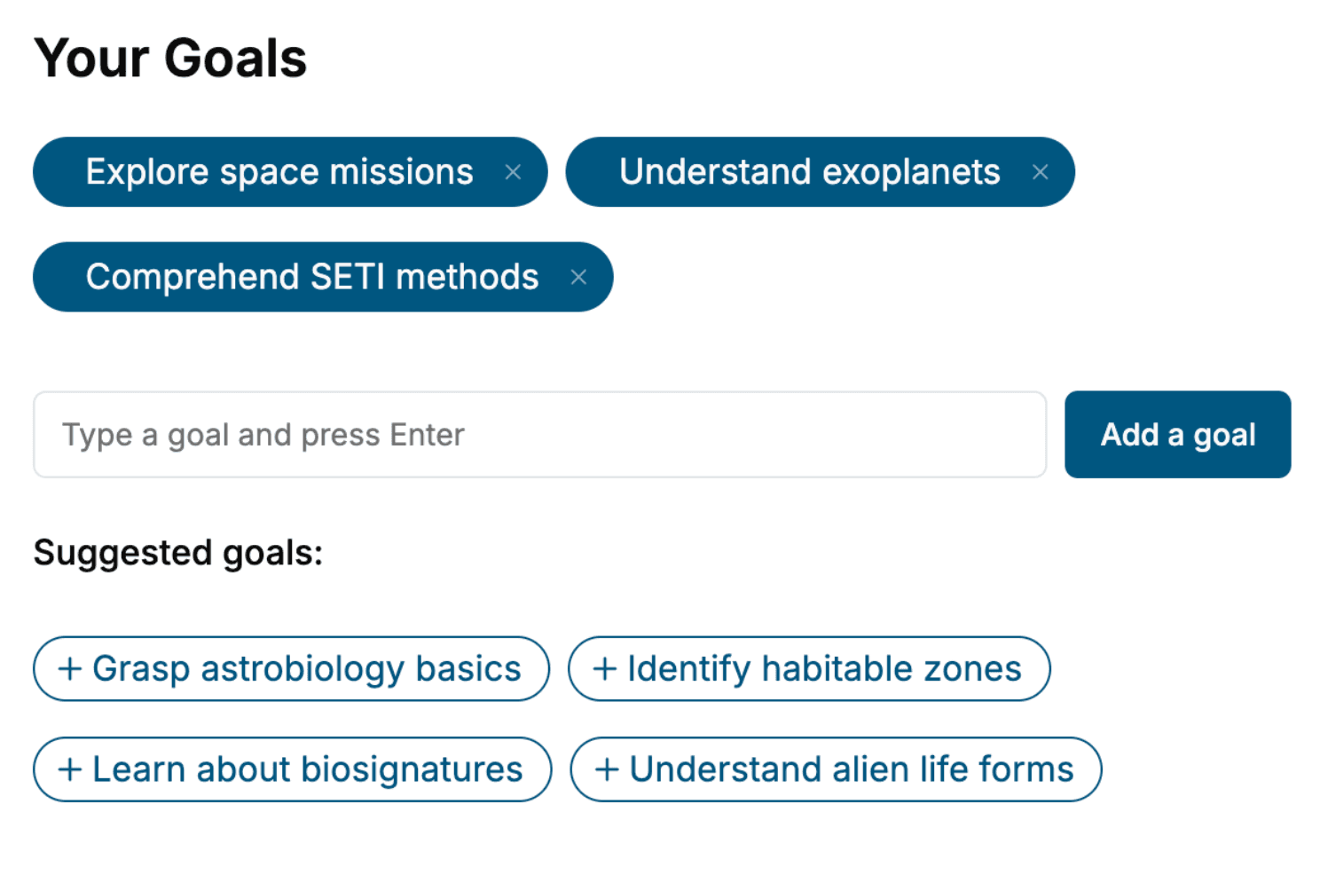
Tell us your goals and background, and get your own version of this book, tailored by AI to you.


Benefits of AI-tailored books
- Read one book, not ten:
- all the Environmental Engineering knowledge you need, gathered into a single book.
- Save days of learning:
- tell us your goals, choose your topics, and the whole book is built around them.
- Learn effortlessly:
- Environmental Engineering book written for your specific background and expertise.
- Understand at a glance:
- includes charts, tables, timelines, checklists, decision trees, and more.
- Stay current:
- written the day you order it, not years ago.
- Trust what you read:
- every book is checked for accuracy, with real research when your subject needs it.
Create your unique book in 3 steps
- 1. Select your focus
Select the focus of your Environmental Engineering book and share your background
- 2. Personalize your book
Specify your goals and choose sub-topics to include
- 3. Get your tailored book
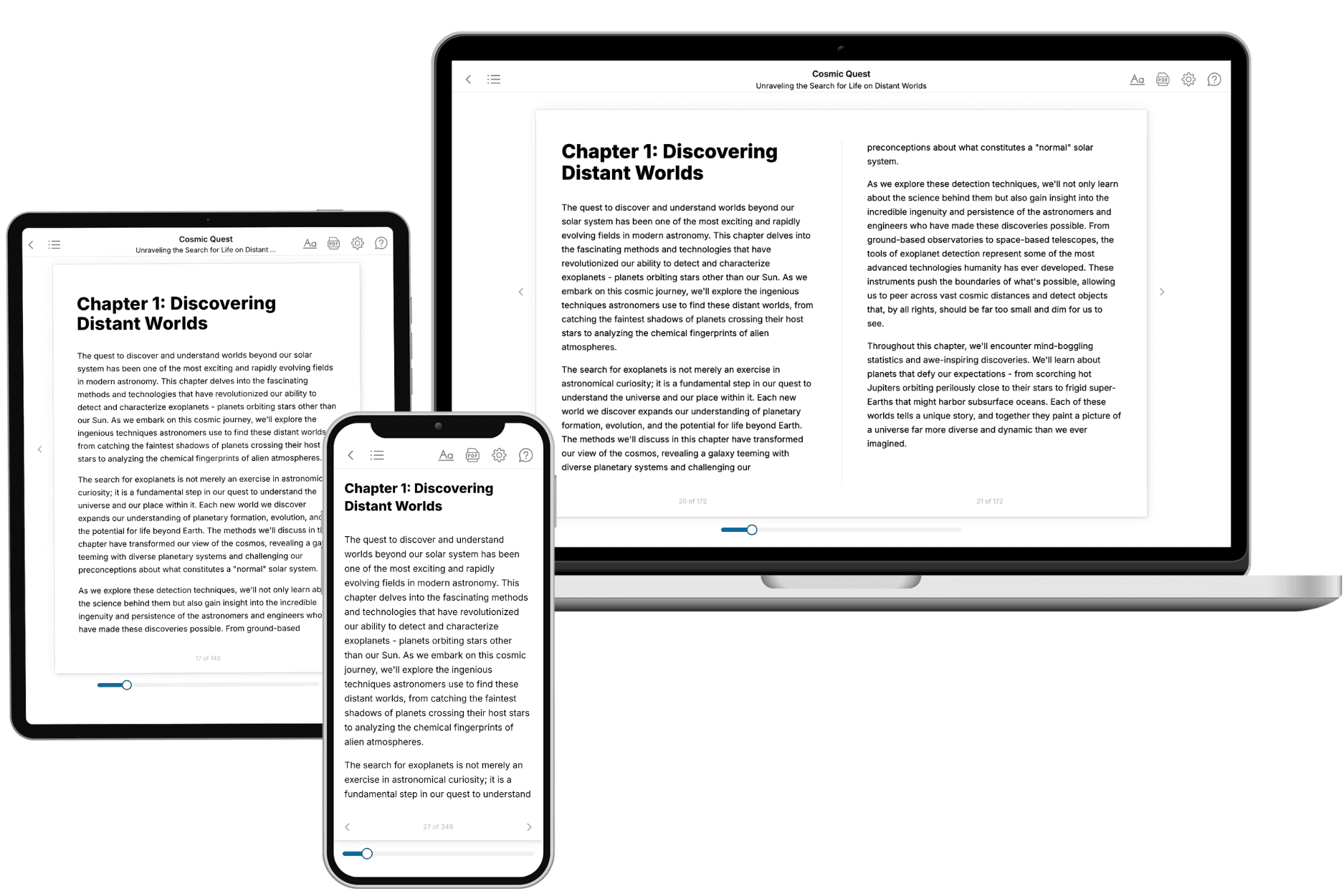
Your book is ready in 10 minutes. Read it online, download as EPUB or PDF, or send to Kindle.

Frequently asked questions
- What is TailoredRead?
TailoredRead creates complete, full-length nonfiction ebooks, written specifically for you. Tell us what you want to learn and why, and TailoredRead writes you a complete ebook on it, with charts, tables, and diagrams throughout. Read it online, on Kindle, or on any e-reader, or download it as a PDF or EPUB. Every book is written fresh the day you order it.
- How is the book tailored to me?
Before anything is written, you answer a few short questions about your goals, your background, and the topics you care about. Your book is then planned around your answers: written at your level, focused on your goals, and covering the topics you chose, instead of the one-size-fits-all book a store sells everyone.
- Will it read like generic AI content?
No. Your book isn't a chat transcript: it's planned chapter by chapter before a single word is written, told in a clear book voice, and explains ideas visually with charts, tables, and diagrams. After writing, every book goes through an editorial pass that polishes chapters so the book reads consistent from start to finish. Judge for yourself: browse thousands of sample books on our Explore Books page.
- How accurate is the content?
Our AI first checks whether your subject needs live research. Niche and fast-moving subjects are researched before writing, and the book plan and chapters are grounded in what it finds. After writing, every book goes through a quality pass that checks its facts and consistency, and researched books list their sources in a Notes section at the back.
- How long is the book?
You choose the length: Comprehensive (250-300 pages), Detailed (150-200 pages), Essential (70-100 pages), or Short (30-50 pages).
- Does the book include visuals?
Yes. Every book includes charts, tables, and diagrams: timelines, checklists, step-by-step guides, decision trees, comparison tables, matrices, and bar charts. A typical book includes dozens of these visual elements.
- Can I read it on Kindle? What formats can I download?
Yes. Every book can be read in our online reader or downloaded as a PDF or EPUB. The EPUB can be opened with Kindle, Apple Books, Kobo, and any e-reader. The Commercial and Author licenses also include an editable Word (DOCX) and Markdown download.
- How much does it cost?
About the price of a regular ebook. The exact price depends on your book's length and complexity, from $2 for the shortest books to $35 for the most comprehensive, and it's shown when you review your book, before you commit to anything. Each book is a one-time purchase, yours to keep, no subscription. Licenses that let you share, teach, or publish your book range from $35.99 to $49.99.
- Can I preview the book before purchasing?
Before you pay, you'll see what your book will cover: the title, a detailed description, the estimated length, and the complete chapter-by-chapter table of contents, so you know what you're getting before you decide. The full text itself is written after you purchase.
- How long does it take to create a book?
About 10 minutes. You can start reading the opening chapters while the rest is still being written.