Cities by Design
How Land Use Shapes Livable, Sustainable Urban Communities
Discover how the decisions made about land use shape the cities where we live, work, and thrive.
191 pages9 chaptersJan 9, 2026Urban Planning
About this book
This book reveals the direct connection between urban planning choices and the livability, sustainability, and ecological health of our communities. You'll learn how zoning regulations, development patterns, and design principles either enable or undermine walkable neighborhoods, environmental resilience, and equitable access to opportunity. Through real-world examples and practical frameworks, you'll understand why some cities feel vibrant and connected while others sprawl and fragment. Whether you're a professional in planning, real estate, or environmental fields, or simply someone who wants to understand the forces shaping your city, this book provides the knowledge to recognize good planning when you see it—and advocate for better decisions in your community.
Table of contents
- IntroductionWhy Land Use Matters More Than You Think, The Planning Challenge We Face Today, What You'll Learn in This BookRead below
- Chapter 1: The Fundamentals of Urban Land UseDefining Land Use and Its Categories, How Cities Grow: Patterns and Processes, A Brief History of Urban Land Use Planning
- Chapter 2: Zoning: The Rules That Shape CitiesUnderstanding Zoning Codes and Regulations, The Rise and Consequences of Single-Use Zoning, Modern Zoning Reforms and Mixed-Use Development
- Chapter 3: Walkability and Neighborhood DesignWhat Makes Neighborhoods Walkable, Street Design and Public Space, The Benefits of Mixed-Use Development
- Chapter 4: Transportation and Land Use IntegrationTransit-Oriented Development: Concentrating Growth, Reducing Car Dependency Through Smart Planning, Building Multimodal Transportation Networks
- Chapter 5: Ecology and Green Infrastructure in CitiesUnderstanding Urban Ecosystems, Green Infrastructure: Parks, Trees, and Water Systems, Creating Ecological Corridors and Habitat Networks
- Chapter 6: Density, Housing, and EquityThe Benefits and Challenges of Urban Density, Creating Diverse Housing Options, Ensuring Equitable Access and Preventing Displacement
- Chapter 7: Brownfields, Infill, and Adaptive ReuseReclaiming Brownfields and Contaminated Sites, Infill Development and Reducing Sprawl, Adaptive Reuse: Giving New Life to Existing Buildings
- Chapter 8: Environmental Challenges and SolutionsUrban Heat Islands and Climate Resilience, Stormwater Management and Water Quality, Air Quality and Reducing Urban Emissions
- Chapter 9: Planning Tools and Implementation StrategiesComprehensive Plans and Strategic Visioning, Community Engagement and Participatory Planning, Financing and Incentive Mechanisms
- ConclusionIntegrating Principles for Better Cities, Your Role in Shaping Urban Futures
- Glossary
Introduction
Every day, you navigate a landscape shaped by decisions made decades ago—decisions about where buildings can stand, how wide streets should be, whether shops can exist near homes, and where parks and green spaces fit into the urban fabric. These choices, often invisible to the casual observer, determine whether you can walk to the grocery store or must drive, whether your neighborhood stays cool during heat waves or bakes under concrete and asphalt, and whether your city feels vibrant and connected or fragmented and isolating. Land use planning is the discipline that governs these decisions, and its impact on your daily life, your community's health, and the planet's ecological future cannot be overstated. Yet most people remain unaware of how profoundly these planning choices shape their experiences, opportunities, and quality of life.
Cities are humanity's greatest invention and our most complex challenge. More than half the world's population now lives in urban areas, and that proportion continues to grow. By 2050, nearly seven billion people will call cities home[1]. How we design and manage these urban spaces will determine whether we can address climate change, preserve biodiversity, provide equitable access to opportunity, and create communities where people genuinely want to live. The patterns we establish today—whether we build compact, walkable neighborhoods or sprawling subdivisions, whether we protect green corridors or pave them over, whether we integrate housing with transit or separate them—will shape urban life for generations. Understanding land use planning is no longer just for professionals in the field; it's essential knowledge for anyone who cares about the future of their community and the planet.
This book bridges the gap between technical planning knowledge and practical understanding. You don't need a degree in urban planning to grasp why some cities work better than others, or to recognize when land use decisions serve the community well versus when they create problems. What you need is a clear framework for understanding the principles that underlie successful urban design, the tools that planners use to implement those principles, and the real-world consequences of different approaches. Whether you work in real estate, environmental management, local government, or community advocacy—or simply want to be a more informed citizen—this knowledge will help you see your city with new eyes and participate more effectively in shaping its future. The goal is not to make you a professional planner, but to give you the literacy to understand, evaluate, and advocate for better land use decisions in your community.
Why Land Use Matters More Than You Think
Land use planning operates as the invisible architecture of urban life, determining the spatial relationships between where people live, work, shop, and recreate. When a city designates certain areas exclusively for single-family homes, other areas solely for commercial use, and still others for industrial purposes, it creates a pattern that requires residents to travel significant distances for basic daily needs. This separation, known as single-use zoning, became the dominant planning paradigm in North American cities during the twentieth century. The consequences ripple through every aspect of urban life: increased car dependency, longer commute times, higher transportation costs, greater greenhouse gas emissions, reduced physical activity, and diminished social interaction. Conversely, when land use planning allows for mixed-use development—where residential, commercial, and sometimes light industrial uses coexist in proximity—it creates neighborhoods where people can walk to meet many of their daily needs, reducing environmental impact while improving quality of life.
The environmental implications of land use decisions extend far beyond transportation emissions. Consider how cities manage stormwater: in sprawling developments with large impervious surfaces—parking lots, wide roads, rooftops spread across vast areas—rainwater cannot infiltrate the ground naturally. Instead, it rushes across pavement, picking up pollutants, overwhelming drainage systems, and degrading water quality in streams and rivers. A study of urbanization patterns found that watersheds with more than ten percent impervious surface coverage show measurable degradation in stream health[2]. Compact development patterns, by contrast, concentrate impervious surfaces in smaller areas, leaving more land available for natural infiltration and reducing the total paved area per capita. The choice between sprawl and compact development is fundamentally a land use decision, governed by zoning codes, subdivision regulations, and comprehensive plans.
Land use patterns also determine the urban heat island effect, where cities become significantly warmer than surrounding rural areas. This phenomenon results directly from land use choices: replacing vegetation with heat-absorbing materials like asphalt and concrete, creating vast parking lots that radiate stored heat, and designing street networks that minimize shade. During heat waves, these temperature differences can mean the difference between discomfort and dangerous health conditions, particularly for vulnerable populations. Cities that integrate green infrastructure—street trees, parks, green roofs, and preserved natural areas—into their land use plans can reduce local temperatures by several degrees. Portland, Oregon, for example, has documented temperature differences of up to twelve degrees Fahrenheit between tree-lined streets and those without canopy cover. These aren't merely aesthetic choices; they're land use decisions with measurable impacts on public health, energy consumption, and climate resilience.
Economic vitality also flows from land use patterns. Walkable, mixed-use neighborhoods consistently command higher property values and generate more tax revenue per acre than sprawling, single-use developments. A study by the Urban Land Institute found that walkable urban places in the thirty largest U.S. metropolitan areas significantly outperformed their regions in GDP growth and job creation[3]. This economic performance stems directly from land use efficiency: when more people and businesses occupy less land, infrastructure costs per capita decrease, services become more efficient to deliver, and the concentration of activity creates vibrant commercial districts. Meanwhile, sprawling development patterns require cities to build and maintain extensive infrastructure—roads, water lines, sewer systems, emergency services—across large areas serving relatively few taxpayers, creating long-term fiscal challenges that many municipalities now struggle to address.
Social equity and access to opportunity are profoundly shaped by land use decisions. When affordable housing is systematically excluded from neighborhoods with good schools, parks, and job access through zoning that requires large lot sizes or prohibits multifamily buildings, it creates spatial segregation by income. When transit-oriented development concentrates housing near public transportation, it provides car-free access to employment for people who cannot afford vehicles. When industrial uses are concentrated in low-income neighborhoods while parks and amenities cluster in wealthy areas, it creates environmental injustice. These patterns don't emerge naturally; they result from specific land use policies and zoning decisions. Understanding this connection is essential for anyone concerned about creating more equitable cities. The spatial distribution of opportunity—which neighborhoods have access to fresh food, quality schools, green space, and employment—is fundamentally a land use question.
Public health outcomes correlate strongly with land use patterns. Neighborhoods designed around walking and cycling promote physical activity, reducing rates of obesity, diabetes, and cardiovascular disease. Access to parks and green spaces improves mental health and provides opportunities for recreation. Air quality improves when land use patterns reduce vehicle miles traveled. Conversely, car-dependent sprawl contributes to sedentary lifestyles, traffic injuries, and exposure to air pollution. The American Journal of Public Health published research showing that people living in walkable neighborhoods engage in substantially more physical activity than those in car-dependent areas[4]. These health impacts represent real costs—in medical expenses, lost productivity, and diminished quality of life—that stem directly from how we plan and zone our cities. Land use planning is, in this sense, a public health intervention with consequences as significant as many medical treatments.
Ecological health within and around cities depends critically on land use decisions. When development fragments natural habitats, it isolates wildlife populations and disrupts ecological processes. When cities preserve and connect green corridors, they maintain biodiversity and ecosystem services even in urban environments. The choice between developing on greenfield sites at the urban edge versus redeveloping underutilized land within existing urban areas determines how much natural habitat is converted to human use. Urban forests, wetlands, and stream corridors provide essential ecosystem services—air and water purification, temperature regulation, flood control, and habitat—but only if land use planning protects and integrates them into the urban fabric. Cities like Singapore have demonstrated that dense urban development and rich biodiversity can coexist when land use planning deliberately incorporates ecological considerations. The alternative—treating nature as something that exists only outside cities—leads to ecological degradation both within urban areas and in the surrounding regions that absorb urban sprawl.
The Planning Challenge We Face Today
Contemporary cities face a complex set of interconnected challenges that land use planning must address simultaneously. Climate change demands that we reduce greenhouse gas emissions dramatically while also adapting to impacts already underway—more intense heat waves, changing precipitation patterns, and increased flooding. Housing affordability has reached crisis levels in many cities, with working families priced out of neighborhoods near employment centers. Infrastructure built decades ago requires replacement or major upgrades, but public budgets are constrained. Social inequality manifests spatially, with opportunity concentrated in some neighborhoods while others face disinvestment. Meanwhile, populations continue to grow, and people increasingly prefer urban living, creating pressure for development. These challenges are not separate issues requiring separate solutions; they are interconnected problems that demand integrated approaches rooted in thoughtful land use planning.
The legacy of twentieth-century planning decisions constrains our options today. Most North American cities are built around the assumption of universal car ownership, with zoning codes that mandate parking, separate uses, and low densities that make transit and walking impractical. Changing these patterns requires overcoming both physical infrastructure and regulatory frameworks designed for a different era. Suburban municipalities built extensive infrastructure to serve sprawling development, and now face the fiscal reality of maintaining that infrastructure with insufficient tax base. Inner-city neighborhoods were often divided by highways or subjected to disinvestment, creating patterns of segregation and inequality that persist today. Brownfield sites—former industrial properties with contamination—sit vacant because cleanup costs and regulatory complexity make redevelopment challenging. These inherited conditions don't make better planning impossible, but they do make it more complex and politically challenging than planning on a blank slate.
Political and economic forces often work against sustainable land use planning. Property owners and developers may resist zoning changes that would allow more density or mixed uses, fearing impacts on property values or neighborhood character. Existing residents sometimes oppose new housing, particularly affordable housing, through exclusionary zoning advocacy. Transportation agencies prioritize vehicle throughput over pedestrian safety or urban design quality. Utility companies design infrastructure for sprawling service areas rather than compact development. Financial institutions may be reluctant to fund innovative development types that don't fit conventional models. These forces aren't necessarily malicious; they often reflect legitimate concerns or institutional inertia. However, they create resistance to land use changes that would benefit the broader community and environment. Effective planning requires navigating these political and economic realities while maintaining focus on long-term community goals.
The fragmentation of planning authority complicates regional challenges. Metropolitan areas typically contain dozens or hundreds of separate municipalities, each with its own zoning authority and planning decisions. A city might invest in transit and walkable development while neighboring suburbs continue sprawling patterns, undermining regional sustainability goals. Wealthy suburbs may use large-lot zoning to exclude affordable housing, concentrating poverty in central cities or inner-ring suburbs. Environmental features like watersheds, wildlife corridors, and airsheds don't respect municipal boundaries, but planning decisions are made jurisdiction by jurisdiction. Some regions have developed metropolitan planning organizations or regional growth management systems to address these coordination challenges, but many have not. The result is often a patchwork of incompatible land use patterns that create regional problems no single municipality can solve alone.
Information and expertise gaps present another challenge. Many local planning departments are understaffed and lack resources for sophisticated analysis. Elected officials who make final decisions on land use matters may have limited understanding of planning principles or long-term consequences. Community members want to participate in planning decisions but may lack access to technical information or frameworks for evaluating options. The complexity of modern planning—integrating transportation, environment, housing, economic development, and social equity—requires multidisciplinary expertise that small municipalities may not have in-house. Meanwhile, the pace of urban change has accelerated, with new technologies, demographic shifts, and climate impacts creating conditions that historical precedents don't fully address. Planning in this context requires both deep expertise and effective ways to make that expertise accessible to decision-makers and the public.
Despite these challenges, opportunities for transformative change exist. Growing recognition of climate urgency is creating political will for sustainable development patterns. Demographic shifts, particularly among younger generations, are driving demand for walkable, transit-oriented neighborhoods. Technology enables new approaches to community engagement and data-driven planning. Successful examples from leading cities demonstrate that better land use patterns are achievable and popular. Federal and state policies increasingly support sustainable development through funding priorities and regulatory frameworks. The convergence of environmental, economic, and social imperatives is creating unusual coalitions supporting planning reform. The challenge is to translate this momentum into concrete changes in zoning codes, development patterns, and infrastructure investments—changes that will shape cities for decades to come.
The window for action is narrowing. Infrastructure investments made today will structure urban form for fifty years or more. Land converted to sprawling development now will be difficult and expensive to retrofit later. Climate impacts are accelerating, requiring both mitigation and adaptation measures. Housing affordability crises are displacing long-term residents and changing community character. The decisions made in the next decade will largely determine whether cities become more sustainable and livable or continue patterns that exacerbate environmental and social problems. This urgency doesn't mean rushing into poorly considered changes, but it does mean that maintaining the status quo is itself a consequential choice. Understanding land use planning principles and their implications is essential for anyone who wants to contribute to better outcomes during this critical period.
What You'll Learn in This Book
This book provides a comprehensive framework for understanding how land use planning shapes cities and how better planning can create more sustainable, livable, and equitable communities. You'll begin with fundamentals: what land use planning is, how cities grow, and how the discipline evolved to its current state. This foundation is essential because many contemporary planning challenges stem from historical decisions and paradigms that still influence current practice. Understanding the origins of single-use zoning, for example, helps explain why it persists despite its limitations. Grasping the basic categories of land use and how they interact provides the vocabulary for analyzing any urban environment. These fundamentals might seem basic, but they're the building blocks for everything that follows, and many people engaged in planning debates lack this foundational knowledge.
You'll explore zoning in depth—the regulatory tool that most directly shapes urban form. Zoning codes determine what can be built where, and understanding how they work is essential for anyone who wants to influence development patterns. You'll learn how to read and interpret zoning regulations, understand their intended and unintended consequences, and recognize when they serve community goals versus when they create problems. The book examines both traditional single-use zoning and modern alternatives like form-based codes and mixed-use zoning. You'll see specific examples of how zoning reform has transformed neighborhoods and cities, along with the political and technical challenges involved in changing these regulations. This knowledge is practical: after reading these chapters, you'll be able to look up your own city's zoning code and understand what it means for your neighborhood's future.
The book dedicates substantial attention to walkability and neighborhood design—the physical characteristics that make some places pleasant and practical for pedestrians while others feel hostile or dangerous. You'll learn the specific design elements that contribute to walkability:
- Street width and design that balances multiple users
- Building placement and orientation that creates active streetscapes
- Block size and connectivity that provides route choices
- Mix of uses that puts destinations within walking distance
- Public space design that invites lingering and social interaction
- Traffic calming measures that prioritize pedestrian safety
Transportation and land use integration receives thorough treatment because the relationship between urban form and mobility is fundamental to sustainability. You'll understand transit-oriented development (TOD)—what it is, why it matters, and how it's implemented successfully. The book explains how land use patterns either support or undermine public transit viability, and why transit investments alone cannot create sustainable mobility without complementary land use changes. You'll learn about complete streets, multimodal networks, and the specific planning strategies that reduce car dependency. Real-world case studies illustrate both successes and failures, showing what works in different contexts. This section provides the knowledge to evaluate whether development proposals genuinely support sustainable transportation or merely pay lip service to these goals while perpetuating car dependency.
Ecology and green infrastructure are integrated throughout the book, but receive focused attention in dedicated chapters. You'll learn how urban ecosystems function, what ecosystem services they provide, and how land use planning can protect and enhance these natural systems within cities. The book covers green infrastructure comprehensively:
- Urban forests and street tree programs
- Parks and open space networks
- Green stormwater infrastructure
- Ecological corridors and habitat connectivity
- Green roofs and walls
- Urban agriculture and food systems
Housing, density, and equity are examined together because they're inseparable in practice. The book explains why density is essential for sustainability but also why density alone doesn't guarantee good outcomes. You'll learn about different housing types—from single-family homes to mid-rise apartments—and how zoning regulations either enable or prohibit this diversity. The relationship between housing supply, affordability, and displacement receives careful attention, along with strategies for creating inclusive development that doesn't displace existing residents. You'll understand concepts like inclusionary zoning, community land trusts, and social housing, along with their strengths and limitations. This section provides frameworks for thinking about housing that go beyond simplistic supply-and-demand models or preservation-at-all-costs approaches, recognizing the legitimate tensions between different community goals.
The book covers adaptive reuse, infill development, and brownfield remediation as essential strategies for sustainable urban growth. Rather than continuously expanding at the urban edge, cities can accommodate growth by using land more efficiently within existing urban areas. You'll learn how former industrial buildings become vibrant mixed-use spaces, how contaminated sites are cleaned and redeveloped, and how vacant or underutilized parcels can be transformed. These strategies are more sustainable than greenfield development—they reduce sprawl, leverage existing infrastructure, and often create more interesting places than new construction on blank sites. The book provides specific examples of successful projects along with the regulatory, financial, and technical tools that make them possible. You'll understand both the opportunities and the challenges involved in these approaches.
Environmental challenges receive systematic treatment, with chapters examining urban heat islands, stormwater management, and air quality. For each challenge, you'll learn how land use patterns contribute to the problem and what planning strategies can mitigate it. The book emphasizes practical solutions that have been implemented successfully in real cities, not just theoretical possibilities. You'll see how tree canopy programs reduce heat, how green infrastructure manages stormwater, and how land use changes reduce emissions. These chapters connect environmental science to planning practice, showing how technical understanding translates into policy and design decisions. The goal is to give you the knowledge to recognize when development proposals will exacerbate environmental problems versus when they'll contribute to solutions.
Finally, the book examines planning tools and implementation strategies—how communities actually make land use changes happen. You'll learn about comprehensive plans, the documents that guide long-term development. You'll understand community engagement processes and how to participate effectively. You'll explore financing mechanisms, from tax increment financing to green bonds, that fund infrastructure and development. This practical focus on implementation distinguishes the book from purely theoretical treatments. Understanding principles is important, but knowing how to apply them in real political and economic contexts is what enables actual change. The book provides frameworks for evaluating planning processes in your own community and identifying opportunities for improvement.
Throughout the book, you'll encounter specific examples from cities around the world. These aren't just illustrations; they're evidence that better planning is achievable and that the principles discussed actually work in practice. You'll see how Portland, Oregon, created an urban growth boundary that concentrated development and preserved farmland. How Copenhagen integrated cycling infrastructure with land use planning to make bikes the dominant mode of transportation. How Singapore maintained biodiversity while becoming one of the world's densest cities. How Medellín, Colombia, used transit and public space investments to transform informal settlements. These examples come from different contexts—different climates, cultures, political systems, and economic conditions—but they demonstrate common principles that apply broadly. The goal is to inspire possibility while providing concrete evidence of what works.
By the end of this book, you'll have a comprehensive understanding of how land use planning shapes cities and how better planning creates more sustainable, livable, and equitable communities. You'll be able to analyze development proposals and planning policies with informed judgment. You'll understand the trade-offs and tensions inherent in planning decisions and have frameworks for thinking about how to balance competing goals. You'll know what questions to ask and what evidence to look for when evaluating whether planning serves community interests. Most importantly, you'll have the knowledge to participate effectively in planning processes in your own community—whether as a professional, an advocate, or an engaged citizen. The future of cities depends on the land use decisions we make today, and those decisions should be informed by the best available knowledge about what creates successful urban places.
Notes
Introduction
- 1. United Nations, Department of Economic and Social Affairs, Population Division, World Urbanization Prospects: The 2018 Revision, 2018
- 2. C. L. Arnold and C. J. Gibbons, "Impervious Surface Coverage," Journal of the American Planning Association, 1996
- 3. C. B. Leinberger and P. Lynch, Foot Traffic Ahead: Ranking Walkable Urbanism in America's Largest Metros, The George Washington University School of Business, 2014
- 4. J. F. Sallis and others, "Neighborhood Built Environment and Income," Social Science & Medicine, 2009
This is the end of the free sample. The full book has 9 chapters.
Want this book written for you?
Tell us your goals and background, and get your own version of this book, tailored by AI to you.


Benefits of AI-tailored books
- Read one book, not ten:
- all the Urban Planning knowledge you need, gathered into a single book.
- Save days of learning:
- tell us your goals, choose your topics, and the whole book is built around them.
- Learn effortlessly:
- Urban Planning book written for your specific background and expertise.
- Understand at a glance:
- includes charts, tables, timelines, checklists, decision trees, and more.
- Stay current:
- written the day you order it, not years ago.
- Trust what you read:
- every book is checked for accuracy, with real research when your subject needs it.
Create your unique book in 3 steps
- 1. Select your focus
Select the focus of your Urban Planning book and share your background
- 2. Personalize your book
Specify your goals and choose sub-topics to include
- 3. Get your tailored book
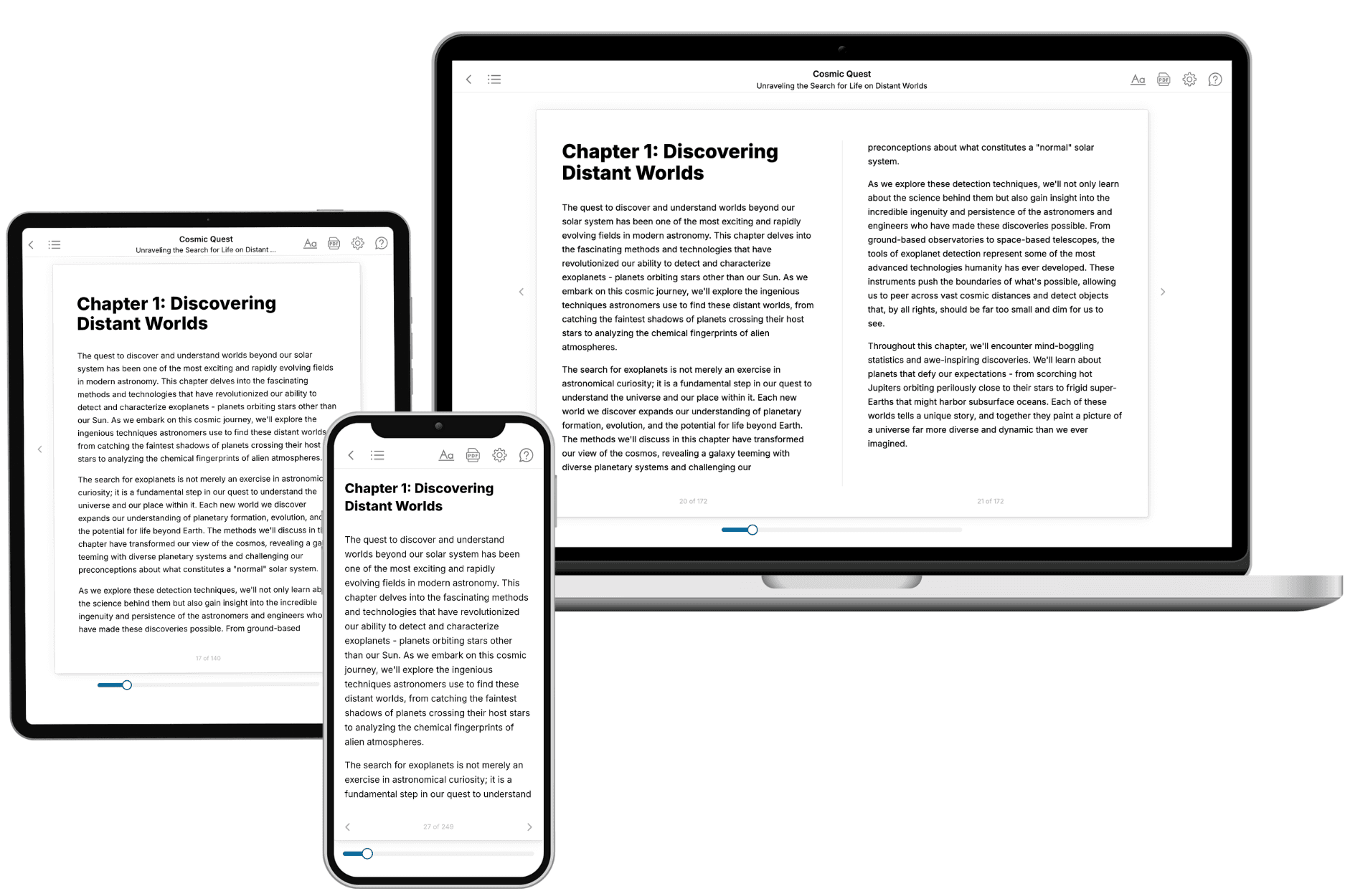
Your book is ready in 10 minutes. Read it online, download as EPUB or PDF, or send to Kindle.

Frequently asked questions
- What is TailoredRead?
TailoredRead creates complete, full-length nonfiction ebooks, written specifically for you. Tell us what you want to learn and why, and TailoredRead writes you a complete ebook on it, with charts, tables, and diagrams throughout. Read it online, on Kindle, or on any e-reader, or download it as a PDF or EPUB. Every book is written fresh the day you order it.
- How is the book tailored to me?
Before anything is written, you answer a few short questions about your goals, your background, and the topics you care about. Your book is then planned around your answers: written at your level, focused on your goals, and covering the topics you chose, instead of the one-size-fits-all book a store sells everyone.
- Will it read like generic AI content?
No. Your book isn't a chat transcript: it's planned chapter by chapter before a single word is written, told in a clear book voice, and explains ideas visually with charts, tables, and diagrams. After writing, every book goes through an editorial pass that polishes chapters so the book reads consistent from start to finish. Judge for yourself: browse thousands of sample books on our Explore Books page.
- How accurate is the content?
Our AI first checks whether your subject needs live research. Niche and fast-moving subjects are researched before writing, and the book plan and chapters are grounded in what it finds. After writing, every book goes through a quality pass that checks its facts and consistency, and researched books list their sources in a Notes section at the back.
- How long is the book?
You choose the length: Comprehensive (250-300 pages), Detailed (150-200 pages), Essential (70-100 pages), or Short (30-50 pages).
- Does the book include visuals?
Yes. Every book includes charts, tables, and diagrams: timelines, checklists, step-by-step guides, decision trees, comparison tables, matrices, and bar charts. A typical book includes dozens of these visual elements.
- Can I read it on Kindle? What formats can I download?
Yes. Every book can be read in our online reader or downloaded as a PDF or EPUB. The EPUB can be opened with Kindle, Apple Books, Kobo, and any e-reader. The Commercial and Author licenses also include an editable Word (DOCX) and Markdown download.
- How much does it cost?
About the price of a regular ebook. The exact price depends on your book's length and complexity, from $2 for the shortest books to $35 for the most comprehensive, and it's shown when you review your book, before you commit to anything. Each book is a one-time purchase, yours to keep, no subscription. Licenses that let you share, teach, or publish your book range from $35.99 to $49.99.
- Can I preview the book before purchasing?
Before you pay, you'll see what your book will cover: the title, a detailed description, the estimated length, and the complete chapter-by-chapter table of contents, so you know what you're getting before you decide. The full text itself is written after you purchase.
- How long does it take to create a book?
About 10 minutes. You can start reading the opening chapters while the rest is still being written.