Covered Bridges of Vermont
A Complete Guide to History, Architecture, and Scenic Drives
What makes Vermont's covered bridges more than just picturesque photo opportunities?
176 pages8 chaptersJul 17, 2026Architecture History
About this book
These 104 wooden structures represent centuries of engineering innovation, community history, and architectural artistry that shaped rural New England. This guide takes you beyond the postcard images to reveal the fascinating stories, technical mastery, and cultural significance behind Vermont's most iconic landmarks. Whether you're planning a weekend bridge-hunting adventure, seeking to understand 19th-century construction techniques, or simply curious about the communities that built and maintained these structures, you'll discover practical travel routes, detailed bridge histories, architectural insights, and insider tips for experiencing them authentically. From the engineering principles that keep these bridges standing to the local legends surrounding them, this comprehensive guide transforms your Vermont travels into a deeper exploration of American heritage and craftsmanship.
Table of contents
- IntroductionWhy Covered Bridges Matter, Vermont's Bridge Legacy, How to Use This GuideRead below
- Chapter 1: The History of Vermont's Covered BridgesEarly Construction Era (1820s-1850s), The Golden Age of Bridge Building, Preservation and Modern Challenges
- Chapter 2: Understanding Bridge ArchitectureTruss Types and Design Principles, Materials and Construction Methods, Engineering Innovations and Longevity
- Chapter 3: Regional Bridge ClustersConnecticut River Valley Bridges, Central Vermont Bridges, Northern and Western Vermont Bridges
- Chapter 4: Iconic Bridges and Their StoriesThe Most Photographed Bridges, Bridges of Historic Significance, Local Legends and Bridge Lore
- Chapter 5: Planning Your Bridge-Hunting AdventureBest Times to Visit, Accessibility and Logistics, What to Bring and How to Prepare
- Chapter 6: Scenic Driving RoutesThe Fall Foliage Bridge Route, Weekend Getaway Itineraries, The Comprehensive Vermont Bridge Tour
- Chapter 7: Photography and DocumentationPhotography Tips and Techniques, Best Angles and Lighting Conditions, Documenting Architectural Details
- Chapter 8: Bridge Preservation and ConservationModern Restoration Efforts, Threats and Conservation Challenges, How You Can Support Preservation
- ConclusionThe Lasting Legacy of Vermont's Bridges
- AppendixComplete Bridge Directory with Coordinates, Additional Resources and Organizations
Introduction
Vermont has 104 covered bridges still standing. That number alone sets the state apart from nearly every other place in North America. These structures range from modest single-span crossings tucked into quiet farm hollows to longer, more elaborate bridges that once carried entire communities across swollen rivers. Some have been standing for well over 150 years. A few have been rebuilt after floods or fires, yet they still carry the same design logic and timber-framing traditions as their predecessors. Together, they form one of the most concentrated collections of historic wooden bridges anywhere in the world.
What draws people to these bridges goes beyond nostalgia or scenic photography, though both are perfectly good reasons to visit. Covered bridges are physical records of how rural communities solved real engineering problems with the materials and knowledge available to them. The wooden trusses inside each bridge represent specific structural systems, each with a name, a history, and a logic that still holds up under scrutiny. The fact that so many of these bridges remain functional, or at least structurally sound, is not an accident. It reflects both the quality of their original construction and the sustained effort of communities that chose to maintain them rather than replace them.
This guide exists to help you get more out of every bridge you visit. Whether you are planning a dedicated bridge-hunting road trip across the state, working a few bridges into a broader Vermont vacation, or simply curious about what makes these structures worth caring about, the pages ahead give you the context, the logistics, and the specific details to make each stop meaningful. The goal is not just to hand you a list of locations. It is to give you the knowledge to stand in front of a covered bridge and actually understand what you are looking at, why it was built the way it was, and what it took to keep it standing.
Vermont's covered bridges are spread across the state in patterns that reflect the geography of settlement, the routes of old trade roads, and the locations of rivers that needed crossing. Some clusters are dense enough that you can visit five or six bridges in a single afternoon. Others require a longer drive through remote countryside, which turns out to be part of the reward. The bridges do not exist in isolation. They are embedded in landscapes, communities, and histories that give them meaning beyond their timber and planks.
Why Covered Bridges Matter
The most common question people ask about covered bridges is also the most practical one: why were they covered in the first place? The answer is straightforward but often misunderstood. The covering was not decorative, and it had nothing to do with protecting travelers from rain or snow. The roof and siding were built to protect the structural timbers underneath. An exposed wooden truss, subjected to repeated cycles of wet and dry weather, would rot and weaken within a decade or two. A covered bridge, with its timbers shielded from direct precipitation, could last a century or more. The covering was, in essence, a long-term investment in the bridge's structural life.
That engineering logic has a direct consequence for why so many Vermont covered bridges are still standing today. Bridges built in the mid-1800s using sound timber-framing techniques and kept reasonably well maintained have outlasted countless steel and concrete structures built in the twentieth century. The irony is that the technology that looked old-fashioned was, in many respects, more durable than what replaced it. This is not a romantic exaggeration. It is a measurable outcome visible in the landscape of Vermont, where bridges from the 1840s and 1850s still carry vehicle traffic on rural roads.
Beyond their engineering logic, covered bridges matter because they are community artifacts. Each bridge was built by specific people, often local craftsmen working with timber harvested from nearby forests, to serve a specific crossing that mattered to the farms and villages around it. The bridges were not mass-produced infrastructure. They were custom solutions to local problems, and they carry the fingerprints of the communities that built them. Understanding that context transforms a visit from a photo stop into something closer to a conversation with the past.
The cultural weight of covered bridges in Vermont is also tied to what they represent about the state's relationship with its own history. Vermont has made deliberate choices to preserve these structures rather than replace them with modern alternatives. That preservation movement reflects values about heritage, craftsmanship, and the importance of maintaining a visible connection to earlier ways of life. Those choices have not always been easy or cheap, and the ongoing work of restoration funding and conservation advocacy is a real and continuing story, not a settled one.
Covered bridges also function as anchors for local identity. Towns like Woodstock, Montgomery, and Tunbridge are known in part because of the bridges within or near their borders. The bridges appear on town seals, in local festivals, and in the marketing materials of regional tourism boards. That visibility is not accidental. Communities have recognized that these structures draw visitors, generate economic activity, and give residents a shared point of pride. The bridges are simultaneously historic artifacts and living parts of the local economy.
For the traveler, all of this means that visiting a covered bridge well requires a bit of preparation. Knowing the truss type inside a bridge, the approximate date of its construction, and the name of the river it crosses does not take long to learn, but it changes the experience significantly. The difference between glancing at a bridge from a car window and spending twenty minutes walking through it, examining its joinery, and understanding its structural system is the difference between seeing Vermont and actually engaging with it.
A covered bridge is not just a crossing. It is a record of how a community understood engineering, valued craftsmanship, and chose to invest in its own future. Every timber joint and wooden peg tells part of that story.
The bridges also matter in a more immediate, sensory way that no amount of historical context can fully replace. Walking through a covered bridge is a distinct physical experience. The light changes as you enter, filtering through gaps in the siding in long, angled shafts. The sound of the river below comes up through the deck planks. The smell of old timber is specific and unmistakable. These sensory qualities are part of why people return to covered bridges again and again, and why photographs, however good, never quite capture the full experience of being inside one.
Vermont's Bridge Legacy
Vermont's position as the state with the highest concentration of surviving covered bridges in the United States is not a coincidence. It reflects a combination of geography, settlement patterns, economic history, and deliberate preservation choices that came together in a way that did not happen quite the same way anywhere else. Understanding that combination helps explain not just why so many bridges exist, but why they are distributed the way they are across the state's varied terrain.
The rivers of Vermont created the need for covered bridges in the first place. The state's landscape is defined by river valleys, and those valleys were the corridors along which settlement moved and trade flowed. The Connecticut River Valley along the eastern border, the Winooski and Lamoille river systems in the north and center, and the numerous smaller streams and tributaries throughout the state all required crossings. In the nineteenth century, a reliable bridge was not a convenience. It was an economic necessity for farms, mills, and villages that depended on moving goods and people across water.
The timber resources available in Vermont during the peak bridge-building era were also a significant factor. The state's forests provided the white pine, hemlock, and hardwoods that builders needed, and local sawmills could process those materials close to the construction site. This combination of need and available materials created conditions in which covered bridge construction became a well-developed local craft. Builders like Nicholas Powers and others developed reputations across multiple counties, and their techniques were passed down and refined over generations.
Vermont's relative economic isolation in the late nineteenth and early twentieth centuries, which might seem like a disadvantage, actually contributed to the survival of its covered bridges. In wealthier or more rapidly industrializing regions, old wooden bridges were replaced with steel and concrete as soon as budgets allowed. In Vermont, where rural towns often lacked the funds for wholesale infrastructure replacement, existing bridges were maintained and repaired rather than demolished. What looked like poverty-driven inertia turned out to be inadvertent preservation.
The formal preservation movement that emerged in the mid-twentieth century built on that foundation. As awareness of the bridges' historical and cultural value grew, state and local governments began making more deliberate decisions to protect them. The Vermont Division for Historic Preservation and various local historical societies developed frameworks for documenting, assessing, and funding the restoration of covered bridges. That institutional support has been critical to keeping the number of surviving bridges as high as it is today.
Tropical Storm Irene in 2011 tested that preservation infrastructure severely. The storm caused catastrophic flooding across Vermont, and several covered bridges were damaged or destroyed. The response to Irene demonstrated both the vulnerability of these structures to extreme weather events and the depth of community commitment to rebuilding them. Bridges that were swept from their foundations were reconstructed using traditional timber-framing methods, often with significant volunteer involvement and public fundraising. The story of Irene and its aftermath is one of the most important chapters in the recent history of Vermont's covered bridges, and it is covered in detail in the section on restoration efforts and conservation threats.
Today, Vermont's 104 covered bridges are distributed across the state in a pattern that rewards systematic exploration. The densest concentrations are in Lamoille County, Windsor County, and Orange County, but bridges appear in nearly every corner of the state. Some are on well-traveled roads and easy to find. Others require navigating unpaved back roads and knowing exactly where to look. The regional bridge clusters described later in this guide provide a framework for understanding that distribution and planning visits that make geographic sense.
The legacy of Vermont's covered bridges is also a living one. These are not museum pieces behind glass. Many still carry vehicle traffic, and even those that have been bypassed by modern roads remain accessible to pedestrians and cyclists. The bridges continue to be used, photographed, studied, and argued over by the communities that surround them. That ongoing engagement is what keeps them relevant and ensures that the work of preservation remains a public priority rather than a niche historical interest.
Vermont's covered bridges survived not because they were forgotten, but because enough people in enough communities kept deciding, generation after generation, that they were worth keeping.
The bridges also connect Vermont to a broader American story about the relationship between landscape, technology, and community. The covered bridge era was a specific moment in the development of rural infrastructure, and Vermont's collection preserves that moment in a way that is accessible, tangible, and geographically coherent. Visiting these bridges is one of the most direct ways to engage with nineteenth-century American engineering and community life outside of a museum setting.
How to Use This Guide
This guide is organized to serve different kinds of readers with different goals. Some people will read it cover to cover before a trip. Others will jump directly to the regional bridge cluster that matches their planned route, or to the scenic driving routes section to find a ready-made itinerary. Both approaches work, and the guide is structured to support either one. The sections build on each other, but each is also designed to stand on its own as a practical reference.
The early sections on history and architecture are worth reading even if your primary interest is logistics and photography. Understanding the chronological story of how and why Vermont's covered bridges were built gives you a framework for interpreting what you see in the field. Knowing the difference between a Town lattice truss and a Burr arch truss, for example, changes how you look at the interior of a bridge. Those structural systems are not just technical details. They are clues to when a bridge was built, who built it, and what engineering problems the builder was trying to solve. The architecture section explains all of this in plain language with specific examples.
The regional bridge clusters section organizes Vermont's bridges by geography, which is the most practical way to plan visits. The three main clusters covered are the Connecticut River Valley bridges, the Central Vermont bridges, and the Northern and Western Vermont bridges. Each cluster has its own character, its own concentration of notable structures, and its own logistical considerations. The section describes what makes each cluster distinct and highlights the bridges within each that are most worth prioritizing.
For readers who want to go deeper on specific bridges, the section on iconic bridges and their stories provides detailed histories of the most significant individual structures. This includes the most photographed bridges, those with particular historic significance, and those associated with local legends and folklore. Emily's Bridge in Stowe, for example, has a story that goes well beyond its structural history, and that story is part of what makes a visit to it different from a visit to a more straightforward historic crossing.
The practical planning sections cover everything you need to know before you leave home. The best times to visit addresses seasonal considerations in detail, including the specific challenges of mud season in spring and the particular rewards of fall foliage bridge routes in October. The accessibility and logistics section covers road conditions, parking, and what to expect at bridges that are off the main tourist circuit. The gear and preparation section gives you a specific, practical checklist rather than generic advice.
Here is a quick overview of how the guide's sections connect to different visitor goals:
- First-time visitors planning a weekend trip: Start with the weekend getaway itineraries, then read the best times to visit and what to bring sections before you go.
- Architecture and history enthusiasts: Read the history and architecture sections first, then use the regional bridge clusters and iconic bridges sections to plan visits around specific structural types or historical periods.
- Photographers: The photography tips, best angles and lighting, and architectural detail documentation sections are your primary references, but the regional clusters section will help you identify which bridges offer the most visually distinctive opportunities.
- Conservation-minded visitors: The bridge preservation and conservation section explains the current state of restoration efforts, the threats these structures face, and specific ways you can contribute to their survival.
- Comprehensive explorers: The comprehensive Vermont bridge tour itinerary and the complete bridge directory in the appendix give you the tools to plan a multi-day trip that covers as much of the state's collection as possible.
A few practical notes about how to use the bridge information throughout this guide. GPS coordinates for every bridge in Vermont's collection are included in the appendix directory. These are more reliable than street addresses for bridges on rural roads, where address numbering can be inconsistent or absent. When planning a route, cross-reference the coordinates with a mapping application before you leave, and download offline maps for the areas you plan to visit. Cell service is unreliable in many of the rural areas where the most interesting bridges are located.
The guide also uses a consistent set of terms for bridge types and structural systems. The canonical terms used throughout are the ones most commonly used by preservation professionals and architectural historians. When a bridge is described as using a Town lattice truss, a Burr arch truss, or a Queenpost truss, those terms refer to specific, well-defined structural systems that are explained in detail in the architecture section. If you encounter one of those terms before reaching that section, a brief definition is provided in context so you are not left guessing.
Seasonal timing matters more for covered bridge visits than for many other kinds of travel in Vermont. The guide addresses this in detail, but the short version is that late September through mid-October offers the most dramatic visual conditions, with fall foliage providing a backdrop that makes even ordinary bridges look extraordinary. Summer offers the easiest access and the most reliable road conditions. Winter visits are possible and can be strikingly beautiful, but require more preparation and flexibility. Mud season, roughly mid-March through late April, is the one period when some rural roads become genuinely impassable, and planning around it is strongly recommended.
Finally, the guide encourages a pace of exploration that allows for genuine engagement with each bridge rather than a rapid checklist approach. Visiting twenty bridges in a single day is technically possible in some parts of the state, but it tends to produce a blur of similar impressions rather than a set of distinct, memorable experiences. A more rewarding approach is to visit fewer bridges per day, spend real time at each one, and use the surrounding landscape and communities as part of the experience. The bridges are most meaningful when they are understood in context, and context takes a little time to absorb.
The appendix at the back of the guide includes a complete bridge directory with GPS coordinates, a summary of each bridge's truss type and approximate construction date, and a list of additional resources including preservation organizations, historical societies, and recommended reading for those who want to go further. Those resources are the starting point for anyone who finishes this guide and finds themselves wanting to know more, which, based on the depth of the subject, is a very reasonable outcome.
This is the end of the free sample. The full book has 8 chapters.
Want this book written for you?
Tell us your goals and background, and get your own version of this book, tailored by AI to you.


Benefits of AI-tailored books
- Read one book, not ten:
- all the Architecture History knowledge you need, gathered into a single book.
- Save days of learning:
- tell us your goals, choose your topics, and the whole book is built around them.
- Learn effortlessly:
- Architecture History book written for your specific background and expertise.
- Understand at a glance:
- includes charts, tables, timelines, checklists, decision trees, and more.
- Stay current:
- written the day you order it, not years ago.
- Trust what you read:
- every book is checked for accuracy, with real research when your subject needs it.
Create your unique book in 3 steps
- 1. Select your focus
Select the focus of your Architecture History book and share your background
- 2. Personalize your book
Specify your goals and choose sub-topics to include
- 3. Get your tailored book
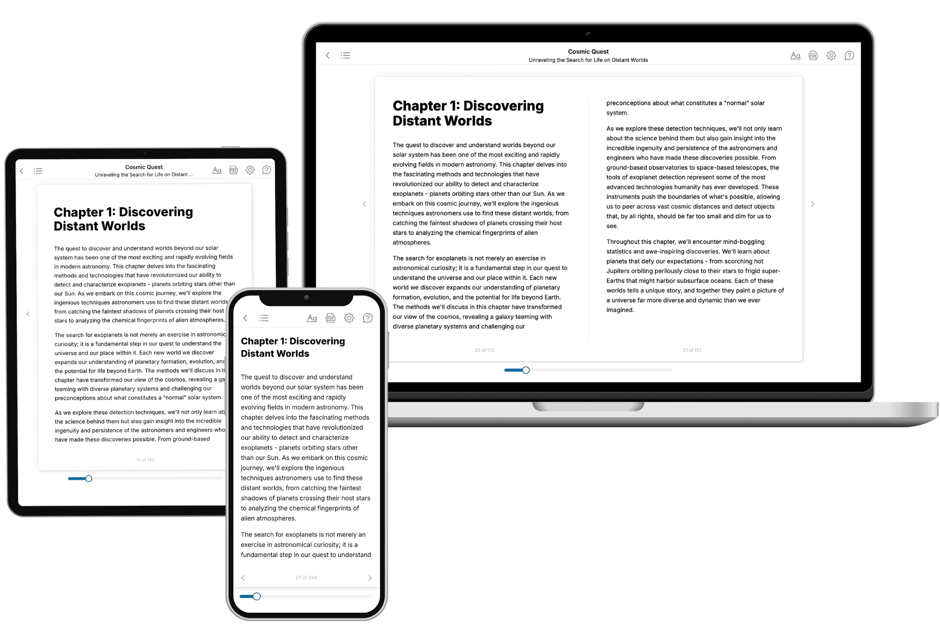
Your book is ready in 10 minutes. Read it online, download as EPUB or PDF, or send to Kindle.

Frequently asked questions
- What is TailoredRead?
TailoredRead creates complete, full-length nonfiction ebooks, written specifically for you. Tell us what you want to learn and why, and TailoredRead writes you a complete ebook on it, with charts, tables, and diagrams throughout. Read it online, on Kindle, or on any e-reader, or download it as a PDF or EPUB. Every book is written fresh the day you order it.
- How is the book tailored to me?
Before anything is written, you answer a few short questions about your goals, your background, and the topics you care about. Your book is then planned around your answers: written at your level, focused on your goals, and covering the topics you chose, instead of the one-size-fits-all book a store sells everyone.
- Will it read like generic AI content?
No. Your book isn't a chat transcript: it's planned chapter by chapter before a single word is written, told in a clear book voice, and explains ideas visually with charts, tables, and diagrams. After writing, every book goes through an editorial pass that polishes chapters so the book reads consistent from start to finish. Judge for yourself: browse thousands of sample books on our Explore Books page.
- How accurate is the content?
Our AI first checks whether your subject needs live research. Niche and fast-moving subjects are researched before writing, and the book plan and chapters are grounded in what it finds. After writing, every book goes through a quality pass that checks its facts and consistency, and researched books list their sources in a Notes section at the back.
- How long is the book?
You choose the length: Comprehensive (250-300 pages), Detailed (150-200 pages), Essential (70-100 pages), or Short (30-50 pages).
- Does the book include visuals?
Yes. Every book includes charts, tables, and diagrams: timelines, checklists, step-by-step guides, decision trees, comparison tables, matrices, and bar charts. A typical book includes dozens of these visual elements.
- Can I read it on Kindle? What formats can I download?
Yes. Every book can be read in our online reader or downloaded as a PDF or EPUB. The EPUB can be opened with Kindle, Apple Books, Kobo, and any e-reader. The Commercial and Author licenses also include an editable Word (DOCX) and Markdown download.
- How much does it cost?
About the price of a regular ebook. The exact price depends on your book's length and complexity, from $2 for the shortest books to $35 for the most comprehensive, and it's shown when you review your book, before you commit to anything. Each book is a one-time purchase, yours to keep, no subscription. Licenses that let you share, teach, or publish your book range from $35.99 to $49.99.
- Can I preview the book before purchasing?
Before you pay, you'll see what your book will cover: the title, a detailed description, the estimated length, and the complete chapter-by-chapter table of contents, so you know what you're getting before you decide. The full text itself is written after you purchase.
- How long does it take to create a book?
About 10 minutes. You can start reading the opening chapters while the rest is still being written.