CrewAI Mastery
Advanced Techniques for Designing and Optimizing AI Systems in Geospatial Applications
Dive into the cutting-edge world of AI system design and optimization with CrewAI Mastery.
346 pages18 chaptersJun 16, 2025AI and Machine LearningCreated by José
About this book
This comprehensive guide takes you on a deep exploration of advanced AI techniques, focusing on their application in geospatial contexts. You'll start by building a solid foundation in CrewAI fundamentals, then progressively advance through complex topics such as RAG implementation, LLM optimization, and AI agent design. As you progress, you'll discover how to automate ML workflows, develop custom AI crews, and significantly improve model accuracy. The book seamlessly integrates GIS with CrewAI, opening up new possibilities in AI-powered geospatial development. You'll learn to implement NLP in CrewAI, optimize RAG techniques, and fine-tune LLMs for peak performance. With a focus on practical applications, this book equips you with the skills to create advanced AI systems, enhance data pipelines, and scale AI agent networks. By the end, you'll have mastered the CrewAI architecture and be able to design, implement, and optimize sophisticated AI systems tailored for geospatial challenges. Whether you're looking to revolutionize your approach to AI in geospatial applications or push the boundaries of what's possible with CrewAI, this book is your definitive guide to becoming a CrewAI expert.
Table of contents
- IntroductionOverview of CrewAI and Its Importance, Book Structure and How to Use It, The Intersection of AI and Geospatial Applications, Learning Objectives and OutcomesRead below
- Chapter 1: CrewAI FundamentalsCrewAI Architecture Overview, Core Concepts and Components, Setting Up Your CrewAI Environment, Basic CrewAI Workflow
- Chapter 2: Implementing RAG in CrewAIIntroduction to Retrieval-Augmented Generation (RAG), Integrating RAG with CrewAI, Building and Managing Knowledge Bases, Optimizing RAG for Improved Performance
- Chapter 3: LLM Optimization TechniquesSelecting the Right LLM for Your Task, LLM Fine-tuning Strategies, Advanced Prompt Engineering, Measuring and Improving LLM Performance
- Chapter 4: AI Agent Design PrinciplesAI Agent Architecture, Designing Goal-Oriented Agents, Inter-Agent Communication Protocols, Specialization and Role Assignment in AI Agents
- Chapter 5: Automating ML Workflows with CrewAIIdentifying Automatable ML Workflow Components, Creating Automated ML Pipelines, Implementing Monitoring and Logging Systems, Error Handling and Recovery in Automated Workflows
- Chapter 6: Developing Custom AI CrewsDesigning Crew Composition and Structure, Task Allocation and Management, Implementing Crew Coordination Mechanisms, Evaluating and Optimizing Crew Performance
- Chapter 7: Improving ML Model AccuracyEnhancing Data Quality and Preprocessing, Advanced Feature Engineering Techniques, Implementing Ensemble Methods, Hyperparameter Tuning Strategies
- Chapter 8: Integrating GIS with CrewAIGIS Fundamentals for AI Practitioners, Processing Spatial Data with CrewAI, Geospatial Analysis Techniques in AI, Visualizing GIS Data with CrewAI
- Chapter 9: Implementing NLP in CrewAIText Preprocessing for NLP Tasks, Sentiment Analysis with CrewAI, Named Entity Recognition in Geospatial Contexts, Text Classification for Geospatial Applications
- Chapter 10: Developing AI-Powered GIS ApplicationsLand Use Classification with AI, AI-Assisted Urban Planning and Development, Environmental Monitoring and Analysis, Disaster Response and Management Systems
- Chapter 11: Advanced RAG Technique OptimizationOptimizing Context Window Size, Advanced Retrieval Methods, Query Expansion and Reformulation, Fine-tuning RAG Models for Specific Domains
- Chapter 12: AI Performance TuningImproving Computational Efficiency, Memory Management in Large-Scale AI Systems, Leveraging Distributed Computing, Hardware Acceleration Techniques
- Chapter 13: Advanced Data Preprocessing TechniquesAdvanced Data Cleaning Methods, Feature Scaling and Normalization, Dimensionality Reduction Techniques, Handling Imbalanced Datasets
- Chapter 14: Creating Advanced AI SystemsDesigning Multi-Modal AI Systems, Implementing Transfer Learning, Exploring Meta-Learning Approaches, Implementing Continual Learning in AI Systems
- Chapter 15: Enhancing Data PipelinesOptimizing ETL Processes, Implementing Real-Time Data Processing, Data Validation and Quality Assurance, Monitoring and Debugging Data Pipelines
- Chapter 16: Scaling AI Agent SystemsHorizontal Scaling Strategies, Vertical Scaling Techniques, Load Balancing in AI Agent Networks, Testing and Ensuring System Scalability
- Chapter 17: Building AI Agent NetworksDesigning Agent Network Topologies, Implementing Collaborative Learning, Consensus Mechanisms in Agent Networks, Ensuring Network Resilience and Fault Tolerance
- Chapter 18: Improving AI Decision-MakingAdvanced Decision Tree Algorithms, Implementing Bayesian Networks, Reinforcement Learning for Decision Optimization, Explainable AI for Transparent Decision-Making
- ConclusionFuture Trends in CrewAI and Geospatial AI, Key Takeaways and Best Practices
- Glossary
- Further Reading
Introduction
Welcome to "CrewAI Mastery: Advanced Techniques for Designing and Optimizing AI Systems in Geospatial Applications." This comprehensive guide is designed to take you on a journey through the cutting-edge world of artificial intelligence, with a specific focus on its applications in geospatial contexts. As you embark on this learning adventure, you'll discover how to harness the power of CrewAI to create sophisticated, efficient, and powerful AI systems that can revolutionize the way we approach geospatial challenges.
In an era where data is abundant and complex, particularly in the realm of geospatial information, the need for advanced AI techniques has never been more critical. This book aims to bridge the gap between theoretical AI concepts and their practical application in the geospatial domain. Whether you're a seasoned data scientist looking to expand your skillset or a geomatics professional eager to integrate AI into your workflow, this book will provide you with the knowledge and tools to excel in this rapidly evolving field.
Throughout this book, you'll delve into a wide array of topics, from the fundamental principles of CrewAI to advanced techniques in machine learning optimization, natural language processing, and geospatial analysis. Each chapter is designed to build upon the last, creating a comprehensive learning experience that will transform you from an AI enthusiast into a CrewAI expert capable of tackling complex geospatial challenges.
As we progress through the book, you'll not only learn about the theoretical aspects of AI and geospatial technology but also gain hands-on experience through practical examples, case studies, and real-world applications. This approach ensures that you can immediately apply your newfound knowledge to your own projects and workflows, enhancing your productivity and opening up new possibilities in your field.
So, prepare to embark on an exciting journey into the world of CrewAI and geospatial AI applications. By the time you reach the end of this book, you'll have gained a deep understanding of how to design, implement, and optimize AI systems that can transform the way we interact with and analyze geospatial data. Let's begin this transformative learning experience and unlock the full potential of AI in the geospatial domain.
Overview of CrewAI and Its Importance
CrewAI stands at the forefront of artificial intelligence innovation, representing a paradigm shift in how we approach the design and implementation of AI systems. At its core, CrewAI is a framework that enables the creation of collaborative AI agents working together to solve complex problems. This approach mirrors human team dynamics, where diverse skills and knowledge are combined to achieve goals that would be difficult or impossible for a single individual to accomplish alone.
The importance of CrewAI in the current AI landscape cannot be overstated. As we face increasingly complex challenges, particularly in fields like geospatial analysis that deal with vast amounts of multidimensional data, traditional single-agent AI systems often fall short. CrewAI addresses this limitation by allowing multiple specialized AI agents to work in concert, each bringing its unique capabilities to the table. This collaborative approach leads to more robust, flexible, and efficient AI solutions.
One of the key strengths of CrewAI lies in its ability to handle tasks that require a diverse set of skills and knowledge. In the context of geospatial applications, this might involve agents specialized in image processing, natural language understanding, spatial analysis, and machine learning working together to interpret satellite imagery, analyze geographical data, and generate insights. This multi-agent approach allows for a more nuanced and comprehensive analysis of complex geospatial problems.
Moreover, CrewAI's architecture promotes scalability and adaptability. As new challenges arise or as the scope of a project expands, additional agents with specialized skills can be seamlessly integrated into the existing crew. This flexibility ensures that CrewAI-based systems can evolve and grow to meet changing requirements without the need for a complete overhaul.
Another crucial aspect of CrewAI is its potential to enhance explainability in AI systems. By breaking down complex tasks into smaller, more manageable components handled by different agents, it becomes easier to trace the decision-making process and understand how the system arrived at its conclusions. This transparency is particularly valuable in geospatial applications, where decisions based on AI analysis can have significant real-world impacts.
CrewAI also excels in handling uncertainty and incomplete information, which are common challenges in geospatial data analysis. Different agents can work with various data sources, cross-referencing and validating information to build a more complete picture. This collaborative approach can lead to more accurate and reliable results, even when dealing with noisy or partial data.
Furthermore, CrewAI's importance extends to its potential for knowledge transfer and continuous learning. Agents within a crew can share insights and learn from each other's experiences, leading to a system that becomes more intelligent and capable over time. This aspect is particularly valuable in the rapidly evolving field of geospatial technology, where new data sources and analytical techniques are constantly emerging.
In the context of geospatial applications, CrewAI opens up new possibilities for integrating diverse data types and analytical methods. For instance, a CrewAI system could combine satellite imagery analysis, GPS data processing, and natural language processing of location-based social media data to provide a comprehensive understanding of urban development patterns. This holistic approach can lead to more accurate predictions and better-informed decision-making in areas such as urban planning, environmental monitoring, and disaster response.
As we move forward in this book, you'll gain a deep understanding of how to leverage CrewAI's capabilities to create powerful, intelligent systems that can tackle the most challenging geospatial problems. You'll learn how to design and orchestrate AI crews, optimize their performance, and apply them to real-world scenarios. By mastering CrewAI, you'll be at the forefront of a new era in AI-powered geospatial analysis, equipped with the tools and knowledge to drive innovation in your field.
Book Structure and How to Use It
This book is structured to provide a comprehensive and logical progression through the world of CrewAI and its applications in geospatial contexts. Each chapter builds upon the knowledge gained in previous sections, gradually increasing in complexity and depth. This structure allows you to develop a solid foundation before diving into more advanced topics, ensuring that you can fully grasp and apply the concepts presented.
The book is divided into several key sections, each focusing on a crucial aspect of CrewAI and its implementation in geospatial applications. We begin with the fundamentals, introducing you to the core concepts of CrewAI and setting up your development environment. From there, we progress through increasingly sophisticated topics, including RAG implementation, LLM optimization, AI agent design, and the integration of CrewAI with GIS technologies.
To make the most of this book, it's recommended that you follow the chapters in order, as each builds upon the last. However, if you're already familiar with certain concepts, you can use the table of contents to jump to specific sections that interest you or align with your current projects. Each chapter is designed to be self-contained to some extent, with references to relevant previous sections when necessary.
Throughout the book, you'll find a mix of theoretical explanations and practical examples. The theoretical portions provide the necessary background and context for understanding the concepts, while the practical examples and code snippets demonstrate how to implement these ideas in real-world scenarios. It's highly recommended that you work through these examples hands-on, experimenting with the code and adapting it to your own use cases.
Case studies are interspersed throughout the book, showcasing how CrewAI can be applied to solve complex geospatial problems. These case studies are drawn from real-world scenarios and provide valuable insights into the practical application of the techniques you're learning. They also serve as inspiration for how you might apply CrewAI in your own work.
Each chapter concludes with a summary of key points and a set of exercises or challenges. These are designed to reinforce your learning and encourage you to think creatively about how to apply the concepts. Taking the time to work through these exercises will significantly enhance your understanding and retention of the material.
As you progress through the book, you'll notice that certain themes recur and evolve. For instance, the concept of optimization is introduced early on and is revisited in various contexts throughout the book, from LLM fine-tuning to AI performance tuning. This spiral approach to learning allows you to deepen your understanding of core concepts as you encounter them in different scenarios.
The book also includes a comprehensive glossary and a section on further reading. The glossary is an invaluable resource for quickly refreshing your understanding of key terms and concepts. The further reading section provides curated recommendations for expanding your knowledge beyond the scope of this book, pointing you towards academic papers, online resources, and other books that delve deeper into specific topics.
To get the most out of this book, it's recommended that you have a working environment set up where you can run and experiment with the code examples. This could be a local development environment on your computer or a cloud-based solution. Familiarity with Python is assumed, as it is the primary language used for examples throughout the book.
Remember that learning is an active process. Don't hesitate to experiment with the concepts presented, modify the example code, and apply the techniques to your own projects. The more you engage with the material, the more deeply you'll understand it and the more effectively you'll be able to apply it in your work.
Finally, while this book covers a wide range of advanced topics, the field of AI is rapidly evolving. Use this book as a foundation and a guide, but always stay curious and open to new developments in the field. The skills and knowledge you gain here will equip you to continue learning and adapting as the technology progresses.
The Intersection of AI and Geospatial Applications
The convergence of Artificial Intelligence (AI) and geospatial technologies represents one of the most exciting and transformative developments in both fields. This intersection has given rise to a new domain of possibilities, where the analytical power of AI is applied to the rich, multidimensional data of the geospatial world. As we delve into this topic, it's crucial to understand the synergies between these two fields and the immense potential they hold when combined.
Geospatial data, by its nature, is complex and multifaceted. It encompasses not just location information, but also temporal aspects, attribute data, and often, vast amounts of unstructured information such as satellite imagery or LiDAR point clouds. Traditional methods of analyzing this data, while valuable, often struggle to fully capture the intricate patterns and relationships hidden within. This is where AI, and particularly CrewAI, comes into play, offering tools and techniques that can uncover insights that might otherwise remain hidden.
One of the primary areas where AI is making significant inroads in geospatial applications is in image analysis and interpretation. Satellite and aerial imagery provide a wealth of information about the Earth's surface, but manually analyzing this data is time-consuming and often impractical at large scales. AI techniques, particularly deep learning models, have shown remarkable ability in tasks such as land use classification, object detection, and change detection in satellite imagery. For instance, AI models can now accurately identify and map urban sprawl, deforestation, or agricultural land use changes over vast areas and time periods, providing crucial data for environmental monitoring and urban planning[1].
Another critical application of AI in the geospatial domain is in predictive modeling and simulation. By analyzing historical geospatial data and identifying patterns, AI models can make predictions about future events or conditions. This has profound implications in areas such as climate modeling, natural disaster prediction, and urban development planning. For example, AI-powered models can predict flood risks by analyzing topographical data, historical weather patterns, and real-time sensor data, allowing for more effective disaster preparedness and response[2].
The integration of AI with Geographic Information Systems (GIS) is another area of significant development. AI can enhance GIS capabilities in data processing, analysis, and visualization. For instance, AI algorithms can automate the process of feature extraction from geospatial data, identify spatial relationships, and even generate realistic 3D models of urban environments. This integration is particularly powerful in urban planning and smart city initiatives, where AI can help optimize everything from traffic flow to energy distribution based on spatial data analysis.
Natural Language Processing (NLP), a branch of AI, is also finding applications in geospatial contexts. NLP techniques can be used to extract location information from unstructured text data, such as social media posts or news articles. This allows for the creation of real-time, location-based insights on topics ranging from public sentiment to disaster response coordination. Furthermore, NLP can enhance the usability of geospatial systems by enabling natural language queries, making complex spatial analyses accessible to non-expert users.
The advent of Internet of Things (IoT) devices and sensors has led to an explosion in real-time geospatial data. AI plays a crucial role in processing and analyzing this data stream, enabling applications such as real-time traffic management, environmental monitoring, and precision agriculture. For example, AI algorithms can process data from distributed sensors to optimize irrigation in agricultural fields, taking into account factors such as soil moisture, weather forecasts, and crop health[3].
The role of AI in improving the accuracy and efficiency of geospatial data collection and processing cannot be overstated. AI techniques can enhance the quality of GPS data, automate the process of georeferencing images, and even fill in gaps in spatial datasets through intelligent interpolation. This not only saves time and resources but also enables the creation of more comprehensive and accurate geospatial databases.
As we look to the future, the integration of AI and geospatial technologies promises even more exciting developments. The emergence of autonomous vehicles, for instance, relies heavily on the fusion of AI and geospatial data for navigation and decision-making. Similarly, augmented reality applications that overlay digital information on the physical world represent another frontier where AI and geospatial technologies intersect.
However, it's important to note that the integration of AI and geospatial applications also brings challenges. Issues of data privacy, ethical use of AI, and the need for transparent and explainable AI models are particularly pertinent when dealing with location data. As we explore the possibilities of AI in geospatial applications throughout this book, we'll also consider these important ethical and practical considerations.
In conclusion, the intersection of AI and geospatial applications represents a frontier of innovation with far-reaching implications. As you progress through this book, you'll gain the skills and knowledge to navigate this exciting field, leveraging CrewAI to create sophisticated AI systems that can unlock the full potential of geospatial data. The journey ahead promises to be both challenging and rewarding, offering opportunities to contribute to solutions for some of the most pressing global challenges of our time.
Learning Objectives and Outcomes
As you embark on this journey through "CrewAI Mastery: Advanced Techniques for Designing and Optimizing AI Systems in Geospatial Applications," it's important to have a clear understanding of what you can expect to learn and achieve. This book has been carefully designed with specific learning objectives in mind, each aimed at equipping you with the knowledge and skills necessary to become proficient in CrewAI and its applications in the geospatial domain. Let's outline these objectives and the outcomes you can anticipate upon completing this book.
First and foremost, you will gain a comprehensive understanding of CrewAI fundamentals. This includes mastering the core concepts, architecture, and components that make up the CrewAI framework. By the end of the book, you'll be able to set up a CrewAI environment, understand its basic workflow, and have a solid grasp of how CrewAI differs from traditional AI approaches. This foundational knowledge will serve as the bedrock for all subsequent learning and application.
A key objective of this book is to enable you to implement and optimize Retrieval-Augmented Generation (RAG) within CrewAI. You'll learn how to integrate RAG techniques, build and manage knowledge bases, and fine-tune RAG models for specific domains. This skill set will allow you to create AI systems that can effectively leverage large amounts of information to generate more accurate and contextually relevant outputs, a crucial capability in geospatial applications where vast amounts of data are often involved.
Another critical learning objective is mastering Large Language Model (LLM) optimization techniques. You'll discover how to select the right LLM for specific tasks, implement advanced fine-tuning strategies, and measure and improve LLM performance. This knowledge will enable you to create more efficient and effective AI systems, capable of handling complex language tasks in geospatial contexts, such as interpreting natural language queries about geographical data or generating detailed reports from spatial analyses.
The book aims to equip you with advanced AI agent design principles. You'll learn how to architect AI agents, design goal-oriented agents, implement inter-agent communication protocols, and assign specialized roles within AI systems. This skill set is crucial for creating sophisticated CrewAI systems that can tackle complex geospatial problems through collaborative AI efforts.
A practical outcome of this book is the ability to automate Machine Learning (ML) workflows using CrewAI. You'll learn to identify automatable components in ML workflows, create automated ML pipelines, implement monitoring and logging systems, and handle errors in automated workflows. This knowledge will significantly increase your productivity and the consistency of your AI development processes.
The book also focuses on teaching you how to develop custom AI crews tailored to specific geospatial applications. You'll learn to design crew compositions, manage task allocation, implement coordination mechanisms, and evaluate crew performance. This skill will allow you to create bespoke AI solutions for unique geospatial challenges, maximizing the potential of CrewAI in your specific domain.
Improving ML model accuracy is another key objective. You'll gain proficiency in enhancing data quality and preprocessing, implementing advanced feature engineering techniques, using ensemble methods, and applying hyperparameter tuning strategies. These skills will enable you to create more accurate and reliable AI models for geospatial applications, leading to better decision-making and insights.
A significant portion of the book is dedicated to teaching you how to integrate Geographic Information Systems (GIS) with CrewAI. You'll learn GIS fundamentals from an AI practitioner's perspective, understand how to process spatial data with CrewAI, apply geospatial analysis techniques in AI, and visualize GIS data using CrewAI. This integration of GIS and AI skills will open up new possibilities in geospatial AI applications, allowing you to create powerful tools for spatial analysis and decision-making.
The book also aims to make you proficient in implementing Natural Language Processing (NLP) within CrewAI. You'll learn text preprocessing techniques for NLP tasks, implement sentiment analysis, perform named entity recognition in geospatial contexts, and apply text classification for geospatial applications. These skills will enable you to create AI systems that can understand and process natural language in geospatial contexts, enhancing human-AI interaction in geospatial applications.
Advanced RAG technique optimization is another learning objective. You'll gain expertise in optimizing context window size, implementing advanced retrieval methods, applying query expansion and reformulation techniques, and fine-tuning RAG models for specific domains. This advanced knowledge will allow you to create highly efficient and accurate information retrieval systems within your CrewAI applications.
The book also covers AI performance tuning, teaching you how to improve computational efficiency, manage memory in large-scale AI systems, leverage distributed computing, and apply hardware acceleration techniques. These skills are crucial for creating scalable and efficient AI systems capable of handling the large datasets often encountered in geospatial applications.
You'll also learn advanced data preprocessing techniques, including methods for data cleaning, feature scaling and normalization, dimensionality reduction, and handling imbalanced datasets. These skills are essential for preparing geospatial data for AI analysis, ensuring the quality and reliability of your AI models.
The book aims to teach you how to create advanced AI systems, including designing multi-modal AI systems, implementing transfer learning, exploring meta-learning approaches, and applying continual learning in AI systems. These cutting-edge techniques will allow you to create sophisticated AI solutions capable of handling complex, multi-faceted geospatial problems.
Finally, you'll learn how to enhance data pipelines, optimize ETL processes, implement real-time data processing, ensure data validation and quality assurance, and monitor and debug data pipelines. These skills are crucial for creating robust, efficient data workflows that can handle the large and complex datasets typical in geospatial applications.
By the end of this book, you will have transformed from an AI enthusiast into a CrewAI expert, capable of designing, implementing, and optimizing sophisticated AI systems for geospatial applications. You'll have the skills to tackle complex geospatial challenges, create innovative AI solutions, and push the boundaries of what's possible at the intersection of AI and geospatial technology. This comprehensive skill set will position you at the forefront of this exciting and rapidly evolving field, ready to drive innovation and solve real-world problems using the power of CrewAI.
This is the end of the free sample. The full book has 18 chapters.
Want this book written for you?
Tell us your goals and background, and get your own version of this book, tailored by AI to you.


Benefits of AI-tailored books
- Read one book, not ten:
- all the AI and Machine Learning knowledge you need, gathered into a single book.
- Save days of learning:
- tell us your goals, choose your topics, and the whole book is built around them.
- Learn effortlessly:
- AI and Machine Learning book written for your specific background and expertise.
- Understand at a glance:
- includes charts, tables, timelines, checklists, decision trees, and more.
- Stay current:
- written the day you order it, not years ago.
- Trust what you read:
- every book is checked for accuracy, with real research when your subject needs it.
Create your unique book in 3 steps
- 1. Select your focus
Select the focus of your AI and Machine Learning book and share your background
- 2. Personalize your book
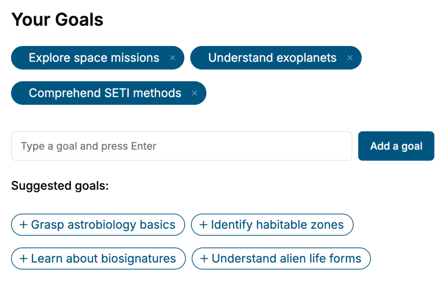
Specify your goals and choose sub-topics to include
- 3. Get your tailored book
Your book is ready in 10 minutes. Read it online, download as EPUB or PDF, or send to Kindle.

Frequently asked questions
- What is TailoredRead?
TailoredRead creates complete, full-length nonfiction ebooks, written specifically for you. Tell us what you want to learn and why, and TailoredRead writes you a complete ebook on it, with charts, tables, and diagrams throughout. Read it online, on Kindle, or on any e-reader, or download it as a PDF or EPUB. Every book is written fresh the day you order it.
- How is the book tailored to me?
Before anything is written, you answer a few short questions about your goals, your background, and the topics you care about. Your book is then planned around your answers: written at your level, focused on your goals, and covering the topics you chose, instead of the one-size-fits-all book a store sells everyone.
- Will it read like generic AI content?
No. Your book isn't a chat transcript: it's planned chapter by chapter before a single word is written, told in a clear book voice, and explains ideas visually with charts, tables, and diagrams. After writing, every book goes through an editorial pass that polishes chapters so the book reads consistent from start to finish. Judge for yourself: browse thousands of sample books on our Explore Books page.
- How accurate is the content?
Our AI first checks whether your subject needs live research. Niche and fast-moving subjects are researched before writing, and the book plan and chapters are grounded in what it finds. After writing, every book goes through a quality pass that checks its facts and consistency, and researched books list their sources in a Notes section at the back.
- How long is the book?
You choose the length: Comprehensive (250-300 pages), Detailed (150-200 pages), Essential (70-100 pages), or Short (30-50 pages).
- Does the book include visuals?
Yes. Every book includes visual elements such as timelines, checklists, step-by-step guides, decision trees, comparison tables, and matrices, and many include bar charts. A typical book includes dozens of these visual elements.
- Can I read it on Kindle? What formats can I download?
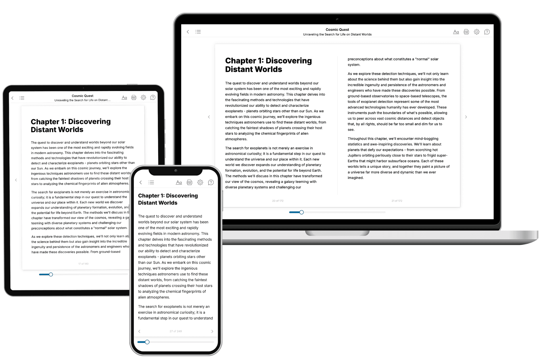
Yes. Every book can be read in our online reader or downloaded as a PDF or EPUB. The EPUB can be opened with Kindle, Apple Books, Kobo, and any e-reader. The Commercial and Author licenses also include an editable Word (DOCX) and Markdown download.
- How much does it cost?
About the price of a regular ebook. The exact price depends on your book's length and complexity, from $2 for the shortest books to $35 for the most comprehensive, and it's shown when you review your book, before you commit to anything. Each book is a one-time purchase, yours to keep, no subscription. Licenses that let you share, teach, or publish your book range from $35.99 to $49.99.
- Can I preview the book before purchasing?
Before you pay, you'll see what your book will cover: the title, a detailed description, the estimated length, and the complete chapter-by-chapter table of contents, so you know what you're getting before you decide. The full text itself is written after you purchase.
- How long does it take to create a book?
About 10 minutes. You can start reading the opening chapters while the rest is still being written.