Crossing Virginia's Wonder
Your Complete Guide to the Chesapeake Bay Bridge-Tunnel Experience
Most people think the Chesapeake Bay Bridge-Tunnel is simply a way to get from point A to point B, missing out on one of Virginia's most spectacular experiences.
284 pages15 chaptersSep 28, 2025Travel Guide
About this book
This engineering marvel stretching 17.6 miles across the mouth of the Chesapeake Bay offers far more than just transportation—it's a gateway to understanding Virginia's coastal heritage, marine ecosystems, and hidden treasures. You'll discover how to transform your crossing from a routine drive into an unforgettable adventure. From the best times to spot dolphins and migrating birds to understanding the fascinating engineering that makes this structure possible, you'll gain insider knowledge that enhances every mile of your journey. The guide reveals the distinct character of Virginia's Eastern Shore, where centuries-old fishing villages, pristine beaches, and unique wildlife refuges await exploration. Whether you're planning your first crossing or you've driven it dozens of times, you'll uncover new perspectives on this iconic landmark. Learn about the optimal viewing spots, seasonal highlights, and how to connect your bridge-tunnel experience with the rich attractions of coastal Virginia. You'll understand why this crossing has captured the imagination of travelers worldwide and how to make the most of your time in this remarkable region. This comprehensive guide ensures you'll never see the Chesapeake Bay Bridge-Tunnel as just another road again. Instead, you'll appreciate it as the extraordinary gateway it truly is—connecting not just two shores, but two worlds of Virginia adventure.
Table of contents
- IntroductionVirginia's Gateway to Adventure, Beyond the Crossing: A Destination Experience, How to Use This Guide, Your Strategic Approach to ExplorationRead below
- Chapter 1: The Engineering MarvelThe Construction Story, Bridge-Tunnel Design Principles, The Four Artificial Islands, Maintenance and Operations
- Chapter 2: Geography and EcosystemChesapeake Bay Overview, The Marine Environment, Wildlife Habitats Along the Route, Seasonal Environmental Changes
- Chapter 3: Planning Your CrossingTiming Considerations, Weather Patterns and Conditions, Understanding Traffic Flow, Vehicle Preparation and Safety
- Chapter 4: The Crossing ExperienceMile-by-Mile Journey Guide, Prime Viewing Opportunities, Photography and Documentation Tips, Safety Protocols During Crossing
- Chapter 5: Wildlife WatchingMarine Mammals and Dolphins, Bird Migration Patterns, Fishing Opportunities and Regulations, Seasonal Wildlife Calendar
- Chapter 6: Eastern Shore GatewayIntroduction to Virginia's Eastern Shore, Cultural Heritage and History, Local Communities and Character, Agricultural and Maritime Traditions
- Chapter 7: Cape Charles and Surrounding AreasHistoric Cape Charles, Beaches and Recreation, Dining and Local Flavor, Accommodation Options
- Chapter 8: Kiptopeke State ParkPark Overview and Features, Hiking Trails and Nature Walks, Camping and Facilities, Educational Programs and Events
- Chapter 9: Seafood Culture and CuisineOyster Harvesting Traditions, Blue Crab Industry and Culture, Local Restaurants and Seafood Houses, Seasonal Seafood Specialties
- Chapter 10: Barrier Islands and Coastal AccessAssateague Island National Seashore, Chincoteague Island Connection, Wild Ponies and Wildlife, Coastal Activities and Adventures
- Chapter 11: Historical SignificanceColonial Heritage and Early Settlement, Maritime History and Shipwrecks, Transportation Evolution, Modern Development Impact
- Chapter 12: Connecting to Regional AttractionsVirginia Beach Connection, Norfolk and Hampton Roads, Delmarva Peninsula Exploration, Day Trip and Extended Stay Options
- Chapter 13: Seasonal Visitor GuideSpring Migration and Blooms, Summer Beach and Water Activities, Fall Colors and Harvest Season, Winter Solitude and Storm Watching
- Chapter 14: Practical InformationToll Information and Payment Options, Emergency Services and Contacts, Visitor Centers and Information Resources, Accessibility and Special Needs
- Chapter 15: Photography and Documentation GuideBest Photography Locations, Optimal Lighting and Weather Conditions, Equipment and Technique Recommendations, Sharing and Preserving Your Experience
- Conclusion
- Further Reading
Introduction
The Chesapeake Bay Bridge-Tunnel stands as one of America's most remarkable engineering achievements, stretching 17.6 miles across the mouth of the Chesapeake Bay to connect Virginia Beach with the Eastern Shore. This extraordinary structure combines bridges, tunnels, and artificial islands in a feat that took nearly four decades to plan and construct. Yet for most travelers, it remains simply a means of transportation—a necessary route to reach their destination rather than a destination worthy of exploration in its own right.
Your journey across this marvel offers far more than efficient passage between two points on the map. The crossing provides a unique window into Virginia's coastal ecosystem, where the Atlantic Ocean meets the largest estuary in North America. From your vehicle, you'll witness the convergence of diverse marine environments, observe migrating wildlife, and experience the dramatic interplay between human engineering and natural forces. The structure itself tells a compelling story of innovation, determination, and the ongoing relationship between Virginia's communities and the waters that define them.
Beyond the crossing lies Virginia's Eastern Shore, a region that maintains its distinct character despite being connected to the mainland for over half a century. This peninsula offers authentic coastal experiences that differ markedly from the more developed areas of Virginia Beach and Norfolk. Here, centuries-old fishing traditions continue alongside modern conservation efforts, creating a landscape where maritime heritage and environmental stewardship intersect. Understanding how to approach both the bridge-tunnel crossing and the Eastern Shore exploration will transform your visit from a simple trip into a comprehensive Virginia coastal adventure.
Virginia's Gateway to Adventure
The Chesapeake Bay Bridge-Tunnel serves as more than Virginia's longest bridge—it functions as a portal between two distinct worlds of coastal experience. On the western approach, you'll encounter the bustling development of Virginia Beach and the Hampton Roads metropolitan area, where military installations, urban beaches, and commercial districts create a dynamic modern landscape. The crossing itself becomes a transitional experience, carrying you over and under waters that have shaped Virginia's identity since colonial times.
As you progress eastward across the structure, the character of your surroundings shifts dramatically. The artificial islands that anchor the tunnel sections provide unique vantage points for observing the bay's marine life and understanding the engineering challenges overcome during construction. These islands, built specifically to support the tunnel entrances, have become inadvertent wildlife habitats where seabirds nest and marine mammals frequently surface nearby. The experience of driving through the tunnels themselves offers a rare perspective on traveling beneath one of America's most important waterways.
The Eastern Shore that awaits at the crossing's end presents a Virginia that many visitors never discover. Small fishing villages like Cape Charles maintain their historic character while adapting to modern tourism and conservation needs. The region's barrier islands, including world-famous Assateague with its wild ponies, remain largely undeveloped and offer pristine coastal experiences. This contrast between the developed western shore and the more natural eastern peninsula creates opportunities for diverse adventures within a single trip.
Your approach to experiencing this gateway determines the depth of your understanding and enjoyment. Rushing across the bridge-tunnel to reach a specific destination means missing the subtle details that make the crossing memorable. The optimal viewing spots for wildlife observation, the historical significance of various landmarks visible from the structure, and the seasonal changes that affect both the crossing experience and Eastern Shore activities all require intentional attention and timing.
The bridge-tunnel's role as a gateway extends beyond physical transportation to cultural and environmental education. The crossing provides insights into the Chesapeake Bay's ecological importance, supporting both commercial fishing industries and recreational activities that define coastal Virginia life. Understanding these connections enhances your appreciation for the region's complexity and the ongoing efforts to balance development with environmental protection.
Weather patterns and seasonal changes dramatically affect the gateway experience, creating different opportunities throughout the year. Spring migrations bring diverse bird species through the area, while summer offers optimal conditions for marine mammal observation. Fall provides clear visibility for photography and comfortable temperatures for Eastern Shore exploration, and winter storms create dramatic seascapes for those seeking solitude and natural power displays. Each season transforms the gateway experience, making multiple visits rewarding for those who develop an appreciation for the region's dynamic character.
The economic and cultural significance of this gateway continues to evolve as Virginia's coastal communities adapt to changing environmental conditions and tourism patterns. The bridge-tunnel's construction fundamentally altered the Eastern Shore's relationship with the rest of Virginia, bringing new opportunities while challenging traditional ways of life. Understanding these ongoing changes provides context for your exploration and helps you appreciate the delicate balance between preservation and progress that defines modern coastal Virginia.
Planning your gateway experience requires considering multiple factors that affect both the crossing itself and your Eastern Shore activities. Traffic patterns, weather conditions, seasonal wildlife activity, and local event schedules all influence the optimal timing for your visit. The most rewarding approaches combine flexibility with specific objectives, allowing you to adapt to conditions while ensuring you experience the key elements that make this gateway truly special.
Beyond the Crossing: A Destination Experience
Transforming your bridge-tunnel crossing from transportation into destination requires shifting your perspective from efficiency to exploration. The structure itself offers multiple opportunities for observation and photography that most travelers overlook in their focus on reaching the other side. Strategic stops at the designated areas, timing your crossing for optimal lighting conditions, and understanding the seasonal patterns of wildlife activity can turn the journey into a highlight of your Virginia coastal experience.
The four artificial islands that support the tunnel sections represent unique environments created specifically for this engineering project. These islands have developed their own ecosystems over the decades since construction, attracting seabirds, marine mammals, and fish populations that create viewing opportunities unavailable elsewhere in the region. Island Four, the southernmost and largest, offers the most comprehensive facilities and viewing areas, while the other islands provide different perspectives on the bay's marine environment and the structure's engineering complexity.
Photography opportunities along the crossing change dramatically with weather, season, and time of day. Early morning crossings often provide the clearest visibility and most dramatic lighting, while late afternoon sun creates optimal conditions for capturing the structure's architectural elements against the bay's waters. Storm systems approaching or departing the area can create spectacular cloud formations and lighting effects, though safety considerations must always take precedence over photographic ambitions.
The marine environment visible from the bridge-tunnel supports an impressive diversity of species that vary seasonally and with weather conditions. Dolphin pods frequently travel through the area, particularly during warmer months when their prey species are most abundant. Large fish species, including rays and sharks, can sometimes be observed from the higher bridge sections during clear water conditions. Understanding the factors that influence marine life visibility helps you time your crossing for the best wildlife viewing opportunities.
Bird migration patterns make the bridge-tunnel crossing a significant location for avian observation, particularly during spring and fall migration periods. The structure serves as both a landmark for migrating species and a resting area for birds crossing the bay. Seasonal timing can provide opportunities to observe large flocks of waterfowl, raptors following the coastline, and seabirds that use the artificial islands for nesting and feeding activities.
Weather patterns across the bay create microclimates that affect visibility, wildlife activity, and overall crossing conditions. The open water environment can produce rapid weather changes that create both challenges and opportunities for visitors. Understanding how to read approaching weather systems and adapt your crossing plans accordingly ensures both safety and optimal experience quality. The bridge-tunnel's weather monitoring systems provide real-time information that helps visitors make informed decisions about timing their crossing.
The historical context of the crossing adds depth to the destination experience, connecting your journey to the broader story of Virginia's coastal development. The engineering challenges overcome during construction, the economic impact on Eastern Shore communities, and the ongoing maintenance required to keep this complex structure operational all contribute to understanding the crossing as a significant achievement in American infrastructure development.
Connecting your bridge-tunnel experience with Eastern Shore exploration requires understanding how the crossing serves as an introduction to the region's character. The transition from the developed western shore to the more rural eastern peninsula becomes apparent during the crossing itself, as the landscape visible from the structure changes from urban development to agricultural fields and natural areas. This transition prepares you for the different pace and character of Eastern Shore communities and attractions.
The destination experience extends beyond the crossing to include the immediate area surrounding both approaches to the bridge-tunnel. The western approach offers connections to Virginia Beach attractions, state parks, and urban amenities, while the eastern approach provides access to Cape Charles, Kiptopeke State Park, and the beginning of your Eastern Shore exploration. Understanding how to integrate these areas into your overall experience maximizes the value of your visit to this remarkable region.
How to Use This Guide
This comprehensive guide organizes information to support both spontaneous exploration and detailed advance planning of your Chesapeake Bay Bridge-Tunnel experience. The structure progresses from foundational knowledge about the engineering and environmental context through practical planning advice to specific guidance for maximizing your crossing and Eastern Shore exploration. Each chapter builds upon previous information while remaining accessible for readers who prefer to focus on specific aspects of their visit.
The early chapters provide essential background that enhances your appreciation of the crossing experience. Understanding the engineering challenges overcome during construction helps you recognize the significance of what you're experiencing as you travel across the structure. Similarly, knowledge of the bay's ecosystem and seasonal patterns enables you to identify wildlife and environmental features that might otherwise go unnoticed during your crossing.
Planning chapters offer practical frameworks for timing your visit, preparing your vehicle, and understanding the factors that affect crossing conditions. These sections include specific recommendations for different types of visitors, from families with young children to photography enthusiasts seeking optimal conditions for capturing the structure and surrounding environment. The planning guidance addresses both single crossings and extended stays that incorporate Eastern Shore exploration.
The crossing experience chapters provide mile-by-mile guidance that helps you understand what you're seeing and when to expect key viewing opportunities. This detailed approach ensures you don't miss significant features while maintaining focus on safe driving practices. The information includes specific landmarks, optimal viewing areas, and timing considerations that enhance your experience without compromising safety or traffic flow.
Eastern Shore chapters introduce you to the region's character and attractions, providing context for understanding how the bridge-tunnel serves as a gateway to distinctly different Virginia coastal experiences. These sections balance practical visitor information with cultural and historical background that deepens your appreciation for the communities and environments you'll encounter. The coverage includes both popular attractions and lesser-known locations that offer authentic Eastern Shore experiences.
Seasonal guidance throughout the guide helps you understand how timing affects every aspect of your visit, from crossing conditions to wildlife viewing opportunities to Eastern Shore activities. Rather than treating seasons as separate topics, this information integrates seasonal considerations into each aspect of your experience, helping you make informed decisions about when to visit and what to prioritize during different times of year.
Practical information sections provide specific details about costs, regulations, safety procedures, and resources that support your visit. This includes current toll information, emergency contact procedures, accessibility considerations, and connections to additional resources for extended exploration. The practical guidance addresses common questions and concerns while providing frameworks for handling unexpected situations.
Photography and documentation guidance recognizes that many visitors want to capture and share their bridge-tunnel experience. These sections provide technical advice for different skill levels and equipment types, while emphasizing safety considerations and respect for other travelers. The photography guidance includes specific location recommendations, timing suggestions, and techniques for capturing both the structure itself and the surrounding environment.
Cross-references throughout the guide help you connect related information and adapt the guidance to your specific interests and circumstances. Whether you're primarily interested in wildlife observation, historical significance, or family-friendly activities, the guide provides pathways to the most relevant information while encouraging broader exploration of the region's diverse offerings.
The guide's organization supports both linear reading and selective reference use, recognizing that different visitors have varying levels of interest in background information versus practical guidance. Key information appears in multiple contexts where relevant, ensuring that readers focusing on specific chapters still receive essential safety and planning information. This approach makes the guide useful for both first-time visitors and returning travelers seeking to deepen their understanding of the region.
Your Strategic Approach to Exploration
Developing an effective strategy for exploring the Chesapeake Bay Bridge-Tunnel and Eastern Shore requires balancing multiple factors that influence both the quality of your experience and the practical aspects of your visit. Your approach should consider your primary interests, available time, seasonal conditions, and the specific combination of activities that will create the most satisfying experience. The most successful visits combine structured planning with flexibility to adapt to changing conditions and unexpected opportunities.
Time allocation represents a critical strategic decision that affects every aspect of your visit. A simple crossing can be completed in approximately 30 minutes under normal conditions, but allowing additional time for stops, wildlife observation, and photography can extend this to several hours. Eastern Shore exploration can range from a few hours in Cape Charles to multiple days exploring the region's diverse attractions. Your strategic approach should align time allocation with your primary objectives while building in flexibility for spontaneous discoveries.
Seasonal timing dramatically affects the opportunities available during your visit and should influence your strategic planning from the earliest stages. Spring offers optimal conditions for bird migration observation and comfortable weather for outdoor activities, while summer provides the best marine mammal viewing and beach access. Fall delivers excellent visibility for photography and pleasant temperatures for hiking and exploration, while winter offers solitude and dramatic weather displays for those seeking unique experiences.
Weather monitoring becomes essential for strategic planning, as conditions can change rapidly over the open water environment of the Chesapeake Bay. Your approach should include multiple contingency plans that account for different weather scenarios, from optimal clear conditions to challenging storms that might affect crossing safety or visibility. Understanding how to interpret weather forecasts and adapt your plans accordingly ensures both safety and optimal experience quality.
Equipment and preparation requirements vary significantly based on your planned activities and the season of your visit. Basic crossing preparation differs from the equipment needed for extended Eastern Shore exploration, wildlife photography, or outdoor activities in state parks and natural areas. Your strategic approach should include comprehensive preparation checklists that ensure you have necessary items while avoiding over-packing that complicates your travel.
Integration with broader Virginia coastal exploration can significantly enhance the value of your bridge-tunnel experience by connecting it with related attractions and activities in the region. Strategic planning might include coordination with Virginia Beach visits, Norfolk area attractions, or extended Delmarva Peninsula exploration. Understanding how the bridge-tunnel fits into broader regional tourism patterns helps you optimize your overall Virginia coastal experience.
Budget considerations affect multiple aspects of your strategic approach, from toll costs and fuel expenses to accommodation choices and activity fees. The bridge-tunnel toll represents a significant expense that should be factored into your planning, particularly if you're considering multiple crossings or extended stays that might benefit from different crossing strategies. Understanding the full cost implications helps you make informed decisions about trip duration and activity priorities.
Safety planning must be integrated into every aspect of your strategic approach, from vehicle preparation and emergency kit assembly to understanding weather-related risks and communication procedures. The bridge-tunnel environment presents unique safety considerations related to high winds, rapid weather changes, and limited emergency access during crossing. Your strategic approach should include comprehensive safety preparation and clear procedures for handling various emergency scenarios.
Documentation and sharing strategies help you preserve and communicate your experience while respecting safety requirements and other visitors' experiences. Planning your approach to photography, note-taking, and social media sharing ensures you capture meaningful memories without compromising your safety or the quality of your experience. This includes understanding restrictions on stopping and photography locations, as well as techniques for documenting your experience while maintaining focus on safe driving.
Learning objectives can enhance your strategic approach by providing frameworks for understanding and appreciating the various aspects of your bridge-tunnel and Eastern Shore experience. Whether you're interested in engineering achievements, environmental education, cultural history, or recreational opportunities, establishing clear learning goals helps you focus your attention and preparation on the most relevant information and experiences.
Follow-up planning ensures that your bridge-tunnel experience contributes to ongoing exploration and understanding of Virginia's coastal regions. This might include plans for return visits during different seasons, connections with related educational opportunities, or integration with broader travel goals in the Mid-Atlantic region. Strategic thinking about follow-up activities helps you maximize the long-term value of your initial investment in exploring this remarkable area.
This is the end of the free sample. The full book has 15 chapters.
Want this book written for you?
Tell us your goals and background, and get your own version of this book, tailored by AI to you.


Benefits of AI-tailored books
- Read one book, not ten:
- all the Travel Guide knowledge you need, gathered into a single book.
- Save days of learning:
- tell us your goals, choose your topics, and the whole book is built around them.
- Learn effortlessly:
- Travel Guide book written for your specific background and expertise.
- Understand at a glance:
- includes charts, tables, timelines, checklists, decision trees, and more.
- Stay current:
- written the day you order it, not years ago.
- Trust what you read:
- every book is checked for accuracy, with real research when your subject needs it.
Create your unique book in 3 steps
- 1. Select your focus
Select the focus of your Travel Guide book and share your background
- 2. Personalize your book
Specify your goals and choose sub-topics to include
- 3. Get your tailored book
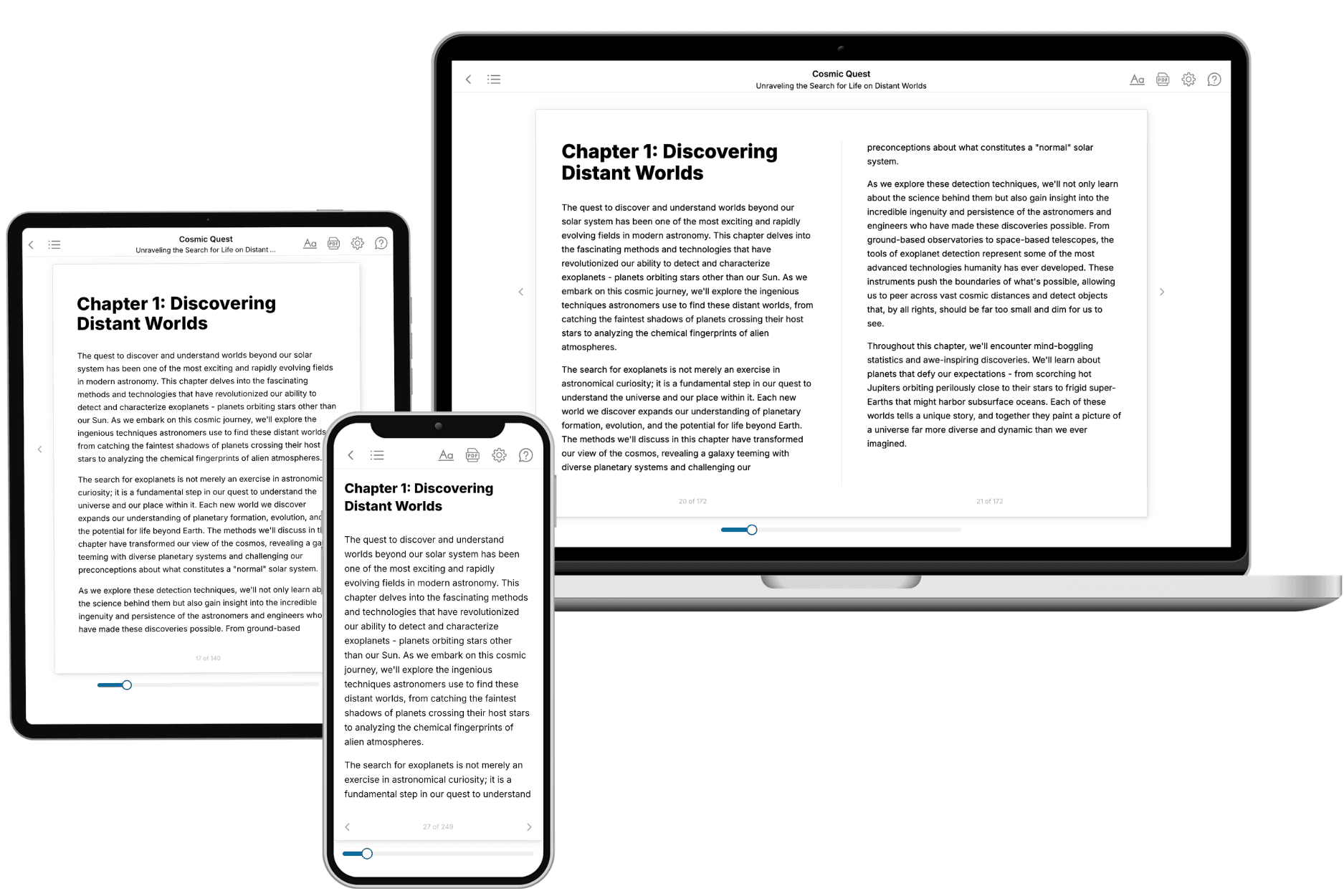
Your book is ready in 10 minutes. Read it online, download as EPUB or PDF, or send to Kindle.

Frequently asked questions
- What is TailoredRead?
TailoredRead creates complete, full-length nonfiction ebooks, written specifically for you. Tell us what you want to learn and why, and TailoredRead writes you a complete ebook on it, with charts, tables, and diagrams throughout. Read it online, on Kindle, or on any e-reader, or download it as a PDF or EPUB. Every book is written fresh the day you order it.
- How is the book tailored to me?
Before anything is written, you answer a few short questions about your goals, your background, and the topics you care about. Your book is then planned around your answers: written at your level, focused on your goals, and covering the topics you chose, instead of the one-size-fits-all book a store sells everyone.
- Will it read like generic AI content?
No. Your book isn't a chat transcript: it's planned chapter by chapter before a single word is written, told in a clear book voice, and explains ideas visually with charts, tables, and diagrams. After writing, every book goes through an editorial pass that polishes chapters so the book reads consistent from start to finish. Judge for yourself: browse thousands of sample books on our Explore Books page.
- How accurate is the content?
Our AI first checks whether your subject needs live research. Niche and fast-moving subjects are researched before writing, and the book plan and chapters are grounded in what it finds. After writing, every book goes through a quality pass that checks its facts and consistency, and researched books list their sources in a Notes section at the back.
- How long is the book?
You choose the length: Comprehensive (250-300 pages), Detailed (150-200 pages), Essential (70-100 pages), or Short (30-50 pages).
- Does the book include visuals?
Yes. Every book includes charts, tables, and diagrams: timelines, checklists, step-by-step guides, decision trees, comparison tables, matrices, and bar charts. A typical book includes dozens of these visual elements.
- Can I read it on Kindle? What formats can I download?
Yes. Every book can be read in our online reader or downloaded as a PDF or EPUB. The EPUB can be opened with Kindle, Apple Books, Kobo, and any e-reader. The Commercial and Author licenses also include an editable Word (DOCX) and Markdown download.
- How much does it cost?
About the price of a regular ebook. The exact price depends on your book's length and complexity, from $2 for the shortest books to $35 for the most comprehensive, and it's shown when you review your book, before you commit to anything. Each book is a one-time purchase, yours to keep, no subscription. Licenses that let you share, teach, or publish your book range from $35.99 to $49.99.
- Can I preview the book before purchasing?
Before you pay, you'll see what your book will cover: the title, a detailed description, the estimated length, and the complete chapter-by-chapter table of contents, so you know what you're getting before you decide. The full text itself is written after you purchase.
- How long does it take to create a book?
About 10 minutes. You can start reading the opening chapters while the rest is still being written.