The Ground Beneath Our Work
A Principal's Field Guide to Modern Engineering Geology
Picture the moment when your site model holds together under scrutiny, your slope analysis withstands peer review, and your hazard map becomes the document other disciplines rely on without question.
222 pages10 chaptersOct 15, 2026Geotechnical engineering
About this book
This book is written for the principal geologist who already knows the foundations and now wants to sharpen the methods that define senior practice. It moves through the modern toolkit with a practitioner's eye: updated slope stability approaches and rock slope kinematic analysis, landslide hazard mapping and monitoring, probabilistic seismic hazard and site amplification, groundwater pore pressure and aquifer drawdown, karst and mining subsidence risk, and the digital workflows of LiDAR, drone photogrammetry, and GIS modelling. Alongside the technical material, it addresses the work that shapes outcomes just as much: planning ground investigations that evolve with the project, classifying rock masses and joint roughness consistently, writing geotechnical reports that decision-makers can use, and leading multidisciplinary teams through risk-based decisions. Each chapter pairs current standards and methods with the judgment needed to apply them on real sites, and the closing sections return to the ethical responsibilities that define the profession. It is a working reference for the engineering geologist who is ready to refine, challenge, and renew their practice.
Table of contents
- IntroductionWhy Senior Practice Demands Continuous Renewal, How the Chapters Connect Across a Project, Assumed Knowledge and Working StandardsRead below
- Chapter 1: Slope Stability Updates and Strength ModellingLimit Equilibrium Methods in Current Practice, Selecting Shear Strength Parameters for Weathered Materials, Progressive Failure and Strain-Softening Behaviour
- Chapter 2: Landslide Hazard Mapping and MonitoringInventories and Susceptibility Zoning Approaches, Instrumentation and Landslide Monitoring Sensors, Defining Trigger Thresholds and Early Warning
- Chapter 3: Geohazard Risk Scoring and Decision FrameworksDefining Consequence and Exposure Categories, Weighting Criteria and Transparent Scoring Methods, Representing Uncertainty in Risk Outputs
- Chapter 4: Seismic Hazard Standards and Site ResponseProbabilistic Seismic Hazard Assessment Principles, Site Amplification and Local Soil Effects, Applying Current Seismic Design Provisions
- Chapter 5: Groundwater Impact and Pore Pressure AnalysisGroundwater Pore Pressure in Slope and Excavation Design, Aquifer Drawdown Assessment and Settlement Risk, Conceptual Models and Numerical Groundwater Modelling
- Chapter 6: Karst, Sinkholes, and Mining SubsidenceKarst Processes and Dissolution Features, Sinkhole Susceptibility Mapping Methods, Predicting Subsidence Above Abandoned Workings
- Chapter 7: Ground Investigation Planning and Geological Data IntegrationPhased Ground Investigation Planning Strategies, Integrating Geophysical Surveys with Borehole Data, Geotechnical Data Management and Quality Control
- Chapter 8: Digital Geological Mapping and Terrain AnalysisLiDAR Terrain Analysis for Geological Interpretation, Drone Photogrammetry Mapping Workflows, GIS Hazard Modelling and Map Validation
- Chapter 9: Rock Mass Classification and Discontinuity CharacterizationRock Mass Classification Systems in Practice, Discontinuity Mapping Methods and Sampling Bias, Joint Roughness Coefficient and Weathering Profiles
- Chapter 10: Reporting, Team Leadership, and Professional EthicsWriting Geotechnical Reports That Inform Decisions, Communicating Geological Uncertainty to Stakeholders, Leading Multidisciplinary Teams Through Complex Projects
- ConclusionLooking Ahead at the Evolving Profession
- Further Reading and Resources
- Glossary
Introduction
A site model that was defensible ten years ago can fail quietly today, not because the geology changed but because the standards, instruments, and expectations around it did. A Factor of Safety of 1.5 computed with a Limit Equilibrium Method and hand-picked strength parameters once satisfied most reviewers. Now that same number invites questions about which strength envelope was used, whether Residual Shear Strength was considered along a pre-existing shear surface, and whether the Critical Slip Surface was searched with a method that can actually find it. A principal geologist signing a report carries the weight of those questions whether or not a reviewer asks them.
This book assumes a reader who already holds the registrations, has sat through the site visits, and has written reports that other engineers built foundations and retaining structures on top of. It is not an introduction to engineering geology. It is a working update for someone whose judgment is sound but whose toolkit, standards references, and reporting habits may have drifted from current practice without anyone flagging it. The chapters that follow move through the technical spine of the discipline, slope stability, landslide hazard, seismic hazard, groundwater, karst and subsidence, investigation planning, digital mapping, rock mass characterization, and finally reporting and leadership, each one written at the level a principal geologist operates at daily.
The three sections of this introduction set up how to read what follows. The first explains why renewal is a professional obligation rather than a preference, using the gap between static qualifications and a moving evidence base as the throughline. The second shows how the ten technical chapters relate to one another on an actual project, so the book can be used as a sequence or dipped into out of order without losing the connective logic. The third states plainly what is assumed already known, so later chapters can move at the pace a senior practitioner expects instead of re-deriving basics.
None of this is abstract housekeeping. A principal who treats methodology as settled risks producing a Geotechnical Report that a peer reviewer, a regulator, or a court-appointed expert can dismantle on process grounds alone, regardless of whether the underlying geology was read correctly. The chapters ahead are built to close that exposure.
Why Senior Practice Demands Continuous Renewal
Registration exams and degree programs capture a snapshot of competence at a fixed point. The discipline itself does not stay fixed. Probabilistic Seismic Hazard Assessment methodology, site amplification corrections tied to Vs30, and the design codes that consume their outputs have all been revised multiple times since most senior practitioners finished formal training[1]. A geologist who last engaged deeply with seismic hazard a decade ago is not wrong about the fundamentals, but is very likely missing updated attenuation relationships and amplification factors that materially change a Response Spectrum at a given site.
The same erosion happens in slope stability. Progressive Failure and strain-softening behavior were documented decades ago[2], yet it remains common to see limit equilibrium analyses that apply a single peak strength value uniformly along a slip surface, ignoring that strength along a pre-sheared segment may already have dropped toward residual. The method has not changed; the discipline of applying it correctly has simply been allowed to slip in routine practice. Renewal, in this sense, is not about chasing novelty. It is about closing the gap between what is known in the literature and what is actually applied on a given site.
Three forces push that gap wider every year, and recognizing them explains why a principal geologist cannot treat continuing education as optional. The decision tree below lays out a simple way to decide, for any given tool or standard, whether it needs active refreshing before the next sign-off.
Does This Method Need Refreshing Before Sign-off?
- Has the relevant code or standard been revised since you last applied it?
- Yes Flag for review before use
- No Has new site data (monitoring, investigation) emerged since the model was built?
- Yes Update the ground model first
- No Proceed with current method, document the check
The first force is regulatory and code revision. Seismic design provisions, dam safety guidance, and slope stability acceptance criteria are periodically rewritten by national and international bodies, and a report that cites a superseded clause can be rejected on procedural grounds alone, independent of its technical merit. The second force is the instrumentation and data landscape. LiDAR Terrain Analysis, Structure-from-Motion photogrammetry from drones, and cloud-based GIS Hazard Modelling platforms have changed what a ground investigation can observe before a single borehole is drilled, and a geologist unfamiliar with these tools is working with a narrower evidence base than peers who use them.
The third force is accumulated case history. Every landslide, sinkhole collapse, or mining subsidence event that gets properly investigated adds to the collective understanding of failure mechanisms, and that understanding feeds back into updated classification systems, updated Trigger Threshold definitions for Early Warning System design, and updated susceptibility mapping criteria. A geologist who stops reading post-incident investigation reports is cut off from exactly the evidence that refines judgment the fastest, because these events are natural experiments that textbooks cannot simulate.
There is also a liability dimension that senior practitioners underweight at their own risk. A principal geologist's signature on a report represents a professional assertion that current, defensible methods were applied, not merely that an analysis was completed and a number was produced. When a slope fails or a sinkhole opens under a structure, the first question in any subsequent review is whether the responsible geologist used methods and data consistent with prevailing practice at the time. Prevailing practice
is a moving target, and falling behind it is a measurable, documentable exposure, not a vague professional shortcoming.
Renewal also serves a quieter function: it keeps judgment calibrated. A geologist who regularly revisits strength parameter selection, rock mass classification consistency, and groundwater model validation against piezometer records develops sharper instincts for where a given site's uncertainty actually lives. Those instincts degrade with disuse just as technical knowledge does. The chapters ahead are built to refresh both the explicit methods and the tacit judgment that senior practice depends on, treating them as inseparable rather than as separate tracks of competence.
Consider a case that illustrates the stakes concretely. A regional slope stability assessment conducted in the early 2000s for a highway corridor used peak strength parameters from laboratory triaxial tests on intact samples, producing Factor of Safety values comfortably above 1.3 across the corridor. A decade later, a reassessment incorporating Residual Shear Strength along mapped relict shear surfaces, identified through updated discontinuity logging, found several sections with Factor of Safety values below 1.1 under saturated conditions. The geology had not changed. The method applied to it had matured, and the original assessment, defensible when written, would not survive scrutiny against current practice.
That example generalizes across every chapter in this book. The underlying physics of slope failure, seismic wave propagation, groundwater flow, and karst dissolution are stable. What changes is the resolution at which a competent geologist is now expected to characterize them, the transparency expected in how conclusions were reached, and the tools available to gather and validate the evidence. A principal who absorbs that distinction reads the rest of this book not as a list of new facts to memorize, but as a recalibration of where the bar for defensible work currently sits.
The callout below distills that recalibration into a working principle worth carrying into every subsequent chapter.
Key takeaway: The Renewal Principle
Competence is not a credential held once. It is a standard of evidence, method, and transparency that shifts under every practitioner's feet, and staying level with it is itself part of the duty of care owed to the public.
Finally, renewal has a practical payoff beyond risk avoidance. Updated methods tend to be more efficient as well as more rigorous. GIS Hazard Modelling workflows that integrate Digital Elevation Model outputs with susceptibility layers can process terrain analysis that once took weeks of manual photo interpretation in a fraction of the time, freeing senior judgment to focus on validation and interpretation rather than data assembly. A geologist who resists updating tools is not preserving rigor by sticking to familiar methods. In most cases, that resistance is simply trading efficiency and evidentiary strength for comfort.
The remainder of this book is organized to make that trade unnecessary. Each technical chapter pairs a current method or standard with the judgment needed to apply it on a real, imperfect site, because a method without judgment produces a number nobody should trust, and judgment without an updated method produces a conclusion nobody can reproduce. Holding both together is the actual definition of senior practice this book is written toward.
How the Chapters Connect Across a Project
The ten technical chapters are sequenced to mirror a project's actual lifecycle, from first site reconnaissance through to the signed report, though each stands independently enough to be used as a reference when a specific problem arises mid-project. Understanding that sequence matters because the chapters are not isolated topics. A decision made in one, such as how a Ground Model is built during phased investigation, directly constrains what is defensible in another, such as the strength parameters selected for a subsequent slope stability analysis. Treating the book as a connected system rather than a topic list will make each chapter more useful.
The project typically begins with terrain and desk study work, covered in the chapter on digital geological mapping. LiDAR Terrain Analysis and Structure-from-Motion outputs from drone photogrammetry generate a preliminary Digital Elevation Model and highlight candidate hazard features, lineaments, scarps, drainage anomalies, before a single borehole is planned. That output feeds directly into the ground investigation chapter, where a Phased Ground Investigation is designed around the uncertainties the terrain analysis could not resolve, rather than a fixed scope decided in advance regardless of what the desk study found.
As the investigation proceeds, discontinuity data and rock mass data accumulate, and the chapter on rock mass classification becomes active. Rock Mass Rating, the Q-System, and the Geological Strength Index depend on consistent discontinuity logging, and the Joint Roughness Coefficient measured in that phase feeds forward into strength parameter selection for slope stability work. A sampling bias introduced at this stage, for instance logging only discontinuities visible from an accessible bench while missing a critical joint set on an inaccessible face, propagates silently into every downstream analysis that assumes the discontinuity data is representative.
Groundwater characterization typically runs in parallel with the geotechnical investigation rather than after it, because piezometer installation needs to happen while boreholes are open. The groundwater chapter's Conceptual Groundwater Model and Phreatic Surface estimates then feed directly into the slope stability chapter's treatment of Pore Pressure Ratio and Effective Stress, since no limit equilibrium analysis on a natural slope is defensible without an explicit, tested assumption about groundwater conditions at the time of potential failure. A table makes this chain of dependency easier to hold in view across the whole project.
| Project Stage | Primary Chapter | Feeds Forward Into |
|---|---|---|
| Desk study and terrain analysis | Digital Geological Mapping | Investigation Planning, Landslide Hazard Mapping |
| Site investigation and logging | Investigation Planning; Rock Mass Characterization | Slope Stability, Groundwater Analysis |
| Groundwater instrumentation | Groundwater Impact and Pore Pressure Analysis | Slope Stability, Karst and Subsidence |
| Slope and hazard analysis | Slope Stability; Landslide Hazard Mapping | Geohazard Risk Scoring |
| Seismic context | Seismic Hazard Standards | Geohazard Risk Scoring, Slope Stability |
| Synthesis and decision support | Geohazard Risk Scoring | Reporting and Team Leadership |
| Deliverable and sign-off | Reporting, Team Leadership, and Ethics | Project closeout |
Seismic hazard work, covered separately, intersects the sequence at two points rather than one. Early in a project, Probabilistic Seismic Hazard Assessment outputs inform whether seismic loading is likely to govern slope or structural design at all. Later, once a Ground Model is mature enough to define Site Amplification corrections with confidence, those outputs feed into both the slope stability chapter's treatment of seismic coefficients in limit equilibrium analysis and into the risk scoring chapter's consequence assessment for earthquake-triggered landslide scenarios.
The karst and mining subsidence chapter operates somewhat differently from the others, because it applies only where the regional geology warrants it. On a site with no carbonate bedrock and no mining history, that chapter is simply not activated, and the investigation and risk scoring chapters proceed without it. On a site where it is relevant, however, it interacts heavily with the groundwater chapter, since Aquifer Drawdown can trigger Cover-Collapse Sinkhole formation, and with the investigation planning chapter, since geophysical methods suited to detecting dissolution voids differ from those suited to characterizing a landslide body.
All of these technical threads converge in the geohazard risk scoring chapter, which exists specifically to synthesize outputs from slope stability, landslide hazard, seismic hazard, groundwater, and karst and subsidence work into a single, ranked, defensible decision aid. This is where Consequence Category definitions, criteria weighting, and the ALARP Principle get applied, and where the honest representation of uncertainty from every upstream chapter either gets preserved or gets lost. A risk score that hides the uncertainty baked into its slope stability or groundwater inputs is not a synthesis, it is a false precision dressed up as one.
The final technical chapter, on reporting and leadership, is deliberately placed last but should not be read last in practice. Report structure, plain-language communication of geological uncertainty, and the discipline of a Risk Register that tracks open items rather than burying them are habits that need to be active from the first site visit, not bolted on at the point of writing. Reading that chapter early, alongside the introduction, and then returning to it again before drafting a final deliverable, will produce better results than treating it purely as a closing topic.
A useful way to think about the whole structure is as a funnel, narrowing from broad regional data collection down to a single, defensible decision. The funnel below visualizes that narrowing, though the width of each stage reflects the volume of raw information involved, not its importance.
From Broad Site Data to a Defensible Decision
Terrain and desk study data (100)
Phased investigation and monitoring data (70)
Validated ground, groundwater, and rock mass models (45)
Hazard and risk synthesis (25)
Signed report and decision (10)
None of this sequencing is rigid in practice. Real projects loop back constantly, a drilling result can force a return to the investigation planning chapter mid-project, a monitoring anomaly can force a return to the trigger threshold discussion in the landslide hazard chapter. The value of seeing the chapters as connected rather than standalone is that when a loop-back happens, it is clear which other chapters' conclusions need to be revisited rather than assumed to still hold.
Readers who want a single-topic refresher, say on Joint Roughness Coefficient measurement ahead of a specific field campaign, can go directly to that subsection without reading the surrounding chapter in full. But for a project-wide review, such as updating an internal quality assurance procedure or mentoring a team through a complex multidisciplinary assessment, working through the chapters in sequence will surface dependencies that a topic-by-topic search would miss.
Assumed Knowledge and Working Standards
This book assumes fluency with the foundational vocabulary and mechanics of engineering geology at the level expected of a Certified Engineering Geologist or Professional Geoscientist. It does not define basic terms such as shear strength, cohesion, or friction angle from first principles, and it does not walk through the derivation of the Limit Equilibrium Method as a teaching exercise. Where those concepts appear, they appear as the starting point for a more advanced discussion, such as how strength parameters shift under Progressive Failure conditions rather than how shear strength is defined in the first place.
Readers are assumed to be comfortable interpreting borehole logs, geophysical survey outputs, and standard penetration test or cone penetration test data without a primer, and to understand the basic classification systems for soil and rock before encountering the more advanced treatment of Rock Mass Rating, the Q-System, and the Geological Strength Index in the rock mass characterization chapter. Similarly, basic hydrogeological concepts, such as the distinction between confined and unconfined aquifers, are treated as known background rather than explained anew, freeing the groundwater chapter to focus on Conceptual Groundwater Model construction and numerical modeling validation.
On the regulatory side, this book references current seismic design provisions and investigation standards in general terms, because specific code clauses vary by jurisdiction and are revised on their own schedules. A principal geologist practicing in a given jurisdiction is expected to cross-reference the general frameworks discussed here, such as the structure of a Probabilistic Seismic Hazard Assessment or the logic of a Site Amplification correction, against the specific, currently in-force code that governs a given project. No chapter here substitutes for checking the latest edition of a locally applicable design standard.
The book also assumes a working familiarity with basic GIS concepts and spatial data formats, even though the digital mapping chapter goes further into specific workflows involving LiDAR Terrain Analysis, Structure-from-Motion photogrammetry, and GIS Hazard Modelling. A reader who has never opened a GIS platform will find that chapter harder going than one who has used spatial software for routine mapping tasks, even informally. The same applies to statistical literacy: susceptibility zoning and risk scoring discussions assume comfort with basic probability and weighted scoring concepts, without re-teaching what a probability distribution or a weighted average is.
Professional and ethical standards referenced throughout the book, including the duty of care owed to the public, the obligation to disclose limitations, and the resistance to tailoring conclusions under commercial pressure, are treated as already internalized commitments rather than as new instruction. The final chapter on ethics builds on that assumed foundation to discuss specific pressure points, such as how to handle a client request to soften a hazard finding, rather than introducing the general concept of professional responsibility for the first time.
A short table summarizes the baseline this book builds from, separating what is assumed already solid from what each relevant chapter extends it toward.
Where a specific named study, dataset, or standard is cited in later chapters, it is cited because the claim behind it is a specific, checkable fact, a published attenuation relationship, a documented case history, a formally adopted classification system. General principles that are common knowledge within the profession, such as the basic logic of limit equilibrium analysis, are not footnoted, since footnoting settled disciplinary knowledge would clutter the text without adding verifiable value.
One area where this book intentionally holds back is jurisdiction-specific legal and regulatory interpretation. Ground investigation requirements, sign-off authority, and liability frameworks differ meaningfully across regions, and a principal geologist operating under one regulatory regime cannot assume that procedural guidance written for another applies directly. Where legal or regulatory topics arise, particularly around reporting obligations and professional liability, the discussion stays at the level of general principle, such as how courts and regulators typically weigh adherence to prevailing practice, rather than offering jurisdiction-specific procedural advice.
The example below illustrates how this assumed baseline plays out in practice, using a scenario a principal geologist is likely to recognize. A junior team member produces a slope stability model with a Factor of Safety of 1.6, using peak strength parameters from intact rock samples on a slope with visible evidence of prior movement. A principal geologist reading that result with the baseline knowledge this book assumes should immediately recognize two gaps: the absence of residual strength consideration along any relict shear surface, and the lack of a stated pore pressure assumption tied to a conceptual groundwater model.
A Factor of Safety is only as trustworthy as the weakest assumption buried inside it, and a senior reviewer's first job is finding that assumption before anyone downstream builds on the number.
That example is not a teaching moment about what a Factor of Safety is. It is a demonstration of the kind of critical reading this book assumes a principal geologist already does instinctively, and which the chapters ahead are designed to sharpen rather than install from scratch. Readers who find that example straightforward are reading at the level this book is written for.
With that baseline established, the next chapter moves directly into the technical heart of the discipline, starting with how current limit equilibrium practice handles the strength parameters that so often get selected too casually, and the consequences that casual selection carries once a slope is built on top of it.
This is the end of the free sample. The full book has 10 chapters.
Want this book written for you?
Tell us your goals and background, and get your own version of this book, tailored by AI to you.


Benefits of AI-tailored books
- Read one book, not ten:
- all the Geotechnical engineering knowledge you need, gathered into a single book.
- Save days of learning:
- tell us your goals, choose your topics, and the whole book is built around them.
- Learn effortlessly:
- Geotechnical engineering book written for your specific background and expertise.
- Understand at a glance:
- includes charts, tables, timelines, checklists, decision trees, and more.
- Stay current:
- written the day you order it, not years ago.
- Trust what you read:
- every book is checked for accuracy, with real research when your subject needs it.
Create your unique book in 3 steps
- 1. Select your focus
Select the focus of your Geotechnical engineering book and share your background
- 2. Personalize your book
Specify your goals and choose sub-topics to include
- 3. Get your tailored book
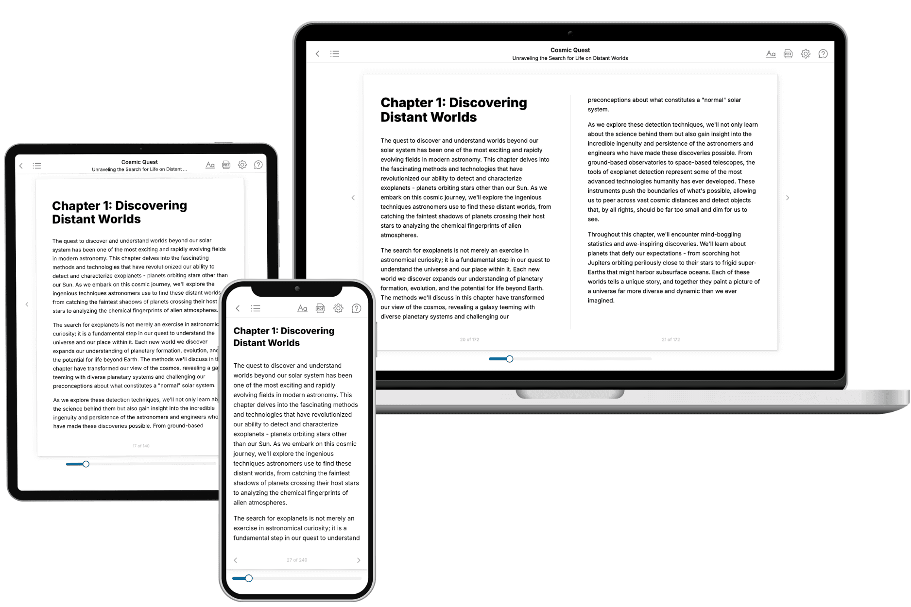
Your book is ready in 10 minutes. Read it online, download as EPUB or PDF, or send to Kindle.

Frequently asked questions
- What is TailoredRead?
TailoredRead creates complete, full-length nonfiction ebooks, written specifically for you. Tell us what you want to learn and why, and TailoredRead writes you a complete ebook on it, with charts, tables, and diagrams throughout. Read it online, on Kindle, or on any e-reader, or download it as a PDF or EPUB. Every book is written fresh the day you order it.
- How is the book tailored to me?
Before anything is written, you answer a few short questions about your goals, your background, and the topics you care about. Your book is then planned around your answers: written at your level, focused on your goals, and covering the topics you chose, instead of the one-size-fits-all book a store sells everyone.
- Will it read like generic AI content?
No. Your book isn't a chat transcript: it's planned chapter by chapter before a single word is written, told in a clear book voice, and explains ideas visually with charts, tables, and diagrams. After writing, every book goes through an editorial pass that polishes chapters so the book reads consistent from start to finish. Judge for yourself: browse thousands of sample books on our Explore Books page.
- How accurate is the content?
Our AI first checks whether your subject needs live research. Niche and fast-moving subjects are researched before writing, and the book plan and chapters are grounded in what it finds. After writing, every book goes through a quality pass that checks its facts and consistency, and researched books list their sources in a Notes section at the back.
- How long is the book?
You choose the length: Comprehensive (250-300 pages), Detailed (150-200 pages), Essential (70-100 pages), or Short (30-50 pages).
- Does the book include visuals?
Yes. Every book includes charts, tables, and diagrams: timelines, checklists, step-by-step guides, decision trees, comparison tables, matrices, and bar charts. A typical book includes dozens of these visual elements.
- Can I read it on Kindle? What formats can I download?
Yes. Every book can be read in our online reader or downloaded as a PDF or EPUB. The EPUB can be opened with Kindle, Apple Books, Kobo, and any e-reader. The Commercial and Author licenses also include an editable Word (DOCX) and Markdown download.
- How much does it cost?
About the price of a regular ebook. The exact price depends on your book's length and complexity, from $2 for the shortest books to $35 for the most comprehensive, and it's shown when you review your book, before you commit to anything. Each book is a one-time purchase, yours to keep, no subscription. Licenses that let you share, teach, or publish your book range from $35.99 to $49.99.
- Can I preview the book before purchasing?
Before you pay, you'll see what your book will cover: the title, a detailed description, the estimated length, and the complete chapter-by-chapter table of contents, so you know what you're getting before you decide. The full text itself is written after you purchase.
- How long does it take to create a book?
About 10 minutes. You can start reading the opening chapters while the rest is still being written.