The Inca Roads: Highways of Empire and Conquest
How an Ancient Network Shaped the Spanish Conquest and Changed the Course of History
What if the very infrastructure that held an empire together became the instrument of its downfall?
207 pages10 chaptersFeb 24, 2026South American History
About this book
The Inca road system stands as one of humanity's most remarkable achievements—a 25,000-mile network of highways, bridges, and way stations that connected a vast empire across mountains, deserts, and jungles without the aid of wheeled vehicles or written language. Yet this same network, designed to consolidate imperial power, became the highway for Spanish conquistadors to penetrate the heart of the Inca realm. This book explores the intricate relationship between the Inca roads and the Spanish conquest, examining how geography, engineering, military strategy, and human ambition intersected at a critical moment in world history. Discover how the roads functioned as communication arteries, military highways, and economic lifelines—and how their very existence shaped the outcome of one of history's most consequential encounters between civilizations.
Table of contents
- IntroductionWhy Roads Matter in History, The Inca Empire at Its Height, The Spanish Arrival and the Question of ConquestRead below
- Chapter 1: The Engineering Marvel: Building the Inca Road SystemScale and Scope: 25,000 Miles of Ambition, Construction Methods and Labor Organization, Conquering Impossible Terrain, Architectural Innovations and Design Principles
- Chapter 2: The Two Main Routes: Spine of the EmpireThe Coastal Highway: Desert Passage, The Mountain Highway: The High Road, Connecting Routes and Regional Networks
- Chapter 3: Infrastructure Beyond Roads: Bridges, Tunnels, and Way StationsSuspension Bridges: Engineering Wonders, Tunnels and Stone Cuts Through Mountains, Tambos and Way Stations: Logistics and Supply, Storage Facilities and Resource Management
- Chapter 4: Communication and Control: How the Roads Unified an EmpireThe Chasqui: The Inca Messenger System, Administrative Control and Governance, Military Movement and Rapid Deployment, Economic Integration and Trade Networks
- Chapter 5: The Inca Empire on the Eve of ConquestThe Extent and Diversity of the Empire, Internal Tensions and Civil Conflict, The Succession Crisis and Huáscar vs. Atahualpa
- Chapter 6: Spanish Arrival: Pizarro and the ConquistadorsEarly Expeditions and First Contact, Pizarro's Expedition: Preparation and Ambitions, Initial Encounters and Misunderstandings, Technological Advantages and Disadvantages
- Chapter 7: The Roads as Conquest Highways: Spanish StrategyExploiting Existing Infrastructure, Rapid Penetration into the Heartland, Supply Lines and Logistical Advantages, Strategic Positioning and Military Movements
- Chapter 8: The Capture of Atahualpa and the Unraveling of EmpireThe Encounter at Cajamarca, Capture and Its Immediate Consequences, The Collapse of Central Authority, How the Roads Became Vectors of Vulnerability
- Chapter 9: Disease, Disruption, and the Transformation of the RoadsEpidemic Spread Along Trade Routes, Social and Economic Breakdown, Cultural Transformation and Resistance
- Chapter 10: Legacy and Continuity: The Roads After ConquestSpanish Adaptation and Modification of the Roads, Colonial Infrastructure and Economic Exploitation, Modern Legacy and Contemporary Significance, Archaeological Preservation and Study
- ConclusionRoads as Agents of History, Lessons for Understanding Conquest and Civilization
- Further Reading and Resources
Introduction
Imagine standing at the edge of a rope bridge suspended over a gorge in the Andes, the wind pulling at your clothes, the river churning hundreds of feet below. The bridge sways gently under your weight, woven from grass and fiber, yet strong enough to carry llama caravans and marching armies. On the other side, a stone road stretches ahead, perfectly graded, disappearing into mountain mist. This was the Inca road system in its prime: a network so vast, so carefully engineered, and so deeply woven into the fabric of daily life that it held together one of the largest empires the world had ever seen. And then, in the space of a few extraordinary years, it helped bring that empire down.
The story of the Inca roads is not simply a story about engineering. It is a story about power, about how civilizations organize themselves across space, and about the strange ways that strength can become vulnerability. The roads that allowed Inca rulers to govern millions of people across 25,000 miles of mountains, deserts, and jungles also gave a small band of Spanish conquistadors a ready-made highway into the heart of the empire. Understanding this paradox is one of the most compelling puzzles in the history of the Americas.
This book is built around that puzzle. It traces the full arc of the Inca road system, from its origins as a tool of imperial expansion to its role in the Spanish conquest and its lasting influence on South American civilization. Along the way, it asks a deeper question: what does infrastructure reveal about the societies that build it? Roads are never neutral. They carry armies as easily as merchants, diseases as readily as diplomats. The Inca understood this better than almost anyone in the ancient world, and their story offers lessons that reach far beyond the sixteenth century.
Each chapter of this book focuses on a specific dimension of the roads and their historical significance. The early chapters examine the engineering and logistics of the network itself, exploring how the Inca built roads across terrain that would challenge modern construction crews. The middle chapters turn to the conquest, analyzing how Spanish forces under Francisco Pizarro exploited the road system to achieve a military outcome that still seems improbable by any reasonable measure. The later chapters follow the roads into the colonial period and beyond, tracing their transformation from instruments of Inca power into tools of Spanish extraction and, eventually, into the foundations of modern South American infrastructure. By the end, the roads emerge not just as a historical curiosity but as one of the most consequential pieces of infrastructure ever built.
Why Roads Matter in History
Roads have shaped the course of human history in ways that are easy to overlook precisely because they are so fundamental. When historians talk about the rise and fall of empires, they tend to focus on battles, leaders, and ideas. But underneath all of those dramatic events, there is almost always a logistical story, and roads are at the center of it. Without roads, armies cannot move quickly, supplies cannot reach the front, and central governments cannot enforce their authority over distant territories. Roads are, in a very real sense, the physical expression of political will.
The Roman Empire offers the most famous example of this principle. Rome built roughly 50,000 miles of roads across Europe, North Africa, and the Middle East, and those roads were the backbone of Roman military and administrative power.[1] The famous saying all roads lead to Rome
was not just a metaphor. It described a real network designed to funnel resources, troops, and information toward the imperial center. When the roads fell into disrepair in the later empire, Roman authority followed. The connection between infrastructure and power was direct and measurable.
The Inca road system operated on a similar logic, but in a very different environment. Where Roman roads crossed relatively flat terrain and connected existing urban centers, Inca roads climbed to altitudes above 16,000 feet, crossed some of the world's driest deserts, and spanned river gorges with suspension bridges that would not be matched in Europe for centuries. The engineering challenges were immense, and the solutions the Inca developed were often unique in world history. This makes the Inca road system not just comparable to Roman roads but in some respects more impressive.
Roads also matter because they shape the movement of ideas, diseases, and cultures, not just armies and goods. The Silk Road connected China to the Mediterranean world and carried Buddhism, Islam, and the Black Death along its length. The roads of the Inca Empire carried similar invisible cargo. When Spanish conquistadors arrived in the 1530s, they brought with them diseases to which Andean populations had no immunity. Those diseases spread along the road network with devastating speed, killing millions of people before a single battle was fought. The roads that were designed to sustain life became, in this context, vectors of catastrophic death.
Understanding why roads matter is also understanding why their study is never purely technical. Every road represents a set of choices about who gets to move, how fast, and toward what purpose. The Inca road system was built by a state that controlled labor, resources, and movement with extraordinary precision. It was a tool of governance as much as a tool of transportation. Examining it closely reveals how the Inca state actually worked, how it fed its armies, communicated with its governors, and integrated dozens of distinct ethnic groups into a single political system.
This book approaches roads as historical actors in their own right. They are not passive backdrops to the drama of conquest. They are participants in it, shaping what was possible for both the Inca and the Spanish at every stage of the encounter. Keeping that perspective in mind will help make sense of events that might otherwise seem random or inevitable. The conquest of the Inca Empire was neither. It was the product of specific conditions, specific choices, and a specific piece of infrastructure that made certain outcomes far more likely than others.
Roads do not just connect places. They connect possibilities. The Inca road system connected an empire to its own potential, and then, in a twist of history, connected that empire to its conquerors.
The Inca Empire at Its Height
At its peak in the early sixteenth century, the Inca Empire, known in the Quechua language as Tawantinsuyu, meaning "the four regions together," was the largest empire in the pre-Columbian Americas and one of the largest in the world.[2] It stretched roughly 2,500 miles from north to south, covering what is today Ecuador, Peru, Bolivia, northern Chile, northwestern Argentina, and a portion of southern Colombia. Its population is estimated to have been between 10 and 12 million people, though some scholars place the figure higher. It encompassed dozens of distinct ethnic groups, languages, and ecological zones, from tropical rainforest to high-altitude grassland to coastal desert.
What made this empire remarkable was not just its size but the speed of its growth. The Inca state as a major power emerged only in the early fifteenth century, under the ruler Pachacuti, who transformed a regional kingdom centered on the city of Cusco into a continental empire within a few generations.[3] This rapid expansion required an equally rapid development of administrative and logistical systems. The road network was central to that project. Without it, the empire could not have been governed at all.
The Inca achieved this governance without two tools that most historians associate with complex state organization: a written language and wheeled vehicles. Instead of writing, they used quipus, knotted strings that encoded numerical and possibly narrative information in a system that scholars are still working to fully decode. Instead of wheeled carts, they used human runners and llama caravans to move goods and information across the road network. These were not primitive substitutes for more advanced technologies. They were sophisticated solutions to specific problems, and they worked with remarkable efficiency.
The empire was organized around the concept of mit'a, a labor tax that required all subjects to contribute work to the state in exchange for food, clothing, and protection. This system built the roads, staffed the way stations, and supplied the armies. It also created a web of obligation and reciprocity that bound the empire together more effectively than simple military force. The roads were both a product of this system and its most visible expression. Every mile of road represented thousands of hours of human labor, organized and directed by a state that understood logistics at a level that few ancient civilizations matched.
Cusco, the imperial capital, sat at the center of the road network like a hub at the center of a wheel. All four of the empire's main regions radiated outward from the city, and the roads followed that pattern. To travel from one end of the empire to the other, you passed through Cusco. This was not accidental. It was a deliberate design choice that concentrated power and information at the center while allowing the periphery to function with a degree of local autonomy. The roads were, in this sense, a physical map of Inca political philosophy.
The empire also maintained an elaborate system of storehouses, called qollqas, positioned at regular intervals along the roads. These facilities held food, weapons, textiles, and other supplies that could be drawn upon by armies, administrators, or communities in need. The storehouses were so well stocked that Spanish observers in the 1530s reported finding them full of goods even after years of civil war had disrupted normal supply chains. This logistical depth was one of the empire's greatest strengths, and it was entirely dependent on the road network that connected the storehouses to the people who needed them.
Understanding the empire at its height is essential for understanding what the Spanish encountered when they arrived. They did not find a primitive society. They found a sophisticated state with a functioning bureaucracy, a professional army, a complex economy, and an infrastructure system that in some respects surpassed anything in contemporary Europe. The conquest of such a state required more than military superiority. It required exploiting specific weaknesses at a specific moment in time, and the roads played a central role in making that exploitation possible.
The Spanish Arrival and the Question of Conquest
In November 1532, Francisco Pizarro led a force of roughly 168 Spanish soldiers into the highland city of Cajamarca, where the Inca emperor Atahualpa was camped with an army estimated at between 40,000 and 80,000 warriors.[4] What happened next is one of the most studied and debated events in the history of the Americas. In a single afternoon, the Spanish captured Atahualpa, killed thousands of his soldiers, and effectively decapitated the Inca state. Within a few years, the largest empire in the Western Hemisphere had ceased to exist as an independent political entity. How was this possible?
The standard explanations focus on technology: Spanish steel swords and armor against Inca bronze and quilted cotton; horses against foot soldiers; firearms against slings and clubs. These advantages were real, but they are not sufficient to explain the outcome. The Spanish were outnumbered by ratios that no technological advantage could fully compensate for. Other factors were at work, and among the most important of them was the road network that Pizarro's forces used to reach Cajamarca in the first place.
The Spanish did not hack their way through jungle and mountain to reach the Inca heartland. They walked on Inca roads, slept in Inca way stations, and ate from Inca storehouses. The infrastructure that the Inca had built to project their own power became the infrastructure that the Spanish used to project theirs. This is one of the central ironies of the conquest, and it is one that deserves far more attention than it typically receives in popular accounts of the period.
The conquest also unfolded against a backdrop of internal Inca crisis. In the years immediately before Pizarro's arrival, the empire had been torn apart by a civil war between two rival claimants to the throne: Huáscar and Atahualpa, both sons of the recently deceased emperor Huayna Capac. That civil war had exhausted the empire's military resources, disrupted its administrative systems, and created a population of disaffected subjects who were, in some cases, willing to ally with the Spanish against the ruling faction. The roads that had once carried imperial authority now carried the chaos of civil conflict.
Disease had also already begun its devastating work before Pizarro arrived. Smallpox, introduced to the Americas by earlier Spanish expeditions, had swept through the Inca Empire in the late 1520s, killing Huayna Capac himself along with a large portion of the Inca nobility and military leadership.[5] The epidemic spread along the road network, moving from community to community with a speed that the Inca had no way to understand or contain. By the time the Spanish arrived, the empire was already weakened in ways that were not immediately visible but were nonetheless profound.
The question of conquest is ultimately a question about contingency. Was the fall of the Inca Empire inevitable once the Spanish arrived? Many historians have argued that it was, pointing to the overwhelming advantages that European technology, disease, and political organization gave the conquistadors. But a closer look at the specific role of the roads suggests a more complicated picture. The roads gave the Spanish advantages they could not have created on their own. They also created vulnerabilities in the Inca system that the Spanish were able to exploit with remarkable precision. The conquest was not inevitable. It was the product of a specific set of circumstances, and the roads were woven through all of them.
This book does not argue that the roads alone explain the conquest. History is never that simple. But it does argue that the roads have been systematically underappreciated as a factor in the conquest, and that understanding them changes how we understand the event as a whole. The roads were not just the stage on which the conquest played out. They were one of its main actors, shaping the choices available to both sides at every critical moment. Recognizing that changes the story in important ways, and those changes are worth exploring in detail.
What follows is an attempt to tell that story as fully and honestly as possible. It draws on archaeological evidence, Spanish chronicles, Andean oral traditions, and modern scholarship to reconstruct both the road system and the conquest in enough detail to make the connections between them clear. Some of what you will find here is well established in the academic literature. Some of it represents more recent research that has not yet made its way into popular accounts. All of it is aimed at giving you a richer, more nuanced understanding of one of history's most consequential encounters between civilizations.
The Inca roads are still there, in many places. You can walk sections of them today, feel the fitted stones under your feet, and look out over the same landscapes that Inca runners and Spanish soldiers crossed five centuries ago. They are a reminder that infrastructure outlasts the empires that build it, and that the choices made by engineers and administrators in one era can shape the possibilities available to people in the next. That is the deepest lesson of the Inca roads, and it is one that resonates far beyond the Andes.
Notes
Introduction
- 1. Raymond Chevallier, Roman Roads, B.T. Batsford Ltd., London, 1976
- 2. Terence N. D'Altroy, The Incas, Blackwell Publishing, Oxford, 2002
- 3. John H. Rowe, "Inca Culture at the Time of the Spanish Conquest," Handbook of South American IndiansSmithsonian Institution, Washington D.C, 1946
- 4. John Hemming, The Conquest of the Incas, Harcourt Brace Jovanovich, New York, 1970
- 5. Noble David Cook, Born to Die, Cambridge University Press, Cambridge, 1998
This is the end of the free sample. The full book has 10 chapters.
Want this book written for you?
Tell us your goals and background, and get your own version of this book, tailored by AI to you.


Benefits of AI-tailored books
- Read one book, not ten:
- all the South American History knowledge you need, gathered into a single book.
- Save days of learning:
- tell us your goals, choose your topics, and the whole book is built around them.
- Learn effortlessly:
- South American History book written for your specific background and expertise.
- Understand at a glance:
- includes charts, tables, timelines, checklists, decision trees, and more.
- Stay current:
- written the day you order it, not years ago.
- Trust what you read:
- every book is checked for accuracy, with real research when your subject needs it.
Create your unique book in 3 steps
- 1. Select your focus
Select the focus of your South American History book and share your background
- 2. Personalize your book
Specify your goals and choose sub-topics to include
- 3. Get your tailored book
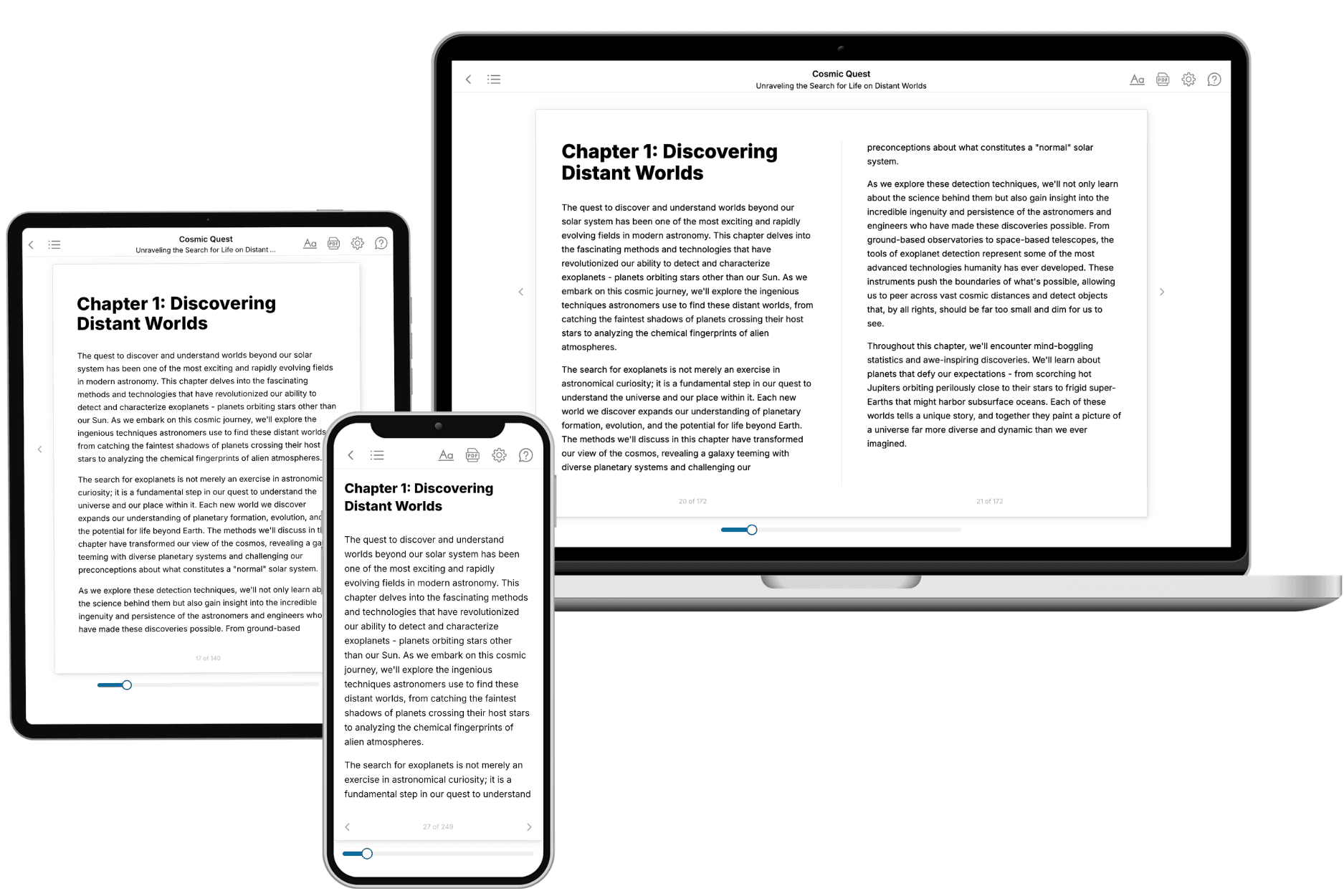
Your book is ready in 10 minutes. Read it online, download as EPUB or PDF, or send to Kindle.

Frequently asked questions
- What is TailoredRead?
TailoredRead creates complete, full-length nonfiction ebooks, written specifically for you. Tell us what you want to learn and why, and TailoredRead writes you a complete ebook on it, with charts, tables, and diagrams throughout. Read it online, on Kindle, or on any e-reader, or download it as a PDF or EPUB. Every book is written fresh the day you order it.
- How is the book tailored to me?
Before anything is written, you answer a few short questions about your goals, your background, and the topics you care about. Your book is then planned around your answers: written at your level, focused on your goals, and covering the topics you chose, instead of the one-size-fits-all book a store sells everyone.
- Will it read like generic AI content?
No. Your book isn't a chat transcript: it's planned chapter by chapter before a single word is written, told in a clear book voice, and explains ideas visually with charts, tables, and diagrams. After writing, every book goes through an editorial pass that polishes chapters so the book reads consistent from start to finish. Judge for yourself: browse thousands of sample books on our Explore Books page.
- How accurate is the content?
Our AI first checks whether your subject needs live research. Niche and fast-moving subjects are researched before writing, and the book plan and chapters are grounded in what it finds. After writing, every book goes through a quality pass that checks its facts and consistency, and researched books list their sources in a Notes section at the back.
- How long is the book?
You choose the length: Comprehensive (250-300 pages), Detailed (150-200 pages), Essential (70-100 pages), or Short (30-50 pages).
- Does the book include visuals?
Yes. Every book includes charts, tables, and diagrams: timelines, checklists, step-by-step guides, decision trees, comparison tables, matrices, and bar charts. A typical book includes dozens of these visual elements.
- Can I read it on Kindle? What formats can I download?
Yes. Every book can be read in our online reader or downloaded as a PDF or EPUB. The EPUB can be opened with Kindle, Apple Books, Kobo, and any e-reader. The Commercial and Author licenses also include an editable Word (DOCX) and Markdown download.
- How much does it cost?
About the price of a regular ebook. The exact price depends on your book's length and complexity, from $2 for the shortest books to $35 for the most comprehensive, and it's shown when you review your book, before you commit to anything. Each book is a one-time purchase, yours to keep, no subscription. Licenses that let you share, teach, or publish your book range from $35.99 to $49.99.
- Can I preview the book before purchasing?
Before you pay, you'll see what your book will cover: the title, a detailed description, the estimated length, and the complete chapter-by-chapter table of contents, so you know what you're getting before you decide. The full text itself is written after you purchase.
- How long does it take to create a book?
About 10 minutes. You can start reading the opening chapters while the rest is still being written.