Mastering Aerial Photogrammetry
From Drone Capture to 3D Models: The Complete Technical Guide
Take your aerial photography to the next level by mastering the science and practice of photogrammetry.
222 pages10 chaptersMay 2, 2026Photogrammetry
About this book
This comprehensive guide bridges the gap between capturing images and creating accurate 3D models that professionals rely on for surveying, mapping, and documentation. You'll learn the mathematical foundations that make photogrammetry work, discover how to plan flights that maximize data quality, and master the software workflows that transform raw images into precise spatial data. Whether you're documenting construction sites, mapping agricultural land, or creating detailed surveys, this book provides the technical knowledge and practical strategies you need. Explore real-world case studies, troubleshoot common challenges, and understand how to validate your results for professional standards. With step-by-step guidance on equipment setup, flight execution, and post-processing, you'll gain the confidence to deliver photogrammetry projects that meet industry expectations.
Table of contents
- IntroductionWhat is Photogrammetry and Why It Matters, The Evolution of Aerial Imaging Technology, How to Use This Book for Maximum LearningRead below
- Chapter 1: Photogrammetry FundamentalsMathematical Principles Behind 3D Reconstruction, Triangulation and Feature Matching Explained, Understanding Accuracy, Precision, and Error Sources
- Chapter 2: Equipment and Camera SetupSelecting the Right Drone for Photogrammetry, Camera Sensors, Lenses, and Optical Properties, Sensor Calibration and Distortion Correction
- Chapter 3: Flight Planning and ExecutionMission Planning Software and Tools, Calculating Overlap Percentages and Flight Altitude, Weather, Lighting, and Environmental Considerations, Safe Flight Execution and Data Capture
- Chapter 4: Ground Control Points and GeoreferencingWhy Ground Control Points Matter for Accuracy, GCP Placement Strategies and Measurement Techniques, Georeferencing Workflows and Coordinate Systems
- Chapter 5: Image Processing and PreprocessingAssessing and Ensuring Image Quality, Preprocessing Techniques and Image Enhancement, Batch Processing and Workflow Automation
- Chapter 6: Photogrammetry Software SolutionsStructure-from-Motion (SfM) Software Platforms, Specialized Photogrammetry and Survey Software, Comparing Software and Selecting the Right Tool
- Chapter 7: 3D Model Generation and ReconstructionPoint Cloud Generation and Optimization, Mesh Creation, Refinement, and Texturing, Orthomosaic and Orthophoto Production
- Chapter 8: Quality Assessment and ValidationAccuracy Testing and Validation Methods, Error Analysis and Troubleshooting Common Issues, Meeting Professional Standards and Specifications
- Chapter 9: Real-World Applications and Case StudiesSurveying, Mapping, and Land Documentation, Construction Site Monitoring and Progress Tracking, Archaeology, Agriculture, and Environmental Assessment
- Chapter 10: Advanced Techniques and OptimizationMultispectral and Thermal Imaging Integration, Managing Large-Scale Projects and Data, Performance Optimization and Processing Efficiency
- ConclusionKey Takeaways and Next Steps, The Future of Aerial Photogrammetry
- Glossary of Terms
- Further Reading and Resources
Introduction
There is a moment that every drone operator experiences at least once. You've just landed after a careful flight over a construction site, a field, or a historic building. You have hundreds of images on your memory card, and you know they overlap precisely the way you planned. Then you load them into software, wait for the processing to finish, and suddenly a fully realized three-dimensional model of the world appears on your screen. It's accurate enough to measure. It's detailed enough to analyze. And you built it entirely from photographs taken from the air. That moment is what photogrammetry is all about.
Photogrammetry is not a new idea, but the tools available today have made it more accessible and more powerful than at any point in history. What once required expensive aircraft, specialized film cameras, and teams of trained surveyors can now be accomplished with a consumer-grade drone, a laptop, and the right knowledge. The barrier to entry has dropped dramatically, but the technical depth of the discipline has not. Doing photogrammetry well still requires understanding the science behind it, planning your work carefully, and making smart decisions at every stage of the process.
This book is designed for people who already have some experience with aerial photography and want to take that foundation further. If you've flown a drone, captured images, and wondered how professionals turn those images into precise spatial data, you're in exactly the right place. The chapters ahead will walk you through the full pipeline, from the mathematical principles that make 3D reconstruction possible, to flight planning, ground control, software workflows, and final quality validation. Each step builds on the last, and by the end, you'll have a complete technical picture of how professional photogrammetry projects are planned and executed.
The goal here is not just to explain concepts but to give you practical tools you can use immediately. Every chapter includes specific techniques, real-world examples, and actionable guidance. Whether you're working on land surveys, construction monitoring, agricultural mapping, or heritage documentation, the principles covered in this book apply directly to your work. The field is broad, but the core skills are transferable, and mastering them opens doors to a wide range of professional applications with measurable value.
What is Photogrammetry and Why It Matters
Photogrammetry is the science of extracting precise measurements and three-dimensional information from photographs. The word itself comes from the Greek roots for light, writing, and measurement. At its core, the process works by analyzing how the same physical point in the real world appears in multiple overlapping images taken from different positions. By comparing those appearances mathematically, software can calculate the exact position of that point in three-dimensional space. Do this for millions of points across a scene, and you get a detailed, measurable 3D model.
The key distinction between photogrammetry and regular photography is the intent behind the images. In standard photography, you're capturing a visual record. In photogrammetry, you're capturing geometric data. Every image is a measurement instrument. The position of the camera when the photo was taken, the angle of view, the focal length of the lens, and the overlap between adjacent images all contribute to the accuracy of the final model. This is why photogrammetry requires careful planning rather than casual shooting.
Why does this matter in practice? Consider a few concrete examples. A land surveyor using traditional methods might spend two days measuring a five-acre site with a total station and GPS equipment. A photogrammetry workflow covering the same site can be completed in a single morning flight, with the resulting model providing comparable accuracy and far more visual detail. A construction project manager can use weekly photogrammetry flights to track earthwork volumes, compare progress against design plans, and identify discrepancies before they become expensive problems.
Research published in the ISPRS Journal of Photogrammetry and Remote Sensing has consistently shown that well-executed drone photogrammetry can achieve horizontal accuracies of 1-3 cm and vertical accuracies of 2-5 cm under controlled conditions with proper ground control points.[1]
The applications of aerial photogrammetry span an impressive range of industries. In surveying and mapping, it produces topographic maps, digital elevation models, and cadastral data. In construction, it enables volume calculations, progress monitoring, and as-built documentation. In agriculture, it supports crop health analysis, drainage planning, and yield estimation. In archaeology, it creates permanent digital records of excavation sites with millimeter-level detail. Each of these applications relies on the same underlying principles, which is what makes photogrammetry such a versatile skill to develop.
Understanding why photogrammetry matters also means understanding its limitations. It is not a magic solution for every measurement problem. It struggles with reflective surfaces like water or glass, featureless areas like blank concrete or sand, and scenes with moving objects. It requires good lighting, sufficient image overlap, and careful calibration to produce reliable results. Knowing these boundaries is just as important as knowing the capabilities, because it helps you design projects that play to the technology's strengths and avoid situations where it will underperform.
The economic case for photogrammetry is also compelling. A professional drone setup capable of producing survey-grade outputs can be acquired for a fraction of the cost of traditional survey equipment. The time savings on data collection are significant, and the richness of the resulting data often exceeds what traditional methods provide. For businesses and professionals who invest in learning the discipline properly, the return on that investment tends to be rapid and substantial. This is not a niche technology anymore. It is becoming a standard tool in multiple industries, and the professionals who understand it deeply are in high demand.
Finally, photogrammetry matters because it democratizes spatial data. Detailed 3D models of real-world environments were once accessible only to well-funded organizations with specialized equipment. Today, a skilled operator with a mid-range drone and the right knowledge can produce outputs that rival those of much larger operations. That shift has opened up new possibilities for small businesses, independent consultants, researchers, and community organizations who need accurate spatial information but don't have the budget for traditional survey methods.
The Evolution of Aerial Imaging Technology
The history of aerial photogrammetry stretches back further than most people expect. The first aerial photograph was taken in 1858 by French photographer and balloonist Gaspard-Félix Tournachon, known as Nadar, who captured an image of a Paris suburb from a tethered balloon.[2] Within a few decades, military organizations recognized the potential of aerial imagery for mapping and reconnaissance, and the discipline began developing in earnest during the late 19th and early 20th centuries. By World War I, aerial photography had become a critical military tool, and systematic methods for extracting measurements from overlapping photographs were being formalized.
The interwar period saw the development of dedicated aerial survey cameras, stereoscopic plotting instruments, and the mathematical frameworks that still underpin modern photogrammetry. Organizations like the International Society for Photogrammetry (founded in 1910, now the ISPRS) began standardizing methods and sharing research across national boundaries. By the mid-20th century, aerial photogrammetry was the primary method for producing topographic maps at national scale, and entire government agencies were dedicated to the discipline.
The transition from analog to digital technology in the 1980s and 1990s transformed the field significantly. Film cameras gave way to digital sensors, and the labor-intensive process of manual stereo plotting was gradually replaced by computer-assisted and then fully automated processing. The development of Structure-from-Motion (SfM) algorithms in the early 2000s was particularly transformative. SfM made it possible to reconstruct 3D geometry from unordered sets of overlapping images without requiring precise knowledge of camera positions in advance, dramatically simplifying the data collection process.
The consumer drone revolution, which accelerated rapidly after 2010, brought aerial photogrammetry within reach of a much wider audience. Early platforms like the DJI Phantom series gave photographers and surveyors an affordable way to capture aerial imagery without the cost of manned aircraft. As drone technology matured, purpose-built photogrammetry platforms emerged with features like RTK (Real-Time Kinematic) GPS positioning, mechanical shutters to eliminate motion blur, and integrated mission planning software. These advances reduced the technical barriers to entry while simultaneously raising the ceiling on achievable accuracy.
Today's photogrammetry ecosystem includes a remarkable range of tools at every price point. On the hardware side, options range from sub-$1,000 consumer drones to $50,000+ professional survey platforms. On the software side, platforms like Agisoft Metashape, Pix4D, DroneDeploy, and open-source tools like OpenDroneMap offer varying combinations of automation, accuracy, and flexibility. Cloud processing has made it possible to handle large datasets without requiring expensive local computing hardware. The result is a mature, accessible technology ecosystem that continues to evolve rapidly.
One of the most significant recent developments is the integration of photogrammetry with other sensing technologies. Multispectral cameras capture data beyond the visible spectrum, enabling vegetation health analysis and precision agriculture applications. Thermal cameras detect heat signatures for building inspection and search-and-rescue operations. LiDAR (Light Detection and Ranging) sensors provide point cloud data that complements photogrammetric outputs, particularly in areas with dense vegetation where cameras struggle to see the ground. Understanding how these technologies relate to and interact with photogrammetry is increasingly important for professionals working in complex environments.
The regulatory landscape has also evolved alongside the technology. Most countries now have established frameworks for commercial drone operations, with requirements around pilot certification, airspace authorization, and operational limitations. In the United States, the FAA's Part 107 rules govern commercial drone operations. In Europe, the EASA drone regulations provide a tiered framework based on operational risk. Staying current with these regulations is a practical necessity for anyone doing professional photogrammetry work, and the regulatory environment continues to develop as the technology matures and becomes more widespread.
Looking at this history, a clear pattern emerges. Each major technological shift, from film to digital, from manual to automated processing, from manned aircraft to drones, has expanded what's possible while making the technology more accessible. The current moment is no different. The tools available today are more capable and more affordable than ever before, but the professionals who get the most out of them are those who understand the underlying principles deeply enough to use the tools intelligently rather than just following automated workflows without understanding what's happening under the hood.
How to Use This Book for Maximum Learning
This book is structured as a complete technical guide that follows the natural workflow of a photogrammetry project from start to finish. The chapters are designed to build on each other, so reading them in order will give you the most coherent understanding of how all the pieces fit together. That said, if you have specific knowledge gaps or immediate project needs, each chapter is also written to stand on its own as a reference. The table of contents and the glossary at the back of the book will help you navigate to specific topics quickly when you need them.
Here's a brief map of what each section covers and how they connect:
- Chapters 1 and 2 cover the foundational knowledge you need before you fly. Chapter 1 explains the mathematical and conceptual principles behind photogrammetry. Chapter 2 covers equipment selection and camera setup. If you're already comfortable with these topics, you can skim them and use them as reference material.
- Chapters 3 and 4 focus on the field work phase. Chapter 3 covers flight planning and execution in detail. Chapter 4 addresses ground control points and georeferencing, which are critical for achieving professional accuracy levels.
- Chapters 5, 6, and 7 cover the processing pipeline. Chapter 5 addresses image quality and preprocessing. Chapter 6 compares the major software platforms. Chapter 7 walks through the actual 3D reconstruction process from point clouds to finished models.
- Chapters 8 and 9 address quality and application. Chapter 8 covers accuracy validation and troubleshooting. Chapter 9 presents real-world case studies across multiple industries.
- Chapter 10 covers advanced topics including multispectral imaging, large-scale project management, and processing optimization for experienced practitioners.
The most effective way to use this book is to combine reading with hands-on practice. Photogrammetry is a skill that develops through doing, not just through understanding. After reading each chapter, try to apply what you've learned on a real project, even a small one. Fly a test area near your home or workplace. Process the images using the techniques described. Compare your results against the quality benchmarks discussed in Chapter 8. This kind of deliberate practice will accelerate your learning far more than reading alone.
Throughout the book, you'll find several recurring elements designed to make the content more practical and easier to apply:
- Concrete examples and case studies that show how the concepts work in real projects with specific numbers and outcomes
- Step-by-step processes and frameworks that you can follow directly in your own work
- Common mistakes and how to avoid them, drawn from the kinds of errors that consistently trip up practitioners at every level
- Troubleshooting guidance for when things don't go as planned, because in real-world photogrammetry, something unexpected almost always comes up
- Footnotes and citations pointing to research and resources for topics where you want to go deeper
A note on software references throughout the book. Photogrammetry software evolves quickly, and specific interface details change with each version update. Rather than providing step-by-step click-by-click instructions that may become outdated, the book focuses on the underlying concepts and workflows that apply across platforms. When specific software is mentioned, it's to illustrate a concept or compare approaches, not to serve as a definitive tutorial. The official documentation for whichever platform you choose will always be the most current source for interface-specific guidance.
If you're coming to this book with a specific application in mind, such as construction monitoring or agricultural mapping, you'll find the most directly relevant material in Chapter 9. However, resist the temptation to skip straight there. The quality of your application-specific work will depend heavily on the foundational skills covered in the earlier chapters. A construction monitoring workflow that uses poorly planned flights or skips ground control will produce results that look impressive but fail under professional scrutiny. The foundation matters.
The book also assumes that you have access to a drone and are operating within the legal framework of your jurisdiction. It does not cover the basics of drone piloting or the specifics of regulatory compliance in detail, as these topics are well covered elsewhere and vary significantly by location. What it does assume is that you can fly safely and legally, and that you're ready to focus on the photogrammetry-specific knowledge that will elevate the quality and usefulness of the data you collect.
One of the most valuable things you can do as you work through this material is to build a personal reference library of your own project results. Keep notes on the settings you used, the conditions you flew in, the processing parameters you applied, and the accuracy results you achieved. Over time, this personal dataset becomes an invaluable resource for calibrating your judgment and making better decisions on future projects. The professionals who consistently produce excellent photogrammetry results are almost always the ones who have developed this kind of systematic, reflective practice.
Finally, approach this material with the understanding that photogrammetry rewards patience and precision. It is a discipline where cutting corners in the field almost always creates problems in processing, and where problems in processing undermine the value of the final deliverable. The good news is that when you do things right, the results are genuinely impressive. Accurate, detailed, measurable 3D models of real-world environments are powerful tools, and the ability to produce them reliably is a skill that opens significant professional opportunities. The investment in learning the discipline properly is well worth making.
This is the end of the free sample. The full book has 10 chapters.
Want this book written for you?
Tell us your goals and background, and get your own version of this book, tailored by AI to you.


Benefits of AI-tailored books
- Read one book, not ten:
- all the Photogrammetry knowledge you need, gathered into a single book.
- Save days of learning:
- tell us your goals, choose your topics, and the whole book is built around them.
- Learn effortlessly:
- Photogrammetry book written for your specific background and expertise.
- Understand at a glance:
- includes charts, tables, timelines, checklists, decision trees, and more.
- Stay current:
- written the day you order it, not years ago.
- Trust what you read:
- every book is checked for accuracy, with real research when your subject needs it.
Create your unique book in 3 steps
- 1. Select your focus
Select the focus of your Photogrammetry book and share your background
- 2. Personalize your book
Specify your goals and choose sub-topics to include
- 3. Get your tailored book
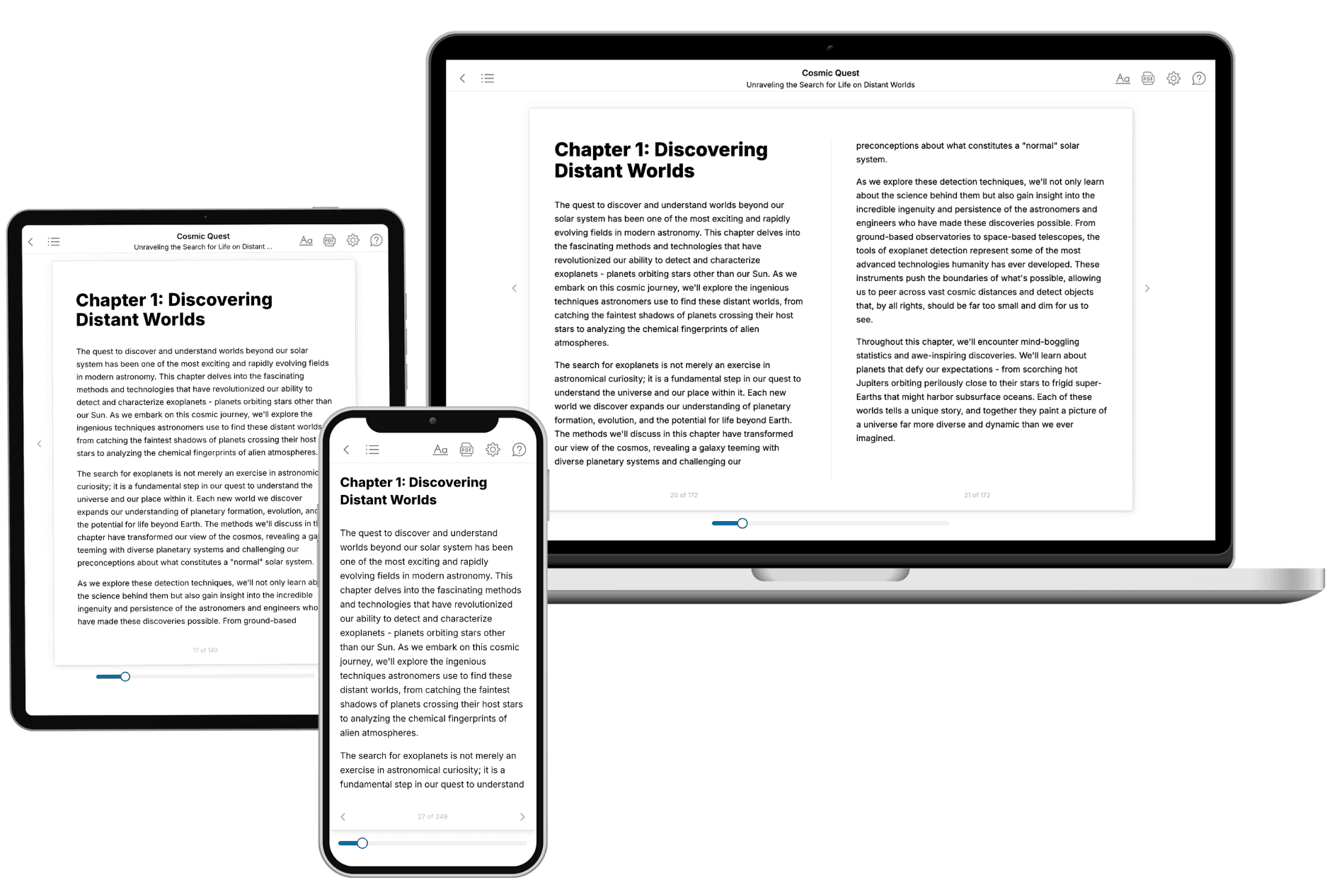
Your book is ready in 10 minutes. Read it online, download as EPUB or PDF, or send to Kindle.

Frequently asked questions
- What is TailoredRead?
TailoredRead creates complete, full-length nonfiction ebooks, written specifically for you. Tell us what you want to learn and why, and TailoredRead writes you a complete ebook on it, with charts, tables, and diagrams throughout. Read it online, on Kindle, or on any e-reader, or download it as a PDF or EPUB. Every book is written fresh the day you order it.
- How is the book tailored to me?
Before anything is written, you answer a few short questions about your goals, your background, and the topics you care about. Your book is then planned around your answers: written at your level, focused on your goals, and covering the topics you chose, instead of the one-size-fits-all book a store sells everyone.
- Will it read like generic AI content?
No. Your book isn't a chat transcript: it's planned chapter by chapter before a single word is written, told in a clear book voice, and explains ideas visually with charts, tables, and diagrams. After writing, every book goes through an editorial pass that polishes chapters so the book reads consistent from start to finish. Judge for yourself: browse thousands of sample books on our Explore Books page.
- How accurate is the content?
Our AI first checks whether your subject needs live research. Niche and fast-moving subjects are researched before writing, and the book plan and chapters are grounded in what it finds. After writing, every book goes through a quality pass that checks its facts and consistency, and researched books list their sources in a Notes section at the back.
- How long is the book?
You choose the length: Comprehensive (250-300 pages), Detailed (150-200 pages), Essential (70-100 pages), or Short (30-50 pages).
- Does the book include visuals?
Yes. Every book includes charts, tables, and diagrams: timelines, checklists, step-by-step guides, decision trees, comparison tables, matrices, and bar charts. A typical book includes dozens of these visual elements.
- Can I read it on Kindle? What formats can I download?
Yes. Every book can be read in our online reader or downloaded as a PDF or EPUB. The EPUB can be opened with Kindle, Apple Books, Kobo, and any e-reader. The Commercial and Author licenses also include an editable Word (DOCX) and Markdown download.
- How much does it cost?
About the price of a regular ebook. The exact price depends on your book's length and complexity, from $2 for the shortest books to $35 for the most comprehensive, and it's shown when you review your book, before you commit to anything. Each book is a one-time purchase, yours to keep, no subscription. Licenses that let you share, teach, or publish your book range from $35.99 to $49.99.
- Can I preview the book before purchasing?
Before you pay, you'll see what your book will cover: the title, a detailed description, the estimated length, and the complete chapter-by-chapter table of contents, so you know what you're getting before you decide. The full text itself is written after you purchase.
- How long does it take to create a book?
About 10 minutes. You can start reading the opening chapters while the rest is still being written.