Electrical Resistivity Tomography Explained
Survey design, inversion algorithms and subsurface data processing
Achieve precise subsurface imaging capabilities that reveal hidden geological structures, groundwater systems, and environmental conditions with unprecedented clarity.
284 pages16 chaptersSep 22, 2025Geophysics
About this book
This comprehensive guide transforms your understanding of electrical resistivity tomography from basic concepts to advanced professional applications. You'll master the complete workflow from survey design through final interpretation, learning how to select optimal electrode configurations, process complex datasets, and apply sophisticated inversion algorithms. The book provides detailed coverage of modern data processing techniques, quality control methods, and integration strategies that professional geophysicists rely on for accurate subsurface characterization. Through systematic exploration of field procedures, computational methods, and interpretation techniques, you'll develop the expertise to tackle challenging subsurface investigations with confidence. Real-world case studies demonstrate how to apply these methods across diverse geological settings, from environmental site assessments to groundwater exploration. Whether you're advancing your geophysical career or enhancing your research capabilities, this book provides the technical depth and practical insights needed to excel in electrical resistivity tomography applications.
Table of contents
- IntroductionOverview of Electrical Resistivity Tomography, Applications and Scope, How to Use This Book, Prerequisites and Background KnowledgeRead below
- Chapter 1: Fundamentals of Electrical ResistivityElectrical Properties of Earth Materials, Resistivity and Conductivity Concepts, Current Flow in Heterogeneous Media, Basic Measurement Principles
- Chapter 2: Electrode Array ConfigurationsWenner Array Design and Applications, Schlumberger Array Configuration, Dipole-Dipole Array Systems, Pole-Pole and Pole-Dipole Arrays, Comparative Analysis of Array Performance
- Chapter 3: Survey Design and PlanningSite Assessment and Reconnaissance, Electrode Spacing and Line Layout, Resolution and Depth Penetration, Survey Parameter Optimization
- Chapter 4: Field Data AcquisitionEquipment Setup and Calibration, Electrode Installation Techniques, Data Collection Protocols, Field Quality Control Procedures
- Chapter 5: Data Preprocessing and Quality AssessmentRaw Data Review and Validation, Noise Identification and Characterization, Data Filtering and Smoothing, Outlier Detection and Removal
- Chapter 6: Forward Modeling TheoryMathematical Foundation of Forward Modeling, Finite Element Method Applications, Boundary Conditions and Mesh Design, Synthetic Model Generation
- Chapter 7: Inversion Theory and AlgorithmsFundamental Inversion Principles, Least Squares Inversion Methods, Regularization Techniques, Convergence Criteria and Optimization
- Chapter 8: 2D Resistivity Inversion2D Modeling Assumptions and Limitations, Smoothness Constraints and Damping, Topographic Correction Methods, Inversion Parameter Selection
- Chapter 9: 3D Resistivity Inversion3D Data Acquisition Requirements, 3D Mesh Generation and Refinement, Computational Efficiency and Memory Management, 3D Model Visualization Techniques
- Chapter 10: Processing Software and ToolsCommercial Software Packages, Open Source Processing Tools, Workflow Automation and Scripting, Custom Algorithm Development
- Chapter 11: Interpretation Methods and TechniquesResistivity-Geology Relationships, Structural Feature Identification, Hydrogeological Interpretation, Uncertainty Analysis and Error Assessment
- Chapter 12: Integration with Other Geophysical MethodsIntegration with Seismic Methods, Electromagnetic Method Integration, Gravity and Magnetic Data Integration, Joint Inversion Techniques
- Chapter 13: Environmental ApplicationsContamination Plume Detection, Landfill and Waste Site Characterization, Groundwater Monitoring Applications, Remediation Monitoring Techniques
- Chapter 14: Hydrogeological ApplicationsAquifer Mapping and Characterization, Saltwater Intrusion Studies, Water Well Siting Applications, Hydraulic Property Estimation
- Chapter 15: Engineering and Infrastructure ApplicationsFoundation Investigation Methods, Cavity and Void Detection, Infrastructure Monitoring Applications, Geotechnical Site Characterization
- Chapter 16: Advanced Processing TechniquesTime-Lapse Resistivity Monitoring, Anisotropy Analysis and Modeling, Machine Learning Applications, Resolution Enhancement Techniques
- ConclusionKey Takeaways and Best Practices, Future Developments in ERT
Introduction
Electrical resistivity tomography represents one of the most powerful and versatile geophysical methods available for subsurface investigation today. This non-invasive technique provides detailed images of underground structures by measuring how electrical current flows through different earth materials, revealing critical information about geological formations, groundwater systems, and environmental conditions that would otherwise remain hidden. The method's ability to produce high-resolution cross-sectional images of the subsurface has revolutionized how geophysicists approach complex subsurface characterization challenges. Modern resistivity tomography systems can detect subtle variations in subsurface properties, making it possible to identify features ranging from small-scale contamination plumes to large-scale geological structures with remarkable precision.
The evolution of electrical resistivity tomography from simple resistivity profiling to sophisticated multi-dimensional imaging represents a significant advancement in geophysical methodology. Traditional resistivity methods provided point measurements or simple profiles, but tomographic approaches generate comprehensive subsurface models that reveal the spatial distribution of resistivity values throughout the investigation area. This transformation has been driven by advances in field instrumentation, computational power, and inversion algorithms that can process large datasets efficiently. Contemporary resistivity tomography systems can collect thousands of measurements automatically, while sophisticated software packages can process this data to produce detailed subsurface images within hours rather than days or weeks.
Understanding the principles and applications of electrical resistivity tomography has become essential for professionals working in environmental consulting, hydrogeology, engineering geology, and archaeological investigation. The method's versatility allows it to address diverse subsurface investigation challenges, from detecting groundwater contamination and mapping aquifer boundaries to locating buried utilities and assessing foundation conditions. As environmental regulations become more stringent and infrastructure development projects become more complex, the demand for accurate subsurface characterization continues to grow. Mastering electrical resistivity tomography techniques provides geophysicists with a powerful tool for meeting these evolving professional challenges while delivering reliable results that support critical decision-making processes.
Overview of Electrical Resistivity Tomography
Electrical resistivity tomography operates on the fundamental principle that different subsurface materials exhibit distinct electrical properties when subjected to applied electrical currents. The method involves injecting controlled electrical currents into the ground through current electrodes and measuring the resulting voltage differences at potential electrodes positioned at various locations across the survey area. These measurements reflect the subsurface distribution of electrical resistivity, which varies significantly among different geological materials, fluid compositions, and structural features. Resistivity values can range from less than one ohm-meter for highly conductive materials like clay-rich sediments or saline groundwater to several thousand ohm-meters for resistive materials such as dry bedrock or unsaturated coarse-grained sediments.
The tomographic aspect of the method refers to the mathematical reconstruction process that transforms the collected electrical measurements into detailed cross-sectional images of subsurface resistivity distribution. This process involves sophisticated inversion algorithms that solve the inverse problem of determining subsurface resistivity structure from surface electrical measurements. The inversion process considers the complex three-dimensional nature of electrical current flow in heterogeneous subsurface conditions, accounting for factors such as electrode geometry, topographic variations, and measurement uncertainties. Modern inversion algorithms can process hundreds or thousands of individual resistivity measurements simultaneously to produce coherent subsurface models that honor the observed data while maintaining geological reasonableness.
Contemporary electrical resistivity tomography systems integrate advanced field instrumentation with powerful data processing capabilities to deliver comprehensive subsurface characterization solutions. Modern resistivity meters can automatically switch between multiple electrode configurations, collect high-quality data under challenging field conditions, and provide real-time data quality assessment during field operations. These systems typically include:
- Multi-channel resistivity meters capable of simultaneous measurements from multiple electrode pairs
- Automated electrode switching systems that can manage dozens or hundreds of electrodes
- GPS positioning systems for precise electrode location recording
- Data logging capabilities with built-in quality control algorithms
- Wireless communication systems for remote monitoring and control
The spatial resolution and depth penetration capabilities of electrical resistivity tomography depend on several key factors including electrode spacing, array configuration, and subsurface resistivity contrasts. Spatial resolution generally decreases with depth, with the finest resolution achieved near the surface where electrode spacing is smallest. Typical surveys can achieve horizontal resolution on the order of the electrode spacing, while vertical resolution is generally somewhat coarser. Depth penetration typically ranges from one-quarter to one-half of the total electrode spread length, though this can vary significantly depending on subsurface conditions and array configuration. Understanding these fundamental relationships is crucial for designing effective surveys that can address specific investigation objectives while maintaining appropriate resolution and coverage.
The interpretation of electrical resistivity tomography results requires comprehensive understanding of the relationships between measured resistivity values and subsurface conditions. Resistivity variations reflect changes in several key subsurface properties including porosity, fluid saturation, fluid chemistry, clay content, and temperature. Archie's law provides a fundamental framework for relating resistivity measurements to porosity and fluid saturation in clean sediments, while more complex relationships apply in clay-rich materials where surface conduction effects become significant. Successful interpretation also requires consideration of geological context, hydrogeological conditions, and potential anthropogenic influences that may affect subsurface electrical properties.
Quality control and uncertainty assessment represent critical components of professional electrical resistivity tomography practice. Measurement uncertainties can arise from various sources including electrode contact resistance, electrical noise, instrumental drift, and three-dimensional effects in nominally two-dimensional surveys. Data quality assessment involves systematic evaluation of measurement repeatability, reciprocal measurement consistency, and statistical analysis of data scatter. Modern processing workflows incorporate uncertainty propagation through the inversion process, providing quantitative estimates of model reliability that support confident interpretation and decision-making. Understanding and managing these uncertainties is essential for producing reliable results that meet professional standards and regulatory requirements.
The integration of electrical resistivity tomography with other geophysical methods and direct investigation techniques enhances subsurface characterization capabilities significantly. Multi-method approaches can reduce interpretation ambiguity, improve spatial resolution, and provide complementary information about different subsurface properties. Common integration strategies include combining resistivity data with seismic refraction surveys for comprehensive geotechnical characterization, electromagnetic methods for enhanced conductivity mapping, and ground-penetrating radar for high-resolution shallow investigations. Direct validation through drilling, sampling, and laboratory analysis provides essential ground-truth information that supports confident interpretation of geophysical results.
Recent technological advances continue to expand the capabilities and applications of electrical resistivity tomography. Time-lapse monitoring applications enable tracking of dynamic subsurface processes such as contaminant migration, groundwater flow variations, and remediation progress over extended time periods. Three-dimensional survey techniques provide comprehensive volumetric characterization of complex subsurface conditions, while advanced inversion algorithms incorporate geological constraints and multi-physics coupling to improve model accuracy. Machine learning approaches are beginning to enhance automated data processing and interpretation capabilities, potentially reducing the time and expertise required for routine applications while maintaining high-quality results.
Applications and Scope
Environmental site characterization represents one of the most significant application areas for electrical resistivity tomography, where the method provides critical information for assessing contamination extent, monitoring remediation progress, and evaluating long-term environmental conditions. Contaminant plume delineation relies on the distinct electrical signatures of different contaminant types and their effects on groundwater chemistry. Organic contaminants such as petroleum hydrocarbons typically increase subsurface resistivity by displacing conductive groundwater, while inorganic contaminants like dissolved salts or acids often decrease resistivity by increasing groundwater conductivity. The method's ability to map these resistivity variations continuously across large areas makes it invaluable for defining contamination boundaries, identifying preferential flow paths, and optimizing remediation system design.
Landfill characterization and waste site investigation benefit significantly from electrical resistivity tomography's capability to penetrate through heterogeneous fill materials and detect subsurface features that control contaminant migration. Leachate plumes typically exhibit low resistivity signatures due to their high dissolved solids content, making them readily detectable against background groundwater conditions. The method can also identify key hydrogeological features such as clay layers that may act as barriers to vertical migration, permeable zones that facilitate lateral spreading, and bedrock topography that influences groundwater flow directions. Case studies from municipal solid waste landfills demonstrate the method's effectiveness in mapping leachate extent over distances of several hundred meters with spatial resolution sufficient to guide monitoring well placement and remediation system design.
Hydrogeological applications encompass a broad range of groundwater investigation challenges where electrical resistivity tomography provides essential information about aquifer geometry, hydraulic properties, and water quality variations. Aquifer mapping applications rely on the resistivity contrasts between water-saturated sediments and surrounding materials to delineate aquifer boundaries, identify recharge and discharge zones, and characterize internal heterogeneity that affects groundwater flow patterns. The method's depth penetration capabilities make it particularly valuable for investigating deep aquifer systems where drilling costs would be prohibitive for comprehensive characterization. Successful aquifer mapping projects have identified productive water-bearing zones at depths exceeding 100 meters, providing critical information for water supply development in arid and semi-arid regions.
Saltwater intrusion studies represent a specialized hydrogeological application where electrical resistivity tomography's sensitivity to groundwater salinity provides unique advantages for monitoring and management. Saltwater intrusion creates distinctive low-resistivity anomalies that can be tracked both spatially and temporally to assess intrusion extent, monitor seasonal variations, and evaluate the effectiveness of management strategies. Coastal aquifer studies have demonstrated the method's capability to map the freshwater-saltwater interface with sufficient resolution to support numerical groundwater flow modeling and water resource management decisions. Time-lapse monitoring applications can detect subtle changes in interface position that may indicate long-term trends or responses to pumping stress or climate variations.
Engineering and geotechnical applications utilize electrical resistivity tomography to characterize subsurface conditions that affect foundation design, construction planning, and infrastructure stability. Foundation investigation projects benefit from the method's ability to identify key geotechnical features such as:
- Bedrock depth variations that affect bearing capacity and settlement characteristics
- Soil layer boundaries with different engineering properties
- Groundwater table fluctuations that influence foundation design requirements
- Weak zones or cavities that may pose stability risks
- Fill material extent and compaction characteristics
Cavity and void detection applications demonstrate electrical resistivity tomography's capability to identify subsurface features that pose significant risks to infrastructure and public safety. Karst terrain investigations utilize the high resistivity contrast between air-filled or water-filled cavities and surrounding rock matrix to locate potentially hazardous voids before they cause surface collapse. The method has successfully identified cavities ranging from small solution features less than one meter in diameter to large cave systems extending over hundreds of meters. Urban applications include detecting abandoned underground storage tanks, utility tunnels, and basement structures that may not be accurately documented in historical records.
Archaeological applications leverage electrical resistivity tomography's ability to detect subtle subsurface features associated with human occupation and cultural activities. Archaeological prospection relies on the resistivity contrasts created by buried structures, disturbed soils, and cultural deposits to identify sites of potential significance before excavation. The method can detect features such as building foundations, hearths, burial sites, and refuse pits that exhibit different electrical properties compared to undisturbed natural soils. Large-scale archaeological surveys have successfully mapped entire settlement patterns and identified previously unknown sites across landscapes covering several square kilometers.
Mineral exploration and geological mapping applications utilize electrical resistivity tomography to characterize subsurface geology and identify targets for further investigation. Structural geology studies benefit from the method's ability to map fault systems, fracture zones, and lithological contacts that control mineralization processes and groundwater flow. The method's sensitivity to alteration zones associated with mineral deposits makes it valuable for reconnaissance-scale exploration programs, particularly when combined with other geophysical methods. Successful applications include mapping of epithermal gold systems, porphyry copper deposits, and sediment-hosted base metal occurrences where resistivity variations reflect hydrothermal alteration patterns.
Infrastructure monitoring and maintenance applications represent an emerging area where electrical resistivity tomography provides valuable information about the long-term performance and stability of engineered systems. Dam safety monitoring utilizes time-lapse resistivity measurements to detect seepage development, internal erosion, and structural deterioration that may compromise dam integrity. Levee monitoring applications can identify weak zones, preferential seepage paths, and settlement-related damage that require maintenance attention. Transportation infrastructure applications include monitoring embankment stability, detecting pavement subgrade problems, and assessing the condition of retaining structures and bridge foundations.
How to Use This Book
This book follows a systematic progression from fundamental concepts through advanced applications, designed to build your expertise in electrical resistivity tomography methodically and comprehensively. The structure reflects the typical workflow of professional resistivity tomography projects, beginning with theoretical foundations and progressing through survey design, data acquisition, processing, and interpretation phases. Each chapter builds upon previous concepts while introducing new material at an appropriate level of complexity for intermediate-level practitioners. The organization allows you to focus on specific topics of immediate interest while maintaining awareness of how individual components integrate into complete investigation workflows.
The early chapters establish essential theoretical foundations that underpin all aspects of electrical resistivity tomography practice. Chapters 1-3 cover fundamental electrical properties of earth materials, electrode array configurations, and survey design principles that form the basis for effective field investigations. These chapters provide the conceptual framework necessary for understanding why certain approaches work better than others under different subsurface conditions. The material includes quantitative relationships, design equations, and selection criteria that support informed decision-making during project planning phases. Working through these chapters systematically will ensure you have the theoretical background needed to tackle more advanced topics with confidence.
The middle chapters focus on practical implementation aspects including field procedures, data processing, and modeling techniques that transform raw measurements into interpretable subsurface images. Chapters 4-10 provide detailed coverage of:
- Field data acquisition protocols that ensure high-quality measurements
- Data preprocessing techniques for noise reduction and quality assessment
- Forward and inverse modeling theory with practical implementation guidance
- Two-dimensional and three-dimensional inversion methods for different investigation scenarios
- Software tools and processing workflows used in professional practice
The later chapters address interpretation methods and specialized applications that demonstrate how to extract meaningful geological and engineering information from resistivity tomography results. Chapters 11-16 cover interpretation techniques, integration with other geophysical methods, and detailed application examples across environmental, hydrogeological, and engineering domains. These chapters emphasize the relationship between measured resistivity values and subsurface conditions, providing the knowledge needed to translate geophysical results into actionable information for clients and stakeholders. The application chapters include case studies with specific details about survey parameters, processing approaches, and interpretation strategies that led to successful project outcomes.
Throughout the book, practical examples and case studies illustrate key concepts and demonstrate real-world applications of the techniques being discussed. These examples are drawn from diverse geological settings and investigation objectives to show how fundamental principles adapt to different circumstances. Each case study includes sufficient detail about survey design, data processing parameters, and interpretation approaches to serve as templates for similar investigations. The examples also highlight common challenges and their solutions, helping you anticipate and address problems that may arise during your own projects.
The book includes extensive use of visual aids and technical illustrations to clarify complex concepts and demonstrate proper implementation of various techniques. Figures include electrode array diagrams, data processing flowcharts, inversion parameter selection guides, and interpretation examples that support the written material. Tables provide quantitative information such as typical resistivity ranges for different materials, survey design parameters for various applications, and software comparison matrices that support informed tool selection. These visual elements are designed to serve as quick reference materials that you can return to during active project work.
For readers seeking to implement specific techniques immediately, each chapter includes actionable guidance that can be applied directly to ongoing projects. Key sections are clearly marked with implementation steps, parameter selection criteria, and quality control checkpoints that ensure reliable results. The book also identifies common pitfalls and provides troubleshooting guidance for situations where standard approaches may not work effectively. This practical focus ensures that the book serves as both a learning resource and a working reference for active practitioners.
The progression through the book can be adapted to different learning objectives and time constraints. Readers seeking comprehensive mastery should work through the chapters sequentially, completing the practical exercises and case study analyses that reinforce key concepts. Those focusing on specific applications can concentrate on relevant chapters while referring to foundational material as needed. The extensive cross-referencing and index system facilitate this flexible approach by making it easy to locate related information throughout the book.
Advanced practitioners may find particular value in the later chapters that address cutting-edge techniques and emerging applications. Time-lapse monitoring, machine learning applications, and advanced integration methods represent areas of active development where new capabilities continue to emerge. These chapters provide the foundation for staying current with technological advances and adapting new methods to your specific application areas. The book also includes guidance on continuing education resources and professional development opportunities that support ongoing skill enhancement.
Prerequisites and Background Knowledge
Successful mastery of electrical resistivity tomography requires a solid foundation in several key technical areas that form the basis for understanding both theoretical principles and practical implementation challenges. Undergraduate-level physics and mathematics provide essential background for comprehending electrical current flow, potential field theory, and the mathematical relationships that govern resistivity measurements. Specifically, you should be comfortable with vector calculus, differential equations, and basic electromagnetic theory as typically covered in junior-level physics courses. Linear algebra concepts including matrix operations, eigenvalue problems, and least-squares solutions are fundamental to understanding inversion algorithms and data processing techniques.
Geophysical background knowledge significantly enhances your ability to understand resistivity tomography within the broader context of subsurface investigation methods. Previous exposure to geophysical principles through coursework or professional experience provides valuable perspective on how electrical methods relate to other techniques such as seismic, electromagnetic, and gravity methods. Understanding concepts such as resolution limitations, depth penetration relationships, and ambiguity in geophysical interpretation helps establish realistic expectations for resistivity tomography applications. Familiarity with geophysical data processing concepts including filtering, interpolation, and statistical analysis provides useful background for understanding resistivity data processing workflows.
Geological knowledge forms a critical foundation for effective interpretation of resistivity tomography results, as the method's value lies primarily in its ability to characterize subsurface geological conditions. Basic understanding of geological processes including sedimentary, igneous, and metamorphic rock formation helps explain the resistivity variations observed in different geological settings. Structural geology concepts such as faulting, folding, and fracturing are essential for interpreting resistivity anomalies associated with deformed rock masses. Hydrogeology fundamentals including groundwater flow principles, aquifer types, and water chemistry effects on electrical conductivity are particularly important for environmental and water resource applications.
Computer skills and familiarity with data processing software significantly impact your ability to implement modern resistivity tomography techniques effectively. Proficiency with spreadsheet applications and basic programming concepts helps with data manipulation, quality control procedures, and custom analysis tasks that arise during complex projects. While specialized resistivity processing software handles most routine calculations, understanding the underlying computational approaches enables more effective use of these tools and better recognition of potential problems. Familiarity with geographic information systems (GIS) software is increasingly important for integrating resistivity results with other spatial datasets and producing professional-quality deliverables.
Field experience with geophysical or geological investigation methods provides valuable practical background that enhances your ability to plan and execute successful resistivity tomography surveys. Understanding of field safety procedures, equipment handling, and data collection protocols helps ensure efficient and safe field operations. Previous experience with surveying techniques, GPS positioning, and field documentation standards supports the systematic approach required for high-quality resistivity surveys. Familiarity with drilling, sampling, and other direct investigation methods helps in planning integrated investigation programs that combine geophysical and direct methods effectively.
Statistical analysis and uncertainty assessment concepts are increasingly important for modern resistivity tomography practice, where quantitative evaluation of data quality and model reliability has become standard professional practice. Basic statistics knowledge including concepts such as:
- Probability distributions and confidence intervals for measurement uncertainty assessment
- Regression analysis for evaluating relationships between resistivity and other parameters
- Hypothesis testing for comparing different interpretation models
- Error propagation for understanding how measurement uncertainties affect final results
- Quality control statistics for systematic data validation procedures
Project management and client communication skills become increasingly important as you advance in resistivity tomography applications, particularly for consulting and applied research environments. Understanding of project planning principles helps in developing realistic schedules, budgets, and deliverable specifications that meet client needs while maintaining technical quality standards. Effective communication skills are essential for explaining technical results to non-technical audiences, preparing clear and concise reports, and presenting findings in formats appropriate for different stakeholder groups. These skills are particularly important for environmental and engineering applications where resistivity results must support regulatory compliance or design decisions.
Regulatory and professional standards awareness provides important context for resistivity tomography applications in environmental and engineering consulting environments. Familiarity with relevant regulations and industry standards helps ensure that investigation programs meet applicable requirements and that results are presented in formats acceptable to regulatory agencies. Professional ethics considerations including data quality standards, appropriate method limitations disclosure, and honest uncertainty communication are fundamental to maintaining credibility and supporting sound decision-making processes.
While this book provides comprehensive coverage of resistivity tomography techniques, continuing education and professional development remain essential for staying current with evolving methods and applications. Active participation in professional organizations, attendance at technical conferences, and engagement with current literature help maintain awareness of new developments and best practices. The rapidly evolving nature of geophysical software, instrumentation, and processing techniques requires ongoing learning to maintain professional competency and take advantage of new capabilities as they become available.
This is the end of the free sample. The full book has 16 chapters.
Want this book written for you?
Tell us your goals and background, and get your own version of this book, tailored by AI to you.


Benefits of AI-tailored books
- Read one book, not ten:
- all the Geophysics knowledge you need, gathered into a single book.
- Save days of learning:
- tell us your goals, choose your topics, and the whole book is built around them.
- Learn effortlessly:
- Geophysics book written for your specific background and expertise.
- Understand at a glance:
- includes charts, tables, timelines, checklists, decision trees, and more.
- Stay current:
- written the day you order it, not years ago.
- Trust what you read:
- every book is checked for accuracy, with real research when your subject needs it.
Create your unique book in 3 steps
- 1. Select your focus
Select the focus of your Geophysics book and share your background
- 2. Personalize your book
Specify your goals and choose sub-topics to include
- 3. Get your tailored book
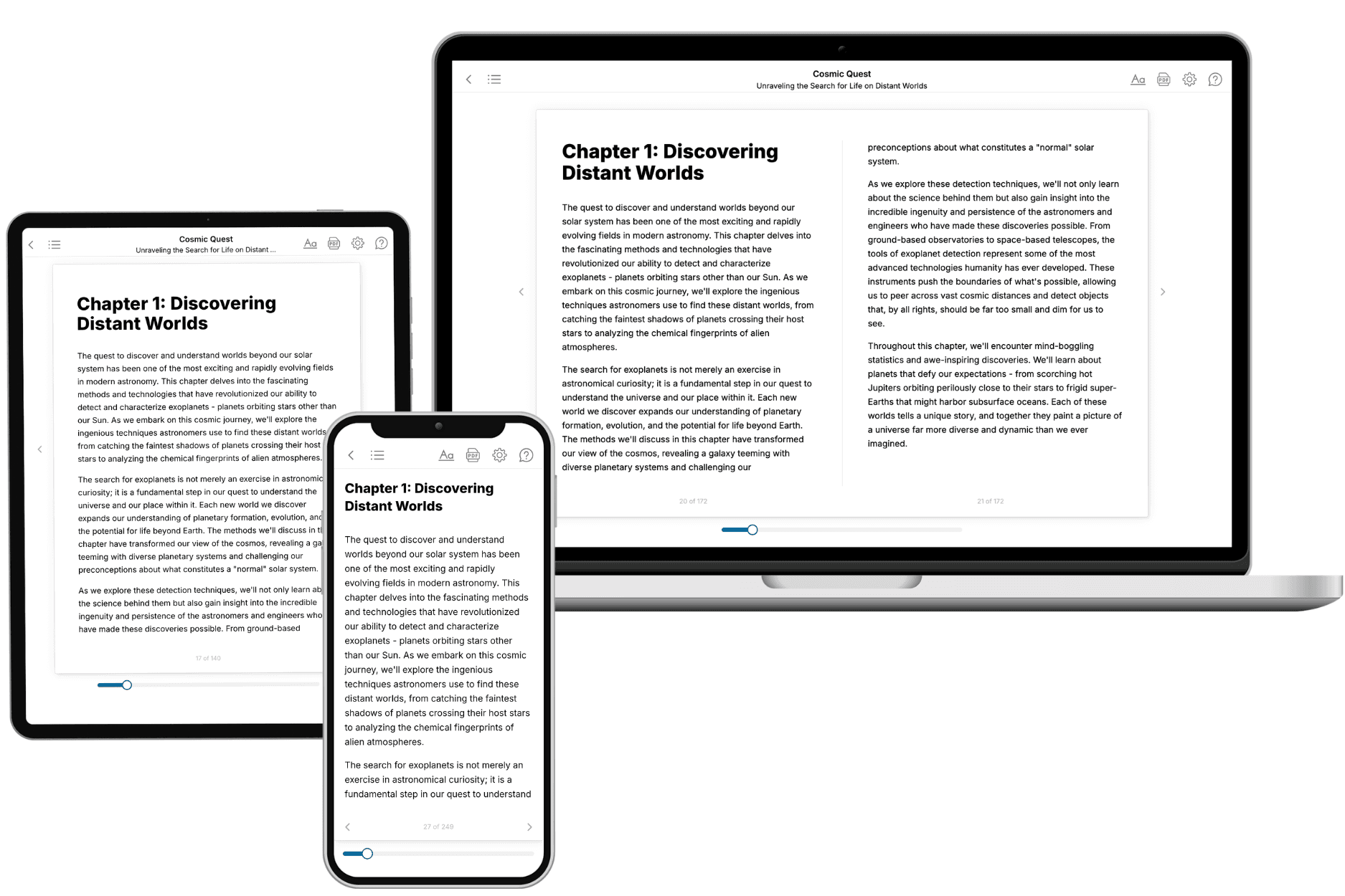
Your book is ready in 10 minutes. Read it online, download as EPUB or PDF, or send to Kindle.

Frequently asked questions
- What is TailoredRead?
TailoredRead creates complete, full-length nonfiction ebooks, written specifically for you. Tell us what you want to learn and why, and TailoredRead writes you a complete ebook on it, with charts, tables, and diagrams throughout. Read it online, on Kindle, or on any e-reader, or download it as a PDF or EPUB. Every book is written fresh the day you order it.
- How is the book tailored to me?
Before anything is written, you answer a few short questions about your goals, your background, and the topics you care about. Your book is then planned around your answers: written at your level, focused on your goals, and covering the topics you chose, instead of the one-size-fits-all book a store sells everyone.
- Will it read like generic AI content?
No. Your book isn't a chat transcript: it's planned chapter by chapter before a single word is written, told in a clear book voice, and explains ideas visually with charts, tables, and diagrams. After writing, every book goes through an editorial pass that polishes chapters so the book reads consistent from start to finish. Judge for yourself: browse thousands of sample books on our Explore Books page.
- How accurate is the content?
Our AI first checks whether your subject needs live research. Niche and fast-moving subjects are researched before writing, and the book plan and chapters are grounded in what it finds. After writing, every book goes through a quality pass that checks its facts and consistency, and researched books list their sources in a Notes section at the back.
- How long is the book?
You choose the length: Comprehensive (250-300 pages), Detailed (150-200 pages), Essential (70-100 pages), or Short (30-50 pages).
- Does the book include visuals?
Yes. Every book includes charts, tables, and diagrams: timelines, checklists, step-by-step guides, decision trees, comparison tables, matrices, and bar charts. A typical book includes dozens of these visual elements.
- Can I read it on Kindle? What formats can I download?
Yes. Every book can be read in our online reader or downloaded as a PDF or EPUB. The EPUB can be opened with Kindle, Apple Books, Kobo, and any e-reader. The Commercial and Author licenses also include an editable Word (DOCX) and Markdown download.
- How much does it cost?
About the price of a regular ebook. The exact price depends on your book's length and complexity, from $2 for the shortest books to $35 for the most comprehensive, and it's shown when you review your book, before you commit to anything. Each book is a one-time purchase, yours to keep, no subscription. Licenses that let you share, teach, or publish your book range from $35.99 to $49.99.
- Can I preview the book before purchasing?
Before you pay, you'll see what your book will cover: the title, a detailed description, the estimated length, and the complete chapter-by-chapter table of contents, so you know what you're getting before you decide. The full text itself is written after you purchase.
- How long does it take to create a book?
About 10 minutes. You can start reading the opening chapters while the rest is still being written.