Measuring Confidence in Remote Sensing
A Practical Guide to Uncertainty Quantification in Earth Observation and Geospatial Analysis
Make your remote sensing data more credible and actionable by mastering uncertainty quantification.
222 pages10 chaptersNov 1, 2025Remote Sensing
About this book
This practical guide shows you how to identify, measure, and communicate the confidence levels in your geospatial measurements and predictions. Whether you're analyzing satellite imagery, processing sensor data, or building predictive models, understanding uncertainty transforms raw data into trustworthy intelligence that stakeholders can confidently use for decision-making. You'll learn systematic approaches to quantifying different error sources, from instrumental limitations to atmospheric effects to processing artifacts. Discover how to build uncertainty budgets, validate your results, and present findings in ways that resonate with non-technical audiences. With real-world examples and step-by-step methods, this book equips you to navigate the complexities of remote sensing uncertainty—turning potential weaknesses into demonstrated strengths that enhance your credibility and impact.
Table of contents
- IntroductionWhy Uncertainty Matters in Remote Sensing, What You'll Learn in This Book, How to Use This Guide, Key Concepts and TerminologyRead below
- Chapter 1: Understanding Uncertainty in Remote SensingDefining Uncertainty and Error, Sources of Uncertainty in Remote Sensing Systems, Distinguishing Between Uncertainty, Accuracy, and Precision, Why Quantifying Uncertainty Matters for Decision-Making
- Chapter 2: Sources and Types of UncertaintyInstrumental and Sensor Uncertainty, Atmospheric and Environmental Effects, Processing and Calibration Artifacts, Model and Algorithm Uncertainty
- Chapter 3: Statistical Foundations for UncertaintyProbability Distributions and Their Applications, Descriptive Statistics for Uncertainty, Confidence Intervals and Credible Ranges, Hypothesis Testing and Significance
- Chapter 4: Building Uncertainty BudgetsThe Uncertainty Budget Framework, Identifying and Categorizing Uncertainty Components, Combining Uncertainties: Propagation Methods, Real-World Uncertainty Budget Examples
- Chapter 5: Validation and Error AssessmentValidation Strategies and Study Design, Selecting and Preparing Reference Data, Error Metrics and Performance Indicators, Continuous Monitoring and Adaptive Assessment
- Chapter 6: Uncertainty in Classification and MappingSources of Uncertainty in Classification Tasks, Confusion Matrices and Classification Metrics, Generating and Interpreting Probability Maps, Decision Thresholding and Confidence Levels
- Chapter 7: Machine Learning and UncertaintyUnique Uncertainty Challenges in Machine Learning, Ensemble Methods for Uncertainty Estimation, Bayesian Approaches and Probabilistic Models, Model Calibration and Confidence Adjustment
- Chapter 8: Communicating Uncertainty EffectivelyUnderstanding Your Audience and Their Needs, Visualization Techniques for Uncertainty, Language, Framing, and Narrative Strategies, Engaging Stakeholders in Uncertainty Discussions
- Chapter 9: Practical Applications and Case StudiesLand Cover Mapping and Classification Uncertainty, Change Detection and Temporal Uncertainty, Environmental Monitoring and Prediction Uncertainty, Urban Analysis and Infrastructure Assessment
- Chapter 10: Tools, Standards, and Best PracticesSoftware Tools and Computational Frameworks, International Standards and Protocols, Quality Assurance and Quality Control Procedures, Documentation and Reporting Best Practices
- ConclusionKey Takeaways and Next Steps, Future Directions in Uncertainty Quantification
- Glossary of Terms
- Further Reading and Resources
Introduction
Remote sensing has transformed how we observe and understand our planet. Satellites, aircraft, and drones capture vast amounts of data about Earth's surface, atmosphere, and oceans every day. This information drives critical decisions in agriculture, urban planning, disaster response, climate science, and countless other fields. Yet despite the sophistication of modern sensors and processing algorithms, every remote sensing measurement carries uncertainty. The question isn't whether uncertainty exists—it's whether you're measuring, managing, and communicating it effectively. Without quantifying uncertainty, even the most advanced remote sensing products remain incomplete, potentially misleading decision-makers who rely on them.
The challenge facing remote sensing professionals today extends beyond technical accuracy. Stakeholders increasingly demand transparency about data reliability. Regulatory frameworks require documented uncertainty assessments. Funding agencies expect rigorous validation protocols. End-users need to understand not just what your data shows, but how confident they should be in those findings. This shift represents a fundamental change in how remote sensing products are evaluated and used. The ability to quantify and communicate uncertainty has evolved from a specialized technical skill to an essential professional competency that directly impacts your credibility and the real-world impact of your work.
This book provides practical methods for addressing uncertainty throughout the remote sensing workflow. You'll discover systematic approaches to identifying error sources, quantifying their magnitude, combining multiple uncertainty components, and presenting results in ways that enhance rather than undermine confidence in your work. The focus remains firmly on actionable techniques you can implement immediately, supported by real-world examples and step-by-step guidance. Whether you're processing satellite imagery, developing classification algorithms, or presenting findings to non-technical stakeholders, understanding uncertainty transforms potential vulnerabilities into demonstrated strengths that distinguish professional-grade analysis from amateur efforts.
Why Uncertainty Matters in Remote Sensing
Remote sensing measurements never perfectly represent ground truth. Sensors have physical limitations. Atmospheric conditions interfere with signal transmission. Processing algorithms make simplifying assumptions. Classification models misidentify features. Each step in the workflow from data acquisition to final product introduces potential errors. Ignoring these uncertainties doesn't make them disappear—it simply leaves decision-makers unaware of the limitations affecting their choices. When a land cover map shows 95% accuracy, stakeholders need to know what that means for their specific application, which classes are most reliable, and where spatial uncertainty is highest.
Consider a practical scenario: agricultural monitoring using satellite-derived vegetation indices. A farmer receives a report indicating crop stress in specific fields based on NDVI values. Without uncertainty information, they might invest thousands of dollars in irrigation or fertilization. But what if atmospheric haze reduced measurement accuracy that day? What if the sensor's calibration had drifted slightly? What if the processing algorithm struggles with that particular crop type? Quantified uncertainty allows the farmer to weigh the evidence appropriately—perhaps conducting ground verification before major investments, or recognizing that borderline readings require additional confirmation while extreme values warrant immediate action.
The consequences of unquantified uncertainty extend beyond individual decisions to systemic issues. Climate change assessments rely on detecting subtle trends in satellite-derived temperature or vegetation data. Without rigorous uncertainty quantification, natural variability might be mistaken for climate signals, or genuine trends might be dismissed as noise. Legal disputes over property boundaries, environmental compliance, or resource rights increasingly involve remote sensing evidence. Courts demand documented accuracy assessments and uncertainty bounds. Insurance companies using satellite data for risk assessment need confidence intervals to price policies appropriately. Scientific publications require uncertainty analysis for peer review acceptance.
Uncertainty quantification also reveals opportunities for improvement. By systematically identifying which error sources contribute most to total uncertainty, you can prioritize efforts where they'll have the greatest impact. Perhaps atmospheric correction is your dominant uncertainty source, suggesting investment in better correction algorithms would be more valuable than upgrading sensors. Maybe classification uncertainty concentrates in specific land cover types, indicating where additional training data or algorithm refinement would help most. An uncertainty budget transforms vague concerns about data quality into specific, actionable insights for enhancing your remote sensing products.
The competitive landscape increasingly favors those who can demonstrate data reliability. When multiple providers offer similar remote sensing products, transparent uncertainty reporting becomes a differentiator. Organizations that can confidently state this measurement is accurate to within ±2 meters with 95% confidence
inspire more trust than those offering vague assurances about high accuracy.
Regulatory compliance in fields like environmental monitoring or agricultural subsidies often mandates documented uncertainty assessments. Grant proposals and research funding increasingly require detailed validation plans and uncertainty quantification methods. Professional credibility depends on acknowledging limitations while demonstrating you've rigorously characterized and managed them.
Understanding uncertainty also protects against overconfidence. Remote sensing technology's sophistication can create an illusion of precision that exceeds actual accuracy. High-resolution imagery looks convincing, but resolution doesn't guarantee accuracy. Machine learning models produce confident-looking predictions, but confidence scores don't always reflect true reliability. Sophisticated processing chains can propagate and amplify errors in non-obvious ways. Systematic uncertainty quantification provides a reality check, ensuring claims about data quality rest on evidence rather than assumptions. This intellectual honesty ultimately strengthens rather than weakens your work's impact, as stakeholders learn they can trust your assessments because you've demonstrated awareness of limitations.
The field of remote sensing continues evolving rapidly, with new sensors, platforms, and analytical methods emerging constantly. Each innovation introduces new uncertainty characteristics that must be understood and quantified. Commercial satellite constellations offer unprecedented temporal resolution but with varying calibration standards. Machine learning enables sophisticated feature extraction but with complex, sometimes opaque uncertainty properties. Cloud computing platforms democratize access to massive datasets but require users to understand the uncertainty characteristics of pre-processed products. As remote sensing becomes more accessible and widely applied, the responsibility for proper uncertainty quantification becomes more critical and more widely distributed across the professional community.
What You'll Learn in This Book
This book provides a comprehensive framework for uncertainty quantification in remote sensing, organized around practical implementation rather than abstract theory. You'll begin by understanding the fundamental concepts that distinguish uncertainty from related ideas like accuracy and precision, learning why these distinctions matter for your work. The early chapters establish a conceptual foundation, identifying the major sources of uncertainty in remote sensing systems—from instrumental limitations and atmospheric effects to processing artifacts and model assumptions. You'll learn to recognize these error sources in your own workflows and understand how they interact and propagate through analysis chains.
The statistical foundations section equips you with essential tools for quantifying uncertainty mathematically. You'll discover how probability distributions describe measurement variability, how confidence intervals express uncertainty ranges, and how to select appropriate statistical methods for different remote sensing applications. These chapters translate statistical concepts into practical remote sensing contexts, showing exactly how to apply techniques like error propagation, hypothesis testing, and distribution fitting to real geospatial data. The emphasis remains on usable methods rather than mathematical derivations, with step-by-step examples demonstrating implementation.
Building uncertainty budgets represents a core skill developed throughout the book. You'll learn systematic approaches to:
- Identifying all significant uncertainty components in your workflow
- Quantifying the magnitude of each component using appropriate methods
- Combining individual uncertainties into total uncertainty estimates
- Documenting assumptions and limitations transparently
- Using uncertainty budgets to prioritize quality improvement efforts
Validation and error assessment receive detailed treatment, recognizing that uncertainty quantification requires empirical verification. You'll discover strategies for designing validation studies, selecting appropriate reference data, and calculating meaningful error metrics. The book addresses practical challenges like limited ground truth availability, spatial and temporal mismatches between validation data and remote sensing products, and the ongoing nature of quality monitoring. You'll learn how to interpret validation results, identify systematic versus random errors, and use validation findings to refine uncertainty estimates and improve products over time.
Specialized chapters address uncertainty in specific remote sensing applications. Classification and mapping uncertainty receives thorough coverage, including confusion matrix interpretation, probability map generation, and decision threshold selection. Machine learning applications get dedicated attention, acknowledging that modern algorithms introduce unique uncertainty challenges. You'll learn about ensemble methods, Bayesian approaches, and model calibration techniques that help quantify confidence in machine learning predictions. These chapters recognize that different applications require tailored approaches while maintaining consistent underlying principles.
Communication skills receive equal emphasis with technical methods. You'll discover how to:
- Translate technical uncertainty metrics into language stakeholders understand
- Design visualizations that convey uncertainty without overwhelming audiences
- Frame uncertainty discussions positively rather than defensively
- Engage stakeholders in productive conversations about data limitations
- Document uncertainty in reports, publications, and metadata
Practical case studies throughout the book demonstrate uncertainty quantification in realistic scenarios. You'll see detailed examples from land cover mapping, change detection, environmental monitoring, and urban analysis. Each case study walks through the complete process from initial uncertainty identification through quantification, validation, and communication. These examples reveal how theoretical concepts translate into practice, including the messy realities of incomplete information, competing priorities, and resource constraints. You'll learn not just what to do in ideal circumstances, but how to make pragmatic decisions when perfect data or unlimited time aren't available.
The final chapters address tools, standards, and best practices that support professional uncertainty quantification. You'll discover software tools and computational frameworks that facilitate uncertainty analysis, from specialized packages to general-purpose programming libraries. International standards and protocols receive coverage, helping you align your work with established guidelines from organizations like ISO, CEOS, and INSPIRE. Quality assurance procedures and documentation best practices ensure your uncertainty quantification efforts meet professional standards and provide lasting value. By the book's conclusion, you'll possess a complete toolkit for implementing rigorous uncertainty quantification in your remote sensing work.
How to Use This Guide
This book is designed for flexible use depending on your background, needs, and time constraints. If you're new to uncertainty quantification, reading sequentially from beginning to end provides the most comprehensive learning experience. Each chapter builds on previous concepts, gradually developing your understanding from fundamental principles through advanced applications. The early chapters establish essential vocabulary and conceptual frameworks that later chapters assume you understand. Sequential reading ensures you don't encounter unfamiliar terms or concepts without proper context, making the learning process smoother and more efficient.
Experienced practitioners may prefer a selective approach, focusing on chapters addressing specific challenges or knowledge gaps. The book's structure supports this usage pattern through:
- Self-contained chapters that can be read independently with minimal cross-referencing
- Clear chapter summaries identifying key concepts and practical takeaways
- Extensive cross-references when concepts from other chapters are essential
- A comprehensive glossary defining technical terms for quick reference
- Detailed table of contents enabling rapid navigation to relevant sections
The book balances conceptual understanding with practical implementation. Each major concept includes concrete examples showing how theory translates into practice. When you encounter a new technique or method, you'll find step-by-step guidance for applying it to your own data. Code snippets and computational examples use widely accessible tools and platforms, avoiding proprietary software dependencies where possible. However, the book emphasizes understanding principles over memorizing specific software commands. Tools and platforms evolve rapidly, but fundamental concepts remain stable. By focusing on underlying logic, you'll be equipped to adapt methods to whatever tools you're using.
Active engagement enhances learning effectiveness. As you read, consider how concepts apply to your specific remote sensing applications. When examples describe uncertainty sources, mentally inventory which ones affect your work. When validation strategies are discussed, evaluate which approaches fit your available resources and data characteristics. The book includes reflection questions and practical exercises designed to bridge the gap between reading and implementation. Taking time to work through these activities, even mentally, significantly improves retention and practical skill development compared to passive reading.
The case studies deserve special attention regardless of whether they match your specific application domain. While a case study might focus on agricultural monitoring and your work involves urban analysis, the underlying uncertainty quantification principles transfer across domains. Pay attention to the process: how uncertainty sources are identified, how quantification methods are selected and justified, how validation is designed given practical constraints, and how results are communicated to stakeholders. These procedural insights often prove more valuable than domain-specific technical details, as they reveal expert thinking patterns you can apply to any remote sensing challenge.
Use the book as an ongoing reference rather than a one-time read. Uncertainty quantification involves numerous techniques, metrics, and considerations that you won't memorize from a single reading. As you encounter specific challenges in your work—designing a validation study, selecting an appropriate error metric, explaining uncertainty to stakeholders—return to relevant chapters for detailed guidance. The comprehensive index and cross-referencing system facilitate this reference usage. Consider annotating your copy with notes about how concepts apply to your specific context, creating a personalized reference that grows more valuable over time.
Supplementary resources extend the book's value beyond its pages. The further reading section identifies authoritative sources for deeper exploration of specific topics. Online resources, including datasets, code repositories, and interactive examples, provide hands-on learning opportunities. Professional communities and forums offer venues for discussing uncertainty quantification challenges with peers. Standards documents and technical guidelines referenced throughout the book provide detailed specifications for formal compliance requirements. Treat this book as an entry point into a broader ecosystem of resources rather than a complete, self-contained treatment of every possible uncertainty quantification scenario.
Finally, recognize that uncertainty quantification is a skill developed through practice, not just reading. The book provides knowledge and frameworks, but competence comes from applying these concepts to real data, making mistakes, refining your approach, and gradually building intuition about what works in different situations. Start with simple applications—perhaps quantifying uncertainty for a single measurement or creating a basic uncertainty budget for a straightforward workflow. As your confidence grows, tackle more complex scenarios involving multiple uncertainty sources, sophisticated propagation methods, and challenging communication contexts. The journey from novice to expert in uncertainty quantification is gradual, but each step enhances the credibility and impact of your remote sensing work.
Key Concepts and Terminology
Understanding uncertainty quantification requires familiarity with specific terminology that has precise meanings in this context. Uncertainty refers to the doubt that exists about the result of a measurement or prediction—it quantifies the range within which the true value likely falls. This differs from error, which is the difference between a measured or predicted value and the true value. You can quantify uncertainty without knowing the actual error, since true values are often unknown. For example, you might state that a temperature measurement has an uncertainty of ±0.5°C without knowing whether the actual error is +0.3°C, -0.2°C, or some other value within that range.
Accuracy describes how close measurements are to the true value, while precision describes how close repeated measurements are to each other. A sensor can be precise but inaccurate (consistently measuring values that are close together but far from truth) or accurate but imprecise (measurements scattered around the true value). Remote sensing professionals often confuse these concepts, leading to mischaracterization of data quality. A high-resolution satellite image (precise spatial detail) isn't necessarily accurate in its spectral measurements or geometric positioning. Understanding this distinction helps you identify which aspects of your data need improvement and how to characterize quality appropriately.
Systematic uncertainty (or systematic error) affects measurements consistently in one direction, often due to calibration issues, algorithm biases, or environmental factors. Random uncertainty varies unpredictably between measurements, caused by factors like sensor noise, atmospheric turbulence, or natural variability in the phenomenon being measured. These uncertainty types require different quantification and mitigation approaches:
- Systematic uncertainties can often be reduced through calibration, correction algorithms, or improved processing methods
- Random uncertainties typically require averaging multiple measurements or statistical modeling
- Systematic uncertainties don't decrease with repeated measurements, while random uncertainties do
- Identifying whether uncertainty is systematic or random guides appropriate response strategies
Uncertainty propagation describes how uncertainties in input measurements or parameters affect uncertainty in derived products. When you calculate NDVI from red and near-infrared bands, uncertainties in those band measurements propagate through the calculation to produce uncertainty in the NDVI result. When you classify pixels based on spectral signatures, uncertainties in the signatures and the classification algorithm combine to create uncertainty in the final land cover map. Understanding propagation is essential because final product uncertainty often exceeds input uncertainties due to compounding effects through complex processing chains.
The uncertainty budget provides a systematic framework for accounting for all uncertainty sources contributing to a final measurement or product. It itemizes individual components, quantifies their magnitudes, and combines them according to appropriate mathematical rules to estimate total uncertainty. Think of it as a financial budget that tracks where uncertainty costs
come from and which components consume the largest share of your total uncertainty budget.
This framework transforms vague concerns about data quality into specific, quantified components that can be prioritized for improvement efforts. A well-constructed uncertainty budget becomes a powerful communication tool, demonstrating thorough understanding of your data's limitations.
Confidence intervals and confidence levels express uncertainty in statistical terms. A 95% confidence interval for a measurement might be stated as 15.3 ± 0.8 meters,
meaning you're 95% confident the true value falls between 14.5 and 16.1 meters. The confidence level (95% in this example) indicates how certain you are that the interval contains the true value. Higher confidence levels require wider intervals—being 99% confident requires a larger range than being 90% confident. These concepts provide standardized ways to communicate uncertainty that stakeholders can interpret consistently across different measurements and applications.
Validation refers to the process of assessing how well remote sensing products match independent reference data considered more accurate or reliable. Verification checks whether processing steps were implemented correctly according to specifications. These terms are sometimes used interchangeably but have distinct meanings. You might verify that your atmospheric correction algorithm ran without errors (verification) while separately validating that the corrected reflectance values match ground measurements (validation). Both activities contribute to uncertainty quantification but address different aspects of data quality.
In classification contexts, commission errors occur when pixels are incorrectly assigned to a class (false positives), while omission errors occur when pixels that should belong to a class are assigned elsewhere (false negatives). The confusion matrix tabulates these errors across all classes, providing detailed insight into classification uncertainty patterns. Overall accuracy summarizes correct classifications across all classes, while producer's accuracy and user's accuracy describe class-specific performance from different perspectives. Understanding these metrics helps you characterize classification uncertainty comprehensively rather than relying on single summary statistics that may hide important patterns.
Traceability refers to the ability to relate a measurement to established standards through an unbroken chain of comparisons, each with documented uncertainty. In remote sensing, this might mean tracing satellite sensor calibration back to laboratory standards, which themselves trace to international reference standards. Traceability provides confidence that measurements are consistent with accepted reference systems and comparable across different sensors, platforms, and time periods. Regulatory applications and scientific research increasingly require documented traceability, making it an essential component of professional uncertainty quantification.
Finally, metadata—data about data—plays a crucial role in uncertainty quantification. Comprehensive metadata documents processing steps, algorithm parameters, calibration information, known limitations, and uncertainty estimates. Without adequate metadata, users cannot properly interpret remote sensing products or assess their suitability for specific applications. Quality metadata transforms a simple data file into a trustworthy information product by providing the context necessary for appropriate use. As you develop uncertainty quantification skills, you'll simultaneously develop better metadata practices, as the two activities are deeply interconnected. The discipline of documenting uncertainty forces clarity about data characteristics that might otherwise remain implicit and unexamined.
This is the end of the free sample. The full book has 10 chapters.
Want this book written for you?
Tell us your goals and background, and get your own version of this book, tailored by AI to you.


Benefits of AI-tailored books
- Read one book, not ten:
- all the Remote Sensing knowledge you need, gathered into a single book.
- Save days of learning:
- tell us your goals, choose your topics, and the whole book is built around them.
- Learn effortlessly:
- Remote Sensing book written for your specific background and expertise.
- Understand at a glance:
- includes charts, tables, timelines, checklists, decision trees, and more.
- Stay current:
- written the day you order it, not years ago.
- Trust what you read:
- every book is checked for accuracy, with real research when your subject needs it.
Create your unique book in 3 steps
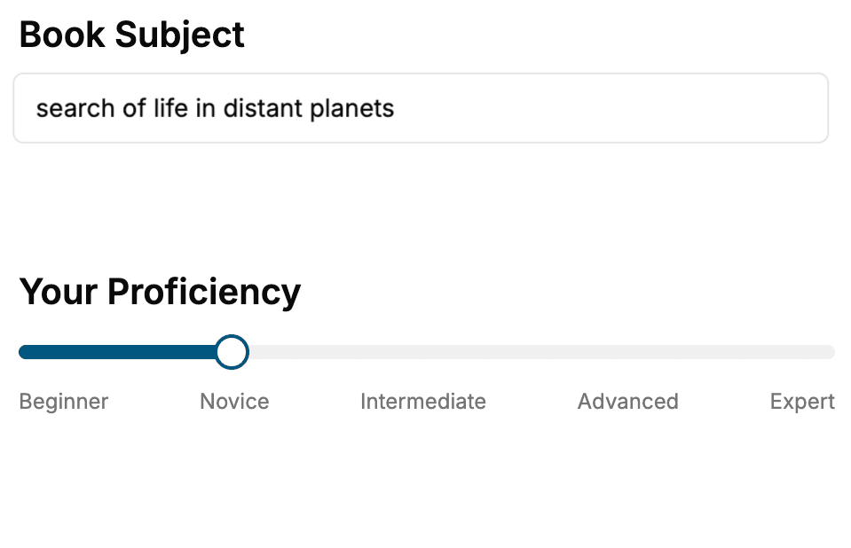
- 1. Select your focus
Select the focus of your Remote Sensing book and share your background
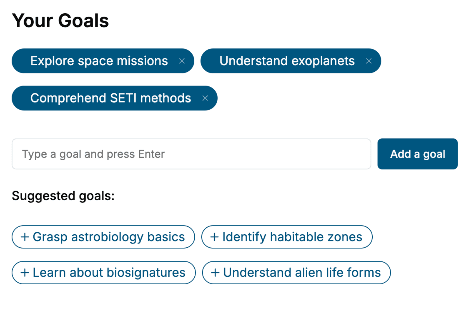
- 2. Personalize your book
Specify your goals and choose sub-topics to include
- 3. Get your tailored book
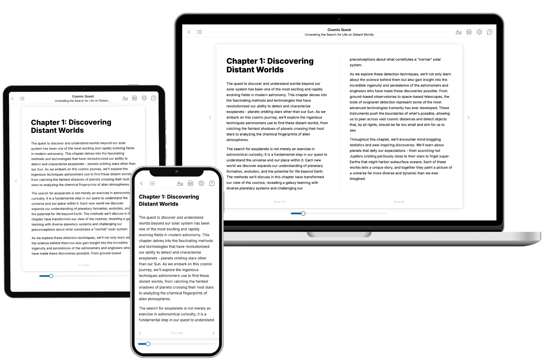
Your book is ready in 10 minutes. Read it online, download as EPUB or PDF, or send to Kindle.
Frequently asked questions
- What is TailoredRead?
TailoredRead creates complete, full-length nonfiction ebooks, written specifically for you. Tell us what you want to learn and why, and TailoredRead writes you a complete ebook on it, with charts, tables, and diagrams throughout. Read it online, on Kindle, or on any e-reader, or download it as a PDF or EPUB. Every book is written fresh the day you order it.
- How is the book tailored to me?
Before anything is written, you answer a few short questions about your goals, your background, and the topics you care about. Your book is then planned around your answers: written at your level, focused on your goals, and covering the topics you chose, instead of the one-size-fits-all book a store sells everyone.
- Will it read like generic AI content?
No. Your book isn't a chat transcript: it's planned chapter by chapter before a single word is written, told in a clear book voice, and explains ideas visually with charts, tables, and diagrams. After writing, every book goes through an editorial pass that polishes chapters so the book reads consistent from start to finish. Judge for yourself: browse thousands of sample books on our Explore Books page.
- How accurate is the content?
Our AI first checks whether your subject needs live research. Niche and fast-moving subjects are researched before writing, and the book plan and chapters are grounded in what it finds. After writing, every book goes through a quality pass that checks its facts and consistency, and researched books list their sources in a Notes section at the back.
- How long is the book?
You choose the length: Comprehensive (250-300 pages), Detailed (150-200 pages), Essential (70-100 pages), or Short (30-50 pages).
- Does the book include visuals?
Yes. Every book includes charts, tables, and diagrams: timelines, checklists, step-by-step guides, decision trees, comparison tables, matrices, and bar charts. A typical book includes dozens of these visual elements.
- Can I read it on Kindle? What formats can I download?
Yes. Every book can be read in our online reader or downloaded as a PDF or EPUB. The EPUB can be opened with Kindle, Apple Books, Kobo, and any e-reader. The Commercial and Author licenses also include an editable Word (DOCX) and Markdown download.
- How much does it cost?
About the price of a regular ebook. The exact price depends on your book's length and complexity, from $2 for the shortest books to $35 for the most comprehensive, and it's shown when you review your book, before you commit to anything. Each book is a one-time purchase, yours to keep, no subscription. Licenses that let you share, teach, or publish your book range from $35.99 to $49.99.
- Can I preview the book before purchasing?
Before you pay, you'll see what your book will cover: the title, a detailed description, the estimated length, and the complete chapter-by-chapter table of contents, so you know what you're getting before you decide. The full text itself is written after you purchase.
- How long does it take to create a book?
About 10 minutes. You can start reading the opening chapters while the rest is still being written.