Precision in Practice
Advanced Construction Surveying Techniques for the Modern Contractor
Many contractors underestimate the complexity and impact of precise surveying in construction projects.
269 pages13 chaptersJul 18, 2025Construction SurveyingCreated by Thomas
About this book
This oversight can lead to costly errors, delays, and subpar results. Precision in Practice shatters this misconception, offering you a comprehensive guide to mastering advanced construction surveying techniques. You'll discover how to leverage cutting-edge technology, from robotic total stations to drone surveying, to elevate your project outcomes. This book doesn't just explain theories; it provides practical, actionable strategies that you can implement immediately on your job sites. By the final page, you'll possess the knowledge to confidently tackle complex surveying challenges, optimize your workflow, and deliver projects with unprecedented accuracy and efficiency.
Table of contents
- IntroductionThe Critical Role of Surveying in Modern Construction, Book Overview and How to Use This Guide, The Evolution of Surveying Technology, The Impact of Precision on Project SuccessRead below
- Chapter 1: Fundamentals of Construction SurveyingBasic Principles and Concepts, Understanding Coordinate Systems, Measurement Units and Conversions, Common Sources of Error in Surveying
- Chapter 2: Essential Surveying Equipment and ToolsTotal Stations and Their Applications, GPS and GNSS Equipment, Levels and Theodolites, 3D Laser Scanners and LiDAR, UAV and Drone Surveying Equipment
- Chapter 3: Advanced Field TechniquesEstablishing Control Networks, Traversing and Traverse Calculations, Resection and Intersection Methods, Advanced Stakeout Techniques
- Chapter 4: GNSS Surveying TechniquesGNSS Fundamentals and Signal Processing, Real-Time Kinematic (RTK) Surveying, Static and Fast-Static Surveying, GNSS Survey Planning and Execution
- Chapter 5: Data Processing and AnalysisProcessing Raw Survey Data, Least Squares Adjustment Techniques, Error Analysis and Propagation, Quality Control in Data Processing
- Chapter 6: Digital Terrain Modeling and 3D VisualizationCreating Digital Terrain Models, Contour Generation and Analysis, Volume Calculation Techniques, 3D Visualization for Project Planning
- Chapter 7: Laser Scanning and Point Cloud ProcessingPrinciples of Laser Scanning, Planning and Executing Laser Scans, Point Cloud Processing Techniques, Integrating Scan Data with Other Survey Methods
- Chapter 8: UAV and Drone SurveyingPrinciples of UAV Surveying, Flight Planning and Mission Execution, Photogrammetry and Image Processing, Applications of UAV Surveying in Construction
- Chapter 9: GIS Integration in Construction SurveyingGIS Fundamentals for Surveyors, Integrating Survey Data with GIS, Spatial Analysis for Construction Projects, GIS Visualization and Mapping Techniques
- Chapter 10: Advanced Applications in Construction SurveyingDeformation Monitoring Techniques, Machine Control and Guidance Systems, BIM Integration with Survey Data, Advanced As-Built Survey Techniques
- Chapter 11: Project-Specific Surveying StrategiesSurveying for Road and Highway Construction, Surveying for Building Construction, Surveying for Bridge Construction, Surveying for Tunnel Construction
- Chapter 12: Error Management and Quality AssuranceIdentifying and Classifying Error Sources, Strategies for Error Mitigation, Implementing Effective Quality Control Measures, Meeting Accuracy Standards and Specifications
- Chapter 13: Future Trends in Construction SurveyingArtificial Intelligence and Machine Learning in Surveying, Internet of Things (IoT) Integration, Augmented Reality in Construction Surveying, Emerging Technologies and Their Potential Impact
- Conclusion
- Glossary
- Further Reading
Introduction
In the dynamic world of construction, precision is not just a goal—it's a necessity. As you embark on this journey to master advanced construction surveying techniques, you're taking a crucial step towards elevating your projects to new heights of accuracy and efficiency. The construction industry has undergone a remarkable transformation in recent years, driven by technological advancements and an ever-increasing demand for precision. This introduction will set the stage for your exploration of cutting-edge surveying methods, providing you with a solid foundation upon which to build your expertise.
Throughout this book, you'll discover how integrating advanced surveying techniques can significantly improve project accuracy and efficiency. From the revolutionary impact of Global Navigation Satellite Systems (GNSS) to the game-changing capabilities of Light Detection and Ranging (LiDAR) and Unmanned Aerial Vehicles (UAVs), modern technology is reshaping the landscape of construction surveying. As you delve deeper into these pages, you'll gain a comprehensive understanding of how these tools, when properly utilized, can provide you with a competitive edge in the industry.
One of the key themes you'll encounter is the critical importance of understanding coordinate systems and datum transformations. These concepts form the bedrock of precise measurements, and mastering them will enable you to navigate complex surveying challenges with confidence. Equally crucial is the role of effective data processing and analysis—skills that are just as vital as field measurements in the surveying process. You'll learn how to harness the power of 3D modeling and Building Information Modeling (BIM) integration to enhance project visualization and decision-making, revolutionizing the way you approach construction projects.
As you progress through this book, you'll come to appreciate that quality control and error detection are not mere afterthoughts but critical components of successful surveying practices. You'll discover strategies for implementing robust quality assurance measures that will elevate the standard of your work and instill confidence in your clients. Moreover, you'll learn the art of crafting customized surveying plans tailored to specific project needs, ensuring optimal results for every unique challenge you encounter.
This introduction serves as your gateway to a world where traditional surveying methods seamlessly blend with cutting-edge technologies. By mastering both, you'll position yourself at the forefront of the industry, equipped to tackle projects of any scale or complexity. Remember, the field of construction surveying is ever-evolving, and continuous learning and adaptation to new technologies will be essential for your long-term success. As you absorb the knowledge within these pages, you'll develop the skills to effectively communicate survey data to project stakeholders—a crucial aspect of project success that often goes overlooked.
Prepare to embark on a transformative journey that will reshape your approach to construction surveying. The pages that follow are filled with practical insights, actionable strategies, and in-depth explorations of advanced techniques that will empower you to achieve unprecedented levels of precision in your work. Let's begin this exciting exploration of "Precision in Practice: Advanced Construction Surveying Techniques for the Modern Contractor."
The Critical Role of Surveying in Modern Construction
In the intricate tapestry of modern construction, surveying stands as a fundamental thread, weaving together precision, planning, and execution. Its importance cannot be overstated—surveying is the bedrock upon which successful projects are built, quite literally from the ground up. As you navigate the complexities of today's construction landscape, understanding the critical role of surveying becomes not just advantageous, but essential for achieving excellence in your field.
At its core, surveying in construction serves as the eyes and ears of a project, providing crucial spatial data that informs every subsequent decision and action. It's the process that transforms abstract plans into tangible realities, ensuring that structures rise from the earth exactly where they should, with the precise dimensions and orientations specified in the design. This precision is not merely a matter of aesthetics or adherence to plans; it's a fundamental requirement for structural integrity, safety, and functionality.
Consider, for a moment, the cascading effects of even minor surveying errors. A slight miscalculation in the initial layout can lead to misaligned foundations, improperly positioned utilities, or discrepancies in road gradients. These issues, if undetected, can snowball into major structural problems, safety hazards, and costly rework. In contrast, accurate surveying from the outset acts as a preventive measure, safeguarding against such pitfalls and ensuring smooth project progression.
Moreover, the role of surveying extends far beyond the initial stages of a project. Throughout the construction process, ongoing surveying activities serve as a continuous feedback loop, allowing for real-time adjustments and quality control. This iterative approach ensures that each phase of construction aligns perfectly with the overall plan, maintaining precision from groundbreaking to the final touches. In essence, surveying acts as the project's conscience, constantly checking and rechecking to ensure adherence to design specifications and regulatory requirements.
In the realm of large-scale infrastructure projects, the importance of surveying becomes even more pronounced. When constructing bridges, tunnels, or highways, the margins for error shrink dramatically. Here, advanced surveying techniques become indispensable tools for managing complex geometries, ensuring proper alignment over vast distances, and accounting for the curvature of the Earth—factors that can make the difference between a structure that stands the test of time and one that fails to meet its intended purpose.
The advent of digital technologies has further amplified the critical role of surveying in modern construction. The integration of Geographic Information Systems (GIS), Building Information Modeling (BIM), and advanced data analytics has transformed surveying from a standalone activity into a central hub of project information. This evolution allows for unprecedented levels of coordination between different aspects of construction, from design and planning to execution and maintenance. Surveying data now serves as a common language, facilitating clear communication among diverse project stakeholders and enabling more informed decision-making at every level.
Furthermore, the environmental and economic implications of precise surveying cannot be overlooked. In an era where sustainability and resource efficiency are paramount, accurate surveying ensures optimal land use, minimizes waste, and reduces the environmental impact of construction activities. From an economic perspective, the cost savings realized through precise surveying—in terms of reduced material waste, minimized rework, and streamlined project timelines—can be substantial, directly impacting the bottom line of construction projects.
As you delve deeper into the world of advanced surveying techniques, it's crucial to recognize that the skills you're developing are not just technical competencies, but strategic assets that can set you apart in the competitive construction industry. Mastery of modern surveying methods positions you as a valuable problem-solver, capable of navigating complex challenges and delivering projects with unparalleled accuracy and efficiency.
The critical role of surveying in modern construction is multifaceted and ever-expanding. It's the foundation that ensures structural integrity, the guide that keeps projects on track, and the tool that enables innovation in design and execution. As you progress through this book, keep in mind that each technique you master, each technology you embrace, is another step towards excellence in your field. The knowledge you gain here will not only enhance your professional capabilities but will also contribute to the advancement of the construction industry as a whole, pushing the boundaries of what's possible in the built environment.
In the chapters that follow, you'll explore the intricate details of advanced surveying techniques, from the latest in satellite positioning systems to cutting-edge laser scanning technologies. Each section will build upon this foundation, reinforcing the critical importance of surveying and equipping you with the tools to excel in this vital aspect of modern construction. As you embark on this journey, remember that the precision you bring to your work has far-reaching implications, shaping not just individual projects, but the very landscape of our built world.
Book Overview and How to Use This Guide
"Precision in Practice: Advanced Construction Surveying Techniques for the Modern Contractor" is designed to be your comprehensive resource for mastering the intricacies of construction surveying in the contemporary landscape. This guide is meticulously structured to take you on a journey from foundational concepts to cutting-edge applications, ensuring that you build a robust understanding of both theory and practice. As you navigate through this book, you'll find that each chapter builds upon the last, creating a cohesive learning experience that mirrors the interconnected nature of surveying in real-world projects.
The book is divided into thirteen main chapters, each focusing on a crucial aspect of advanced construction surveying. Beginning with the fundamentals, you'll progress through essential equipment and tools, field techniques, and specialized surveying methods. As you advance, you'll explore data processing, digital modeling, and the integration of surveying with other critical construction technologies. The final chapters delve into project-specific strategies, error management, and future trends, providing you with a comprehensive view of the field.
To maximize your learning from this guide, it's recommended that you approach it with a strategic mindset. While the chapters are designed to flow logically, feel free to focus on areas that are most relevant to your current projects or areas of interest. Each chapter begins with an overview of key concepts, followed by detailed explanations, practical examples, and case studies. Pay special attention to the "Key Takeaways" sections at the end of each chapter, which summarize the most critical points and provide a quick reference for future use.
Throughout the book, you'll encounter various features designed to enhance your learning experience:
- Technical Deep Dives: These sections provide in-depth explanations of complex topics, perfect for when you need a thorough understanding of a particular concept or technology.
- Practical Tips: Look for these callout boxes that offer real-world advice and best practices, drawn from years of industry experience.
- Case Studies: Real-world examples illustrate how the techniques and technologies discussed are applied in actual construction projects, helping you bridge the gap between theory and practice.
- Diagrams and Illustrations: Visual aids throughout the book help clarify complex concepts and demonstrate proper equipment usage and field techniques.
- Glossary: A comprehensive glossary at the end of the book provides quick definitions of key terms, ensuring you're always on solid ground with the terminology.
To get the most out of this guide, consider the following approach:
- Start with a thorough read-through of the table of contents to familiarize yourself with the book's structure and content.
- Read the introduction and first chapter carefully to establish a strong foundation in the fundamentals of construction surveying.
- For subsequent chapters, assess your current knowledge and project needs. You may choose to read chapters sequentially or jump to sections most relevant to your immediate requirements.
- Take notes as you read, jotting down key concepts, questions, and ideas for applying the techniques in your work.
- After each chapter, review the Key Takeaways and reflect on how you can implement what you've learned in your projects.
- Use the case studies as opportunities for problem-solving. Before reading the solutions, try to devise your own approach based on what you've learned.
- Regularly revisit chapters and sections as you encounter related challenges in your work, using the book as a reference guide.
Remember, the field of construction surveying is dynamic, with new technologies and methodologies constantly emerging. This book provides a solid foundation and introduces you to cutting-edge techniques, but it's crucial to stay informed about industry developments. The "Further Reading" section at the end of the book offers resources for continuing your education and staying abreast of the latest advancements.
As you progress through "Precision in Practice," you'll find that each chapter not only imparts knowledge but also challenges you to think critically about how to apply these advanced techniques in your work. The goal is not just to inform, but to transform your approach to construction surveying, elevating your skills and, by extension, the quality of your projects.
Whether you're looking to refine your existing surveying skills, expand into new areas of expertise, or stay ahead of industry trends, this guide is designed to be your companion in that journey. By the time you reach the conclusion, you'll have gained not just a wealth of knowledge, but a new perspective on the pivotal role of advanced surveying in modern construction. Let this book be your roadmap to precision, efficiency, and excellence in your field.
The Evolution of Surveying Technology
The field of surveying has undergone a remarkable transformation over the centuries, evolving from simple tools and manual calculations to sophisticated digital systems that offer unprecedented accuracy and efficiency. This evolution has not only changed the way surveyors work but has also significantly impacted the entire construction industry. Understanding this technological journey is crucial for appreciating the capabilities of modern surveying tools and for anticipating future developments in the field.
The roots of surveying can be traced back to ancient civilizations, where rudimentary tools like measuring ropes, plumb bobs, and water levels were used to lay out buildings and infrastructure. The ancient Egyptians, for instance, used these methods to construct the pyramids with remarkable precision. As civilizations advanced, so did surveying techniques. The introduction of the theodolite in the 16th century marked a significant leap forward, allowing for more accurate angular measurements[1].
The 19th and early 20th centuries saw further refinements in surveying instruments. The development of the transit theodolite improved accuracy in both horizontal and vertical angle measurements. Parallel to this, advancements in optics led to the creation of more precise leveling instruments. These improvements allowed for more accurate mapping and layout of large-scale projects, such as railways and canals, which were crucial for the industrial revolution.
The mid-20th century brought about a revolution in surveying with the introduction of electronic distance measurement (EDM) devices. These instruments used electromagnetic waves to measure distances with unprecedented accuracy and speed. The integration of EDM technology with theodolites led to the development of total stations in the 1980s, combining angular and distance measurements in a single instrument. This innovation dramatically increased the efficiency of field surveys and reduced the potential for human error in data collection.
Perhaps the most significant technological leap in surveying came with the advent of Global Positioning System (GPS) technology in the 1980s and its subsequent refinement for civilian use. GPS revolutionized surveying by allowing precise positioning without the need for line-of-sight between points. The development of Real-Time Kinematic (RTK) GPS in the 1990s further enhanced the capabilities of satellite-based surveying, enabling centimeter-level accuracy in real-time[2].
The digital revolution of the late 20th and early 21st centuries has continued to transform surveying technology. The integration of computers and specialized software with surveying instruments has automated many aspects of data collection and processing. Geographic Information Systems (GIS) have emerged as powerful tools for managing and analyzing spatial data, allowing surveyors to create complex, layered maps and perform sophisticated spatial analyses.
In recent years, several cutting-edge technologies have further expanded the surveyor's toolkit:
- LiDAR (Light Detection and Ranging): This technology uses laser pulses to create highly detailed 3D models of landscapes and structures, revolutionizing topographic surveying and as-built documentation.
- Unmanned Aerial Vehicles (UAVs) or Drones: Equipped with high-resolution cameras or LiDAR sensors, drones have made aerial surveying more accessible and cost-effective, especially for large or difficult-to-access areas.
- Mobile Mapping Systems: These vehicle-mounted systems combine GPS, LiDAR, and cameras to collect vast amounts of geospatial data quickly, ideal for road and infrastructure surveys.
- 3D Laser Scanning: This technology allows for the rapid collection of millions of data points, creating highly accurate 3D models of complex structures and environments.
The integration of these advanced technologies with Building Information Modeling (BIM) has further enhanced the role of surveying in construction. Surveyors now provide crucial data that forms the foundation of 3D building models, facilitating better design, construction planning, and facility management.
Artificial Intelligence (AI) and Machine Learning (ML) are beginning to play a role in surveying, particularly in data processing and analysis. These technologies promise to automate many aspects of data interpretation, feature extraction, and quality control, potentially increasing efficiency and accuracy in surveying workflows.
The Internet of Things (IoT) is another emerging trend, with the potential to create networks of interconnected surveying instruments and sensors. This could lead to real-time monitoring of structures and landscapes, providing continuous data for analysis and decision-making.
As we look to the future, several trends are likely to shape the continued evolution of surveying technology:
- Increased Automation: The development of robotic total stations and autonomous surveying drones points towards a future where many surveying tasks can be performed with minimal human intervention.
- Enhanced Data Integration: The ability to seamlessly combine data from multiple sources (GPS, LiDAR, photogrammetry, etc.) will likely improve, leading to more comprehensive and accurate spatial models.
- Augmented Reality (AR): AR technology has the potential to revolutionize how surveyors interact with spatial data in the field, overlaying digital information onto the physical world.
- Quantum Sensors: Research into quantum technology may lead to the development of ultra-precise sensors, potentially offering orders of magnitude improvement in measurement accuracy.
The evolution of surveying technology has been marked by a constant drive towards greater accuracy, efficiency, and comprehensiveness in spatial data collection and analysis. From simple ropes and plumb bobs to satellite systems and AI-powered data processing, each technological advancement has expanded the capabilities of surveyors and enhanced the value they bring to construction projects.
As a modern contractor, understanding this technological evolution is crucial. It not only provides context for the advanced tools and techniques you'll explore in this book but also underscores the importance of staying abreast of technological developments. The surveying methods of today are the result of centuries of innovation, and the pace of change shows no signs of slowing. By embracing these advancements and continually updating your skills, you position yourself at the forefront of the industry, ready to deliver precision and efficiency in every project you undertake.
The Impact of Precision on Project Success
In the realm of construction, precision is not merely a desirable attribute—it's a fundamental requirement that can make or break a project. The impact of precision, particularly in surveying, reverberates through every phase of construction, from initial planning to final execution and beyond. As you delve deeper into advanced surveying techniques, it's crucial to understand how the level of precision you achieve can significantly influence project outcomes, both in terms of quality and financial success.
At its core, precision in surveying ensures that the physical reality of a construction project aligns perfectly with its design intent. This alignment is critical for several reasons:
- Structural Integrity: Precise measurements and layouts are essential for ensuring that loads are distributed as designed, foundations are correctly positioned, and structural elements align properly. Even minor discrepancies can lead to significant structural issues over time.
- Functional Performance: Many building systems, such as plumbing, HVAC, and electrical systems, rely on precise spatial relationships to function correctly. Accurate surveying ensures these systems are installed in their intended locations, preventing conflicts and ensuring optimal performance.
- Aesthetic Quality: In an era where architectural designs often push the boundaries of form and function, precision is crucial for achieving the desired visual impact. This is particularly true for projects with complex geometries or tight tolerances.
- Regulatory Compliance: Many construction projects must adhere to strict regulatory requirements regarding setbacks, heights, and other spatial parameters. Precise surveying is essential for demonstrating compliance and avoiding costly legal issues.
The financial implications of precision in surveying cannot be overstated. A study by the National Institute of Standards and Technology estimated that inadequate interoperability and data management in the U.S. capital facilities industry cost $15.8 billion annually, with a significant portion attributable to inaccuracies in spatial data[3]. This underscores the critical role that precise surveying plays in project economics.
Consider the cascading effects of even small surveying errors:
- Material Waste: Inaccurate measurements can lead to over-ordering or under-ordering of materials. In large projects, even small percentage errors can translate to significant financial losses.
- Rework and Delays: Discovering errors late in the construction process often necessitates costly rework, leading to project delays and potential contractual penalties.
- Dispute Resolution: Precise surveying records can be invaluable in resolving disputes between contractors, owners, and other stakeholders, potentially saving millions in litigation costs.
- Long-term Maintenance Costs: Buildings and infrastructure constructed with high precision tend to perform better over time, reducing maintenance costs and extending the lifespan of the asset.
The advent of Building Information Modeling (BIM) has further amplified the importance of precision in surveying. BIM relies on accurate spatial data to create comprehensive digital models of construction projects. These models serve as the single source of truth for all stakeholders, informing decisions throughout the project lifecycle. Precise surveying data forms the foundation of these models, ensuring that virtual designs translate accurately to the physical world.
Moreover, the impact of precision extends beyond individual projects to influence broader industry trends:
- Prefabrication and Modular Construction: These increasingly popular construction methods rely heavily on precise measurements to ensure that factory-built components fit perfectly on-site.
- Sustainable Design: Accurate surveying supports more efficient use of materials and better energy performance, contributing to sustainability goals.
- Smart Cities and Infrastructure: As cities become more interconnected, the precision of spatial data becomes crucial for integrating various systems and technologies.
The psychological impact of precision on project teams should not be underestimated. When surveyors consistently deliver highly accurate data, it instills confidence throughout the project team. This confidence can lead to more efficient decision-making, reduced stress levels, and improved overall project morale. Conversely, a lack of precision can create an atmosphere of uncertainty and mistrust, hampering collaboration and potentially leading to a adversarial project environment.
As technology continues to advance, the standards for precision in construction surveying are becoming increasingly stringent. Clients and stakeholders expect levels of accuracy that would have been challenging to achieve just a few decades ago. This trend is driven not only by technological capabilities but also by the growing complexity of modern construction projects and the increasing financial stakes involved.
Looking to the future, the impact of precision in surveying is likely to become even more pronounced:
- Digital Twins: The creation of highly accurate digital representations of physical assets will rely on extremely precise surveying data, enabling better asset management and predictive maintenance.
- Autonomous Construction: As construction processes become more automated, the precision of spatial data will be critical for guiding robotic systems and ensuring safety.
- Climate Resilience: Precise surveying will play a crucial role in planning and implementing infrastructure adaptations to climate change, where millimeters can make the difference in flood prevention or structural resilience.
In conclusion, the impact of precision in surveying on project success is multifaceted and far-reaching. It influences not just the physical outcome of construction projects, but also their financial performance, regulatory compliance, and long-term sustainability. As you progress through this book and master advanced surveying techniques, keep in mind that each improvement in precision you achieve has the potential to significantly enhance project outcomes. The pursuit of precision is not just a technical challenge—it's a fundamental driver of excellence in the construction industry.
By embracing the highest standards of precision in your surveying work, you position yourself as a valuable asset in any construction project. You become not just a data collector, but a crucial contributor to project success, risk mitigation, and value creation. In an industry where margins can be tight and the consequences of errors severe, your commitment to precision can be the differentiating factor that sets your work apart and drives project success.
Notes
Introduction
- 1. W. Schofield and M. Breach, Engineering Surveying, Butterworth-Heinemann, 2007
- 2. B. F. Kavanagh, Surveying with Construction Applications, Pearson Prentice Hall, 2009
- 3. M. P. Gallaher and others, Cost Analysis of Inadequate Interoperability in the U.S. Capital Facilities Industry, National Institute of Standards and Technology, 2004
This is the end of the free sample. The full book has 13 chapters.
Want this book written for you?
Tell us your goals and background, and get your own version of this book, tailored by AI to you.


Benefits of AI-tailored books
- Read one book, not ten:
- all the Construction Surveying knowledge you need, gathered into a single book.
- Save days of learning:
- tell us your goals, choose your topics, and the whole book is built around them.
- Learn effortlessly:
- Construction Surveying book written for your specific background and expertise.
- Understand at a glance:
- includes charts, tables, timelines, checklists, decision trees, and more.
- Stay current:
- written the day you order it, not years ago.
- Trust what you read:
- every book is checked for accuracy, with real research when your subject needs it.
Create your unique book in 3 steps
- 1. Select your focus
Select the focus of your Construction Surveying book and share your background
- 2. Personalize your book
Specify your goals and choose sub-topics to include
- 3. Get your tailored book
Your book is ready in 10 minutes. Read it online, download as EPUB or PDF, or send to Kindle.

Frequently asked questions
- What is TailoredRead?
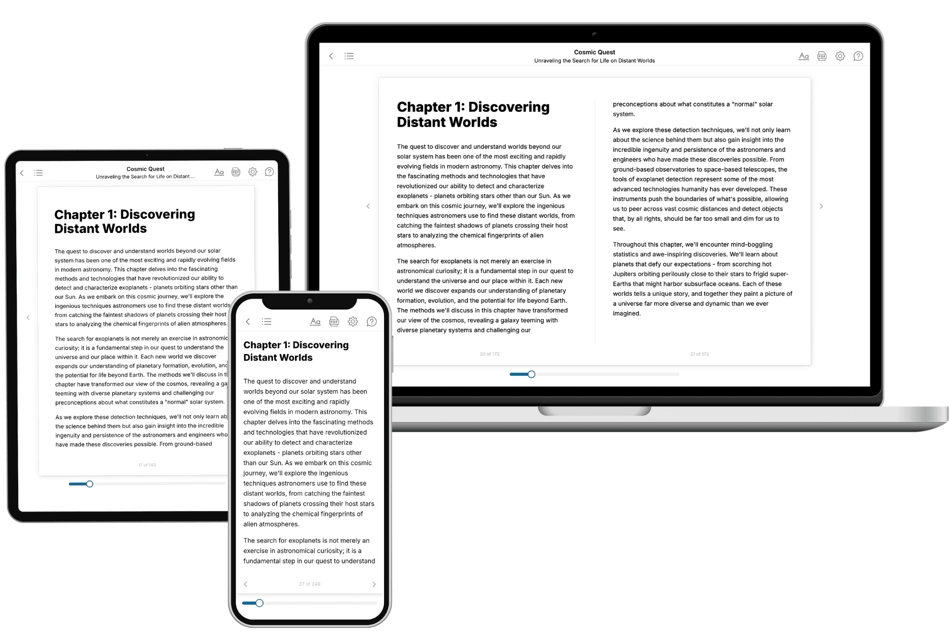
TailoredRead creates complete, full-length nonfiction ebooks, written specifically for you. Tell us what you want to learn and why, and TailoredRead writes you a complete ebook on it, with charts, tables, and diagrams throughout. Read it online, on Kindle, or on any e-reader, or download it as a PDF or EPUB. Every book is written fresh the day you order it.
- How is the book tailored to me?
Before anything is written, you answer a few short questions about your goals, your background, and the topics you care about. Your book is then planned around your answers: written at your level, focused on your goals, and covering the topics you chose, instead of the one-size-fits-all book a store sells everyone.
- Will it read like generic AI content?
No. Your book isn't a chat transcript: it's planned chapter by chapter before a single word is written, told in a clear book voice, and explains ideas visually with charts, tables, and diagrams. After writing, every book goes through an editorial pass that polishes chapters so the book reads consistent from start to finish. Judge for yourself: browse thousands of sample books on our Explore Books page.
- How accurate is the content?
Our AI first checks whether your subject needs live research. Niche and fast-moving subjects are researched before writing, and the book plan and chapters are grounded in what it finds. After writing, every book goes through a quality pass that checks its facts and consistency, and researched books list their sources in a Notes section at the back.
- How long is the book?
You choose the length: Comprehensive (250-300 pages), Detailed (150-200 pages), Essential (70-100 pages), or Short (30-50 pages).
- Does the book include visuals?
Yes. Every book includes charts, tables, and diagrams: timelines, checklists, step-by-step guides, decision trees, comparison tables, matrices, and bar charts. A typical book includes dozens of these visual elements.
- Can I read it on Kindle? What formats can I download?
Yes. Every book can be read in our online reader or downloaded as a PDF or EPUB. The EPUB can be opened with Kindle, Apple Books, Kobo, and any e-reader. The Commercial and Author licenses also include an editable Word (DOCX) and Markdown download.
- How much does it cost?
About the price of a regular ebook. The exact price depends on your book's length and complexity, from $2 for the shortest books to $35 for the most comprehensive, and it's shown when you review your book, before you commit to anything. Each book is a one-time purchase, yours to keep, no subscription. Licenses that let you share, teach, or publish your book range from $35.99 to $49.99.
- Can I preview the book before purchasing?
Before you pay, you'll see what your book will cover: the title, a detailed description, the estimated length, and the complete chapter-by-chapter table of contents, so you know what you're getting before you decide. The full text itself is written after you purchase.
- How long does it take to create a book?
About 10 minutes. You can start reading the opening chapters while the rest is still being written.