Reading the Landscape
A Practical Guide to Spatial Analysis in Cultural Geography
What stories do the spaces around you tell about power, culture, and belonging?
207 pages9 chaptersAug 9, 2026Human Geography
About this book
Spatial analysis is far more than plotting points on a map—it's a way of thinking critically about how people, cultures, and environments are organized across the Earth. This book teaches you to read landscapes like texts, uncovering the patterns, relationships, and inequalities embedded in geographic space. Whether you're examining migration patterns, cultural boundaries, resource distribution, or urban development, spatial analysis provides the frameworks and tools to move beyond surface observations. You'll learn how to work with maps, data, and spatial concepts to answer meaningful questions about the world. This practical guide bridges theory and application, showing how spatial thinking applies to real challenges in cultural geography, environmental management, and social understanding. By the end, you'll see familiar places with new depth and understand how spatial analysis reveals the complex interplay between culture, nature, and human society.
Table of contents
- IntroductionWhy Spatial Analysis Matters, What You'll Learn in This Book, How to Use This GuideRead below
- Chapter 1: Foundations of Spatial ThinkingUnderstanding Space, Place, and Scale, The Geographic Perspective, Core Spatial Concepts
- Chapter 2: Maps and Spatial RepresentationMaps as Arguments, Not Truths, Projections, Distortions, and Choices, Reading and Interpreting Maps Critically
- Chapter 3: Quantitative Spatial AnalysisTypes of Spatial Data, Distance, Proximity, and Spatial Relationships, Analyzing Spatial Patterns and Distributions, GIS Fundamentals and Applications
- Chapter 4: Qualitative Spatial AnalysisEthnographic and Observational Approaches, Narrative, Memory, and Sense of Place, Participatory and Community-Based Methods
- Chapter 5: Spatial Analysis in Cultural GeographyIdentity, Territory, and Belonging, Reading Cultural Landscapes, Power, Representation, and Spatial Justice
- Chapter 6: Spatial Analysis in Earth SciencesEnvironmental Patterns and Processes, Human-Environment Interactions, Sustainability and Spatial Planning
- Chapter 7: Scale, Networks, and ConnectivityScalar Analysis and Multi-Scale Thinking, Networks, Flows, and Connectivity, Connecting Global and Local Scales
- Chapter 8: Spatial Inequality and JusticeUneven Development and Spatial Inequality, Marginalization, Exclusion, and Access, Frameworks for Spatial Justice
- Chapter 9: Spatial Analysis in PracticeUrban Spatial Patterns and Segregation, Migration, Diaspora, and Transnational Spaces, Resource Distribution and Environmental Justice
- ConclusionIntegrating Spatial Approaches, Future Directions in Spatial Analysis
- Glossary of Key Terms
- Further Reading and Resources
Introduction
Two neighborhoods sit less than a mile apart in the same city. One has three grocery stores, two parks, a library, and reliable bus service. The other has a check-cashing outlet, a liquor store, and a bus stop that was removed during a budget cut three years ago. The distance between them is walkable. The difference between them is not accidental. That gap, and the geographic logic behind it, is exactly what spatial analysis is built to explain. The tools and frameworks in this book exist to help you see those patterns, name them, and understand how they came to be.
Spatial analysis is the practice of examining where things are, why they are there, and what their location means in relation to everything else. It draws on geography, data, cultural theory, and fieldwork to answer questions that purely statistical or purely narrative approaches cannot answer alone. When you ask why certain communities bear a disproportionate share of industrial pollution, or how a diaspora community maintains cultural identity across continents, or why two cities with similar populations have such different urban forms, you are asking spatial questions. This book gives you the methods to pursue those questions rigorously.
The approach here is deliberately practical. Concepts are introduced because they solve real problems, not because they fill out a theoretical checklist. Each method, whether quantitative or qualitative, is connected to the kind of question it is best suited to answer. You will move through foundational ideas about space, place, and scale, through the mechanics of maps and GIS, through cultural and environmental applications, and finally into integrated case studies that show how these tools work together. The goal is not to make you a specialist in any single technique but to give you a working spatial vocabulary and a set of analytical habits that transfer across contexts.
Why Spatial Analysis Matters
Geography has a habit of making the invisible visible. Patterns that seem random or purely social often have a clear spatial logic once you map them. In the 1850s, physician John Snow mapped cholera deaths in London's Soho district and traced the outbreak to a single water pump on Broad Street. The map did not just describe the epidemic; it revealed its cause.[1] That same basic move, plotting where something happens and asking why it clusters there, remains one of the most productive analytical gestures in any field that deals with human or environmental systems.
The reason spatial analysis matters so much today is that the questions facing communities, planners, researchers, and policymakers are increasingly geographic in nature. Climate change does not affect all places equally. Economic globalization concentrates wealth in some regions while hollowing out others. Migration reshapes the cultural geography of cities within a single generation. None of these phenomena can be fully understood without asking where they happen, at what scale, and in relation to what other spatial features. Spatial thinking is not a niche skill; it is a fundamental mode of reasoning about a world that is organized across space.
Consider how spatial analysis changes the way you read a familiar situation. A school district reports that test scores vary widely across its schools. A non-spatial analysis might focus on teaching quality, funding levels, or student demographics in isolation. A spatial analysis would ask: where are the low-scoring schools located relative to high-poverty neighborhoods, transit deserts, environmental hazards, and historical redlining boundaries? That spatial framing does not replace the other questions. It connects them to a geography that often turns out to be the organizing logic behind the pattern.
Spatial analysis also matters because it exposes the constructed nature of the landscapes we inhabit. Streets, borders, zoning lines, and park placements are not natural features. They are decisions made by people with particular interests and perspectives, and those decisions accumulate into the built environment that shapes daily life. Reading those decisions spatially, understanding who drew the lines and why, is a form of critical literacy. The chapter on cultural landscapes develops this idea in depth, but it runs as a thread through the entire book.
There is also a practical dimension that is easy to underestimate. Spatial analysis skills are increasingly in demand across a wide range of fields. Urban planners use GIS to model land use scenarios. Public health researchers use point pattern analysis to track disease spread. Environmental scientists use ecological gradient mapping to monitor habitat change. Journalists use spatial data to investigate inequality and corporate behavior. Knowing how to work with spatial data, interpret maps critically, and apply geographic frameworks to real problems is genuinely useful, not just academically interesting.
Finally, spatial analysis matters because place matters to people. The concept of sense of place, the emotional and cultural attachment that communities develop toward specific locations, is not a soft or secondary concern. It shapes political mobilization, cultural production, and individual identity in measurable ways. When a neighborhood is demolished for a highway, or a sacred landscape is rezoned for extraction, the loss is spatial before it is anything else. Understanding that loss, and the processes that produce it, requires the kind of careful geographic attention this book develops.
Spatial analysis is not about making maps. It is about asking geographic questions rigorously enough that the answers reveal something you could not have seen any other way.
The methods in this book range from highly technical, such as calculating spatial autocorrelation in a dataset, to deeply interpretive, such as reading a cultural landscape as a text that encodes power and identity. Both ends of that spectrum are legitimate, and both are necessary. The most compelling spatial analyses tend to combine them, using quantitative patterns to identify where to look and qualitative methods to understand what is actually happening there.
What You'll Learn in This Book
This book is organized to build your spatial analysis capabilities progressively, starting with foundational concepts and moving toward complex, integrated applications. Each section introduces new tools and frameworks, but always in connection with the ideas that came before. By the time you reach the case studies in the final chapter, you will have a full toolkit to bring to bear on real geographic problems.
The first major area is spatial thinking itself. Before any method makes sense, you need a clear understanding of what space, place, and scale actually mean in geographic analysis, and how the geographic perspective differs from other ways of looking at the world. These are not just vocabulary items. They are conceptual tools that change how you frame questions. A question about poverty looks different when you ask it at the neighborhood scale versus the regional scale versus the national scale, and spatial thinking gives you the habits to notice that difference and work with it deliberately.
The second area is maps and spatial representation. Maps are the primary medium of geographic communication, but they are also arguments. Every map reflects choices about what to show, what to omit, which map projection to use, and how to classify data. Understanding cartographic distortion and the politics of spatial representation makes you a more critical reader of any map you encounter, whether it appears in a news article, a government report, or a real estate brochure.
The third area covers quantitative methods. This includes working with spatial data types such as vector data and raster data, understanding distance and proximity relationships, detecting spatial patterns using tools like buffer zones and point pattern analysis, and using GIS workflows to manage and analyze geographic information. These methods are introduced at a level that is accessible to intermediate learners without requiring advanced mathematics, though the underlying logic is explained clearly enough that you can go deeper if you choose.
The fourth area is qualitative spatial analysis, which is often underemphasized in geography courses but is essential for understanding the human dimensions of spatial patterns. Ethnographic methods, spatial narrative, oral history, and participatory mapping all provide ways of accessing knowledge about place that quantitative data cannot capture. A GIS layer can show you where a community garden is located. It cannot tell you what that garden means to the people who tend it, or how it became a site of political organizing. Qualitative methods fill that gap.
The fifth and sixth areas apply spatial analysis to cultural geography and earth sciences respectively. In cultural geography, you will learn to read cultural landscapes as texts, analyze how territory and identity intersect, and examine how power shapes spatial representation. In earth sciences, you will work with concepts like human-environment interaction, land use analysis, ecological gradients, and sustainability planning. These two domains are often taught separately, but they share a common spatial logic, and the methods transfer between them more readily than most textbooks suggest.
The seventh area addresses scale, networks, and connectivity. Scalar analysis teaches you to move deliberately between levels of geographic analysis. Network thinking reveals how flows of people, goods, information, and capital connect places that might seem distant or unrelated. The concept of relational space challenges the idea that places have fixed, bounded identities, showing instead how places are constituted through their connections to other places. This section is particularly relevant for understanding phenomena like transnational space and global-local linkages.
The eighth area tackles spatial inequality and justice directly. Uneven development, spatial exclusion, and the historical production of disadvantage through mechanisms like redlining are not background context; they are central subjects of spatial analysis. Frameworks for spatial justice, including the right to the city, give you analytical and normative tools for evaluating geographic arrangements and the processes that produce them.
The final chapter brings everything together through three extended case studies: urban spatial segregation, migration and diaspora space, and resource distribution and environmental justice. Each case study demonstrates how multiple methods, quantitative and qualitative, cultural and environmental, local and global, combine to produce a richer analysis than any single approach could achieve. These are not hypothetical examples. They draw on real geographic situations and real analytical challenges.
How to Use This Guide
This book is designed for intermediate learners who already have some familiarity with geographic concepts and are ready to work with them more rigorously. You do not need a background in statistics or computer science to benefit from the quantitative chapters, but you should be comfortable with the idea that geography involves both data and interpretation. If you have taken an introductory geography course or worked with maps in any professional or academic context, you are well positioned to engage with everything here.
The chapters are sequenced to build on each other, so reading them in order is the most efficient path through the material. That said, the book is also designed to be navigable by topic. If you are primarily interested in cultural geography applications, you can move through the foundations chapters quickly and spend more time in the chapters on qualitative methods, cultural landscapes, and spatial justice. If your focus is environmental or earth science applications, the chapters on quantitative methods, human-environment interaction, and sustainability planning will be most directly relevant. The case studies chapter works best after you have read at least the foundations and one methods section.
Each chapter includes concrete examples drawn from real geographic situations. These examples are not decorative. They are the primary vehicle for showing how abstract concepts translate into actual analytical practice. When you encounter an example, try to think through how you would apply the same logic to a place or situation you know. That transfer exercise, moving from the book's example to your own context, is where the learning actually happens. Spatial analysis is a skill, and skills develop through practice, not just reading.
Here is a practical framework for getting the most out of each chapter:
- Read for the core concept first. Identify the main spatial idea being introduced and make sure you can state it in your own words before moving on.
- Trace the example carefully. Follow the example through its steps and ask yourself what question it is answering and why the spatial approach adds something that a non-spatial approach would miss.
- Apply it to a familiar place. Choose a neighborhood, city, region, or landscape you know and ask how the concept or method would apply there. What data would you need? What would you expect to find?
- Connect it to previous chapters. Spatial analysis is cumulative. Ask how the new concept relates to what you have already learned. Does it extend a previous idea, complicate it, or offer a different angle on the same phenomenon?
- Note the limits. Every method has blind spots. Pay attention to what each approach cannot tell you, and think about which complementary method might fill that gap.
The book uses a consistent set of canonical terms throughout. When a term like spatial autocorrelation or sense of place appears in bold, it signals a concept that will recur across multiple chapters and that you should add to your working vocabulary. A glossary at the end of the book collects all of these terms with concise definitions. If you encounter a term that feels unfamiliar mid-chapter, the glossary is a quick reference point without requiring you to flip back through earlier sections.
One thing to keep in mind as you work through this material: spatial analysis is not a neutral or purely technical enterprise. The questions you choose to ask, the data you choose to collect, the scale at which you choose to analyze, and the maps you choose to make all reflect values and assumptions. This book tries to be explicit about those choices rather than hiding them behind a veneer of objectivity. The goal is not to make you skeptical of spatial analysis but to make you a more self-aware practitioner of it. The most rigorous spatial analysts are the ones who understand the limits and politics of their own methods.
You will also notice that this book moves between different disciplinary traditions without treating any single one as the master framework. Cultural geography, physical geography, urban studies, environmental science, and social theory all appear here because spatial analysis genuinely cuts across those fields. The methods developed in one domain often turn out to be exactly what another domain needs. Participatory mapping, for example, originated in development studies but has become a standard tool in environmental justice research, urban planning, and indigenous land rights advocacy. Keeping that cross-disciplinary perspective in view will make you a more flexible and creative spatial thinker.
A note on technology: GIS software and spatial data platforms are referenced throughout the book, but the focus is always on the analytical logic rather than the specific software interface. Tools change; the underlying concepts do not. Whether you are working in a professional GIS environment, an open-source platform, or a web-based mapping tool, the questions you need to ask about your data, your projections, your classification choices, and your analytical assumptions remain the same. The book equips you to ask those questions well, regardless of which platform you happen to be using.
Finally, this book treats the landscapes around you as primary sources. The most immediate application of everything here is not a dataset or a software exercise but the actual geographic world you move through every day. The street grid of your city, the location of parks and industrial facilities, the boundaries of school districts, the distribution of languages on shop signs in different neighborhoods: all of these are spatial texts waiting to be read. The frameworks in this book are tools for reading them more carefully, more critically, and with a clearer sense of what the patterns reveal about the social and environmental processes that produced them. That kind of reading, attentive, analytical, and grounded in place, is what spatial analysis ultimately makes possible.
Notes
Introduction
- 1. Steven Johnson, The Ghost Map, Riverhead Books, 2006
This is the end of the free sample. The full book has 9 chapters.
Want this book written for you?
Tell us your goals and background, and get your own version of this book, tailored by AI to you.


Benefits of AI-tailored books
- Read one book, not ten:
- all the Human Geography knowledge you need, gathered into a single book.
- Save days of learning:
- tell us your goals, choose your topics, and the whole book is built around them.
- Learn effortlessly:
- Human Geography book written for your specific background and expertise.
- Understand at a glance:
- includes charts, tables, timelines, checklists, decision trees, and more.
- Stay current:
- written the day you order it, not years ago.
- Trust what you read:
- every book is checked for accuracy, with real research when your subject needs it.
Create your unique book in 3 steps
- 1. Select your focus
Select the focus of your Human Geography book and share your background
- 2. Personalize your book
Specify your goals and choose sub-topics to include
- 3. Get your tailored book
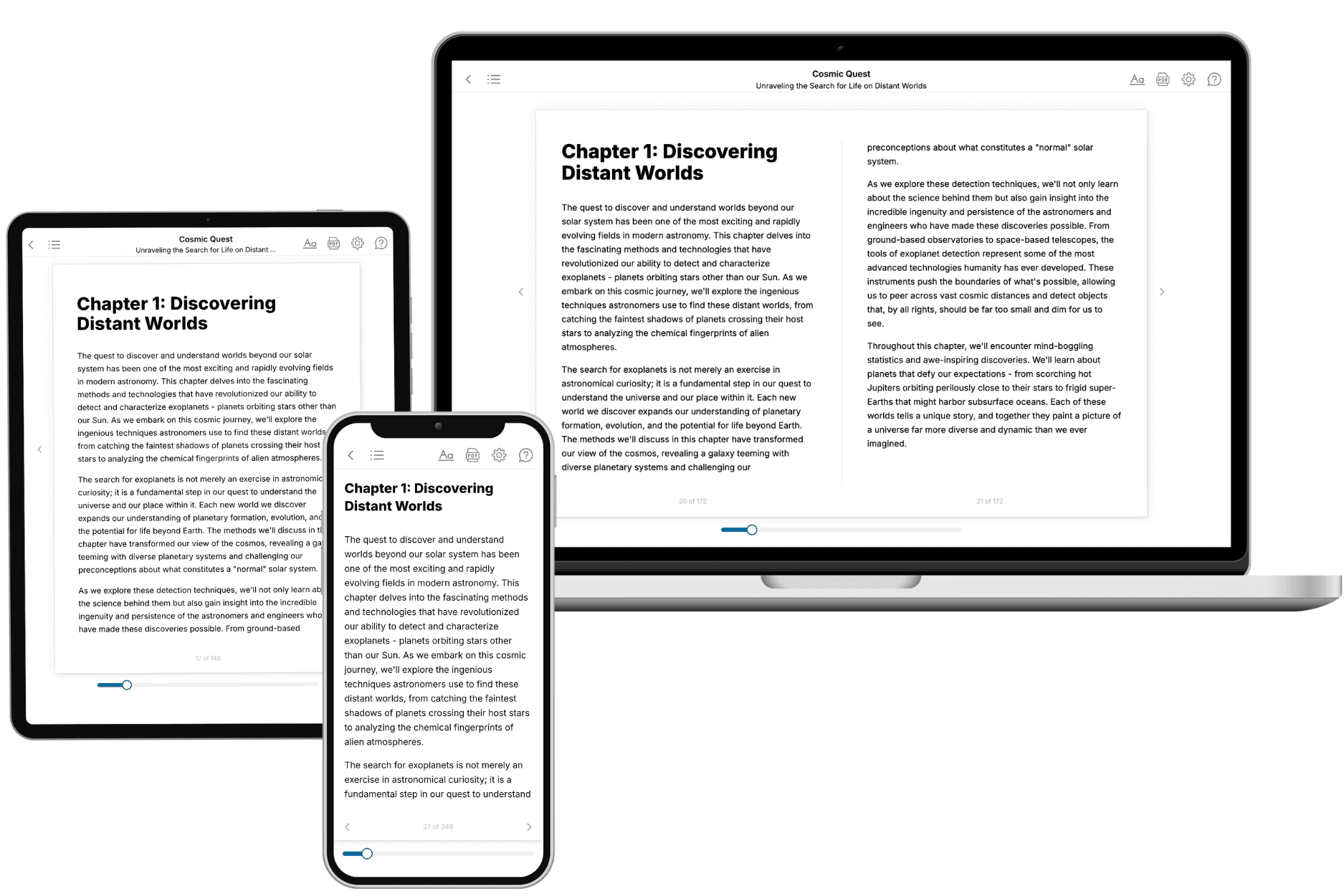
Your book is ready in 10 minutes. Read it online, download as EPUB or PDF, or send to Kindle.
Frequently asked questions
- What is TailoredRead?
TailoredRead creates complete, full-length nonfiction ebooks, written specifically for you. Tell us what you want to learn and why, and TailoredRead writes you a complete ebook on it, with charts, tables, and diagrams throughout. Read it online, on Kindle, or on any e-reader, or download it as a PDF or EPUB. Every book is written fresh the day you order it.
- How is the book tailored to me?
Before anything is written, you answer a few short questions about your goals, your background, and the topics you care about. Your book is then planned around your answers: written at your level, focused on your goals, and covering the topics you chose, instead of the one-size-fits-all book a store sells everyone.
- Will it read like generic AI content?
No. Your book isn't a chat transcript: it's planned chapter by chapter before a single word is written, told in a clear book voice, and explains ideas visually with charts, tables, and diagrams. After writing, every book goes through an editorial pass that polishes chapters so the book reads consistent from start to finish. Judge for yourself: browse thousands of sample books on our Explore Books page.
- How accurate is the content?
Our AI first checks whether your subject needs live research. Niche and fast-moving subjects are researched before writing, and the book plan and chapters are grounded in what it finds. After writing, every book goes through a quality pass that checks its facts and consistency, and researched books list their sources in a Notes section at the back.
- How long is the book?
You choose the length: Comprehensive (250-300 pages), Detailed (150-200 pages), Essential (70-100 pages), or Short (30-50 pages).
- Does the book include visuals?
Yes. Every book includes charts, tables, and diagrams: timelines, checklists, step-by-step guides, decision trees, comparison tables, matrices, and bar charts. A typical book includes dozens of these visual elements.
- Can I read it on Kindle? What formats can I download?
Yes. Every book can be read in our online reader or downloaded as a PDF or EPUB. The EPUB can be opened with Kindle, Apple Books, Kobo, and any e-reader. The Commercial and Author licenses also include an editable Word (DOCX) and Markdown download.
- How much does it cost?
About the price of a regular ebook. The exact price depends on your book's length and complexity, from $2 for the shortest books to $35 for the most comprehensive, and it's shown when you review your book, before you commit to anything. Each book is a one-time purchase, yours to keep, no subscription. Licenses that let you share, teach, or publish your book range from $35.99 to $49.99.
- Can I preview the book before purchasing?
Before you pay, you'll see what your book will cover: the title, a detailed description, the estimated length, and the complete chapter-by-chapter table of contents, so you know what you're getting before you decide. The full text itself is written after you purchase.
- How long does it take to create a book?
About 10 minutes. You can start reading the opening chapters while the rest is still being written.