Reading the Sky
A Comprehensive Guide to Aviation Charts, Airspace, and Safe VFR Navigation
Master the essential skill of reading aviation charts and understanding airspace so you can plan and execute safe VFR flights with confidence.
207 pages10 chaptersMay 24, 2026AviationCreated by Bruce
About this book
This comprehensive guide breaks down the complex world of sectional charts, airspace classifications, and flight planning tools into clear, practical lessons. You'll learn to decode every symbol on a sectional chart, navigate the six airspace categories and their specific rules, interpret weather depictions, read airport diagrams, and understand NOTAMs and special use airspace. Whether you're preparing for recreational flying, refreshing your knowledge, or deepening your aviation expertise, this book provides the authoritative reference you need. Each chapter builds systematically on previous concepts, moving from chart fundamentals through advanced navigation techniques. Real-world examples and practical applications ensure you can immediately apply what you learn to your flight planning and decision-making. By the end, you'll possess the knowledge to confidently interpret any aviation chart and understand the regulatory framework that keeps VFR flights safe and legal.
Table of contents
- IntroductionWhy Aviation Charts Matter, How to Use This Book, Overview of Chart TypesRead below
- Chapter 1: Chart Fundamentals and BasicsUnderstanding Chart Scale and Distance Measurement, Latitude, Longitude, and Grid Systems, Magnetic Variation and True vs. Magnetic Headings
- Chapter 2: Sectional Charts and SymbologyWhat Sectional Charts Show, Decoding Sectional Chart Symbols, Reading Chart Legends and Color Coding
- Chapter 3: Airspace Classification SystemsThe Six Airspace Categories, Controlled Airspace: Classes A, B, C, and D, Uncontrolled Airspace: Classes E and G, Identifying Airspace Boundaries on Charts
- Chapter 4: VFR Navigation FundamentalsNavigation Aids and Their Chart Symbols, Position Fixing and Course Plotting, Dead Reckoning and Pilotage Techniques
- Chapter 5: Airport Diagram InterpretationComponents of Airport Diagrams, Runway Orientation and Markings, Taxiway Layouts and Ground Features
- Chapter 6: Weather Depiction on Flight MapsWeather Symbols and Depiction Codes, Interpreting Weather Information for Flight Planning, Identifying Hazardous Weather Patterns
- Chapter 7: Terrain and Obstacle MappingHow Terrain is Represented on Charts, Identifying Obstacles and Hazards, Obstacle Clearance Standards and Safe Altitudes
- Chapter 8: Special Use Airspace and Restricted AreasTypes of Special Use Airspace, Military Operating Areas and Restricted Airspace, Navigating Around Special Use Airspace
- Chapter 9: NOTAMs and Flight AlertsUnderstanding NOTAM Format and Content, Reading and Interpreting NOTAMs, Applying NOTAMs to Your Flight Planning
- Chapter 10: Practical Flight Planning with ChartsThe Complete Flight Planning Process, Selecting Safe Routes Using Chart Information, Chart-Based Preflight Checklist
- ConclusionYour Path to Chart Mastery, Continuing Your Aviation Education
- Appendix: Quick Reference GuideCommon Chart Symbols Quick Reference, Airspace Rules Summary Table, Additional Resources and Learning Tools
Introduction
There is a moment that every pilot remembers. You unfold a sectional chart for the first time, spread it across a table, and stare at a dense, colorful tapestry of lines, symbols, numbers, and shaded regions. It looks overwhelming. Magenta circles overlap blue boundaries. Tiny numbers cluster around airport symbols. Contour lines ripple across mountain ranges. At first glance, it seems like a foreign language printed on paper the size of a small tablecloth. But here is the truth: it is a language, and like any language, it becomes fluent with the right instruction and a little practice.
Aviation charts are among the most information-rich documents ever designed for practical use. Every symbol, color, and number on a sectional chart exists for a specific reason, and that reason almost always connects directly to safety. The chart tells you where you can fly, how high you need to be, what obstacles stand in your path, and what rules apply to the airspace around you. Pilots who read charts well make better decisions. They catch hazards before takeoff rather than discovering them in the air. They understand the regulatory environment they are operating in, and they navigate with confidence rather than guesswork.
This book was written for people who want to develop genuine, working knowledge of aviation charts and airspace systems. Whether you are pursuing a private pilot certificate, refreshing knowledge you once had, or simply deepening your understanding of how the aviation system works, the material here is designed to be clear, practical, and immediately useful. The approach is systematic. Each chapter builds on the one before it, moving from foundational concepts like chart scale and coordinate systems through to advanced topics like special use airspace, NOTAMs, and complete flight planning workflows. By the time you reach the final chapter, you will have the tools to pick up any aviation chart and read it with confidence.
Aviation has a reputation for complexity, and some of that reputation is earned. The regulatory framework governing airspace is detailed, and the symbology on charts is extensive. But complexity is not the same as inaccessibility. The FAA standardizes chart symbols across all aviation charts published in the United States, which means that once you learn the system, it applies everywhere.[1] You do not need to relearn the language every time you fly to a new region. That standardization is one of aviation's great gifts to the student, and this book takes full advantage of it.
Why Aviation Charts Matter
Aviation charts are not optional accessories. They are primary safety tools, and the FAA treats them as such. Under Visual Flight Rules (VFR), pilots are responsible for their own navigation and terrain separation. There is no radar controller watching your altitude above the mountains. There is no automated system warning you that you are about to enter restricted airspace. The chart, combined with your own situational awareness, is your primary defense against a wide range of hazards that exist in every flight environment.
Consider a concrete example. A pilot planning a cross-country flight from a small regional airport in the Appalachian foothills to a destination 150 miles away might cross through several different airspace classes, pass within a few miles of a military operations area, and fly over terrain that rises to 4,200 feet above sea level. Without a chart, none of that information is visible. With a properly read sectional chart, every one of those factors is clearly marked, and the pilot can plan a route that avoids conflicts and maintains safe terrain clearance before the engine ever starts.
Charts also serve a legal function. Flying into Class B airspace around a major airport without the required clearance is a Federal Aviation Regulation violation, regardless of whether the pilot knew the airspace was there. Ignorance of the chart is not a legal defense. The FAA publishes airspace boundaries on sectional charts precisely so that pilots have access to the information they need to comply with the rules. Knowing how to read those boundaries is not just a skill; it is a legal responsibility for anyone operating an aircraft.
Beyond regulatory compliance, charts support good aeronautical decision-making. The FAA's research into accident causation consistently identifies poor preflight planning as a contributing factor in a significant percentage of general aviation accidents.[2] Many of those planning failures trace back to inadequate chart review. Pilots who skip the chart work miss terrain features, fail to identify alternate airports, and underestimate the complexity of the airspace they are entering. Charts, used properly, are one of the most effective accident prevention tools available.
There is also a practical navigation dimension that matters enormously in real flight conditions. GPS technology has transformed how pilots navigate, but GPS systems fail, batteries die, and databases become outdated. A pilot who can read a paper sectional chart and navigate by pilotage (matching visual landmarks to chart features) has a backup capability that no electronic device can replace. The FAA still requires student pilots to demonstrate chart-reading and pilotage skills for exactly this reason. Redundancy saves lives, and chart literacy is a foundational layer of that redundancy.
Finally, charts matter because they represent a shared language across the entire aviation community. Air traffic controllers, flight service specialists, other pilots, and search-and-rescue teams all use the same charts and the same coordinate systems. When you file a flight plan, describe your route, or report your position, you are communicating within a framework that charts define. Fluency in that framework makes you a more effective communicator and a safer participant in the national airspace system.
Key insight: A sectional chart is not just a map. It is a compressed, standardized safety briefing that covers terrain, airspace, navigation aids, obstacles, and regulatory requirements for every square mile it depicts. Learning to read it is one of the highest-value skills in aviation.
The stakes of chart literacy become especially clear when you look at accident reports involving controlled flight into terrain (CFIT), a category where aircraft in perfectly good working order fly into the ground or obstacles because the pilot lost situational awareness. CFIT accidents are almost always preventable with proper chart use. The terrain is on the chart. The obstacles are on the chart. The minimum safe altitudes are on the chart. Chart literacy does not guarantee safety, but the absence of it creates entirely avoidable risk.
How to Use This Book
This book is organized as a progressive learning journey. Each chapter introduces concepts that build on what came before, so reading in sequence will give you the strongest foundation. That said, the book is also designed to function as a reference. If you already have solid knowledge of chart fundamentals but want to deepen your understanding of special use airspace, you can go directly to Chapter 8 without losing the thread. Clear cross-references throughout the text will point you back to foundational material when it is relevant.
The most effective way to use this book is alongside an actual sectional chart. The FAA publishes sectional charts for every region of the contiguous United States, Alaska, and Hawaii, and they are available for free in digital form through the FAA's aeronautical navigation products website.[3] Apps like ForeFlight, SkyVector, and the FAA's own VFR sectional viewer let you zoom into any region of the country and examine chart features in detail. As you read each chapter, find the features being described on a real chart. That active engagement will accelerate your learning dramatically compared to reading alone.
Here is a suggested approach for getting the most out of each chapter:
- Read the chapter once for overall comprehension without stopping to look things up.
- Open a sectional chart (digital or paper) and work through the chapter a second time, locating each feature or symbol as it is described.
- Complete the practical exercises embedded in each chapter, which ask you to identify specific features, measure distances, or trace routes on the chart.
- Review the chapter summary and test your recall of the key concepts before moving on.
If you are working toward a private pilot certificate, this book aligns closely with the knowledge areas tested on the FAA Private Pilot Knowledge Test, particularly the sections covering chart reading, airspace, and navigation. The material here goes deeper than the minimum required for the test, which is intentional. Passing a test and actually being safe in the air are related but not identical goals. This book aims for the latter, which will naturally take care of the former.
For readers who are not pursuing a certificate but are interested in aviation as a subject, the book is equally useful. Understanding how airspace works, how pilots navigate, and how weather information is communicated gives you a richer appreciation of the aviation system as a whole. Many aviation enthusiasts, air traffic control students, drone operators, and aviation safety professionals find chart literacy valuable even without ever sitting in the left seat of an aircraft.
A note on terminology: aviation uses a lot of abbreviations and technical terms, and this book introduces them as they become relevant rather than front-loading a glossary. Each new term is defined clearly when it first appears, and the appendix includes a quick-reference guide to common symbols and abbreviations. When you encounter an unfamiliar term in a later chapter, the appendix is your first stop for a quick definition before returning to the main text.
The chapters on airspace classification (Chapter 3) and special use airspace (Chapter 8) are particularly important for anyone planning actual flights. These chapters contain regulatory information that is both safety-critical and frequently misunderstood. Take extra time with them. Work through the examples carefully. The airspace system is logical once you understand its structure, but the details matter, and getting them wrong has real consequences.
Practical tip: Download the free sectional chart for your local area from the FAA's digital products page before you start Chapter 1. Having a familiar geographic region on your chart will make every example more concrete and memorable.
Overview of Chart Types
Not all aviation charts are the same. The FAA and its contracted publishers produce a family of charts, each designed for a specific purpose and type of flight operation. Understanding which chart does what job is the first step toward using them effectively. This book focuses primarily on the charts most relevant to VFR flight, but a brief overview of the full family helps you understand where sectional charts fit in the larger picture.
Sectional Aeronautical Charts are the primary tool for VFR navigation and the central focus of this book. They are published at a scale of 1:500,000 (one inch equals approximately 6.86 nautical miles) and cover the entire contiguous United States in 37 individual chart panels.[1] Sectional charts show terrain elevation through color shading and contour lines, all airspace classes and their boundaries, airports, navigation aids, obstacles, and a wealth of additional information. They are updated every 56 days to reflect changes in airspace, new obstacles, and other safety-relevant updates. Using an outdated sectional chart is a genuine safety risk, not just a technicality.
Terminal Area Charts (TACs) cover the airspace around major airports at a larger scale of 1:250,000, which means they show twice the detail of a sectional chart for the same geographic area. TACs are used when flying in or near Class B airspace, where the density of traffic, the complexity of airspace boundaries, and the need for precise navigation make the extra detail essential. If you are planning a flight that takes you near a major hub airport, the TAC for that area is a critical planning tool alongside the sectional chart.
World Aeronautical Charts (WACs) cover larger geographic areas at a scale of 1:1,000,000. They are used for longer cross-country flights where the pilot needs a broader view of the route without the detail density of a sectional chart. WACs are less common in everyday VFR flight planning but remain useful for initial route sketching over long distances.
The chart types most relevant to VFR pilots can be summarized as follows:
- Sectional Aeronautical Chart: Scale 1:500,000. Primary VFR navigation tool. Updated every 56 days. Covers terrain, airspace, airports, and navigation aids.
- Terminal Area Chart (TAC): Scale 1:250,000. Used near Class B airspace. Greater detail for complex terminal environments.
- World Aeronautical Chart (WAC): Scale 1:1,000,000. Broad overview for long-distance route planning.
- Airport Diagram: Not to scale. Shows runway layout, taxiways, ramps, and ground features for a specific airport.
- IFR Enroute Charts: Designed for instrument flight. Less relevant to VFR operations but useful for understanding the full airspace structure.
Airport Diagrams deserve special mention because they serve a completely different function from enroute charts. Rather than showing a geographic region, an airport diagram shows the layout of a single airport in detail: runway numbers and orientations, taxiway designations, ramp areas, control tower locations, and the positions of key facilities. Chapter 5 covers airport diagrams in depth, but it is worth noting here that these diagrams are essential for safe ground operations, particularly at unfamiliar airports where getting lost on the taxiway system is a real and documented hazard.
Weather depiction charts and prognostic charts form another important category. These are not navigation charts in the traditional sense, but they are aviation charts in that they present meteorological information in a standardized visual format designed for flight planning. They show areas of instrument meteorological conditions (IMC), frontal systems, precipitation, and forecast weather patterns. Chapter 6 covers these in detail, including how to interpret the symbols and how to use weather chart information to make go/no-go decisions.
One important concept to understand from the start is that all of these chart types use a common underlying framework of latitude and longitude coordinates, magnetic variation data, and standardized symbology. The specific symbols for a VOR navigation aid look the same on a sectional chart, a TAC, and a WAC. The color conventions for terrain elevation follow consistent rules across chart types. This standardization means that the investment you make in learning one chart type pays dividends across all of them. The learning curve is front-loaded, and it flattens quickly once the foundational concepts are in place.
Digital chart tools have added a new dimension to this landscape. Applications like ForeFlight, Garmin Pilot, and SkyVector display the same FAA-published chart data in interactive formats that allow zooming, layering of weather information, and real-time GPS position overlay. These tools are powerful and widely used in modern aviation. However, they display the same underlying chart data that appears on paper charts. Understanding the paper chart is still the foundation, because digital tools are only as useful as the pilot's ability to interpret what they display. A GPS moving map showing your position on a sectional chart is enormously helpful, but only if you understand what the sectional chart is telling you about the airspace and terrain around that position dot.
Remember: Digital tools enhance chart use; they do not replace chart knowledge. The pilot who understands the underlying data will always use digital tools more effectively and safely than one who treats them as a black box.
As you work through this book, you will develop familiarity with all of the chart types described above, with the deepest focus on sectional charts and airport diagrams. By the time you reach the flight planning chapter, you will understand how to select the right chart for each phase of a flight, how to cross-reference information between chart types, and how to integrate chart data with weather information and NOTAMs into a complete preflight picture. That integrated capability is the real goal, and every chapter in this book is a step toward it.
Notes
Introduction
- 1. Federal Aviation Administration, Aeronautical Chart User's Guide, 11th Edition, FAA Aeronautical Navigation Products, 2023
- 2. NTSB, General Aviation Accidents: Causal Factors and Prevention Strategies, National Transportation Safety Board, 2022
- 3. FAA Aeronautical Navigation Products, "Digital-Visual Charts," 2024
- 1. Federal Aviation Administration, Aeronautical Chart User's Guide, 11th Edition, FAA Aeronautical Navigation Products, 2023
This is the end of the free sample. The full book has 10 chapters.
Want this book written for you?
Tell us your goals and background, and get your own version of this book, tailored by AI to you.


Benefits of AI-tailored books
- Read one book, not ten:
- all the Aviation knowledge you need, gathered into a single book.
- Save days of learning:
- tell us your goals, choose your topics, and the whole book is built around them.
- Learn effortlessly:
- Aviation book written for your specific background and expertise.
- Understand at a glance:
- includes charts, tables, timelines, checklists, decision trees, and more.
- Stay current:
- written the day you order it, not years ago.
- Trust what you read:
- every book is checked for accuracy, with real research when your subject needs it.
Create your unique book in 3 steps
- 1. Select your focus
Select the focus of your Aviation book and share your background
- 2. Personalize your book
Specify your goals and choose sub-topics to include
- 3. Get your tailored book
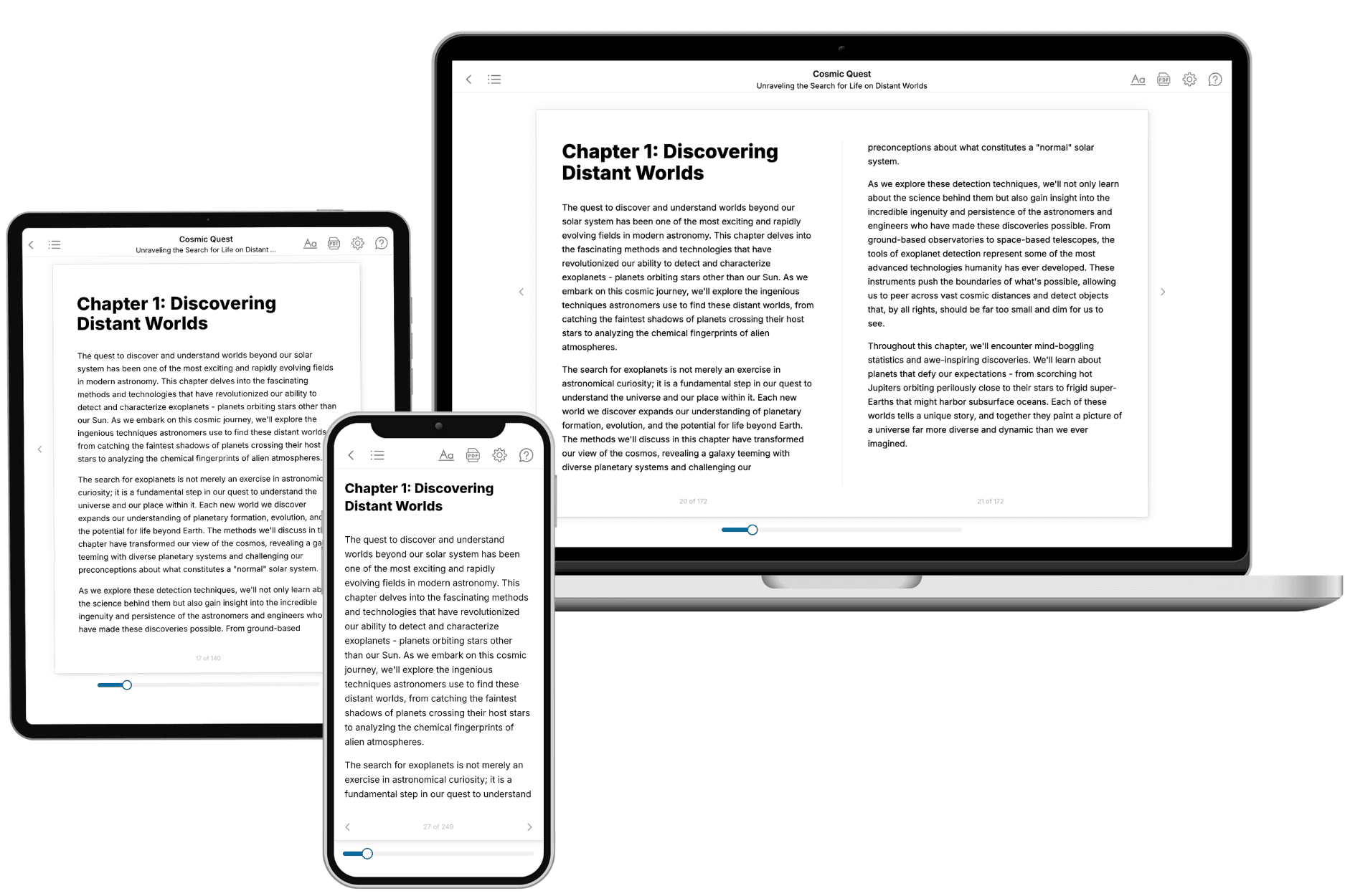
Your book is ready in 10 minutes. Read it online, download as EPUB or PDF, or send to Kindle.

Frequently asked questions
- What is TailoredRead?
TailoredRead creates complete, full-length nonfiction ebooks, written specifically for you. Tell us what you want to learn and why, and TailoredRead writes you a complete ebook on it, with charts, tables, and diagrams throughout. Read it online, on Kindle, or on any e-reader, or download it as a PDF or EPUB. Every book is written fresh the day you order it.
- How is the book tailored to me?
Before anything is written, you answer a few short questions about your goals, your background, and the topics you care about. Your book is then planned around your answers: written at your level, focused on your goals, and covering the topics you chose, instead of the one-size-fits-all book a store sells everyone.
- Will it read like generic AI content?
No. Your book isn't a chat transcript: it's planned chapter by chapter before a single word is written, told in a clear book voice, and explains ideas visually with charts, tables, and diagrams. After writing, every book goes through an editorial pass that polishes chapters so the book reads consistent from start to finish. Judge for yourself: browse thousands of sample books on our Explore Books page.
- How accurate is the content?
Our AI first checks whether your subject needs live research. Niche and fast-moving subjects are researched before writing, and the book plan and chapters are grounded in what it finds. After writing, every book goes through a quality pass that checks its facts and consistency, and researched books list their sources in a Notes section at the back.
- How long is the book?
You choose the length: Comprehensive (250-300 pages), Detailed (150-200 pages), Essential (70-100 pages), or Short (30-50 pages).
- Does the book include visuals?
Yes. Every book includes charts, tables, and diagrams: timelines, checklists, step-by-step guides, decision trees, comparison tables, matrices, and bar charts. A typical book includes dozens of these visual elements.
- Can I read it on Kindle? What formats can I download?
Yes. Every book can be read in our online reader or downloaded as a PDF or EPUB. The EPUB can be opened with Kindle, Apple Books, Kobo, and any e-reader. The Commercial and Author licenses also include an editable Word (DOCX) and Markdown download.
- How much does it cost?
About the price of a regular ebook. The exact price depends on your book's length and complexity, from $2 for the shortest books to $35 for the most comprehensive, and it's shown when you review your book, before you commit to anything. Each book is a one-time purchase, yours to keep, no subscription. Licenses that let you share, teach, or publish your book range from $35.99 to $49.99.
- Can I preview the book before purchasing?
Before you pay, you'll see what your book will cover: the title, a detailed description, the estimated length, and the complete chapter-by-chapter table of contents, so you know what you're getting before you decide. The full text itself is written after you purchase.
- How long does it take to create a book?
About 10 minutes. You can start reading the opening chapters while the rest is still being written.