About this book
Written for a physician who already reasons carefully through complex data, it begins with the surface chart and moves steadily upward through the atmosphere, building the tools you need one layer at a time. You will learn to read METARs and TAFs with the precision of a clinical chart, to interpret winds aloft and jet stream patterns, and to recognize the signatures of icing, frontal systems and mountain wave. Along the way you will see how SIGMETs, AIRMETs and G-AIRMETs fit into a briefing, and how to turn all of this into written go/no-go criteria that guide real decisions. The final chapters bring the pieces together in the context of weather briefing standards and aeronautical decision making, so that the knowledge becomes a habit. This is a practical book, grounded in current U.S. products and terminology, and it rewards a steady reading pace and a sample set of charts close at hand.
Table of contents
- IntroductionWhy Weather Planning Matters for Instrument Flight, How to Use This Book Alongside Real Products, The FAA Aviation Weather Handbook in ContextRead below
- Chapter 1: Reading Surface Weather ChartsSymbols, Pressure Lines and Station Models, Analyzing Highs, Lows and Pressure Gradients, Where Fronts Appear on the Surface Chart
- Chapter 2: Upper-Air Wind Charts and Winds AloftReading Upper-Air Wind Charts Step by Step, Using Winds Aloft Forecasts in Flight Planning, Jet Stream Influences on Route and Timing
- Chapter 3: Decoding METARs and Interpreting TAFsMETAR Decoding Basics for Every Observation, TAF Interpretation and Change Groups, Temperature Dewpoint Spread and Fog Formation Types
- Chapter 4: Evaluating Ceiling, Visibility and Density AltitudeEvaluating Ceiling and Visibility for Approaches, Density Altitude Effects on Performance, Atmospheric Stability and Its Operational Effects
- Chapter 5: Icing, Frontal Systems and Mountain WaveRecognizing Icing Conditions Aloft, Frontal Systems Fundamentals for Route Planning, Recognizing Mountain Wave Hazards
- Chapter 6: Significant Weather Charts and Thunderstorm HazardsReading Significant Weather Charts Effectively, Assessing Thunderstorm Hazards on Route, Low-Level Wind Shear and Its Warning Signs
- Chapter 7: SIGMETs, AIRMETs and G-AIRMET AdvisoriesSIGMET Decoding Essentials for Pilots, AIRMET Advisory Decoding and Its Limits, G-AIRMET Changes Since January 2025
- Chapter 8: Radar, Satellite Imagery and Pilot ReportsInterpreting Weather Radar Returns Accurately, Reading Satellite Imagery for Cloud Structure, Using Pilot Weather Reports as Ground Truth
- Chapter 9: Weather Briefing Standards and Go/No-Go CriteriaWeather Briefing Standards and Expected Content, Building Personal Weather Go/No-Go Criteria, Route, Altitude and Alternate Decisions Together
- Chapter 10: Aeronautical Decision Making Under Changing WeatherAeronautical Decision Making Framework in Practice, Reassessing Conditions as Weather Changes
- ConclusionBringing the Skills Together Before Each Flight, Ongoing Practice and Staying Current
- Further Reading and Resources
- Glossary
Introduction
A physician reviewing a patient's chart does not read a single lab value in isolation. The blood pressure, the heart rate, the oxygen saturation, and the trend over the last several hours all combine into a picture, and that picture changes the plan. Weather analysis for an instrument flight works the same way. A single METAR showing a ceiling of 1,500 feet means little until it is placed alongside the TAF for that airport, the winds aloft along the route, and any SIGMET or G-AIRMET active for the region. The skill this book builds is not memorizing symbols, though symbols matter. It is learning to assemble scattered pieces of atmospheric data into a coherent clinical impression of the sky, and then acting on that impression with the same discipline used at the bedside.
Instrument flight rules exist precisely because the sky sometimes hides the ground, the horizon, or both. Flying through cloud, haze, or darkness without visual reference demands trust in instruments and in a decision made earlier, often hours earlier, about whether the flight should happen at all. That decision rests on weather information gathered from many sources: government observation networks, forecast models, radar and satellite data, and reports from pilots already in the air. None of these sources is complete on its own, and each carries its own kind of uncertainty. Treating any single product as the whole truth is the most common and most dangerous shortcut in weather planning, and this book is built to prevent that shortcut from becoming a habit.
The chapters ahead move through the atmosphere in a logical order, starting at the surface and climbing through the layers a flight actually passes through. Surface charts and station models come first, followed by upper-air winds and the jet stream, then the detailed language of METARs and TAFs. From there the book turns to ceiling, visibility, and density altitude, then to icing, fronts, and mountain wave, then to significant weather charts and thunderstorm hazards. Advisories such as SIGMETs, AIRMETs, and the newer G-AIRMETs follow, along with radar, satellite imagery, and pilot reports. The final chapters bring everything together into a weather briefing and a written set of go/no-go criteria, closing with a framework for aeronautical decision making when conditions shift mid-flight.
Reading in this order matters because each layer depends on the one before it. A ceiling and visibility problem at the destination cannot be judged correctly without first knowing whether a front is approaching, and a front cannot be tracked without understanding the pressure patterns on the surface chart. Skipping ahead to the advisories chapter without the groundwork on fronts and icing risks treating a SIGMET as an isolated warning rather than as confirmation of a pattern that should already have been visible. The sequence is designed to build a stack of understanding, each layer resting on the one underneath, the same way a differential diagnosis narrows as each new test result arrives.
None of this replaces the judgment that develops only through repeated practice with real, current products before real flights. The purpose of this book is to prepare that judgment, not to substitute for it. The three subchapters that follow set the frame: why weather planning deserves this level of rigor, how to use the book alongside actual charts and briefings rather than as a replacement for them, and where the FAA's own guidance fits into the picture of what is required, what is recommended, and what remains a matter of personal judgment.
Why Weather Planning Matters for Instrument Flight
Weather is the variable in instrument flight that cannot be controlled, only understood and planned around. An engine failure, a system malfunction, or a navigation error can often be anticipated through checklists and training built specifically for that failure mode. Weather does not work that way. It evolves continuously across space and time, and the same forecast that looked comfortable at the planning stage can look very different three hours later when the flight actually reaches that point in the sky. This is why weather analysis for instrument flight is treated as an ongoing process rather than a single checkbox completed before departure.
Consider a flight planned from one city to another, four hundred miles away, with an estimated time en route of two hours. The departure airport shows good visual conditions at planning time. The destination TAF, however, forecasts a temporary period of lower ceiling and visibility starting an hour after the planned arrival time, tied to an approaching frontal boundary. A pilot who only checks current conditions at the departure airport and assumes the destination will look the same misses the entire point of forecast interpretation: forecasts exist to describe conditions at a future time, not to confirm what the present already looks like. The subchapter on TAF Interpretation and Change Groups builds the specific skill needed to read that kind of timing correctly.
The stakes of getting this wrong are not abstract. Flying into deteriorating ceiling and visibility without an adequate margin, or encountering unforecast icing at an altitude chosen without checking the winds aloft and temperature profile, converts a routine instrument flight into an emergency. These are not rare or exotic failure modes. They are the direct, mechanical result of incomplete weather analysis, and they recur across the aviation safety record in patterns that are well understood. The chapters on Recognizing Icing Conditions Aloft and Low-Level Wind Shear and Its Warning Signs describe the physical mechanisms behind two of the most consequential of these hazards.
What makes weather analysis different from many other aviation skills is that it requires synthesizing information that was never designed to be read together. A METAR, a TAF, a SIGMET, a winds aloft forecast, and a significant weather chart are each produced by different processes, on different timelines, using different formats and conventions. A pilot has to mentally overlay all of them onto a single route, a single set of altitudes, and a single window of time. This synthesis is a cognitive skill that improves with structured practice, much like interpreting a complex set of lab values or imaging studies against a single patient's clinical picture. That parallel is one reason this book is built the way it is, with the reader's existing analytical training treated as an asset rather than something to set aside.
A second reason weather analysis demands this level of rigor is that conditions along the full route, not only at the departure and destination airports, determine whether a flight can proceed safely. A flight might begin and end under perfectly good conditions while passing through a band of embedded thunderstorms, an area of moderate icing, or a mountain wave zone somewhere in the middle. Pilots who check only the two endpoints and skip the en route segment are, in effect, reviewing a patient's vital signs at admission and discharge while ignoring every reading taken during the stay. The chapters on Significant Weather Charts and Thunderstorm Hazards and on mountain wave are built specifically to close that gap.
Finally, weather analysis matters because the consequences of a wrong decision are not evenly distributed across the flight. A conservative decision made on the ground, before departure, costs an inconvenient delay or a canceled trip. The same level of uncertainty encountered in flight, close to terrain or in deteriorating conditions, costs far more in terms of available options and time to react. This asymmetry is the entire argument for front-loading analysis before departure and for building go/no-go criteria in advance, a theme that returns in detail in the chapter on Building Personal Weather Go/No-Go Criteria.
The following checklist captures the broad categories of weather analysis that a complete instrument flight plan must cover, serving as an orientation point before the book develops each one in depth.
Categories a Complete Weather Picture Must Cover
- Surface conditions and pressure patterns along the entire route
- Winds aloft and jet stream position at planned cruising altitudes
- Current observations (METAR) and forecasts (TAF) for departure, destination, and alternates
- Ceiling, visibility, and temperature-dewpoint spread at each airport
- Icing potential and freezing level along the route
- Frontal boundaries and their timing relative to the flight
- Thunderstorm activity and associated wind shear risk
- Active SIGMETs, AIRMETs, or G-AIRMETs covering the route or altitude
- Radar, satellite, and pilot reports confirming or contradicting the forecast picture
Each of these categories gets its own dedicated treatment later in the book, but seeing them listed together early makes an important point: no single product or chart answers all of these questions. A pilot who checks only a METAR, or only a SIGMET, or only a radar image, has answered one question out of nine. The habit this book is meant to build is running through a structured set of categories every time, rather than relying on whichever product happens to be most familiar or most convenient to pull up.
It also helps to recognize what weather analysis is not. It is not a search for a guarantee of good conditions, because no forecast offers one. It is a structured estimate of probability and margin, built from the best available current information, applied against a set of personal and aircraft limits decided in advance. A pilot who treats a favorable forecast as a certainty has made the same error as a physician who treats a single normal lab value as proof that nothing is wrong. Both outcomes are plausible, but neither is confirmed until more evidence accumulates, and the discipline lies in continuing to gather that evidence rather than stopping at the first reassuring data point.
This is also why the book repeatedly returns to the idea of margin, the gap between actual or forecast conditions and the minimum conditions a pilot and aircraft can safely handle. A ceiling of 800 feet at an airport with a published approach minimum of 500 feet offers a 300-foot margin, but that margin can shrink if the forecast trend is downward, if the TAF has historically run optimistic for that location, or if an alternate airport is itself close to its own minimums. Margin is never a fixed number; it is reassessed continuously as new reports arrive, which is the same logic developed fully in the chapter on Reassessing Conditions as Weather Changes.
One useful mental model, introduced here and expanded later, is to treat every weather decision as having both a technical component and a human component. The technical component is the data: the ceiling, the visibility, the icing level, the SIGMET boundaries. The human component is how that data gets interpreted under time pressure, fatigue, or the desire to complete a planned trip. Continuation Bias, the tendency to keep going with a plan because of momentum rather than because conditions still support it, sits squarely in that human component, and it will recur as a theme in the closing chapters on aeronautical decision making.
None of this is meant to suggest that instrument flight in weather is inherently reckless. The entire instrument rating exists because properly planned and executed flight into cloud and reduced visibility is a normal, safe part of aviation. The purpose of rigorous weather analysis is to make that normal safety reliable, by ensuring that the pilot's mental model of the sky matches reality closely enough that the instruments, the aircraft, and the pilot's decisions all stay within their tested limits. That alignment between mental model and reality is the thread running through every chapter that follows.
By the end of this book, the goal is for weather analysis to feel less like consulting a separate specialist and more like an integrated part of flight planning, done with the same steady, evidence-based approach that already defines careful clinical reasoning. The vocabulary will be different, and the instruments measure different things, but the underlying discipline of gathering data, weighing uncertainty, and deciding deliberately rather than reflexively translates directly.
How to Use This Book Alongside Real Products
This book teaches how to read weather products, not what today's weather actually is. That distinction matters enough to state plainly at the outset. Every chart, METAR, TAF, and advisory discussed in these pages is either a general description of the format and meaning of that product or an illustrative example built to demonstrate a decoding technique. None of it should be treated as current, time-valid information for an actual flight. The Aviation Weather Center, Flight Service, and other official sources are where current data lives, and this book is meant to make that data easier to interpret correctly once it is in hand, not to serve as a substitute source for it.
The most effective way to use this book is side by side with a real briefing, pulled up on a second screen or printed out, while working through each chapter. When the chapter on METAR Decoding Basics for Every Observation walks through the structure of a station identifier, a time group, and a wind group, pause and pull up an actual current METAR for a familiar airport and decode it line by line using the same method. The patterns described abstractly in the text become concrete and memorable once applied to a real report for a real place. This also builds familiarity with the specific quirks of frequently used airports, such as how often a particular field reports fog or how its TAF has historically performed against observed conditions.
Treat each chapter's worked examples as templates for a repeatable process rather than as facts to memorize. The chapter on SIGMET Decoding Essentials for Pilots, for instance, will walk through the structure of a hypothetical advisory piece by piece: the valid time, the affected area described by a set of points, the hazard type, and the expected movement. The specific coordinates and times in that example are invented for teaching purposes. What should be retained is the decoding sequence itself, so that the next real SIGMET encountered during an actual briefing can be worked through using the same sequence of steps, not matched against a memorized example that will never recur exactly.
A sample set of charts kept close at hand while reading, as the book's own description suggests, turns passive reading into active skill-building. This does not need to be elaborate. A folder of saved briefings from a handful of recent flights, real or simulated, provides enough material to practice against every chapter in this book. Reviewing a past briefing with the benefit of hindsight, comparing what the TAF predicted against what the METARs later recorded, builds exactly the kind of calibrated judgment about forecast reliability that experienced pilots develop over years of flying.
It helps to approach each new chapter with a specific question in mind, drawn from recent or upcoming flying, rather than reading in the abstract. Before starting the chapter on Jet Stream Influences on Route and Timing, for example, consider a recent flight that seemed to take noticeably longer or shorter than planned, and read the chapter with that specific case in mind as a way of testing the explanation against lived experience. This kind of active questioning turns a reference chapter into a working explanation for something that already happened, which tends to make the material stick far better than reading without a concrete anchor.
The book also includes short self-check quizzes, checklists, and decision trees scattered through relevant chapters, and these are worth treating as genuine checkpoints rather than skimming past. A quiz question that asks whether a given temperature-dewpoint spread and wind pattern favors radiation fog or advection fog is testing exactly the kind of discrimination that matters in a real briefing, where misclassifying the fog type leads to misjudging how quickly it will clear. Getting a question wrong on a first attempt is a useful signal to reread the relevant paragraph rather than move on, since the underlying concept will reappear in later chapters that assume it has been mastered.
Because aviation weather terminology and products do change over time, this book anchors itself to the terms and categories defined by the FAA and the National Weather Service as understood at the time of writing, and it flags the most significant recent shift directly: the move from text-based CONUS AIRMETs to the newer graphical G-AIRMET product. Even so, official sources should always be checked for the current state of any product, format, or regulation before relying on it operationally. A book is printed once; aviation weather products are revised continuously.
One practical habit worth adopting immediately is keeping a simple log of real briefings reviewed while working through this book, noting the date, the route, and one thing learned or confirmed from that session. This log becomes personally valuable in two ways. First, it creates a growing library of real examples tied to actual flying, which is far more useful for review than the book's own illustrative examples. Second, it creates a record of developing judgment that can be revisited later, much like a reflective log kept during clinical training, showing not just what was learned but how thinking about a particular hazard or product changed with more exposure.
Reading order matters less rigidly after the first few chapters than the opening section suggested. The core sequence from surface charts through METARs and TAFs builds foundational vocabulary that later chapters assume, and skipping those early chapters will make later material harder to follow. Once that foundation is in place, however, a chapter like Reading Significant Weather Charts Effectively or Interpreting Weather Radar Returns Accurately can reasonably be pulled forward if a specific upcoming flight raises questions about thunderstorms or radar interpretation sooner than the book's default order would reach them.
It is equally useful to revisit earlier chapters after finishing later ones, since concepts introduced early often make more sense once their downstream consequences have been seen. The discussion of pressure gradients and isobars in the surface chart chapter, for example, will likely feel more meaningful after working through how those same gradients translate into the wind shear discussion later in the book. Nonlinear, recursive reading of this kind mirrors how clinical knowledge is typically built as well, where an early lecture on a mechanism only becomes fully clear after seeing its clinical consequences months later.
Finally, resist the temptation to treat finishing this book as the end of the learning process rather than the beginning of a practice habit. Weather analysis skill, like diagnostic skill, is maintained through repetition against real cases over time, not secured permanently by one thorough reading. The closing chapter on Ongoing Practice and Staying Current returns to this point directly, but it is worth stating here as well: plan to revisit specific chapters of this book periodically, matched against real upcoming flights, rather than treating it as a one-time reference to be set aside once read.
The decision tree below offers one simple way to decide, at any point while reading, whether the book's explanation in hand is sufficient on its own or whether an official source needs to be checked before moving forward, which is a useful habit to build from the very first chapter.
Is This Book's Explanation Enough on Its Own?
- Is this a real flight being planned right now?
- Yes Check current official products before any decision
- No, just studying Is the question about format, meaning, or decoding method?
- Format or decoding This book's explanation is sufficient
- Current rule or product status Verify against the current FAA Aviation Weather Handbook or AWC guidance
The FAA Aviation Weather Handbook in Context
The Federal Aviation Administration maintains a central reference document covering aviation weather theory, products, and interpretation, and this book draws heavily on the structure and terminology that document establishes. The FAA identifies FAA-H-8083-28B, published in 2026, as the current edition of the Aviation Weather Handbook[1]. Understanding where that handbook fits, and where it does not, helps set realistic expectations for how this book and official FAA guidance relate to one another throughout the chapters ahead.
The handbook is comprehensive by design, covering atmospheric theory, chart types, observation and forecast products, and hazard recognition in a single reference volume intended for pilots at every level of experience. This book is narrower and more applied. It is written specifically for instrument flight planning, with chapters organized around the sequence of decisions a pilot actually makes when building a weather picture for a cross-country instrument flight, rather than around the broader theoretical organization a general reference handbook follows. Where the handbook might spend significant space on the physics behind a weather phenomenon, this book focuses more directly on what that phenomenon means operationally and how to recognize it in the products a pilot checks before and during a flight.
One point deserves particular emphasis given how often it gets blurred in casual conversation among pilots: the handbook's own guidance and recommendations are voluntary. The handbook functions as an educational and reference resource rather than as a regulatory document in itself, and treating its content as legally binding in the way a specific federal aviation regulation is binding would be a misunderstanding of its role. Regulatory requirements for weather information, briefings, and minimums come from the applicable federal aviation regulations and from operation-specific requirements, not from the handbook directly, even though the handbook explains and supports compliance with those regulations.
This distinction matters practically because it shapes how to read any piece of weather guidance, including the guidance in this book. A requirement is not optional and must be satisfied for the flight to be conducted legally. A recommendation or best practice, by contrast, represents accumulated judgment about what tends to produce safer outcomes, and following it is a matter of prudent decision making rather than legal compliance. Much of the content on building personal minimums, structuring a briefing, and setting go/no-go criteria falls into this second category. It is strongly advisable, grounded in real patterns of risk, but it is a matter of airmanship and judgment rather than a checklist enforced by regulation.
The Aviation Weather Center and the National Weather Service produce the actual observational and forecast data referenced throughout this book, including METARs, TAFs, SIGMETs, AIRMETs, and the newer G-AIRMET products. Flight Service provides briefing services and pilot support built on top of that underlying data. The handbook sits alongside these operational sources as the explanatory layer, describing what the products mean and how they are generated, while this book sits one level further out, focused specifically on how a pilot facing an instrument flight planning decision should read and combine all of it.
Understanding this layered structure helps clarify a question that comes up naturally for a reader with a background in evidence-based practice: which source should be trusted when two seem to conflict? The answer follows a consistent hierarchy. A current, time-valid operational product (an actual METAR, TAF, or SIGMET) always takes precedence over any general description of what that product typically looks like, including the examples in this book or in the handbook itself. The handbook's explanatory guidance takes precedence over this book's narrower, applied explanations whenever the two seem to differ, since the handbook is the authoritative FAA reference and gets updated on its own cycle. This book's role is to make that handbook's material more directly usable for instrument flight planning, not to compete with or override it.
It is worth noting how the January 2025 shift from CONUS text AIRMETs to graphical G-AIRMETs illustrates this layered relationship in practice. The Aviation Weather Center reports that CONUS G-AIRMETs replaced CONUS text AIRMETs in January 2025[2]. A pilot who learned weather briefing procedures before that transition, or who is reading an older reference that still describes text AIRMETs as the current format, needs to recognize that the underlying hazard categories AIRMETs have always covered (icing, turbulence, low ceilings and visibility, and strong surface winds, among others) continue under the G-AIRMET format, but the presentation has changed from a text description to a graphical depiction. The chapter on G-AIRMET Changes Since January 2025 works through this transition in detail, but it is flagged here because it is a clear, concrete example of why checking current official sources matters even for a reader who has studied this book thoroughly.
This layered relationship between regulation, handbook, and applied instruction also explains why this book repeatedly directs attention back toward checking current products rather than presenting itself as a standalone source of operational truth. A reference book, by its nature, is written once and then read over an extended period, during which product formats, advisory categories, and even handbook editions can change. Building the habit of verifying current guidance against official FAA and National Weather Service sources, rather than relying on any single book regardless of how recently it was written, is itself one of the core skills this book is trying to instill.
A useful way to think about the relationship between regulation, the handbook, and applied books like this one is to compare it to the relationship between a clinical practice guideline, a textbook chapter explaining the physiology behind that guideline, and a bedside quick-reference card built from both. The guideline carries the practical weight of professional consensus and, in many contexts, regulatory expectation. The textbook chapter explains why the guideline makes sense and how its underlying mechanisms work. The quick-reference card translates both into something usable in the moment, without claiming to replace either source it was built from. This book functions as that quick-reference layer for weather analysis, built on top of FAA regulation and the Aviation Weather Handbook, meant to be used alongside them rather than instead of them.
The table below summarizes this hierarchy of sources, making explicit where each one sits and what role it plays, as a reference point to return to whenever a question arises about which source should settle a disagreement or fill a gap in understanding.
| Source | Role | Authority Level |
|---|---|---|
| Federal aviation regulations | Defines legal requirements for weather information and minimums | Binding |
| Current operational products (METAR, TAF, SIGMET, G-AIRMET) | Describes actual, time-valid conditions and forecasts | Authoritative for that moment only |
| FAA Aviation Weather Handbook | Explains products, theory, and recommended practice | Voluntary guidance |
| This book | Applies handbook concepts to instrument flight planning decisions | Educational, not a source of current data |
Keeping this hierarchy in mind while reading the rest of the book prevents a common misreading: treating a well-explained concept as equivalent to a verified current fact. Every decoding method, every framework for assessing ceiling and visibility, and every suggested approach to building personal minimums in the chapters ahead is meant to strengthen the judgment applied to real, current data, never to substitute for checking that data directly before a flight. With that framing established, the next chapter begins the climb through the atmosphere itself, starting where every weather briefing starts: the surface chart.
This is the end of the free sample. The full book has 10 chapters.
Want this book written for you?
Tell us your goals and background, and get your own version of this book, tailored by AI to you.


Benefits of AI-tailored books
- Read one book, not ten:
- all the knowledge you need, gathered into a single book.
- Save days of learning:
- tell us your goals, choose your topics, and the whole book is built around them.
- Learn effortlessly:
- a book written for your specific background and expertise.
- Understand at a glance:
- includes charts, tables, timelines, checklists, decision trees, and more.
- Stay current:
- written the day you order it, not years ago.
- Trust what you read:
- every book is checked for accuracy, with real research when your subject needs it.

Create your unique book in 3 steps
- 1. Pick a subject
Select what you want to learn and share your background
- 2. Personalize your book
Specify your goals and choose sub-topics to include
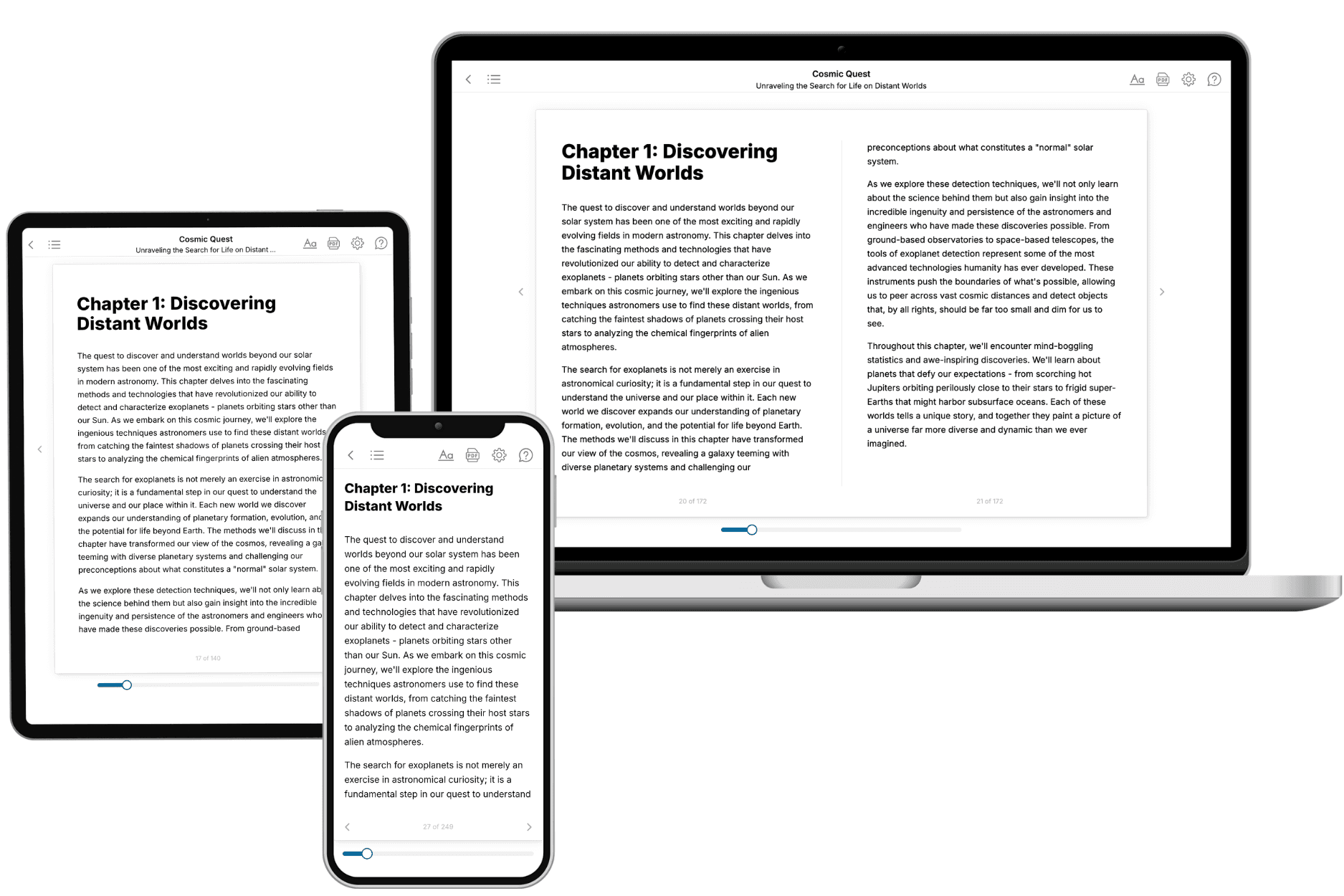
- 3. Get your tailored book
Your book is ready in 10 minutes. Read it online, download as EPUB or PDF, or send to Kindle.
Frequently asked questions
- What is TailoredRead?
TailoredRead creates complete, full-length nonfiction ebooks, written specifically for you. Tell us what you want to learn and why, and TailoredRead writes you a complete ebook on it, with charts, tables, and diagrams throughout. Read it online, on Kindle, or on any e-reader, or download it as a PDF or EPUB. Every book is written fresh the day you order it.
- How is the book tailored to me?
Before anything is written, you answer a few short questions about your goals, your background, and the topics you care about. Your book is then planned around your answers: written at your level, focused on your goals, and covering the topics you chose, instead of the one-size-fits-all book a store sells everyone.
- Will it read like generic AI content?
No. Your book isn't a chat transcript: it's planned chapter by chapter before a single word is written, told in a clear book voice, and explains ideas visually with charts, tables, and diagrams. After writing, every book goes through an editorial pass that polishes chapters so the book reads consistent from start to finish. Judge for yourself: browse thousands of sample books on our Explore Books page.
- How accurate is the content?
Our AI first checks whether your subject needs live research. Niche and fast-moving subjects are researched before writing, and the book plan and chapters are grounded in what it finds. After writing, every book goes through a quality pass that checks its facts and consistency, and researched books list their sources in a Notes section at the back.
- How long is the book?
You choose the length: Comprehensive (250-300 pages), Detailed (150-200 pages), Essential (70-100 pages), or Short (30-50 pages).
- Does the book include visuals?
Yes. Every book includes visual elements such as timelines, checklists, step-by-step guides, decision trees, comparison tables, and matrices, and many include bar charts. A typical book includes dozens of these visual elements.
- Can I read it on Kindle? What formats can I download?
Yes. Every book can be read in our online reader or downloaded as a PDF or EPUB. The EPUB can be opened with Kindle, Apple Books, Kobo, and any e-reader. The Commercial and Author licenses also include an editable Word (DOCX) and Markdown download.
- How much does it cost?
About the price of a regular ebook. The exact price depends on your book's length and complexity, from $2 for the shortest books to $35 for the most comprehensive, and it's shown when you review your book, before you commit to anything. Each book is a one-time purchase, yours to keep, no subscription. Licenses that let you share, teach, or publish your book range from $35.99 to $49.99.
- Can I preview the book before purchasing?
Before you pay, you'll see what your book will cover: the title, a detailed description, the estimated length, and the complete chapter-by-chapter table of contents, so you know what you're getting before you decide. The full text itself is written after you purchase.
- How long does it take to create a book?
About 10 minutes. You can start reading the opening chapters while the rest is still being written.