Remote Sensing Essentials
Understanding Earth from Above—A Practical Guide to Environmental Monitoring
Discover how to harness satellite technology to monitor and understand environmental changes across your region or the globe.
238 pages11 chaptersApr 8, 2026Remote Sensing
About this book
This practical guide demystifies remote sensing—the science of observing Earth from space—and shows you how to apply it to real environmental challenges. Whether you're tracking deforestation, monitoring water quality, assessing agricultural health, or responding to natural disasters, you'll learn the fundamental principles of how satellites capture environmental data, how to interpret what those images reveal, and how to use freely available tools to conduct your own analyses. With clear explanations of sensors, wavelengths, and image processing techniques, plus concrete examples from environmental monitoring projects worldwide, this book bridges the gap between remote sensing theory and practical application. You'll gain the confidence to work with satellite imagery, understand its capabilities and limitations, and make informed decisions about which remote sensing approaches suit your environmental questions.
Table of contents
- IntroductionWhy Remote Sensing Matters for Environmental Science, What You'll Learn in This Book, How to Use This GuideRead below
- Chapter 1: Fundamentals of Remote SensingWhat Is Remote Sensing?, Understanding the Electromagnetic Spectrum, Passive vs. Active Remote Sensing, History and Evolution of Remote Sensing Technology
- Chapter 2: Sensors and PlatformsTypes of Satellites and Orbital Characteristics, Common Sensor Types and Their Capabilities, Major Remote Sensing Missions and Data Sources, Choosing the Right Sensor for Your Application
- Chapter 3: Image Characteristics and Data PropertiesSpatial Resolution and Scale Considerations, Spectral Resolution and Band Selection, Temporal Resolution and Revisit Frequency, Radiometric Resolution and Data Quality
- Chapter 4: Image Processing and Analysis TechniquesPreprocessing: Calibration and Atmospheric Correction, Image Enhancement and Visualization, Classification Methods for Land Cover Mapping, Change Detection and Temporal Analysis
- Chapter 5: Spectral Analysis and IndicesUnderstanding Spectral Signatures, Vegetation Indices and Plant Health Monitoring, Water and Moisture Indices, Creating Custom Indices for Specific Applications
- Chapter 6: Land Cover and Land Use MonitoringFundamentals of Land Cover Classification, Detecting Deforestation and Forest Changes, Monitoring Urban Growth and Development, Agricultural Land Use and Crop Monitoring
- Chapter 7: Water Resources and Aquatic MonitoringAssessing Water Quality from Space, Lake and Reservoir Monitoring, Coastal Zone and Ocean Monitoring, Snow and Ice Monitoring
- Chapter 8: Disaster Response and Emergency ManagementFlood Detection and Mapping, Wildfire Detection and Monitoring, Earthquake Damage Assessment, Rapid Response Protocols and Data Access
- Chapter 9: Climate and Atmospheric ApplicationsLand Surface Temperature Monitoring, Atmospheric Composition and Air Quality, Cloud and Precipitation Monitoring, Long-term Climate Indicators and Trends
- Chapter 10: Tools, Software, and Data AccessOpen-Source Remote Sensing Platforms, Accessing Free Satellite Data, GIS Fundamentals for Remote Sensing, Building Your First Remote Sensing Workflow
- Chapter 11: Validation and Accuracy AssessmentCollecting and Using Ground-Truth Data, Accuracy Metrics and Error Assessment, Understanding Uncertainty in Remote Sensing
- ConclusionKey Takeaways and Next Steps, The Future of Remote Sensing
- Glossary of Remote Sensing Terms
- Further Reading and Resources
Introduction
On any given day, hundreds of satellites orbit Earth at altitudes ranging from a few hundred to tens of thousands of kilometers above the surface. They carry sensors that measure reflected sunlight, emitted heat, radar pulses, and dozens of other signals bouncing off forests, oceans, cities, and ice sheets. Every few days, many of these satellites pass over the same patch of ground and record a new snapshot. Taken together, these images form one of the most powerful environmental monitoring systems ever created, and the data they produce is largely free for anyone to use.
Remote sensing, at its core, is the science of learning about something without touching it. When a satellite detects the infrared light reflected from a forest canopy, it is measuring something real about the health of those trees without a single researcher setting foot in the woods. When a radar satellite bounces microwave pulses off a flooded plain, it can map the extent of that flood within hours, even through cloud cover and darkness. These capabilities have transformed how scientists, governments, and conservation organizations understand and respond to environmental change.
This book is designed to bridge the gap between remote sensing theory and practical application. There is no shortage of technical literature on the subject, but much of it assumes either a deep background in physics and mathematics or access to expensive commercial software. This guide takes a different approach. It explains the core concepts clearly, grounds every idea in real-world examples, and points you toward freely available tools and data that you can start using right away. Whether you are a graduate student mapping land cover for a thesis, an environmental consultant assessing watershed health, or a conservation practitioner tracking habitat loss, this book gives you the foundation you need to work confidently with satellite data.
The field has changed dramatically in the past decade. Open-access satellite archives from programs like NASA's Landsat and the European Space Agency's Copernicus have made decades of Earth observation data freely available. Cloud-based platforms like Google Earth Engine allow you to analyze those archives without downloading terabytes of files to your own computer. Machine learning tools have made image classification faster and more accurate. These developments have democratized remote sensing in a genuine way, and this book reflects that reality by focusing on accessible, practical methods throughout.
Why Remote Sensing Matters for Environmental Science
Environmental science faces a fundamental challenge: the systems it studies are enormous, dynamic, and often located in places that are difficult or dangerous to reach. A researcher studying deforestation in the Amazon cannot walk every hectare of forest. A hydrologist monitoring drought across a continent cannot install rain gauges everywhere. Ground-based measurements are invaluable, but they are inherently limited in their spatial coverage. Remote sensing solves this problem by providing consistent, repeatable observations across vast areas at regular intervals.
Consider what happened during the 2019 to 2020 Australian bushfire season. The fires burned more than 18 million hectares, an area larger than the entire country of Syria.[1] Ground crews could not assess the full extent of the damage in real time. Satellite sensors, however, tracked the fire fronts daily, mapped burned areas within days of the fires passing, and monitored vegetation recovery for months afterward. That kind of comprehensive, timely information is simply not achievable through any other means.
Remote sensing also provides something that ground measurements rarely can: a historical record. The Landsat program has been continuously collecting imagery since 1972, giving researchers access to more than five decades of Earth surface data. This archive has been used to document the retreat of glaciers, the expansion of cities, the degradation of coral reefs, and the transformation of agricultural landscapes. When you work with this data, you are not just looking at the present state of the environment. You are looking at how it has changed over time, which is often the most important question of all.
The environmental challenges of the coming decades make remote sensing more relevant than ever. Climate change is altering ecosystems faster than traditional monitoring networks can track. Deforestation continues in biodiversity hotspots around the world. Water scarcity is intensifying in many regions. Extreme weather events are becoming more frequent and severe. Remote sensing does not solve these problems, but it provides the observational foundation that effective responses require. You cannot manage what you cannot measure, and remote sensing dramatically expands what can be measured.
Beyond large-scale environmental monitoring, remote sensing has practical value at regional and local scales too. A regional water authority can use satellite-derived evapotranspiration data to improve irrigation scheduling. A city government can use thermal infrared imagery to identify urban heat islands and target tree-planting programs. A conservation organization can use high-resolution imagery to monitor the boundaries of a protected area and detect encroachment. These applications do not require a large research team or a significant budget. They require knowledge of the right tools and data, which is exactly what this book provides.
It is also worth acknowledging what remote sensing cannot do. Satellite imagery does not replace field work. It cannot measure soil chemistry, identify species from orbit, or capture the fine-grained ecological details that only direct observation reveals. The most effective environmental monitoring programs combine remote sensing with targeted ground-based measurements, using each approach where it is strongest. This book will help you understand both the power and the limits of satellite data so you can make informed decisions about when and how to use it.
A practical example: The Global Forest Watch platform, operated by the World Resources Institute, uses Landsat and other satellite data to provide near-real-time alerts when forest cover is lost anywhere on Earth. Conservation organizations in countries like Indonesia and Brazil use these alerts to direct ranger patrols to areas where illegal logging may be occurring. This is remote sensing directly enabling on-the-ground conservation action.
The democratization of remote sensing data and tools means that the barrier to entry has never been lower. A decade ago, working with satellite imagery required expensive software licenses, significant computing infrastructure, and specialized training that was hard to find outside of major research universities. Today, you can access decades of satellite data for free, process it in a web browser using cloud computing, and find tutorials and documentation for every step of the process. The main barrier now is knowledge, and that is a barrier this book is designed to help you clear.
What You'll Learn in This Book
This book is organized to take you from foundational concepts to practical applications in a logical sequence. Each chapter builds on the ones before it, but the structure also allows you to jump to specific topics if you already have background knowledge in certain areas. Here is a clear picture of what each part of the book covers and what you will be able to do after working through it.
The first section of the book covers the fundamentals of remote sensing. You will learn what remote sensing actually is, how electromagnetic radiation interacts with Earth's surface and atmosphere, and why different wavelengths reveal different kinds of environmental information. You will understand the difference between passive sensors, which detect naturally reflected or emitted energy, and active sensors, which generate their own energy pulses. You will also get a brief history of how the field developed, from early aerial photography to today's constellation of sophisticated Earth observation satellites. This foundation is essential for everything that follows.
The next section covers sensors and platforms in detail. Not all satellites are the same, and choosing the right data source for your application is one of the most important decisions you will make in any remote sensing project. You will learn about different orbital types, the major satellite missions that produce freely available data, and the key characteristics that distinguish one sensor from another. By the end of this section, you will be able to look at an environmental monitoring question and identify which satellite data sources are most appropriate for answering it.
Image characteristics and data properties form the next major topic. Remote sensing data has four key resolution dimensions that determine what you can and cannot detect:
- Spatial resolution: how large an area each pixel represents on the ground
- Spectral resolution: how many wavelength bands the sensor measures and how narrow those bands are
- Temporal resolution: how frequently the satellite revisits the same location
- Radiometric resolution: how precisely the sensor measures the intensity of incoming energy
Understanding these four dimensions and the trade-offs between them is critical for selecting appropriate data and interpreting results correctly. A sensor with very high spatial resolution, for example, often has lower temporal resolution, meaning you get detailed images but less frequently. Knowing these trade-offs helps you avoid common mistakes in data selection.
Image processing and analysis techniques occupy a substantial portion of the book. Raw satellite data is not ready to use straight out of the archive. It needs to be calibrated, corrected for atmospheric effects, and processed before it can yield reliable environmental information. You will learn the standard preprocessing steps, how to enhance images for better visualization, how to classify land cover, and how to detect changes between images taken at different times. These are the core analytical skills that underpin almost every remote sensing application.
Spectral analysis and indices represent one of the most powerful and accessible tools in remote sensing. By combining different spectral bands mathematically, you can create indices that highlight specific environmental features. The most famous example is the Normalized Difference Vegetation Index (NDVI), which uses red and near-infrared bands to measure vegetation greenness and health. But there are dozens of other indices for water, soil, burned areas, snow, and more. You will learn how these indices work, when to use them, and how to create custom indices for specific applications.
The applied chapters cover the major environmental monitoring domains where remote sensing is most widely used:
- Land cover and land use monitoring, including deforestation detection, urban expansion, and agricultural assessment
- Water resources and aquatic monitoring, including water quality, lake levels, coastal zones, and snow and ice
- Disaster response and emergency management, including flood mapping, wildfire monitoring, and earthquake damage assessment
- Climate and atmospheric applications, including land surface temperature, air quality, and long-term climate indicators
The final chapters address the practical side of doing remote sensing work. You will get a guide to the most important open-source software platforms and free data repositories, along with a walkthrough of building your first remote sensing workflow from data access to final output. The book closes with a chapter on validation and accuracy assessment, which is often overlooked but is essential for producing results that are scientifically defensible and practically useful. By the time you finish, you will have both the conceptual understanding and the practical skills to conduct meaningful remote sensing analyses on your own.
How to Use This Guide
This book is written for intermediate learners in environmental science and earth sciences. It assumes you have some foundational knowledge of environmental systems and basic scientific concepts, but it does not assume prior experience with remote sensing, image processing, or geographic information systems. If you have worked with maps or spatial data before, that background will be helpful, but it is not required. The goal is to make remote sensing genuinely accessible without oversimplifying the science.
If you are new to remote sensing entirely, the recommended approach is to read the book from beginning to end. The chapters are sequenced deliberately. The fundamentals chapters give you the conceptual vocabulary you need to understand the applied chapters. Jumping straight to the chapter on flood mapping, for example, will be more productive if you already understand how radar sensors work and what spatial resolution means. Reading in order ensures that each new concept builds on a solid foundation.
If you already have some background in remote sensing, you can use the book more selectively. Each chapter is designed to be reasonably self-contained, with cross-references to related sections where relevant. Someone who already understands the electromagnetic spectrum and sensor types might start with the image processing chapters and then move to the application chapters that are most relevant to their work. The glossary at the back of the book is a useful reference if you encounter terms that are unfamiliar.
Throughout the book, you will find several recurring features designed to make the content more practical and immediately useful:
- Concrete examples: Every major concept is illustrated with a real-world scenario drawn from actual environmental monitoring projects. These examples show how abstract principles translate into practical decisions.
- Step-by-step processes: For analytical techniques, the book walks through the process in clear, sequential steps rather than just describing the outcome.
- Tool recommendations: Where relevant, specific software platforms and data sources are named and described, with guidance on how to access them.
- Common pitfalls: Each application area includes notes on the mistakes that beginners most commonly make and how to avoid them.
- Footnotes and citations: Claims that rest on specific research findings are cited so you can follow up on the primary literature if you want to go deeper.
The tools and software chapter deserves special mention. Remote sensing software evolves quickly, and specific interface details can become outdated. Rather than providing step-by-step click-by-click tutorials that may not match the version of software you are using, this book focuses on concepts, workflows, and principles that remain stable across software versions. The goal is to give you enough understanding that you can navigate any platform, not just follow a script that works only in one specific version of one specific tool. For current tutorials on specific platforms, the further reading section points you to maintained online resources.
One practical suggestion: as you read through the conceptual chapters, try to connect the ideas to an environmental question you actually care about. Remote sensing is much easier to learn when it is attached to a real problem. If you are interested in monitoring wetland loss in your region, keep that question in mind as you read about spectral indices and classification methods. Ask yourself how each technique might apply to your specific case. This kind of active engagement with the material will accelerate your learning considerably.
It is also worth setting realistic expectations about the learning curve. Remote sensing is a genuinely multidisciplinary field. It draws on physics, ecology, geography, statistics, and computer science. You will not master all of it from a single book. What this guide aims to do is give you a solid, practical foundation that allows you to work effectively with satellite data, understand the results you produce, and know where to go when you need to learn more. Think of it as the foundation of a building. The structure you build on top of it is up to you.
Getting started immediately: If you want to begin exploring satellite data before you finish reading, visit the USGS EarthExplorer portal (earthexplorer.usgs.gov) or the Copernicus Open Access Hub (scihub.copernicus.eu). Both are free to use with a simple registration. Browse imagery for a region you know well. Notice what looks familiar and what surprises you. That curiosity is exactly the right starting point for learning remote sensing.
Finally, a note on the pace of change in this field. Remote sensing technology is advancing rapidly. New satellite constellations are being launched, new analytical methods are emerging from machine learning research, and new applications are being developed across every environmental domain. This book focuses on principles and methods that are well-established and likely to remain relevant, while also pointing toward emerging directions where appropriate. The goal is to give you knowledge that will serve you well not just today but as the field continues to evolve. The satellites will keep watching. This book will help you understand what they are seeing.
Notes
Introduction
- 1. M. M. Boer and others, "Unprecedented burn area of Australian mega forest fires," Nature Climate Change, 2020
This is the end of the free sample. The full book has 11 chapters.
Want this book written for you?
Tell us your goals and background, and get your own version of this book, tailored by AI to you.


Benefits of AI-tailored books
- Read one book, not ten:
- all the Remote Sensing knowledge you need, gathered into a single book.
- Save days of learning:
- tell us your goals, choose your topics, and the whole book is built around them.
- Learn effortlessly:
- Remote Sensing book written for your specific background and expertise.
- Understand at a glance:
- includes charts, tables, timelines, checklists, decision trees, and more.
- Stay current:
- written the day you order it, not years ago.
- Trust what you read:
- every book is checked for accuracy, with real research when your subject needs it.
Create your unique book in 3 steps
- 1. Select your focus
Select the focus of your Remote Sensing book and share your background
- 2. Personalize your book
Specify your goals and choose sub-topics to include
- 3. Get your tailored book
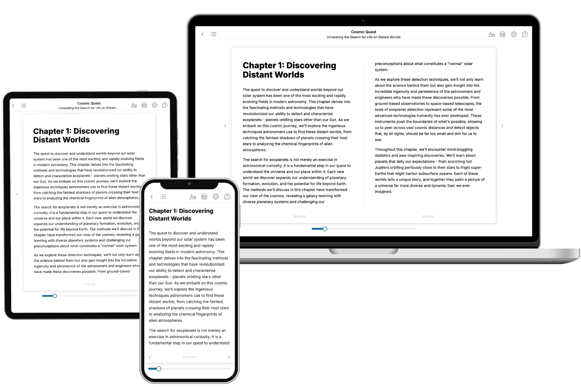
Your book is ready in 10 minutes. Read it online, download as EPUB or PDF, or send to Kindle.
Frequently asked questions
- What is TailoredRead?
TailoredRead creates complete, full-length nonfiction ebooks, written specifically for you. Tell us what you want to learn and why, and TailoredRead writes you a complete ebook on it, with charts, tables, and diagrams throughout. Read it online, on Kindle, or on any e-reader, or download it as a PDF or EPUB. Every book is written fresh the day you order it.
- How is the book tailored to me?
Before anything is written, you answer a few short questions about your goals, your background, and the topics you care about. Your book is then planned around your answers: written at your level, focused on your goals, and covering the topics you chose, instead of the one-size-fits-all book a store sells everyone.
- Will it read like generic AI content?
No. Your book isn't a chat transcript: it's planned chapter by chapter before a single word is written, told in a clear book voice, and explains ideas visually with charts, tables, and diagrams. After writing, every book goes through an editorial pass that polishes chapters so the book reads consistent from start to finish. Judge for yourself: browse thousands of sample books on our Explore Books page.
- How accurate is the content?
Our AI first checks whether your subject needs live research. Niche and fast-moving subjects are researched before writing, and the book plan and chapters are grounded in what it finds. After writing, every book goes through a quality pass that checks its facts and consistency, and researched books list their sources in a Notes section at the back.
- How long is the book?
You choose the length: Comprehensive (250-300 pages), Detailed (150-200 pages), Essential (70-100 pages), or Short (30-50 pages).
- Does the book include visuals?
Yes. Every book includes charts, tables, and diagrams: timelines, checklists, step-by-step guides, decision trees, comparison tables, matrices, and bar charts. A typical book includes dozens of these visual elements.
- Can I read it on Kindle? What formats can I download?
Yes. Every book can be read in our online reader or downloaded as a PDF or EPUB. The EPUB can be opened with Kindle, Apple Books, Kobo, and any e-reader. The Commercial and Author licenses also include an editable Word (DOCX) and Markdown download.
- How much does it cost?
About the price of a regular ebook. The exact price depends on your book's length and complexity, from $2 for the shortest books to $35 for the most comprehensive, and it's shown when you review your book, before you commit to anything. Each book is a one-time purchase, yours to keep, no subscription. Licenses that let you share, teach, or publish your book range from $35.99 to $49.99.
- Can I preview the book before purchasing?
Before you pay, you'll see what your book will cover: the title, a detailed description, the estimated length, and the complete chapter-by-chapter table of contents, so you know what you're getting before you decide. The full text itself is written after you purchase.
- How long does it take to create a book?
About 10 minutes. You can start reading the opening chapters while the rest is still being written.