Satellite Data to Atmosphere: A Practical Guide to Remote Sensing
Master Real-Time Atmospheric Monitoring from Satellite Payloads to Ground Truth
You're responsible for procuring satellite systems that will monitor Earth's atmosphere, yet the technical details connecting payload specifications to actual atmospheric measurements can feel disconnected from your procurement decisions.
222 pages10 chaptersFeb 9, 2026Remote Sensing
About this book
This guide bridges that gap by walking you through the complete journey from satellite sensor design to actionable atmospheric data. You'll discover how hyperspectral imaging systems detect trace gases like methane, understand the critical role of sensor calibration in maintaining data quality, and learn how real-time data pipelines transform raw spectral measurements into air quality insights. By mastering ground resolution trade-offs, spectral radiance principles, and atmospheric chemistry fundamentals, you'll make more informed payload decisions and better understand the capabilities and limitations of your satellite systems. This practical resource combines engineering rigor with accessible explanations, giving you the knowledge to evaluate sensor specifications, interpret satellite data, and apply remote sensing to real-world atmospheric monitoring challenges.
Table of contents
- IntroductionWhy Satellite Data Matters for Atmospheric Monitoring, From Procurement Decisions to Atmospheric Insights, How to Use This GuideRead below
- Module 1: Fundamentals of Atmospheric Remote SensingUnderstanding the Electromagnetic Spectrum for Atmospheric Sensing, Comparing Multispectral and Hyperspectral Sensor Technologies, Identifying Atmospheric Windows for Trace Gas Detection
- Module 2: Spectral Radiance and Measurement PrinciplesMastering Spectral Radiance Fundamentals, Implementing Radiometric Calibration Procedures, Optimizing Signal-to-Noise Ratios in Satellite Measurements, Converting Radiance Data to Reflectance and Brightness Temperature
- Module 3: Sensor Calibration and Data QualityConducting Pre-Launch Sensor Calibration, Maintaining In-Orbit Calibration Throughout Mission Life, Detecting and Correcting Calibration Drift
- Module 4: Ground Resolution and Spatial ConsiderationsUnderstanding Ground Resolution and Pixel Size, Evaluating Resolution Trade-offs in Payload Selection, Optimizing Spatial Sampling for Air Quality Monitoring
- Module 5: Hyperspectral Image Processing WorkflowsExecuting Preprocessing Steps for Hyperspectral Data, Applying Spectral Unmixing Techniques, Reducing Dimensionality While Preserving Information, Implementing Classification Algorithms for Atmospheric Analysis
- Module 6: Atmospheric Trace Gas DetectionLearning Atmospheric Chemistry Basics for Trace Gases, Identifying Spectral Absorption Features of Key Gases, Evaluating Sensor Sensitivity for Trace Gas Detection
- Module 7: Methane Concentration MappingUnderstanding Methane Spectroscopy and Detection Methods, Implementing Methane Concentration Mapping Techniques, Validating Methane Measurements Against Ground Truth Data, Analyzing Real-World Methane Monitoring Case Studies
- Module 8: Real-Time Data Pipelines and ProcessingDesigning Real-Time Data Pipeline Architecture, Managing Data Ingestion from Satellite Sensors, Minimizing Processing Latency for Operational Monitoring, Implementing Quality Assurance in Data Pipelines
- Module 9: Air Quality Monitoring ApplicationsInterpreting Air Quality Indices from Satellite Data, Tracking Pollution Events and Atmospheric Transport, Implementing Regional Air Quality Monitoring Systems
- Module 10: Satellite Payload Requirements and ProcurementDefining Critical Payload Specifications for Atmospheric Sensing, Evaluating Sensor Performance Metrics and Trade-offs, Making Informed Procurement Decisions Based on Mission Requirements
- ConclusionIntegrating Your Knowledge into Procurement Strategy, Future Directions in Satellite Atmospheric Monitoring
- Glossary
- Further Reading and Resources
Introduction
Every day, satellites orbiting Earth collect vast amounts of atmospheric data that could transform how we monitor air quality, track greenhouse gas emissions, and understand climate change. Yet for many satellite procurement professionals, the technical journey from sensor specifications to actionable atmospheric insights remains frustratingly opaque. You understand orbital mechanics and spacecraft systems, but the nuances of spectral radiance measurements, hyperspectral imaging capabilities, and trace gas detection often feel disconnected from your procurement decisions. This gap between engineering knowledge and atmospheric science expertise can lead to suboptimal payload selections, missed opportunities for enhanced monitoring capabilities, and difficulty communicating with atmospheric scientists about mission requirements.
This guide bridges that critical gap by providing you with the practical knowledge needed to understand how satellite sensors actually measure atmospheric composition and how those measurements translate into air quality data. You'll discover the direct connections between payload specifications you evaluate during procurement and the atmospheric monitoring capabilities those specifications enable. Rather than treating atmospheric remote sensing as a black box, you'll gain insight into the physical principles, data processing workflows, and calibration procedures that determine whether a satellite system can successfully detect methane plumes, map pollution events, or provide real-time air quality alerts. This knowledge will fundamentally change how you approach procurement decisions, enabling you to ask better questions, evaluate competing proposals more effectively, and understand the true capabilities and limitations of different sensor technologies.
The atmospheric monitoring landscape is evolving rapidly, with new hyperspectral sensors, improved calibration techniques, and real-time data processing capabilities emerging regularly. As someone responsible for procuring satellite systems that will operate for years or decades, you need to understand not just current technologies but also the fundamental principles that will help you evaluate future innovations. This guide provides that foundation while remaining grounded in practical applications. You'll learn through concrete examples, real-world case studies, and actionable frameworks that you can apply immediately to your procurement work. Whether you're evaluating proposals for a new atmospheric monitoring constellation or trying to understand the performance limitations of existing systems, this guide will give you the tools to make informed, confident decisions.
Module Outcomes: By completing this introduction module, you will be able to:
- Articulate the critical role satellite data plays in modern atmospheric monitoring and air quality assessment
- Explain how procurement decisions directly impact atmospheric monitoring capabilities and data quality
- Identify the key connections between sensor specifications and atmospheric measurement performance
- Navigate the structure of this guide to find relevant information for specific procurement challenges
- Recognize the practical applications of atmospheric remote sensing knowledge in your procurement role
When to use this module: Return to this introduction whenever you need to reconnect with the big picture of how satellite atmospheric monitoring works and why it matters for your procurement decisions. Use it when briefing colleagues or stakeholders who need to understand the value proposition of atmospheric monitoring capabilities. Reference it when you're starting a new procurement project and need to frame the technical requirements in terms of atmospheric science objectives. This module establishes the conceptual foundation that all subsequent technical chapters build upon, so revisiting it periodically will help you integrate new knowledge into a coherent understanding of the entire satellite-to-atmosphere data pipeline.
Why Satellite Data Matters for Atmospheric Monitoring
Lesson Outcomes: After completing this lesson, you will be able to:
- Explain the unique advantages satellite platforms provide for atmospheric monitoring compared to ground-based systems
- Identify specific atmospheric monitoring applications where satellite data is essential or superior to alternatives
- Describe how satellite atmospheric data supports regulatory compliance, environmental protection, and climate science
- Recognize the limitations of satellite-based atmospheric monitoring and when ground-based systems are necessary
Satellite-based atmospheric monitoring has fundamentally transformed our ability to understand and respond to air quality challenges at scales ranging from individual industrial facilities to entire continents. Unlike ground-based monitoring stations, which provide precise measurements at fixed locations but limited spatial coverage, satellites offer the unique capability to observe atmospheric composition across vast areas with consistent measurement techniques. This global perspective is essential for tracking transboundary pollution, identifying previously unknown emission sources, and understanding how atmospheric chemistry varies across different regions and climates. For procurement professionals, understanding these unique capabilities helps justify the significant investment required for atmospheric monitoring payloads and clarifies which mission architectures best serve specific monitoring objectives.
The spatial coverage advantage of satellites becomes particularly evident when monitoring trace gases like methane, nitrogen dioxide, and carbon monoxide. Consider a practical example: detecting methane emissions from oil and gas infrastructure across a region spanning thousands of square kilometers. Ground-based monitoring would require hundreds or thousands of sensors strategically positioned near potential emission sources, creating enormous logistical and financial challenges. A single satellite with appropriate hyperspectral imaging capabilities can survey this entire region repeatedly, identifying emission hotspots and quantifying concentration levels with spatial resolution sufficient to pinpoint individual facilities. This capability has enabled companies and regulators to discover previously undetected leaks, quantify fugitive emissions, and prioritize remediation efforts based on actual measured impacts rather than theoretical emission factors.
Temporal coverage represents another critical advantage of satellite systems for atmospheric monitoring. Modern satellite constellations can provide daily or even hourly revisit times over areas of interest, enabling detection of short-duration pollution events, tracking of atmospheric transport patterns, and monitoring of diurnal variations in trace gas concentrations. This temporal resolution is particularly valuable for air quality forecasting, emergency response to industrial accidents, and understanding how atmospheric chemistry responds to changes in human activity. For example, during the COVID-19 pandemic, satellite data revealed dramatic reductions in nitrogen dioxide concentrations over major cities within days of lockdown implementations, providing near-real-time feedback on how reduced transportation and industrial activity affected air quality[1]. This responsiveness would be impossible to achieve with traditional ground-based monitoring networks alone.
Satellite atmospheric data serves multiple critical applications that directly impact environmental policy, public health protection, and climate science. Regulatory agencies use satellite measurements to verify emission inventories, identify non-compliant facilities, and assess the effectiveness of pollution control measures across entire regions. Public health researchers correlate satellite-derived air quality data with health outcomes to understand exposure patterns and identify vulnerable populations. Climate scientists rely on long-term satellite records to track changes in greenhouse gas concentrations, validate atmospheric chemistry models, and attribute emissions to specific sources and sectors. Each of these applications places different demands on sensor specifications, data latency, and measurement accuracy—considerations that directly inform procurement decisions about payload capabilities and mission design.
Real-world application: The European Space Agency's Sentinel-5P satellite, launched in 2017, demonstrates the practical value of satellite atmospheric monitoring. Its TROPOMI instrument measures atmospheric trace gases including nitrogen dioxide, ozone, formaldehyde, sulfur dioxide, methane, and carbon monoxide with unprecedented spatial resolution (7×3.5 km at nadir). Within months of operation, TROPOMI data revealed previously unknown methane emission sources, tracked pollution transport across international boundaries, and provided daily air quality information for environmental agencies worldwide. This single satellite system delivers atmospheric monitoring capabilities that would require tens of thousands of ground-based sensors to replicate, illustrating the cost-effectiveness of satellite platforms for wide-area atmospheric surveillance.
Despite their advantages, satellite systems have important limitations that procurement professionals must understand when defining mission requirements. Clouds obstruct optical and infrared sensors, creating data gaps in regions with persistent cloud cover. Spatial resolution constraints mean that satellites may miss localized pollution sources or struggle to distinguish between nearby emission points. Vertical resolution is limited—most satellite sensors measure column-integrated concentrations rather than providing detailed vertical profiles of atmospheric composition. Temporal resolution depends on orbital parameters, and even constellations with multiple satellites may not capture short-duration events. Understanding these limitations helps you make realistic assessments of what satellite systems can and cannot achieve, avoiding over-promising capabilities or under-specifying requirements for critical monitoring objectives.
The complementary relationship between satellite and ground-based monitoring systems is essential to recognize. Optimal atmospheric monitoring strategies typically combine satellite data for wide-area coverage and source identification with ground-based measurements for continuous temporal monitoring, vertical profiling, and validation of satellite retrievals. This integrated approach is sometimes called ground truth validation, where surface measurements provide reference data to calibrate and verify satellite observations. For procurement professionals, this means considering how satellite payloads will integrate with existing or planned ground-based networks, what data exchange protocols are needed, and how validation campaigns will be conducted. The most successful atmospheric monitoring programs treat satellites and ground stations as complementary components of a unified observing system rather than competing alternatives.
Economic considerations also favor satellite-based atmospheric monitoring for many applications. While satellite development and launch costs are substantial, the per-measurement cost becomes remarkably low when amortized across the vast number of observations a satellite collects over its operational lifetime. A single satellite can make millions of atmospheric measurements annually across global or continental scales, achieving cost-per-measurement figures that ground-based networks cannot match for wide-area monitoring. However, this economic advantage depends critically on mission success—a failed launch or premature sensor degradation can eliminate the cost benefits entirely. This risk profile influences procurement strategies, driving decisions about redundancy, component heritage, and calibration approaches that ensure long-term data quality and mission success.
Practice Tasks: Apply your understanding of satellite atmospheric monitoring advantages with these exercises:
- Identify three specific atmospheric monitoring scenarios where satellite data provides capabilities that ground-based systems cannot practically achieve, and explain the technical reasons for satellite superiority in each case
- For a hypothetical air quality monitoring mission covering a 500,000 square kilometer region, estimate the number of ground-based sensors needed to achieve comparable spatial coverage to a satellite with 5 km ground resolution, and compare the approximate costs
- Review a recent atmospheric monitoring satellite mission (such as Sentinel-5P, GHGSat, or TEMPO) and document three specific applications where its data has been used for environmental protection or climate science
- Create a comparison table listing five atmospheric monitoring objectives (such as methane leak detection, urban air quality assessment, or volcanic SO2 tracking) and rate whether satellites, ground stations, or integrated systems are most appropriate for each objective
Key Takeaways:
- Satellites provide unique wide-area coverage for atmospheric monitoring that ground-based systems cannot practically replicate, making them essential for regional and global-scale observations
- Temporal coverage from satellite constellations enables detection of short-duration pollution events and tracking of atmospheric transport patterns with near-real-time responsiveness
- Satellite atmospheric data serves critical applications in regulatory compliance, public health protection, and climate science, each placing different demands on sensor specifications
- Important limitations including cloud interference, spatial resolution constraints, and limited vertical profiling capability must be considered when defining mission requirements
- Optimal monitoring strategies integrate satellite and ground-based systems as complementary components rather than treating them as competing alternatives
- Economic advantages of satellite monitoring depend on mission success and long-term data quality, influencing procurement decisions about redundancy and calibration approaches
From Procurement Decisions to Atmospheric Insights
Lesson Outcomes: After completing this lesson, you will be able to:
- Trace the complete pathway from payload specifications to actionable atmospheric data products
- Identify which procurement decisions have the greatest impact on atmospheric monitoring capabilities
- Explain how sensor characteristics directly determine what atmospheric phenomena can be detected and measured
- Recognize the interdependencies between payload design, data processing infrastructure, and end-user applications
- Apply systems thinking to evaluate how procurement choices affect the entire data value chain
The journey from procurement specifications to atmospheric insights involves a complex chain of technical decisions, each with cascading effects on data quality and monitoring capabilities. When you specify a sensor's spectral resolution—the ability to distinguish between closely spaced wavelengths—you're directly determining which trace gases can be detected and how accurately their concentrations can be retrieved. When you define ground resolution requirements, you're establishing the minimum size of atmospheric features that can be resolved, affecting everything from urban air quality mapping to industrial emission source identification. These procurement decisions aren't abstract technical parameters; they're fundamental determinants of what atmospheric science questions your satellite system can answer and what environmental monitoring applications it can support.
Consider the specific example of spectral resolution in hyperspectral sensors designed for trace gas detection. Methane has characteristic absorption features in the shortwave infrared spectrum around 2.3 micrometers, but these features are relatively narrow and can be obscured by absorption from other atmospheric constituents like water vapor and carbon dioxide. A sensor with spectral resolution of 10 nanometers might detect the presence of methane but struggle to accurately quantify concentrations, while a sensor with 1 nanometer spectral resolution can resolve the detailed absorption line shapes needed for precise concentration retrievals. This tenfold difference in spectral resolution translates directly into measurement uncertainty—potentially the difference between detecting only major emission sources versus identifying smaller leaks that collectively contribute significantly to total emissions. Your procurement decision about spectral resolution requirements thus determines the fundamental scientific and operational capabilities of the entire mission.
Signal-to-noise ratio (SNR) represents another critical procurement specification with direct atmospheric monitoring implications. SNR determines the minimum detectable concentration change for trace gases—essentially the sensitivity floor below which atmospheric variations become indistinguishable from measurement noise. For methane monitoring, an SNR of 100 might enable detection of concentration enhancements of 20 parts per billion above background levels, while an SNR of 500 could detect enhancements as small as 4 parts per billion. This sensitivity difference determines whether your satellite can identify only large industrial emission sources or also detect smaller sources like landfills, agricultural operations, and natural seeps. The procurement trade-off involves sensor complexity, power requirements, data rates, and cost—but the atmospheric monitoring impact is concrete and measurable in terms of source detection capabilities.
Procurement impact example: Two competing proposals for a methane monitoring satellite offer different sensor specifications. Proposal A features a sensor with 5 nm spectral resolution, SNR of 200, and 2 km ground resolution at a cost of $45 million. Proposal B offers 2 nm spectral resolution, SNR of 400, and 1 km ground resolution for $68 million. The 50% cost premium for Proposal B delivers approximately 2.5× better spectral resolution, 2× better SNR, and 4× better spatial resolution (area per pixel). These improvements translate into detecting methane sources with 3-4× lower emission rates and localizing sources with 4× better spatial precision. For a mission focused on comprehensive emission inventory development, Proposal B's capabilities may justify the additional cost. For a demonstration mission or budget-constrained program, Proposal A might provide adequate performance. The procurement decision requires understanding these technical-to-capability translations.
Radiometric calibration accuracy is a procurement specification that profoundly affects long-term data quality and scientific value. Calibration determines how accurately the sensor's raw measurements can be converted to physical units like spectral radiance or reflectance. A sensor with 2% radiometric accuracy enables atmospheric retrievals with correspondingly better accuracy than a sensor with 5% accuracy. More critically, calibration stability over time determines whether your satellite can detect long-term trends in atmospheric composition—essential for climate monitoring applications. A sensor that maintains 1% calibration stability over five years enables detection of small but scientifically significant trends in greenhouse gas concentrations. A sensor with 3% calibration drift might obscure these trends entirely, rendering the data unsuitable for climate science despite being adequate for short-term pollution monitoring. Your procurement specifications for calibration accuracy and stability thus determine not just initial data quality but the long-term scientific value of the entire mission.
Data processing infrastructure represents a procurement consideration that's often underestimated but critically important for translating raw sensor measurements into actionable atmospheric insights. The processing pipeline must convert raw digital numbers from the sensor into calibrated spectral radiance, apply atmospheric correction algorithms, retrieve trace gas concentrations using radiative transfer models, and generate data products formatted for end users. This processing chain requires substantial computational resources, sophisticated algorithms, and expert personnel. For real-time air quality monitoring applications, processing latency becomes critical—data must flow from sensor to end user within hours or even minutes. Your procurement decisions about ground segment capabilities, data processing algorithms, and operational staffing directly determine whether the satellite system can support time-sensitive applications or only delayed-mode scientific analysis.
The interdependencies between payload design, orbital parameters, and atmospheric monitoring capabilities create complex procurement trade-offs. A low Earth orbit (LEO) satellite at 500 km altitude can achieve better ground resolution and SNR than a satellite at 800 km altitude, but the lower orbit requires more frequent orbit maintenance and may have shorter operational lifetime due to atmospheric drag. A sun-synchronous orbit provides consistent solar illumination conditions that simplify calibration and data processing, but limits temporal sampling to once or twice daily over any given location. A constellation of smaller satellites in different orbital planes can provide better temporal coverage than a single large satellite, but introduces challenges in inter-satellite calibration and data harmonization. These orbital decisions interact with payload specifications to determine overall system capabilities, requiring integrated systems thinking rather than optimizing individual components in isolation.
Understanding the complete value chain from procurement to insights enables you to ask better questions during proposal evaluations and make more informed trade-off decisions. When a vendor proposes a particular sensor design, you can trace through the implications: How will this spectral resolution affect methane detection limits? How will this SNR translate into concentration retrieval uncertainty? How will this calibration approach maintain data quality over the mission lifetime? How will this data rate affect processing latency for real-time applications? These questions connect technical specifications to mission outcomes, helping you evaluate whether proposed solutions actually meet atmospheric monitoring objectives. This systems-level understanding is what distinguishes procurement professionals who simply compare specification sheets from those who ensure mission success.
The feedback loop between atmospheric monitoring applications and procurement requirements is also important to recognize. As atmospheric scientists develop new retrieval algorithms, identify new trace gases of interest, or discover unexpected atmospheric phenomena, requirements for future satellite systems evolve. Your role in procurement includes staying informed about these evolving needs and translating them into technical specifications for next-generation systems. This requires ongoing dialogue with atmospheric science end users, understanding their current limitations and future aspirations, and working with sensor developers to push technological boundaries where needed. The most successful atmospheric monitoring programs maintain this continuous feedback between operational experience and procurement strategy, ensuring that each new satellite generation delivers meaningful capability improvements rather than simply repeating previous designs.
Practice Tasks: Strengthen your understanding of procurement-to-insights connections with these exercises:
- Create a flow diagram showing the complete pathway from three key sensor specifications (spectral resolution, SNR, and ground resolution) through data processing steps to final atmospheric data products, noting where each specification affects data quality
- For a hypothetical methane monitoring mission, calculate how a 50% improvement in SNR would translate into improved minimum detectable emission rates, and estimate the procurement cost implications of achieving this improvement
- Analyze a real satellite atmospheric monitoring mission and identify three procurement decisions that proved critical to mission success or created unexpected limitations, documenting the lessons learned
- Develop a checklist of questions to ask vendors during proposal evaluations that probe the connections between their proposed sensor specifications and actual atmospheric monitoring capabilities
- Compare two existing atmospheric monitoring satellites with different design philosophies (such as high spatial resolution versus high spectral resolution) and evaluate which design better serves three different monitoring applications
Key Takeaways:
- Procurement specifications like spectral resolution and SNR directly determine which atmospheric phenomena can be detected and measured, not just abstract technical performance
- Sensor sensitivity and resolution requirements translate into concrete capabilities like minimum detectable emission rates and source localization precision
- Radiometric calibration accuracy and stability affect both immediate data quality and long-term scientific value for trend detection
- Data processing infrastructure and operational procedures are critical procurement considerations that determine whether raw sensor data becomes actionable atmospheric intelligence
- Orbital parameters interact with payload specifications to determine overall system capabilities, requiring integrated systems thinking
- Understanding the complete value chain from specifications to insights enables better proposal evaluation and more informed trade-off decisions
- Continuous feedback between operational experience and procurement strategy ensures each satellite generation delivers meaningful capability improvements
How to Use This Guide
Lesson Outcomes: After completing this lesson, you will be able to:
- Navigate the guide's structure to find information relevant to specific procurement challenges or technical questions
- Identify which chapters address particular aspects of the satellite-to-atmosphere data pipeline
- Apply the guide's frameworks and examples to real-world procurement scenarios
- Develop a personalized learning path based on your current knowledge gaps and immediate needs
This guide is structured to support both sequential reading and targeted reference use, recognizing that procurement professionals have different learning needs depending on their current projects and knowledge gaps. The chapters progress logically from fundamental atmospheric remote sensing principles through sensor technologies, calibration procedures, data processing workflows, and specific applications like methane monitoring and air quality assessment. If you're new to atmospheric remote sensing or want comprehensive understanding, reading sequentially from Chapter 1 through Chapter 10 will build your knowledge systematically. However, if you're facing an immediate procurement decision or need to understand a specific technical topic, you can jump directly to relevant chapters and use cross-references to fill in background knowledge as needed.
Chapters 1 through 4 establish the foundational knowledge needed to understand how satellite sensors measure atmospheric composition. Chapter 1 covers the electromagnetic spectrum, sensor types, and atmospheric windows—essential background for understanding why sensors are designed with particular spectral ranges and resolutions. Chapter 2 dives into spectral radiance measurement principles and radiometric calibration, explaining the physics underlying atmospheric remote sensing. Chapter 3 addresses sensor calibration procedures throughout the mission lifecycle, a critical topic for ensuring long-term data quality. Chapter 4 explores ground resolution and spatial considerations, connecting orbital parameters and sensor design to atmospheric monitoring capabilities. These foundational chapters provide the technical literacy needed to evaluate sensor specifications and understand their atmospheric monitoring implications.
Chapters 5 through 7 focus on data processing and specific atmospheric monitoring applications. Chapter 5 details hyperspectral image processing workflows, explaining how raw sensor data is transformed into calibrated spectral measurements and then into atmospheric data products. Chapter 6 covers atmospheric trace gas detection principles, including the spectroscopic signatures that enable identification and quantification of different gases. Chapter 7 provides an in-depth treatment of methane concentration mapping, serving as a detailed case study that integrates sensor specifications, data processing techniques, and validation methods. These chapters are particularly valuable when you need to understand what happens after the satellite collects data and how processing capabilities affect the usefulness of atmospheric measurements.
Navigation example: Suppose you're evaluating proposals for a satellite system intended to monitor industrial methane emissions in near-real-time. You might start with Chapter 7 (Methane Concentration Mapping) to understand the specific requirements for methane detection. This chapter will reference spectral resolution requirements, leading you to Chapter 1 (Fundamentals) for background on why methane requires particular spectral bands. You'll encounter discussions of calibration accuracy, pointing you to Chapter 3 (Sensor Calibration) to understand how calibration affects methane retrieval accuracy. The real-time requirement will direct you to Chapter 8 (Real-Time Data Pipelines) to understand processing latency considerations. Finally, Chapter 10 (Payload Requirements and Procurement) will help you translate these technical requirements into procurement specifications and evaluation criteria. This targeted navigation approach lets you build understanding focused on your immediate needs while ensuring you don't miss critical background knowledge.
Chapters 8 through 10 address operational considerations and procurement strategy. Chapter 8 covers real-time data pipelines and processing infrastructure, essential for understanding how satellite data flows from sensor to end user and what determines processing latency. Chapter 9 explores air quality monitoring applications, showing how satellite atmospheric data supports regulatory compliance, public health protection, and environmental management. Chapter 10 synthesizes the technical knowledge from earlier chapters into practical procurement guidance, helping you define payload specifications, evaluate performance metrics, and make informed procurement decisions based on mission requirements. These chapters are particularly valuable when you're translating atmospheric monitoring objectives into technical requirements and procurement strategies.
Each chapter includes practical elements designed to reinforce learning and support application to real-world scenarios. Lesson outcomes at the beginning of each section clarify what you'll be able to do after completing that material. Concrete examples throughout the text illustrate abstract concepts with specific numbers, scenarios, and case studies. Blockquotes highlight particularly important examples or real-world applications that demonstrate how theoretical knowledge translates into practice. Practice tasks at the end of each lesson provide opportunities to apply concepts to realistic scenarios, helping you develop practical skills rather than just theoretical understanding. Key takeaways summarize the most important concepts, serving as quick reference when you return to material later.
The guide's technical depth is calibrated for readers with engineering education and some atmospheric science background, but doesn't assume expertise in remote sensing or atmospheric chemistry. Mathematical concepts are explained conceptually rather than with detailed derivations, focusing on what equations mean and how they're applied rather than mathematical proofs. Technical jargon is defined when first introduced, and the glossary provides quick reference for terminology. When advanced topics are necessary for complete understanding, they're presented with sufficient context that you can grasp the key concepts even if you don't master every technical detail. The goal is to make you an informed consumer of atmospheric remote sensing technology, capable of asking the right questions and evaluating technical claims, rather than turning you into a remote sensing specialist.
To maximize the guide's value for your specific needs, consider creating a personalized learning plan based on your current projects and knowledge gaps. If you're working on a procurement for a specific atmospheric monitoring application, start with the relevant application chapter (Chapter 7 for methane, Chapter 9 for air quality) and work backward through the technical foundations as needed. If you're trying to understand why a current satellite system isn't meeting performance expectations, focus on Chapters 3 (Calibration) and 8 (Data Pipelines) to understand potential data quality issues. If you're preparing for a new procurement cycle and want comprehensive understanding, work through Chapters 1-10 sequentially, completing practice tasks to reinforce learning. The guide's modular structure supports all these approaches while maintaining coherent technical progression.
The guide also serves as an ongoing reference resource throughout procurement processes and mission operations. When evaluating vendor proposals, use Chapter 10's frameworks to assess whether proposed specifications actually meet mission requirements. When reviewing calibration plans, reference Chapter 3 to ensure procedures are comprehensive and appropriate. When atmospheric scientists request specific data products or processing capabilities, consult Chapters 5 and 8 to understand the technical implications and feasibility. When explaining atmospheric monitoring capabilities to non-technical stakeholders, draw on the examples and analogies throughout the guide to make complex concepts accessible. The guide's value extends beyond initial learning to ongoing support for your procurement and program management responsibilities.
Finally, recognize that atmospheric remote sensing is a rapidly evolving field with new sensor technologies, processing algorithms, and applications emerging regularly. This guide provides foundational knowledge that will remain relevant even as specific technologies advance, but staying current requires ongoing engagement with the atmospheric monitoring community. Attend conferences like the American Geophysical Union meetings or specialized remote sensing symposia. Follow key journals like Remote Sensing of Environment and Atmospheric Measurement Techniques. Engage with atmospheric scientists who use satellite data to understand their evolving needs and challenges. Use this guide as your foundation, but continue building knowledge through these additional channels to ensure your procurement decisions reflect the current state of the art.
Practice Tasks: Optimize your use of this guide with these exercises:
- Identify three specific procurement challenges or technical questions you currently face, then locate the chapters and sections most relevant to each challenge
- Create a personalized reading plan that prioritizes chapters based on your immediate needs and schedules time for completing practice tasks
- Review the table of contents and identify which chapters address sensor specifications, which address data processing, and which address applications—understanding this structure will help you navigate efficiently
- Select one chapter that addresses a topic you're less familiar with and read it completely, noting which concepts require additional background from earlier chapters
Key Takeaways:
- The guide supports both sequential reading for comprehensive understanding and targeted reference use for specific procurement challenges
- Chapters 1-4 establish foundational knowledge about sensors and measurement principles; Chapters 5-7 cover data processing and applications; Chapters 8-10 address operational considerations and procurement strategy
- Each chapter includes lesson outcomes, concrete examples, practice tasks, and key takeaways to reinforce learning and support practical application
- Technical depth is calibrated for engineering-educated readers without assuming remote sensing expertise, focusing on concepts and applications rather than mathematical derivations
- Creating a personalized learning plan based on your current projects and knowledge gaps maximizes the guide's value for your specific needs
- The guide serves as both initial learning resource and ongoing reference throughout procurement processes and mission operations
- Foundational knowledge from this guide should be supplemented with ongoing engagement with the atmospheric monitoring community to stay current with evolving technologies
Notes
Introduction
- 1. M. Bauwens and others, "Impact of coronavirus outbreak on NO2 pollution assessed using TROPOMI and OMI observations," Geophysical Research Letters, 2020
This is the end of the free sample. The full book has 10 chapters.
Want this book written for you?
Tell us your goals and background, and get your own version of this book, tailored by AI to you.


Benefits of AI-tailored books
- Read one book, not ten:
- all the Remote Sensing knowledge you need, gathered into a single book.
- Save days of learning:
- tell us your goals, choose your topics, and the whole book is built around them.
- Learn effortlessly:
- Remote Sensing book written for your specific background and expertise.
- Understand at a glance:
- includes charts, tables, timelines, checklists, decision trees, and more.
- Stay current:
- written the day you order it, not years ago.
- Trust what you read:
- every book is checked for accuracy, with real research when your subject needs it.
Create your unique book in 3 steps
- 1. Select your focus
Select the focus of your Remote Sensing book and share your background
- 2. Personalize your book
Specify your goals and choose sub-topics to include
- 3. Get your tailored book
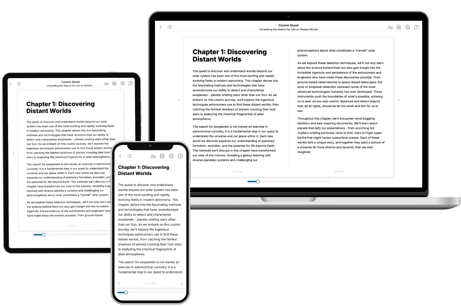
Your book is ready in 10 minutes. Read it online, download as EPUB or PDF, or send to Kindle.

Frequently asked questions
- What is TailoredRead?
TailoredRead creates complete, full-length nonfiction ebooks, written specifically for you. Tell us what you want to learn and why, and TailoredRead writes you a complete ebook on it, with charts, tables, and diagrams throughout. Read it online, on Kindle, or on any e-reader, or download it as a PDF or EPUB. Every book is written fresh the day you order it.
- How is the book tailored to me?
Before anything is written, you answer a few short questions about your goals, your background, and the topics you care about. Your book is then planned around your answers: written at your level, focused on your goals, and covering the topics you chose, instead of the one-size-fits-all book a store sells everyone.
- Will it read like generic AI content?
No. Your book isn't a chat transcript: it's planned chapter by chapter before a single word is written, told in a clear book voice, and explains ideas visually with charts, tables, and diagrams. After writing, every book goes through an editorial pass that polishes chapters so the book reads consistent from start to finish. Judge for yourself: browse thousands of sample books on our Explore Books page.
- How accurate is the content?
Our AI first checks whether your subject needs live research. Niche and fast-moving subjects are researched before writing, and the book plan and chapters are grounded in what it finds. After writing, every book goes through a quality pass that checks its facts and consistency, and researched books list their sources in a Notes section at the back.
- How long is the book?
You choose the length: Comprehensive (250-300 pages), Detailed (150-200 pages), Essential (70-100 pages), or Short (30-50 pages).
- Does the book include visuals?
Yes. Every book includes charts, tables, and diagrams: timelines, checklists, step-by-step guides, decision trees, comparison tables, matrices, and bar charts. A typical book includes dozens of these visual elements.
- Can I read it on Kindle? What formats can I download?
Yes. Every book can be read in our online reader or downloaded as a PDF or EPUB. The EPUB can be opened with Kindle, Apple Books, Kobo, and any e-reader. The Commercial and Author licenses also include an editable Word (DOCX) and Markdown download.
- How much does it cost?
About the price of a regular ebook. The exact price depends on your book's length and complexity, from $2 for the shortest books to $35 for the most comprehensive, and it's shown when you review your book, before you commit to anything. Each book is a one-time purchase, yours to keep, no subscription. Licenses that let you share, teach, or publish your book range from $35.99 to $49.99.
- Can I preview the book before purchasing?
Before you pay, you'll see what your book will cover: the title, a detailed description, the estimated length, and the complete chapter-by-chapter table of contents, so you know what you're getting before you decide. The full text itself is written after you purchase.
- How long does it take to create a book?
About 10 minutes. You can start reading the opening chapters while the rest is still being written.