The Science of Earthquakes
Understanding Seismology and Earth's Dynamic Forces
Dive deep into the fascinating world beneath your feet, where massive forces shape our planet through earthquakes and seismic activity.
300 pages16 chaptersSep 23, 2025Seismology
About this book
This comprehensive guide takes you through the fundamental principles of seismology, from the basic mechanics of how earthquakes occur to the sophisticated methods scientists use to study them. You'll explore the intricate relationship between plate tectonics and seismic activity, learning how different types of seismic waves travel through Earth's layers and what they reveal about our planet's internal structure. Through clear explanations and practical examples, you'll understand how seismologists measure and analyze earthquakes, from the smallest tremors to major seismic events that reshape landscapes. The book bridges theoretical knowledge with real-world applications, showing how modern seismic monitoring networks operate and how historical earthquake data contributes to our understanding of regional seismic patterns. You'll gain insight into the tools and techniques that make seismology a precise science, while developing a deeper appreciation for the dynamic forces that continue to shape our planet. Whether you're building on existing earth science knowledge or seeking to understand the mechanisms behind one of nature's most powerful phenomena, this book provides the comprehensive foundation you need to grasp the complexities of seismology and earthquake science.
Table of contents
- IntroductionEarth as a Dynamic Planet, What is Seismology?, Historical Perspective on Earthquake Studies, Modern Seismology and Its ApplicationsRead below
- Chapter 1: Earth's Internal StructureThe Layers of Earth, Crustal Properties and Variations, Mantle Structure and Dynamics, Core Characteristics and Behavior
- Chapter 2: Plate Tectonics and Seismic ActivityTheory of Plate Tectonics, Types of Plate Boundaries, Seismicity at Different Boundaries, Intraplate Earthquakes
- Chapter 3: Earthquake Mechanics and GenerationStress and Strain in Earth's Crust, Fault Systems and Classifications, The Earthquake Rupture Process, Energy Release and Propagation
- Chapter 4: Seismic Wave Types and PropertiesBody Waves: P-waves and S-waves, Surface Waves: Love and Rayleigh Waves, Wave Propagation Through Earth, Wave Interactions and Reflections
- Chapter 5: Seismographs and Recording InstrumentsBasic Principles of Seismographs, Types of Seismic Instruments, Digital Recording Systems, Calibration and Maintenance
- Chapter 6: Seismic Monitoring NetworksGlobal Seismic Networks, Regional and Local Networks, Real-time Data Transmission, Network Design and Optimization
- Chapter 7: Earthquake Location and TimingP-wave and S-wave Arrival Times, Triangulation and Location Methods, Determining Epicenter and Hypocenter, Factors Affecting Location Accuracy
- Chapter 8: Earthquake Magnitude ScalesThe Richter Scale, Moment Magnitude Scale, Other Magnitude Scales, Comparing Different Scales
- Chapter 9: Earthquake Intensity and EffectsIntensity Scales and Measurements, Ground Motion Characteristics, Local Site Effects, Earthquake Damage Patterns
- Chapter 10: Seismic Tomography and Earth ImagingPrinciples of Seismic Tomography, Velocity Models and Structures, Global Tomographic Studies, Regional and Local Imaging
- Chapter 11: Earthquake Cycles and RecurrenceUnderstanding Seismic Cycles, Recurrence Intervals and Patterns, Paleoseismology and Historical Records, Variations in Earthquake Cycles
- Chapter 12: Induced and Triggered SeismicityHuman-Induced Seismicity, Reservoir-Induced Seismicity, Earthquake Triggering Mechanisms, Monitoring Induced Events
- Chapter 13: Volcanic SeismologyTypes of Volcanic Earthquakes, Seismic Signals of Magma Movement, Monitoring Volcanic Activity, Seismic Hazards from Volcanoes
- Chapter 14: Seismic Data Analysis TechniquesDigital Signal Processing, Filtering and Noise Reduction, Spectral Analysis Methods, Automated Event Detection
- Chapter 15: Global Seismicity PatternsMajor Seismic Belts, Regional Seismicity Variations, Temporal Patterns in Seismicity, Statistical Analysis of Earthquakes
- Chapter 16: Future Directions in SeismologyEmerging Technologies, Machine Learning Applications, Multi-disciplinary Approaches, Current Research Frontiers
- Conclusion
- Glossary
Introduction
Beneath your feet lies one of the most dynamic and powerful systems on Earth. Every day, our planet experiences thousands of earthquakes, ranging from tiny tremors barely detectable by sensitive instruments to massive ruptures that can reshape entire landscapes. These seismic events represent the ongoing expression of Earth's internal energy, a constant reminder that we live on a geologically active world where immense forces operate on scales both vast and immediate. Understanding these forces and the earthquakes they generate requires delving into the science of seismology, a field that combines physics, geology, and advanced technology to decode the messages carried by seismic waves.
The study of earthquakes extends far beyond simply measuring ground shaking or cataloging seismic events. Modern seismology serves as our primary window into Earth's interior structure, revealing details about layers we can never directly observe and processes occurring hundreds of kilometers below the surface. When an earthquake occurs, it generates seismic waves that travel through the entire planet, carrying information about the materials they encounter and the structures they pass through. By analyzing these waves, seismologists can map the boundaries between Earth's layers, identify variations in composition and temperature, and track the movement of tectonic plates that drive much of our planet's geological activity.
Your journey through this book will take you from the fundamental principles governing earthquake generation to the sophisticated methods scientists use to monitor and analyze seismic activity worldwide. You'll discover how different types of seismic waves behave as they travel through Earth's layers, learn about the instruments and networks that detect these waves, and explore the techniques used to determine earthquake locations, magnitudes, and effects. Along the way, you'll gain insight into how seismology contributes to our broader understanding of Earth as a dynamic system, where processes operating in the deep interior ultimately influence the surface environment where we live.
The knowledge presented here builds upon foundational concepts in earth sciences while introducing the specialized tools and methods that make seismology a precise and quantitative science. Whether you're seeking to understand the mechanics behind major seismic events or exploring how earthquake studies contribute to our knowledge of planetary processes, this comprehensive examination will provide you with the conceptual framework and practical understanding needed to appreciate both the power of earthquakes and the elegance of the scientific methods used to study them.
Earth as a Dynamic Planet
Earth's dynamic nature becomes immediately apparent when you consider the scale and frequency of seismic activity occurring continuously around the globe. The United States Geological Survey's earthquake monitoring systems detect and locate approximately 20,000 earthquakes worldwide each year, with many more smaller events occurring that go unrecorded[1]. This constant seismic activity reflects the ongoing movement of tectonic plates, the cooling and contraction of Earth's interior, and the complex interactions between different layers within our planet. Unlike the static, unchanging world that early scientists once imagined, modern understanding reveals Earth as a system in constant motion, where energy accumulated over decades or centuries can be released in seconds during major seismic events.
The energy driving this seismic activity originates primarily from Earth's internal heat, a combination of primordial heat left over from the planet's formation and heat generated by the radioactive decay of elements like uranium, thorium, and potassium within the mantle and crust. This thermal energy creates convection currents in the mantle that drive the movement of tectonic plates at Earth's surface. As these massive plates move, they interact along their boundaries in ways that build up stress in the surrounding rock. When this accumulated stress exceeds the strength of the rock, sudden failure occurs, releasing energy in the form of seismic waves that we experience as earthquakes. The process represents a fundamental mechanism by which Earth's interior energy reaches the surface, making earthquakes an essential component of our planet's thermal and mechanical evolution.
The distribution of earthquake activity across Earth's surface reveals clear patterns that reflect underlying geological processes. Most earthquakes occur along well-defined belts that correspond to the boundaries between tectonic plates, with the most seismically active regions including:
- The Circum-Pacific Belt, often called the "Ring of Fire," which accounts for approximately 81% of the world's largest earthquakes
- The Alpide Belt, extending from the Mediterranean region through Turkey, Iran, and into the Himalayas
- The Mid-Atlantic Ridge and other oceanic spreading centers
- Transform fault systems like the San Andreas Fault in California
Understanding Earth's dynamic nature requires recognizing that seismic activity operates across multiple time scales, from the instantaneous rupture of an earthquake to the million-year cycles of mountain building and plate reorganization. Individual earthquakes may last only seconds or minutes, but they represent the culmination of stress accumulation processes that can span decades to centuries. The 2011 Tohoku earthquake in Japan, for example, resulted from the gradual convergence of the Pacific and North American plates over thousands of years, with stress building along the fault interface until the sudden rupture released energy equivalent to approximately 600 million times the energy of the atomic bomb dropped on Hiroshima[2]. This example illustrates how Earth's dynamic processes connect events occurring on vastly different time scales.
The dynamic nature of our planet also manifests in the continuous deformation of Earth's surface, much of which occurs so slowly that it's imperceptible in human time scales but becomes dramatic when viewed over geological time. GPS measurements can now detect plate motions as small as a few millimeters per year, revealing that continents are constantly moving and that the stress responsible for future earthquakes is accumulating continuously. The Pacific Plate moves northwestward relative to the North American Plate at approximately 50 millimeters per year along the San Andreas Fault system, a rate that seems insignificant until you consider that this motion has created hundreds of kilometers of offset over millions of years. This ongoing deformation demonstrates that the Earth beneath our feet is never truly at rest, even during periods when no earthquakes are occurring.
Modern technology has revolutionized our ability to observe and quantify Earth's dynamic behavior in real-time. Satellite-based monitoring systems can track ground deformation with millimeter precision, while dense networks of seismometers provide continuous surveillance of seismic activity worldwide. Ocean-bottom seismometers extend this monitoring capability to the seafloor, where much of Earth's most significant seismic activity occurs along mid-ocean ridges and subduction zones. These technological advances have revealed that Earth's dynamic processes are far more complex and interconnected than previously understood, with seismic activity in one region potentially influencing earthquake occurrence thousands of kilometers away through stress transfer mechanisms and triggered seismicity.
The recognition of Earth as a dynamic planet has profound implications for how we understand natural hazards and their relationship to human society. Rather than viewing earthquakes as unpredictable catastrophes, seismology approaches them as natural expressions of ongoing geological processes that can be studied, monitored, and to some extent anticipated. This perspective emphasizes the importance of understanding the physical processes driving seismic activity, the patterns and cycles that characterize earthquake occurrence, and the methods available for monitoring and analyzing seismic phenomena. By studying Earth's dynamic nature through the lens of seismology, we gain insights not only into earthquake processes but also into the fundamental workings of our planet as a complex, evolving system.
What is Seismology?
Seismology represents the scientific study of earthquakes and the propagation of elastic waves through Earth's interior and along its surface. This definition, while technically accurate, only begins to capture the breadth and complexity of modern seismological research. At its core, seismology combines principles from physics, geology, mathematics, and computer science to understand how seismic energy is generated, how it travels through different materials, and what information it carries about Earth's internal structure and dynamic processes. The field encompasses everything from the mechanics of fault rupture and wave propagation to the design of sensitive instruments capable of detecting ground motions smaller than the width of an atom. Seismologists work to decode the complex signals recorded by these instruments, extracting information about earthquake sources, Earth's internal structure, and the physical properties of materials deep within our planet.
The scope of seismology extends well beyond the study of natural earthquakes to include a diverse range of seismic phenomena and applications. Modern seismologists investigate volcanic earthquakes that provide insights into magma movement and eruption processes, monitor induced seismicity related to human activities like hydraulic fracturing and geothermal energy production, and analyze the seismic signals generated by explosions, landslides, and even meteorite impacts. The field also encompasses exploration seismology, where controlled seismic sources are used to image subsurface structures for resource exploration and engineering applications. This broad scope reflects the fundamental principle that any process capable of generating elastic waves in solid Earth materials falls within the domain of seismological investigation, making seismology a versatile tool for understanding Earth processes across multiple scales and contexts.
Central to seismological research is the concept that seismic waves carry information about both their sources and the materials through which they travel. When an earthquake occurs, it generates several types of seismic waves that propagate outward from the source at different velocities and with different characteristics. By analyzing the arrival times, amplitudes, frequencies, and polarizations of these waves at multiple recording stations, seismologists can determine:
- The location, depth, and timing of the earthquake source
- The magnitude and mechanism of the rupture process
- The velocity structure and physical properties of materials along the wave paths
- The presence of structural boundaries and discontinuities within Earth
The quantitative nature of seismology distinguishes it from many other earth science disciplines and enables precise measurements and reproducible results. Seismic wave velocities can be measured with accuracies of fractions of a percent, earthquake locations can be determined to within kilometers or even meters under favorable conditions, and the timing of seismic events can be established to within milliseconds. This precision stems from the fundamental physics governing wave propagation, which follows well-established mathematical relationships that allow seismologists to make quantitative predictions about wave behavior. The 2004 Indian Ocean earthquake, for example, was located and its magnitude estimated within hours of occurrence based on seismic wave analysis, demonstrating the power of quantitative seismological methods to provide rapid and accurate information about major seismic events[3].
Modern seismology operates as both an observational and theoretical science, combining extensive data collection with sophisticated modeling and simulation capabilities. Observational seismology focuses on recording, processing, and interpreting seismic signals from natural and artificial sources, requiring networks of sensitive instruments deployed globally and sophisticated data management systems. Theoretical seismology develops mathematical models of wave propagation, source processes, and Earth structure, often using high-performance computing resources to simulate complex seismic phenomena. The integration of observational data with theoretical models enables seismologists to test hypotheses about Earth processes, refine understanding of seismic phenomena, and develop improved methods for earthquake analysis and Earth structure determination.
The interdisciplinary nature of seismology requires practitioners to draw upon knowledge from multiple scientific fields while developing specialized expertise in seismic phenomena. Seismologists must understand the physics of wave propagation and elastic deformation, the geology of fault systems and tectonic processes, the mathematics of signal processing and inverse theory, and the engineering principles underlying seismic instrumentation. This broad knowledge base enables seismologists to approach complex problems from multiple perspectives and to collaborate effectively with researchers in related fields. The study of subduction zone earthquakes, for example, requires understanding of plate tectonic processes, rock mechanics, fluid dynamics, and thermal structure, illustrating how seismological research often integrates concepts from across the earth sciences.
Contemporary seismology increasingly emphasizes real-time monitoring and rapid response capabilities, reflecting both technological advances and societal needs for timely information about seismic events. Modern seismic networks can detect and locate earthquakes within minutes of their occurrence, automatically calculate preliminary magnitudes, and distribute alerts to emergency response agencies and the public. These capabilities represent a significant evolution from the historical practice of seismology as primarily a research discipline focused on understanding past events. The development of earthquake early warning systems, which can provide seconds to minutes of advance notice before strong shaking arrives, exemplifies how seismology now contributes directly to hazard mitigation and public safety efforts while continuing to advance scientific understanding of earthquake processes.
Historical Perspective on Earthquake Studies
The systematic study of earthquakes has ancient roots, with historical records of seismic events dating back thousands of years across many cultures. Chinese scholars maintained detailed earthquake catalogs as early as 780 BCE, documenting not only the occurrence of earthquakes but also their effects on structures and landscapes[4]. Ancient Greek philosophers, including Aristotle, proposed early theories about earthquake causes, suggesting that trapped air or gases within Earth might be responsible for seismic shaking. While these early explanations were incorrect by modern standards, they represented important first attempts to understand earthquakes as natural phenomena rather than supernatural events. The historical perspective reveals how earthquake studies evolved from descriptive observations and mythological explanations toward increasingly sophisticated scientific investigations based on physical principles and quantitative measurements.
The development of the first seismic instruments marked a crucial transition from purely observational earthquake studies to quantitative seismology. In 132 CE, the Chinese inventor Zhang Heng created what is often considered the first seismoscope, a bronze vessel containing a pendulum mechanism that could detect the direction of earthquake motion and drop bronze balls to indicate seismic activity. While this device was more symbolic than scientifically precise, it established the important principle that earthquakes could be detected and studied using mechanical instruments. The concept of instrumental earthquake detection remained largely dormant for over a millennium until European scientists in the 18th and 19th centuries began developing more sophisticated approaches to seismic observation and measurement.
The modern era of seismology began in the late 19th century with the development of the first true seismographs capable of recording ground motion as a function of time. Key developments during this period included:
- The invention of the horizontal pendulum seismograph by John Milne in 1880
- The establishment of the first seismological observatories in Japan and Europe
- The recognition that earthquakes generate different types of waves that travel at different velocities
- The development of methods for determining earthquake epicenters using arrival time differences
The early 20th century witnessed several breakthrough discoveries that established the fundamental principles of modern seismology. In 1906, Harry Fielding Reid's investigation of the great San Francisco earthquake led to the formulation of the elastic rebound theory, which explained earthquakes as the result of sudden stress release along faults after gradual strain accumulation. This theory provided the first physically sound explanation for earthquake generation and remains a cornerstone of seismological understanding today. Simultaneously, seismologists like Richard Dixon Oldham and Andrija Mohorovičić used seismic wave analysis to discover major discontinuities within Earth's interior, including the boundary between the crust and mantle (the Mohorovičić discontinuity) and evidence for Earth's liquid outer core. These discoveries demonstrated that seismology could serve as a powerful tool for investigating Earth's internal structure.
The mid-20th century brought revolutionary changes to seismology through technological advances and theoretical developments that expanded the field's capabilities and applications. The development of electromagnetic seismographs replaced mechanical instruments with more sensitive and reliable electronic systems, while the establishment of the World-Wide Standardized Seismograph Network (WWSSN) in the 1960s provided global coverage with standardized instruments and recording procedures. This period also saw the integration of seismology with the emerging theory of plate tectonics, as seismologists mapped global earthquake patterns that clearly delineated tectonic plate boundaries and provided crucial evidence for continental drift and seafloor spreading. The recognition that earthquake distribution patterns reflected underlying geological processes marked a fundamental shift in understanding Earth as a dynamic system driven by internal heat and convection.
The digital revolution of the late 20th century transformed seismology from an analog science dependent on photographic recording and manual analysis to a digital discipline capable of real-time data processing and automated analysis. Digital seismographs offered superior dynamic range, frequency response, and timing accuracy compared to their analog predecessors, while computer-based data acquisition systems enabled continuous recording and immediate data availability. The development of satellite communication systems allowed real-time data transmission from remote seismic stations, making possible the rapid earthquake location and magnitude determination capabilities that characterize modern seismological practice. These technological advances also enabled new research directions, including high-resolution seismic tomography, detailed source mechanism studies, and the investigation of subtle phenomena like slow earthquakes and non-volcanic tremor.
Contemporary seismology continues to evolve rapidly, driven by advances in sensor technology, computing power, and data analysis techniques. The deployment of broadband seismometers with flat response across a wide frequency range has enabled detailed studies of both high-frequency earthquake signals and long-period Earth oscillations. Dense arrays of seismic instruments, including temporary deployments for specific research projects and permanent networks for monitoring purposes, provide unprecedented spatial resolution for imaging Earth structure and earthquake processes. The integration of seismological data with other geophysical observations, including GPS measurements, satellite imagery, and laboratory experiments on rock properties, has created new opportunities for comprehensive understanding of Earth dynamics. This historical progression from ancient observations to modern high-technology monitoring systems illustrates how seismology has evolved into a sophisticated science capable of addressing fundamental questions about Earth structure, earthquake processes, and planetary dynamics.
Modern Seismology and Its Applications
Modern seismology operates as a highly sophisticated, technology-driven science that extends far beyond traditional earthquake monitoring to encompass a broad range of applications in earth science research, hazard assessment, and societal benefit. Today's seismological capabilities include real-time global earthquake monitoring, detailed imaging of Earth's internal structure, investigation of volcanic processes, monitoring of nuclear explosions for treaty verification, and exploration of subsurface resources. The field now employs advanced sensor technologies, high-speed data communications, powerful computational resources, and sophisticated analysis techniques that enable investigations impossible just decades ago. Modern seismological networks can detect and locate earthquakes anywhere on Earth within minutes, determine detailed source characteristics, and provide immediate information to emergency response agencies and the public through automated systems.
The technological infrastructure supporting modern seismology represents a remarkable achievement in global scientific cooperation and technological integration. The Global Seismographic Network (GSN), operated jointly by the United States Geological Survey and the National Science Foundation, maintains over 150 permanent broadband seismic stations worldwide, providing continuous monitoring of global seismic activity with unprecedented sensitivity and frequency coverage[5]. This network, combined with regional and national seismic networks operated by dozens of countries, creates a global monitoring system capable of detecting earthquakes with magnitudes as small as 4.0 anywhere on Earth and much smaller events in well-instrumented regions. The data from these networks flow continuously to analysis centers where automated systems process millions of seismic signals daily, identifying earthquakes, determining their locations and magnitudes, and distributing results to users worldwide.
Contemporary seismological research addresses fundamental questions about Earth structure and dynamics through increasingly sophisticated approaches that integrate multiple types of data and analysis techniques. Seismic tomography, which uses earthquake waves to create three-dimensional images of Earth's interior, has revealed detailed structure within the mantle including subducted oceanic plates, mantle plumes, and large-scale convection patterns. These studies provide crucial insights into:
- The thermal and chemical structure of Earth's mantle
- The dynamics of plate tectonics and mantle convection
- The history of subduction and continental collision processes
- The relationship between surface tectonics and deep Earth processes
The application of seismology to hazard assessment and risk reduction has become increasingly important as global populations grow and become more concentrated in seismically active regions. Modern probabilistic seismic hazard assessment combines historical earthquake records, geological investigations of past seismic activity, and detailed modeling of ground motion to estimate the likelihood of different levels of earthquake shaking at specific locations. These assessments form the basis for building codes, insurance rates, and emergency planning in earthquake-prone regions. The development of earthquake early warning systems represents another crucial application, with operational systems in Japan, Mexico, and California providing automated alerts that can trigger protective actions before strong shaking arrives. The 2011 Tohoku earthquake demonstrated both the potential and limitations of such systems, providing up to a minute of warning for some areas while highlighting the challenges of accurately estimating earthquake magnitude and ground motion in real-time.
Modern seismology increasingly emphasizes multidisciplinary approaches that integrate seismological observations with other geophysical, geological, and laboratory-based investigations. The study of earthquake processes now routinely combines seismic wave analysis with GPS measurements of ground deformation, satellite radar interferometry, geological field studies, and laboratory experiments on rock friction and failure. This integration has led to important discoveries about earthquake mechanics, including the recognition of slow slip events, the role of fluids in fault processes, and the complex relationship between stress changes and earthquake triggering. The investigation of the 2016 Kaikoura earthquake in New Zealand exemplifies this multidisciplinary approach, combining seismic analysis, GPS measurements, satellite imagery, and field geology to understand how a single earthquake ruptured multiple fault segments and generated complex patterns of ground deformation.
The computational aspects of modern seismology have expanded dramatically with the availability of high-performance computing resources and advanced numerical methods. Seismologists now routinely perform three-dimensional simulations of earthquake rupture processes, wave propagation through complex Earth structure, and ground motion at the surface. These simulations help interpret observational data, test theoretical models, and predict ground motion for scenario earthquakes used in hazard assessment. The Southern California Earthquake Center's CyberShake project, for example, uses supercomputers to calculate earthquake ground motions for millions of potential earthquake scenarios, providing detailed hazard maps that account for the complex geology and fault systems of the region[6]. Such computational capabilities enable seismologists to address questions that would be impossible to investigate through observations alone.
Looking toward the future, modern seismology continues to evolve through technological innovations and expanding applications that promise to further enhance our understanding of Earth processes and our ability to mitigate seismic hazards. Emerging technologies include distributed acoustic sensing using fiber-optic cables, which can turn existing telecommunications infrastructure into dense seismic arrays, and machine learning approaches that can identify subtle patterns in seismic data and improve earthquake detection and characterization. The integration of seismology with other disciplines continues to deepen, with applications ranging from monitoring ice sheet dynamics in polar regions to investigating the internal structure of other planets using data from spacecraft missions. These developments ensure that seismology will remain at the forefront of earth science research while continuing to provide essential information for understanding and preparing for earthquake hazards in an increasingly interconnected world.
Notes
Introduction
- 1. United States Geological Survey, Earthquake Statistics, USGS Earthquake Hazards Program, 2023
- 2. T. Lay and others, "Possible large near-trench slip during the 2011 Mw 9.0 off the Pacific coast of Tohoku Earthquake," Earth, Planets and Space, 2011
- 3. T. Lay and others, "The great Sumatra-Andaman earthquake of 26 December 2004," Science, 2005
- 4. J. Needham, Science and Civilisation in China, Volume 3, Cambridge University Press, 1971
- 5. G. Ekström and others, The global CMT project 2004-2010: Centroid-moment tensors for 13,017 earthquakes, Physics of the Earth and Planetary Interiors, 2012
- 6. R. Graves and others, "CyberShake: A physics-based seismic hazard model for southern California," Pure and Applied Geophysics, 2011
This is the end of the free sample. The full book has 16 chapters.
Want this book written for you?
Tell us your goals and background, and get your own version of this book, tailored by AI to you.


Benefits of AI-tailored books
- Read one book, not ten:
- all the Seismology knowledge you need, gathered into a single book.
- Save days of learning:
- tell us your goals, choose your topics, and the whole book is built around them.
- Learn effortlessly:
- Seismology book written for your specific background and expertise.
- Understand at a glance:
- includes charts, tables, timelines, checklists, decision trees, and more.
- Stay current:
- written the day you order it, not years ago.
- Trust what you read:
- every book is checked for accuracy, with real research when your subject needs it.
Create your unique book in 3 steps
- 1. Select your focus
Select the focus of your Seismology book and share your background
- 2. Personalize your book
Specify your goals and choose sub-topics to include
- 3. Get your tailored book
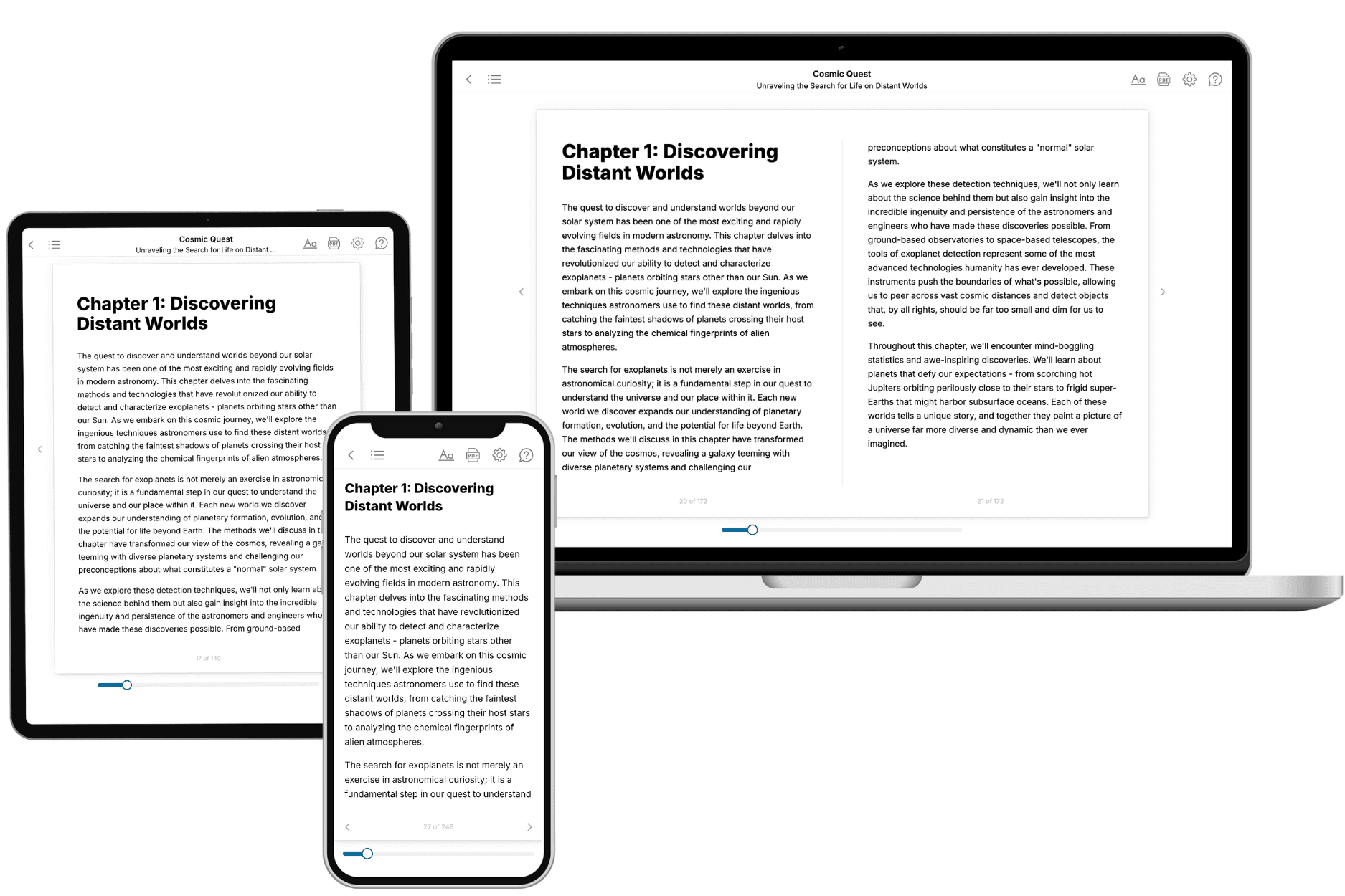
Your book is ready in 10 minutes. Read it online, download as EPUB or PDF, or send to Kindle.

Frequently asked questions
- What is TailoredRead?
TailoredRead creates complete, full-length nonfiction ebooks, written specifically for you. Tell us what you want to learn and why, and TailoredRead writes you a complete ebook on it, with charts, tables, and diagrams throughout. Read it online, on Kindle, or on any e-reader, or download it as a PDF or EPUB. Every book is written fresh the day you order it.
- How is the book tailored to me?
Before anything is written, you answer a few short questions about your goals, your background, and the topics you care about. Your book is then planned around your answers: written at your level, focused on your goals, and covering the topics you chose, instead of the one-size-fits-all book a store sells everyone.
- Will it read like generic AI content?
No. Your book isn't a chat transcript: it's planned chapter by chapter before a single word is written, told in a clear book voice, and explains ideas visually with charts, tables, and diagrams. After writing, every book goes through an editorial pass that polishes chapters so the book reads consistent from start to finish. Judge for yourself: browse thousands of sample books on our Explore Books page.
- How accurate is the content?
Our AI first checks whether your subject needs live research. Niche and fast-moving subjects are researched before writing, and the book plan and chapters are grounded in what it finds. After writing, every book goes through a quality pass that checks its facts and consistency, and researched books list their sources in a Notes section at the back.
- How long is the book?
You choose the length: Comprehensive (250-300 pages), Detailed (150-200 pages), Essential (70-100 pages), or Short (30-50 pages).
- Does the book include visuals?
Yes. Every book includes charts, tables, and diagrams: timelines, checklists, step-by-step guides, decision trees, comparison tables, matrices, and bar charts. A typical book includes dozens of these visual elements.
- Can I read it on Kindle? What formats can I download?
Yes. Every book can be read in our online reader or downloaded as a PDF or EPUB. The EPUB can be opened with Kindle, Apple Books, Kobo, and any e-reader. The Commercial and Author licenses also include an editable Word (DOCX) and Markdown download.
- How much does it cost?
About the price of a regular ebook. The exact price depends on your book's length and complexity, from $2 for the shortest books to $35 for the most comprehensive, and it's shown when you review your book, before you commit to anything. Each book is a one-time purchase, yours to keep, no subscription. Licenses that let you share, teach, or publish your book range from $35.99 to $49.99.
- Can I preview the book before purchasing?
Before you pay, you'll see what your book will cover: the title, a detailed description, the estimated length, and the complete chapter-by-chapter table of contents, so you know what you're getting before you decide. The full text itself is written after you purchase.
- How long does it take to create a book?
About 10 minutes. You can start reading the opening chapters while the rest is still being written.