Weather Mastery for Pilots
Integrating Radar, Satellite, and Model Data for Safer Flight Decisions
Imagine approaching your preflight weather briefing with complete confidence—not just reading reports, but truly understanding the atmospheric conditions that will affect your flight.
238 pages11 chaptersJan 19, 2026Aviation
About this book
You'll know exactly what the radar is showing you, what satellite imagery reveals about storm development, and how upper air data predicts icing and turbulence. This book bridges the gap between raw meteorological data and actionable flight decisions. You'll learn to interpret Doppler radar signatures, analyze satellite cloud patterns, read upper air soundings, recognize synoptic weather patterns, and assess atmospheric stability. Each chapter builds your ability to integrate these diverse data sources into a coherent weather picture. Whether you're planning a cross-country flight or navigating unexpected weather en route, you'll have the tools to make decisions grounded in meteorological science rather than guesswork. This is practical, applied meteorology designed specifically for pilots who want to master their weather decision-making.
Table of contents
- IntroductionWhy Weather Mastery Matters for Pilots, The Data Integration Approach, How to Use This BookRead below
- Chapter 1: Foundations of Atmospheric ObservationThe Global Observation Network, Surface Observations and METAR Data, Understanding Observation Gaps and Limitations
- Chapter 2: Doppler Radar FundamentalsHow Doppler Radar Works, Reflectivity and Velocity: The Two Pillars of Radar, Recognizing Radar Artifacts and Limitations
- Chapter 3: Interpreting Radar Signatures for Flight SafetyReading Storm Structure and Intensity, Detecting Wind Shear and Rotation, Identifying Hail and Icing Signatures, Using Radar for Real-Time Flight Decisions
- Chapter 4: Satellite Cloud AnalysisTypes of Satellite Imagery and What They Show, Recognizing Cloud Patterns and Atmospheric Features, Using Temporal Analysis to Predict Weather Evolution
- Chapter 5: Upper Air Sounding AnalysisUnderstanding Skew-T Log-P Diagrams, Calculating and Interpreting Stability Indices, Identifying Wind Shear Layers and Jet Streams, Predicting Icing and Turbulence from Soundings
- Chapter 6: Synoptic Pattern RecognitionUnderstanding Pressure Systems and Fronts, Recognizing Common Synoptic Patterns, Using Patterns to Anticipate Weather Changes
- Chapter 7: Atmospheric Stability AssessmentCore Concepts of Atmospheric Stability, Predicting Convection and Thunderstorm Development, Connecting Stability to Flight Hazards
- Chapter 8: Numerical Weather Model AnalysisTypes of Weather Models and Their Strengths, Understanding Model Biases and Limitations, Interpreting Model Output for Flight Planning
- Chapter 9: Integrating Multiple Data SourcesBuilding Your Data Integration Framework, Resolving Conflicts Between Data Sources, Developing Sound Decision Logic
- Chapter 10: Preflight Weather Briefing MasteryStructuring Your Preflight Analysis, Systematic Hazard Identification, Making Confident Go/No-Go Decisions
- Chapter 11: In-Flight Weather ManagementReal-Time Weather Assessment During Flight, Modifying Your Route Based on Observed Conditions, Making Emergency Weather Decisions
- ConclusionYour Ongoing Mastery Journey, Staying Current with Meteorological Science
- Glossary
- Further Reading and Resources
Introduction
Weather kills pilots. Not because they lack courage or skill, but because they misunderstand the atmospheric conditions surrounding their aircraft. Every year, accident reports reveal the same pattern: experienced pilots who made critical decisions based on incomplete weather information or misinterpreted data. The difference between a safe flight and a fatal one often comes down to how well you understand what the atmosphere is actually doing, not just what a forecast predicted hours earlier. This book exists to change that equation for you.
You already know the basics. You've passed your written exams, earned your instrument rating, and completed countless weather briefings. But there's a vast gap between reading a METAR and truly understanding the three-dimensional atmospheric structure that will affect your flight. Standard pilot training teaches you what to look at—surface observations, radar images, forecasts—but rarely explains how to integrate these diverse data sources into a coherent mental model of current and future conditions. That integration skill separates pilots who fly confidently in challenging weather from those who either take unnecessary risks or miss perfectly flyable opportunities.
Your medical background gives you a significant advantage in mastering meteorology. You're already comfortable with complex systems, diagnostic reasoning, and evidence-based decision-making under uncertainty. Just as you learned to integrate vital signs, lab results, imaging studies, and clinical presentation to diagnose a patient, you'll learn to synthesize surface observations, radar signatures, satellite imagery, upper air soundings, and model forecasts to diagnose atmospheric conditions. The cognitive frameworks are remarkably similar: pattern recognition, systematic analysis, understanding limitations of each data source, and making decisions when complete information isn't available. This book will help you transfer those analytical skills to the meteorological domain.
The approach here is fundamentally practical. Every concept connects directly to flight decisions you'll actually make. You won't find lengthy theoretical discussions of atmospheric physics unless they directly improve your ability to interpret real-world data. Instead, you'll learn exactly what to look for in a Doppler radar image when thunderstorms are developing along your route, how to read a Skew-T diagram to predict icing layers, what satellite cloud patterns reveal about atmospheric stability, and how to recognize when numerical models are likely to be wrong. Each chapter builds specific interpretive skills that you can apply immediately to your next preflight briefing.
Why Weather Mastery Matters for Pilots
The National Transportation Safety Board consistently identifies weather as a contributing factor in approximately 23% of general aviation accidents, and those weather-related accidents have a fatality rate nearly four times higher than non-weather accidents[1]. These statistics haven't improved significantly in decades despite better forecasts, more sophisticated weather products, and improved aircraft capabilities. The problem isn't lack of information—modern pilots have access to more weather data than meteorologists had twenty years ago. The problem is interpretation and integration. Pilots receive overwhelming amounts of raw data but lack the frameworks to transform that data into actionable intelligence.
Consider a typical scenario: You're planning a cross-country flight and check the Aviation Weather Center website. You see a METAR showing VFR conditions at your destination, a TAF predicting continued good weather, and a radar mosaic with scattered green returns along your route. The area forecast mentions possible afternoon thunderstorms. Satellite imagery shows increasing cloud cover. The Skew-T from the nearest sounding site shows a conditionally unstable atmosphere. A convective outlook gives a slight risk for severe weather in the region. Which data source should drive your decision? How do you reconcile the VFR forecast with the unstable atmosphere? What does "scattered green returns" actually mean for flight safety? Without systematic integration skills, you're left making gut-level decisions or defaulting to the most optimistic interpretation.
Weather mastery transforms your decision-making process from reactive to proactive. Instead of responding to conditions as you encounter them, you anticipate atmospheric behavior based on physical principles. You recognize that the VFR forecast and unstable sounding aren't contradictory—they're telling you that conditions are currently good but convection is likely to develop. The scattered green radar returns reveal where updrafts are already forming. The satellite imagery shows the moisture source feeding those developing cells. Suddenly, you're not looking at disconnected data points but seeing a coherent story about atmospheric evolution. This integrated understanding allows you to make timing decisions, plan alternate routes, and establish decision points before you ever start the engine.
The safety benefits extend beyond avoiding obvious hazards like thunderstorms. Subtle weather phenomena—wind shear on approach, unexpected icing in clouds, turbulence in clear air, rapidly lowering ceilings—often catch pilots by surprise because they didn't recognize the atmospheric signatures in their preflight analysis. A pilot who understands how to read upper air soundings can predict where wind shear layers will form. Someone skilled in satellite interpretation can see fog development hours before it appears in forecasts. A pilot comfortable with radar velocity data can identify rotation in storms that appear benign on reflectivity images alone. These skills don't just prevent accidents; they expand your operational envelope by helping you confidently fly in conditions that would otherwise seem too uncertain.
Beyond safety, weather mastery improves efficiency and reduces stress. How many times have you canceled a flight based on a forecast, only to watch perfect flying weather develop? How often have you launched into deteriorating conditions because the briefing didn't reveal the trend? When you understand atmospheric processes, you make better timing decisions. You know when to delay departure by two hours to let a front pass, when to depart early before convection develops, and when conditions that look marginal are actually stable. This knowledge reduces the anxiety that comes from uncertainty. You're not hoping the weather cooperates—you're predicting what it will do based on physical evidence.
Your instrument rating already demonstrates your commitment to safety and capability. But instruments only help you fly through weather; they don't tell you whether you should fly through it. An instrument-rated pilot who blunders into severe icing or embedded thunderstorms is no safer than a VFR pilot in the same situation. The rating gives you tools; meteorological expertise gives you judgment. Together, they create a pilot who can operate safely in a wide range of conditions while knowing exactly where the boundaries lie. That combination of capability and judgment is what this book aims to develop.
The investment in weather mastery pays dividends throughout your flying career. As you gain experience, you'll encounter increasingly complex scenarios: flying in mountainous terrain where local effects dominate, operating in coastal regions with marine layer dynamics, navigating winter weather systems with multiple icing layers, or planning long cross-country flights through changing synoptic patterns. Each situation demands sophisticated weather analysis. The skills you build now—interpreting radar, reading soundings, analyzing satellite imagery, integrating multiple data sources—become the foundation for handling these advanced challenges. You're not just learning to be safer on your next flight; you're building expertise that compounds over thousands of hours.
The Data Integration Approach
Traditional pilot weather training follows a checklist approach: check the METAR, read the TAF, look at the radar, review the area forecast, check NOTAMs, make a decision. This linear process treats each data source as independent and often leads to contradictory information without a framework for resolution. The integration approach taught in this book is fundamentally different. You'll learn to build a three-dimensional mental model of the atmosphere by combining complementary data sources that each reveal different aspects of the same physical system. Surface observations show current conditions at specific points. Radar reveals precipitation structure and motion. Satellite imagery provides spatial context and cloud-top characteristics. Upper air soundings expose the vertical structure. Models predict evolution. Together, they create a complete picture.
Think of it like diagnostic medicine. A patient's temperature is one data point. Blood pressure is another. Lab results add more information. But diagnosis requires integrating all these measurements into an understanding of underlying physiology. A fever alone doesn't tell you much; a fever combined with elevated white blood cell count, specific symptoms, and physical exam findings points toward a diagnosis. Similarly, green radar returns alone don't tell you whether to fly; but green returns combined with a steep lapse rate on the sounding, rapidly building cumulus on satellite, and surface observations showing increasing dewpoint spread create a clear picture of developing convection. The integration reveals what individual data sources cannot.
This approach requires understanding what each data source actually measures and what it cannot tell you. Radar detects precipitation, not clouds—you can have extensive cloud cover with no radar returns. Satellite sees cloud tops, not what's happening at flight levels below. Surface observations are point measurements that may not represent conditions between stations. Models are mathematical approximations with inherent errors. When you understand these limitations, you stop expecting any single source to give you complete information. Instead, you use each source for what it does well and fill the gaps with complementary data. Radar shows where precipitation is now; satellite shows where clouds are building; soundings explain why convection is developing; models predict when it will intensify.
The integration framework follows a systematic sequence that you'll apply to every weather briefing:
- Establish the synoptic context: What large-scale pressure systems and fronts are affecting your route? This sets the stage for everything else.
- Assess atmospheric structure: What does the vertical temperature and moisture profile look like? This determines what types of weather are possible.
- Identify current conditions: What's actually happening right now according to observations, radar, and satellite?
- Understand the trends: How are conditions evolving? Compare current data to earlier observations and model predictions.
- Predict future states: Based on atmospheric structure and current trends, what will conditions be during your flight?
- Identify uncertainties: Where do data sources conflict? What are the model limitations? What could surprise you?
Each chapter in this book builds one component of this integration framework. You'll start with foundational observation systems, then learn to interpret radar signatures, analyze satellite imagery, read upper air soundings, recognize synoptic patterns, and assess atmospheric stability. The later chapters bring these skills together, showing you how to integrate multiple sources for preflight planning and in-flight decisions. By the end, you won't just know how to read individual weather products—you'll know how to synthesize them into a coherent understanding of atmospheric behavior that drives confident, safe decisions.
The integration approach also addresses a critical cognitive challenge: confirmation bias. When you want to make a flight, it's tempting to focus on data sources that support a "go" decision while discounting those that suggest "no-go." A systematic integration framework forces you to consider all available evidence and reconcile contradictions. If the TAF shows VFR but the sounding indicates strong instability, you can't ignore the sounding just because you prefer the forecast. You must explain the apparent contradiction—perhaps the TAF is correct for early morning but convection will develop by afternoon, or maybe the forecast is wrong and you need to weight the sounding more heavily. This disciplined approach prevents the motivated reasoning that leads to poor decisions.
Integration also reveals opportunities that single-source analysis misses. A forecast might show IFR conditions along your entire route, suggesting cancellation. But when you integrate radar, satellite, and surface observations, you might discover that the IFR conditions are a narrow band of fog that will burn off by mid-morning, with VFR conditions before and after. Or you might find that the forecast low ceilings are actually high stratus with bases at 3,000 feet—perfectly flyable IFR conditions. The forecast alone would have grounded you; integrated analysis reveals a safe flight opportunity. This skill is particularly valuable for professional pilots and those with schedule pressures, where the ability to safely operate in marginal conditions has real operational value.
The data integration approach scales with your experience and the complexity of the situation. For a simple VFR flight on a clear day, a quick check of observations and trends might suffice. For an IFR cross-country through a developing weather system, you'll employ the full systematic framework, spending thirty minutes or more building your atmospheric model. For a multi-day trip, you'll analyze synoptic patterns and model trends days in advance, then refine your analysis as the departure time approaches. The framework adapts to the situation while maintaining the same underlying logic: understand the atmosphere as a physical system, integrate multiple data sources, identify uncertainties, and make decisions based on evidence rather than hope.
How to Use This Book
This book is structured as a progressive skill-building course, not a reference manual. Each chapter assumes you've mastered the content of previous chapters and builds on those foundations. The early chapters establish core concepts—observation networks, radar fundamentals, satellite basics, sounding interpretation—that later chapters combine into integrated analysis frameworks. Skipping ahead will leave gaps in your understanding that undermine the integration approach. Plan to read sequentially, even if you're already familiar with some topics. The perspective here may differ from what you learned in pilot training, and those differences matter for effective integration.
Each chapter follows a consistent structure designed to build both knowledge and practical skills:
- Conceptual foundation: What is this data source measuring, and how does it work? You need to understand the physics to interpret the output correctly.
- Interpretation techniques: What do you actually look for in the data? Specific signatures, patterns, and values that indicate particular atmospheric conditions.
- Limitations and pitfalls: What can this data source not tell you? Common misinterpretations and artifacts that lead pilots astray.
- Integration connections: How does this data source complement others? What gaps does it fill, and what questions does it raise that require other sources to answer?
- Practical application: How do you use this information for actual flight decisions? Concrete examples and decision frameworks.
The book assumes you have basic meteorological knowledge from your pilot training: you understand pressure systems, fronts, air masses, and fundamental weather phenomena. You're comfortable with standard aviation weather products like METARs, TAFs, and AIRMETs. You know what icing, turbulence, and thunderstorms are, even if you don't yet have sophisticated tools for predicting them. If you need to refresh these basics, review your instrument rating study materials before proceeding. This book builds advanced interpretive skills on that foundation rather than re-teaching fundamentals.
Active engagement dramatically improves learning outcomes. Don't just read passively—apply each concept to real weather situations as you learn it. When you finish the radar chapter, spend time analyzing current radar imagery for your local area. After learning about soundings, pull up the latest Skew-T from a nearby site and practice the interpretation techniques. Following the satellite chapter, watch a loop of satellite imagery and identify the features discussed. This immediate application cements the concepts and reveals which aspects you've truly mastered versus which need more work. The book provides knowledge; your practice builds skill.
Consider maintaining a weather analysis journal as you progress through the book. Each week, conduct a detailed analysis of current weather using the techniques you've learned so far. Document your interpretation, make predictions about how conditions will evolve, then check back later to see what actually happened. This practice serves multiple purposes: it forces you to apply concepts actively, creates a record of your developing expertise, reveals patterns in your reasoning (both good and bad), and builds the pattern recognition that comes only from repeated exposure to real atmospheric situations. Over time, you'll notice your analyses becoming faster, more confident, and more accurate.
The book includes numerous examples and case studies, but these are illustrations, not substitutes for your own analysis. When you encounter an example, pause before reading the interpretation. Look at the data yourself and try to analyze it using the techniques just taught. Then compare your analysis to the one provided. Where did you agree? Where did you miss something? Why? This active comparison builds critical thinking skills that passive reading cannot develop. You're training yourself to see what experienced meteorologists see, and that requires practice, not just exposure.
Some chapters will feel more immediately applicable than others based on your flying environment and typical operations. A pilot in the desert Southwest will find the convection and thunderstorm chapters particularly relevant, while someone in the Pacific Northwest might focus more on frontal systems and low-level moisture. A pilot who frequently flies in winter will prioritize icing analysis, while a fair-weather VFR pilot might emphasize stability assessment for turbulence prediction. Don't skip chapters that seem less relevant—atmospheric processes are interconnected, and understanding the full range makes you better at analyzing your specific situations. But do spend extra time on chapters that directly address your most common weather challenges.
The later chapters on integration and decision-making are where everything comes together. By that point, you'll have learned to interpret individual data sources; those chapters teach you how to combine them systematically. Don't rush to reach those chapters—they only work if you've built solid interpretive skills first. A framework for integrating data sources is useless if you can't accurately interpret what each source is telling you. Master the components, then learn to combine them. The integration chapters also introduce decision-making frameworks that help you move from atmospheric understanding to flight decisions, addressing the critical question: "Now that I understand what the atmosphere is doing, what should I do about it?"
Plan to revisit chapters as your experience grows. Your first read-through builds foundational skills. Six months later, after applying those skills to real flights, a second reading will reveal nuances you missed initially. Concepts that seemed abstract will connect to situations you've encountered. Techniques that felt awkward will have become natural through practice. Advanced topics that were challenging will make more sense with experience. This book is designed for multiple readings at different stages of your meteorological development. Each pass through the material deepens your expertise and reveals new layers of understanding that experience makes accessible.
Finally, remember that weather mastery is a journey, not a destination. Even professional meteorologists continue learning throughout their careers as new research reveals atmospheric processes and new tools become available. Your goal isn't to know everything about meteorology—it's to develop robust skills for interpreting the data sources available to you and making sound decisions based on that interpretation. This book provides the framework and techniques; your ongoing practice and experience will build true mastery. Every flight is an opportunity to test your understanding, refine your analysis skills, and deepen your atmospheric intuition. Approach each weather briefing as a learning opportunity, and your expertise will grow continuously throughout your flying career.
Notes
Introduction
- 1. National Transportation Safety Board, Annual Review of Aircraft Accident Data: U.S. General Aviation, Calendar Year 2011, NTSB/ARG-14/01, 2014
This is the end of the free sample. The full book has 11 chapters.
Want this book written for you?
Tell us your goals and background, and get your own version of this book, tailored by AI to you.


Benefits of AI-tailored books
- Read one book, not ten:
- all the Aviation knowledge you need, gathered into a single book.
- Save days of learning:
- tell us your goals, choose your topics, and the whole book is built around them.
- Learn effortlessly:
- Aviation book written for your specific background and expertise.
- Understand at a glance:
- includes charts, tables, timelines, checklists, decision trees, and more.
- Stay current:
- written the day you order it, not years ago.
- Trust what you read:
- every book is checked for accuracy, with real research when your subject needs it.
Create your unique book in 3 steps
- 1. Select your focus
Select the focus of your Aviation book and share your background
- 2. Personalize your book
Specify your goals and choose sub-topics to include
- 3. Get your tailored book
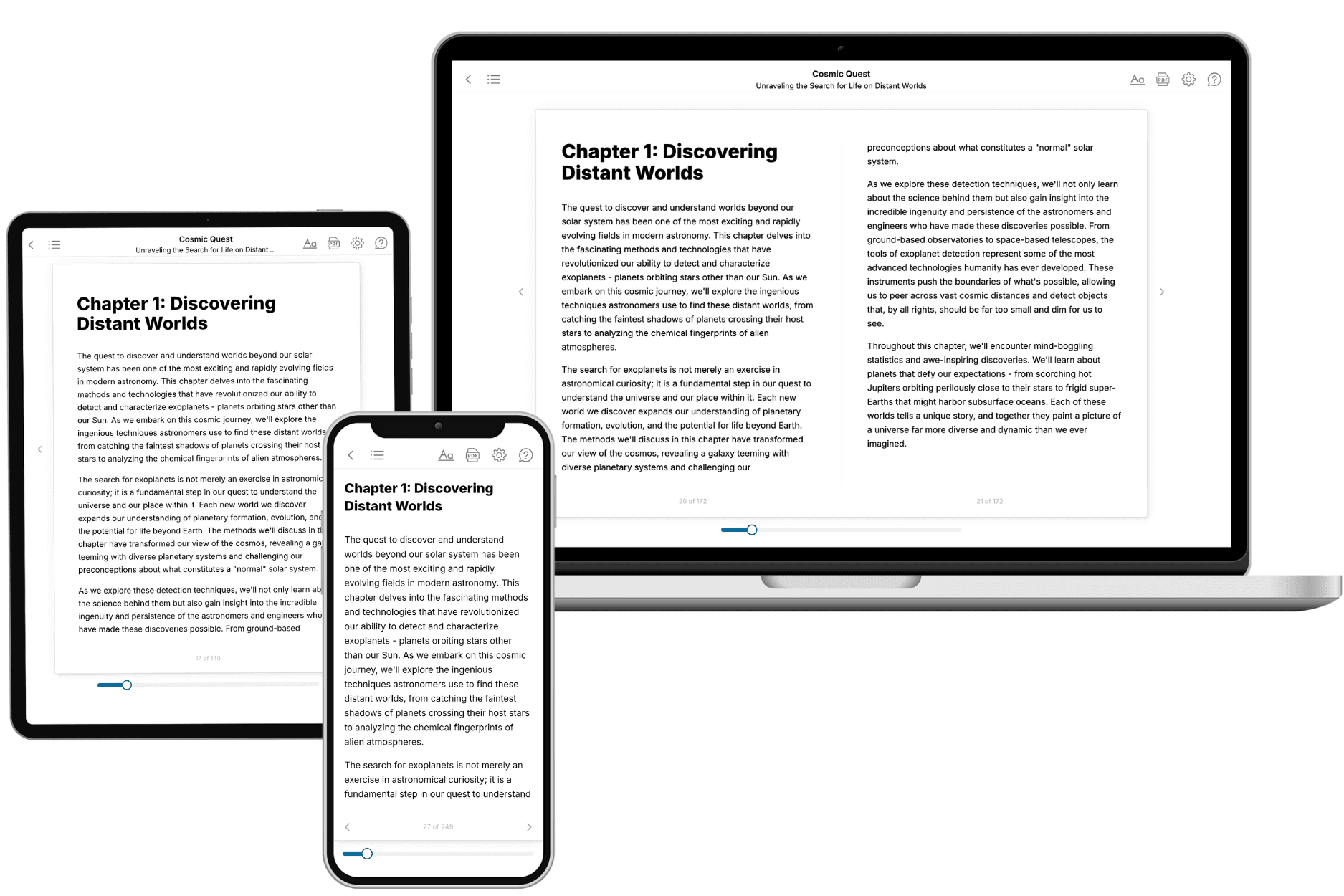
Your book is ready in 10 minutes. Read it online, download as EPUB or PDF, or send to Kindle.
Frequently asked questions
- What is TailoredRead?
TailoredRead creates complete, full-length nonfiction ebooks, written specifically for you. Tell us what you want to learn and why, and TailoredRead writes you a complete ebook on it, with charts, tables, and diagrams throughout. Read it online, on Kindle, or on any e-reader, or download it as a PDF or EPUB. Every book is written fresh the day you order it.
- How is the book tailored to me?
Before anything is written, you answer a few short questions about your goals, your background, and the topics you care about. Your book is then planned around your answers: written at your level, focused on your goals, and covering the topics you chose, instead of the one-size-fits-all book a store sells everyone.
- Will it read like generic AI content?
No. Your book isn't a chat transcript: it's planned chapter by chapter before a single word is written, told in a clear book voice, and explains ideas visually with charts, tables, and diagrams. After writing, every book goes through an editorial pass that polishes chapters so the book reads consistent from start to finish. Judge for yourself: browse thousands of sample books on our Explore Books page.
- How accurate is the content?
Our AI first checks whether your subject needs live research. Niche and fast-moving subjects are researched before writing, and the book plan and chapters are grounded in what it finds. After writing, every book goes through a quality pass that checks its facts and consistency, and researched books list their sources in a Notes section at the back.
- How long is the book?
You choose the length: Comprehensive (250-300 pages), Detailed (150-200 pages), Essential (70-100 pages), or Short (30-50 pages).
- Does the book include visuals?
Yes. Every book includes charts, tables, and diagrams: timelines, checklists, step-by-step guides, decision trees, comparison tables, matrices, and bar charts. A typical book includes dozens of these visual elements.
- Can I read it on Kindle? What formats can I download?
Yes. Every book can be read in our online reader or downloaded as a PDF or EPUB. The EPUB can be opened with Kindle, Apple Books, Kobo, and any e-reader. The Commercial and Author licenses also include an editable Word (DOCX) and Markdown download.
- How much does it cost?
About the price of a regular ebook. The exact price depends on your book's length and complexity, from $2 for the shortest books to $35 for the most comprehensive, and it's shown when you review your book, before you commit to anything. Each book is a one-time purchase, yours to keep, no subscription. Licenses that let you share, teach, or publish your book range from $35.99 to $49.99.
- Can I preview the book before purchasing?
Before you pay, you'll see what your book will cover: the title, a detailed description, the estimated length, and the complete chapter-by-chapter table of contents, so you know what you're getting before you decide. The full text itself is written after you purchase.
- How long does it take to create a book?
About 10 minutes. You can start reading the opening chapters while the rest is still being written.