The Connected World
Understanding Global Systems Through Cultural Geography and Earth Sciences
You'll gain a powerful lens for understanding how our world truly works—not as isolated countries and regions, but as an interconnected system of relationships, flows, and hierarchies that shape everything from local cultures to global patterns.
269 pages13 chaptersOct 11, 2025Geography
About this book
This comprehensive guide takes you beyond surface-level geography to explore the deep structures that organize our planet. You'll discover how historical processes created the core-periphery relationships that still influence global development today, and learn to recognize the spatial patterns that reveal hidden connections between distant places. Through clear explanations and real-world examples, you'll master the analytical tools needed to understand why certain regions prosper while others struggle, and how cultural practices spread across continents. You'll explore how physical geography intersects with human systems, examining how natural resources, climate, and location influence a region's position in the global hierarchy. The book reveals how cities function as command centers in worldwide networks, how migration creates new cultural landscapes, and how technological advances continuously reshape global relationships. By the end, you'll possess a sophisticated understanding of world systems theory that transforms how you view international news, cultural trends, and global challenges. You'll be equipped to analyze complex spatial relationships and understand the geographic forces that shape our interconnected world.
Table of contents
- IntroductionSeeing the World as a Connected System, Why Geography Still Matters in a Global Age, From Theory to Real-World Understanding, Your Path Through This BookRead below
- Chapter 1: Foundations of World Systems TheoryOrigins and Development of World Systems Theory, Key Concepts and Terminology, The Spatial Perspective in Global Analysis, Understanding Scale and Hierarchy
- Chapter 2: The Core-Periphery ModelDefining Core, Semi-Peripheral, and Peripheral Regions, Characteristics of Core Regions, Peripheral Region Dynamics, The Semi-Peripheral Role and Function, Regional Mobility and Structural Change
- Chapter 3: Historical Formation of Global SystemsPre-Modern Trade Networks and Cultural Exchange, Colonial Expansion and Spatial Reorganization, Industrial Revolution and Geographic Transformation, Emergence of the Modern World System
- Chapter 4: Spatial Relationships and Geographic PatternsDistance, Friction, and Spatial Interaction, Accessibility and Connectivity Patterns, Geographic Barriers and Boundaries, Spatial Diffusion Processes
- Chapter 5: Cultural Geography in World SystemsCulture, Space, and Place Relationships, Cultural Landscapes and Regional Identity, Language Patterns and Linguistic Geography, Religion and Sacred Spaces in Global Context, Cultural Diffusion and Globalization
- Chapter 6: Physical Environment and System PositionClimate and Regional Development Patterns, Natural Resources and Global Positioning, Topography and Regional Accessibility, Environmental Constraints and Opportunities
- Chapter 7: Urban Systems and Global CitiesUrban Hierarchy and City Systems, Global Cities and Command Centers, Urban Networks and Connectivity, Megacities and Urban Growth Patterns
- Chapter 8: Transportation and Communication NetworksEvolution of Transportation Systems, Communication Revolution and Space-Time Compression, Network Topology and Global Connectivity, Digital Divide and Information Geography
- Chapter 9: Migration and Human MobilityGlobal Migration Patterns and Flows, Push and Pull Factors in Spatial Context, Diaspora Networks and Transnational Communities, Migration Impacts on Cultural Landscapes
- Chapter 10: Globalization Processes and Spatial OutcomesDimensions of Globalization, Cultural Homogenization vs. Differentiation, Glocalization and Local Adaptation, Resistance Movements and Counter-Globalization
- Chapter 11: Regional Analysis and Case StudiesNorth America in the World System, Europe and Regional Integration, Asia-Pacific Dynamics and Growth, Africa and Development Challenges, Latin America and Dependency Relationships
- Chapter 12: Contemporary Challenges and Spatial ImplicationsClimate Change and Geographic Vulnerability, Resource Scarcity and Spatial Competition, Technological Disruption and Spatial Reorganization, Pandemic Impacts on Global Systems
- Chapter 13: Future Directions and Emerging PatternsEmerging Powers and Shifting Hierarchies, New Technologies and Spatial Transformation, Sustainability and Long-term System Viability, Alternative Models and Future Scenarios
- ConclusionKey Insights and Takeaways, Practical Applications of World Systems Thinking
- Glossary
- Further Reading
Introduction
When you look at a world map, what do you see? Most people see countries divided by borders, oceans separating continents, and cities scattered across landscapes. But there's a deeper reality hidden beneath this surface view—a complex web of relationships, flows, and hierarchies that connects every place on Earth in ways that fundamentally shape how our world operates. This hidden geography reveals itself when you understand that our planet functions as an interconnected system where distant events ripple across continents, where local cultures reflect global processes, and where geographic position determines access to opportunities and resources. The ability to see these connections transforms how you understand everything from why certain cities become global powerhouses to how cultural practices spread across the world.
The framework for understanding these global connections comes from World Systems Theory, a powerful analytical approach that reveals the underlying structure of our interconnected planet. Rather than viewing countries and regions as isolated units, this theory shows how they function as parts of a single, integrated system with distinct roles and relationships. At its core, the theory identifies how some regions serve as cores that concentrate wealth and power, others function as peripheries that provide raw materials and labor, and still others occupy semi-peripheral positions that bridge these extremes. This isn't just abstract theory—it's a practical tool that explains why Silicon Valley became a technology hub, why certain African nations remain dependent on commodity exports, and how cities like Singapore transformed from colonial outposts into global financial centers.
Geography provides the essential lens through which World Systems Theory comes alive, because spatial relationships—distance, location, connectivity, and barriers—fundamentally shape how global systems operate. The physical arrangement of places on Earth's surface influences everything from trade patterns to cultural diffusion, from migration flows to the spread of innovations. When you combine World Systems Theory with geographic analysis, you gain the ability to decode the spatial logic behind global patterns and understand why certain locations become nodes of power while others remain marginalized. This geographic perspective reveals how mountains, rivers, and coastlines influence economic development, how transportation networks create corridors of connection, and how climate and resources shape regional specialization within the global system.
Seeing the World as a Connected System
The first step toward understanding our world through a systems lens requires abandoning the mental map that divides the planet into separate, independent countries. Instead, imagine Earth as a single, integrated network where every location connects to every other location through multiple pathways of interaction. These connections take many forms—trade relationships that move goods across oceans, communication networks that transmit information instantly across continents, migration flows that carry people and cultures between regions, and investment patterns that channel capital from wealthy centers to developing areas. Each connection creates dependencies and influences that ripple throughout the entire system, making events in one location consequential for places thousands of miles away.
Consider how a smartphone in your pocket embodies these global connections. The rare earth minerals in its circuits come from mines in the Democratic Republic of Congo, the manufacturing occurs in factories across China and Southeast Asia, the software development happens in Silicon Valley and Bangalore, and the marketing strategies emerge from corporate headquarters in California and South Korea. This single device represents a complex web of relationships spanning multiple continents, involving millions of workers, and connecting regions with vastly different economic roles. The smartphone's journey from raw materials to your hands reveals the hierarchical structure of the world system, where some regions specialize in resource extraction, others in manufacturing, and still others in high-value design and innovation.
These global connections operate through what geographers call flows—the movement of people, goods, information, and capital across space. Understanding these flows reveals the invisible infrastructure that binds our world together and shapes local experiences everywhere.
- Material flows include the movement of raw materials from peripheral regions to core manufacturing centers, and the distribution of finished products back to global markets
- Information flows encompass everything from financial data transmitted through fiber optic cables to cultural content shared through social media platforms
- Human flows involve migration patterns that redistribute population and skills across regions, creating diaspora communities that maintain connections across vast distances
- Capital flows direct investment and financing from wealthy core regions toward opportunities in peripheral and semi-peripheral areas
The intensity and direction of these flows reveal the power relationships within the global system. Core regions typically generate and control the most valuable flows—advanced technology, financial services, and high-end manufactured goods—while peripheral regions primarily contribute raw materials and labor-intensive products. This creates what economists call unequal exchange, where peripheral regions must export large quantities of low-value goods to afford smaller quantities of high-value imports from core regions. For example, Ghana must export approximately 400 tons of cocoa to purchase a single tractor from Germany, illustrating how global flows can perpetuate regional inequalities even as they create connections.
Technology has dramatically intensified global connections while also creating new forms of spatial inequality. The internet enables instant communication between any two points on Earth, but access to high-speed connectivity remains concentrated in wealthy urban areas of core regions. Satellite networks can track supply chains in real-time, but the control centers for these systems cluster in a handful of global cities. Artificial intelligence can optimize global logistics, but the algorithms are developed primarily in Silicon Valley, Boston, and a few other innovation hubs. These technological advances create what geographer David Harvey calls space-time compression
—the sensation that the world is shrinking as communication and transportation become faster and more efficient[1].
Understanding the world as a connected system also means recognizing how local places reflect global processes. The gentrification of neighborhoods in major cities connects to international investment flows and global migration patterns. The decline of manufacturing towns in the American Midwest links to the rise of production centers in China and Mexico. The growth of call centers in India relates to the digitization of services in North America and Europe. These local changes aren't isolated phenomena—they're manifestations of broader systemic shifts that redistribute economic activities across the global landscape. By learning to see these connections, you develop the ability to understand how global forces shape local experiences and how local actions can have far-reaching consequences.
The COVID-19 pandemic provided a dramatic illustration of global interconnectedness, as a virus that emerged in one Chinese city rapidly spread along the pathways of global connection to affect every corner of the planet. The pandemic revealed both the benefits and vulnerabilities of our interconnected world—while global supply chains normally provide efficiency and specialization, they also created cascading disruptions when key nodes shut down. The crisis demonstrated how events in one location can quickly become global phenomena, and how understanding systemic connections is essential for anticipating and managing such challenges. This experience highlighted the importance of thinking systemically about global relationships rather than focusing only on local or national perspectives.
Developing a systems perspective requires practice in recognizing patterns across different scales and contexts. Start by tracing the origins of everyday objects in your environment—your clothing, food, electronics, and furniture likely represent global supply chains that span multiple continents. Notice how local businesses in your area connect to broader networks—the coffee shop that sources beans from Ethiopia, the restaurant that serves fusion cuisine reflecting global migration patterns, or the tech startup that outsources programming to Eastern Europe. Pay attention to how global events affect local conditions—how international oil prices influence transportation costs, how currency fluctuations affect the price of imported goods, or how global climate patterns influence local weather and agriculture.
Why Geography Still Matters in a Global Age
In an era of instant global communication and rapid transportation, some observers have proclaimed the death of distance
and suggested that geography no longer matters for human activities. This perspective argues that digital technologies have created a flat world where location provides no particular advantage, and where businesses and individuals can operate effectively from anywhere on the planet. However, this view fundamentally misunderstands how space and place continue to shape global systems in profound ways. While technology has certainly reduced some geographic constraints, it has simultaneously created new forms of spatial differentiation and reinforced the importance of strategic locations within global networks.
Geographic location continues to matter because it determines access to resources, markets, and transportation networks that remain essential for economic activity. Silicon Valley didn't become the world's leading technology hub by accident—its success reflects a unique combination of geographic advantages including proximity to major universities, access to venture capital, mild climate that attracts talent, and location on the Pacific Rim that facilitates connections to Asian markets. Similarly, Singapore's rise as a global financial center builds on its strategic position at the intersection of major shipping routes between Europe, Asia, and Australia. These examples demonstrate how locational advantages continue to create competitive benefits even in our highly connected world.
The persistence of geographic clustering reveals another way that space continues to matter in global systems. Rather than dispersing evenly across the planet, economic activities tend to concentrate in specific locations that offer particular advantages.
- Innovation clusters like Silicon Valley, Boston's Route 128, and London's Tech City concentrate research and development activities
- Financial centers such as New York, London, Tokyo, and Hong Kong dominate global capital flows
- Manufacturing hubs including the Pearl River Delta in China and the Bajío region in Mexico specialize in production for global markets
- Resource extraction zones like the Alberta oil sands and the Atacama Desert lithium fields provide essential raw materials
Physical geography continues to shape global systems through its influence on transportation costs, natural hazards, and resource availability. The Suez Canal handles approximately 12% of global trade because it provides the shortest maritime route between Europe and Asia, demonstrating how geographic features create strategic chokepoints in global networks[2]. Mountain ranges like the Himalayas and the Andes continue to create barriers that influence trade patterns and cultural diffusion. Climate zones determine agricultural specialization, with tropical regions producing coffee and cocoa while temperate areas focus on grains and livestock. These physical realities create the geographic foundation upon which human systems develop and operate.
The digital revolution has created new forms of geographic inequality rather than eliminating spatial differences. While information can travel instantly across fiber optic networks, the infrastructure supporting these networks concentrates in wealthy urban areas of core regions. The global internet relies on undersea cables that connect major cities, creating a hierarchy of connectivity where some locations enjoy high-speed access while others remain digitally isolated. Data centers that power cloud computing cluster in areas with cheap electricity, cool climates, and political stability—primarily in the northern United States, Scandinavia, and other core regions. This digital infrastructure creates new forms of digital divides that reinforce existing geographic inequalities.
Climate change is making geography more important, not less, as rising sea levels, changing precipitation patterns, and extreme weather events create new spatial vulnerabilities and opportunities. Coastal cities face increasing risks from storm surge and flooding, potentially triggering massive population movements toward higher ground. Changing agricultural zones may shift food production toward higher latitudes, altering global trade patterns and regional specializations. Arctic ice melting opens new shipping routes and resource extraction opportunities, potentially reshuffling global transportation networks. These climate impacts demonstrate how physical geography continues to shape human systems and create new forms of spatial differentiation.
Cultural geography also persists in our globalized world, as local cultures adapt global influences in distinctive ways rather than simply adopting uniform practices. McDonald's serves rice burgers in Taiwan, vegetarian options in India, and wine in France, reflecting how global brands must adapt to local cultural preferences. Hip-hop music has evolved differently in different places, creating distinctive regional styles in locations from São Paulo to Seoul. These examples illustrate how glocalization—the interaction between global and local forces—creates new forms of spatial diversity rather than homogenization.
Understanding why geography still matters requires recognizing that globalization doesn't eliminate spatial differences—it reorganizes them in new ways. Some locations become more important as they serve as nodes in global networks, while others become marginalized as economic activities concentrate elsewhere. The key insight is that global integration creates new forms of spatial hierarchy rather than spatial equality. Places that can successfully connect to global networks and offer unique advantages thrive, while those that lack connectivity or distinctive assets struggle. This dynamic makes geographic analysis more important than ever for understanding how global systems operate and evolve.
The practical implications of geography's continued importance are significant for individuals, businesses, and governments. Career opportunities remain concentrated in specific metropolitan areas that serve as nodes in global networks. Companies must carefully consider location decisions for different types of activities—research and development in innovation clusters, manufacturing in low-cost production zones, and headquarters in global cities with access to capital and talent. Governments compete to attract investment by developing infrastructure, education systems, and regulatory environments that provide locational advantages. These realities demonstrate that while technology has changed how geography matters, it hasn't eliminated the importance of place in our interconnected world.
From Theory to Real-World Understanding
World Systems Theory provides a powerful framework for understanding global patterns, but its true value emerges when you learn to apply its concepts to analyze real-world situations and contemporary challenges. The theory offers a set of analytical tools that help you decode complex global relationships and understand why certain patterns persist across different regions and time periods. Rather than memorizing abstract concepts, the goal is to develop practical skills in systems thinking that you can use to interpret news events, business trends, cultural phenomena, and policy debates. This application-oriented approach transforms theoretical knowledge into actionable understanding that enhances your ability to navigate and comprehend our interconnected world.
The core-periphery model serves as a diagnostic tool for analyzing regional development patterns and understanding why some areas prosper while others struggle. When examining any region, you can assess its position within the global system by analyzing several key indicators:
- Economic structure—Does the region specialize in high-value services and manufacturing, or does it primarily export raw materials and agricultural products?
- Technological capacity—Does the region generate innovations and advanced technologies, or does it primarily adopt technologies developed elsewhere?
- Financial flows—Does the region attract investment and serve as a source of capital, or does it depend on external financing?
- Educational systems—Does the region produce highly skilled workers and conduct advanced research, or does it experience brain drain to other areas?
Consider how this analytical framework illuminates the contrasting development paths of South Korea and Nigeria since the 1960s. Both countries started with similar per capita incomes, but South Korea successfully transitioned from peripheral to core status while Nigeria remained largely peripheral despite its oil wealth. South Korea invested heavily in education and technology, developed advanced manufacturing capabilities, and created globally competitive companies like Samsung and Hyundai. Nigeria, despite its natural resource advantages, remained dependent on oil exports and failed to develop diversified economic capabilities. This comparison demonstrates how systemic position results from policy choices and institutional development, not just natural endowments.
World Systems Theory also provides insights into urban development patterns and the rise of global cities. Cities that successfully position themselves as nodes in global networks—through financial services, transportation hubs, or innovation clusters—tend to attract investment and talent from around the world. Dubai transformed from a small trading port into a global city by developing world-class airport infrastructure, creating business-friendly regulations, and positioning itself as a gateway between Europe, Asia, and Africa. The city's success illustrates how strategic positioning within global networks can overcome traditional geographic disadvantages and create new forms of locational advantage.
The theory helps explain cultural phenomena and the global spread of ideas, practices, and products. The worldwide popularity of Korean pop culture (K-pop) reflects South Korea's rise within the global system and its investment in cultural industries as a form of soft power. Korean entertainment companies studied successful models from Japan and the United States, then created content designed for global audiences while maintaining distinctive Korean characteristics. The global success of K-pop demonstrates how semi-peripheral regions can use cultural production to enhance their position within world systems and project influence beyond their traditional spheres.
Migration patterns become more comprehensible when viewed through a world systems lens, as people typically move along established pathways that connect peripheral and core regions. Mexican migration to the United States follows historical patterns established through economic integration, family networks, and transportation connections. Similarly, migration from former colonies to European metropoles—such as Algerians to France or Indians to Britain—reflects colonial-era connections that continue to shape contemporary mobility patterns. Understanding these systemic relationships helps explain why migration flows follow predictable routes rather than dispersing randomly across potential destinations.
The framework proves particularly valuable for analyzing contemporary challenges like supply chain disruptions, trade wars, and technological competition. The COVID-19 pandemic revealed the vulnerabilities created by global supply chains that concentrate production in specific regions—particularly China's role as the world's factory
for manufactured goods. When Chinese factories shut down, companies worldwide faced shortages of components and finished products, demonstrating the risks of excessive dependence on single production centers. This experience has prompted many companies to diversify their supply chains and reduce concentration risks, illustrating how systemic vulnerabilities can drive structural changes.
Climate change presents another area where World Systems Theory offers analytical insights. The regions most vulnerable to climate impacts—small island states, sub-Saharan Africa, and parts of South Asia—tend to be peripheral areas with limited adaptive capacity. Meanwhile, core regions have greater resources to invest in climate adaptation and mitigation technologies. This pattern creates what some scholars call climate colonialism, where peripheral regions bear disproportionate climate risks while core regions maintain greater resilience. Understanding these systemic inequalities is essential for developing effective climate policies and international cooperation mechanisms.
Developing practical skills in world systems analysis requires regular practice in applying theoretical concepts to current events and local situations. Start by analyzing news stories through a systems lens—when reading about trade disputes, ask which regions benefit and which face disadvantages. When learning about new technologies, consider where they're developed, manufactured, and deployed. When observing cultural trends, trace their origins and pathways of diffusion. This analytical practice develops your ability to see beyond surface events to understand underlying systemic patterns and relationships.
The ultimate goal is to develop what geographers call spatial thinking—the ability to understand how location, distance, and spatial relationships influence social, economic, and cultural processes. This skill proves valuable in many contexts, from business strategy and policy analysis to personal decision-making about education, career, and residence. By learning to think systemically about global relationships, you gain tools for understanding complexity, anticipating change, and identifying opportunities in our interconnected world. This analytical capability becomes increasingly important as global integration continues to reshape local conditions and create new forms of spatial interdependence.
Your Path Through This Book
This book is designed to take you on a systematic journey from foundational concepts to advanced applications, building your understanding progressively while providing practical tools for analyzing global systems. Each chapter builds upon previous material while introducing new concepts and analytical frameworks that deepen your comprehension of world systems theory and its geographic applications. The structure follows a logical progression that moves from theoretical foundations through historical development to contemporary applications and future challenges. By the end of this journey, you'll possess a comprehensive toolkit for understanding global patterns and relationships that you can apply to diverse situations and contexts.
The early chapters establish the conceptual foundation you need to understand world systems theory and its geographic dimensions. Chapter 1 introduces the origins and key concepts of world systems theory, explaining how scholars like Immanuel Wallerstein developed this framework to understand global capitalism and regional development patterns. You'll learn the essential vocabulary and analytical tools that appear throughout the rest of the book. Chapter 2 explores the core-periphery model in detail, showing how regions occupy different positions within the global hierarchy and how these positions influence development opportunities and constraints. These foundational chapters provide the theoretical framework that guides analysis in subsequent sections.
The middle chapters examine how world systems developed historically and how they operate spatially. Chapter 3 traces the historical formation of global systems from pre-modern trade networks through colonial expansion to the emergence of the modern world economy. This historical perspective helps you understand how contemporary patterns reflect centuries of systemic development and structural change. Chapters 4 and 5 focus on spatial relationships and cultural geography, showing how distance, connectivity, and place-based factors influence global systems. These chapters demonstrate how geographic concepts like spatial interaction, diffusion, and cultural landscapes provide essential tools for understanding world systems operations.
Subsequent chapters explore specific dimensions of world systems, including physical environment, urban systems, transportation networks, and migration patterns. Each chapter combines theoretical concepts with concrete examples and case studies that illustrate how systemic processes operate in practice.
- Chapter 6 examines how physical geography influences regional positions within world systems
- Chapter 7 analyzes urban hierarchies and the role of global cities as command centers
- Chapter 8 explores transportation and communication networks that enable global connectivity
- Chapter 9 investigates migration patterns and their impacts on cultural landscapes
The later chapters address contemporary challenges and future directions, helping you apply world systems thinking to current issues and emerging trends. Chapter 10 examines globalization processes and their spatial outcomes, including both homogenizing forces and local resistance movements. Chapter 11 provides regional case studies that demonstrate how different parts of the world occupy distinct positions within global systems. Chapter 12 analyzes contemporary challenges like climate change, resource scarcity, and technological disruption through a world systems lens. Chapter 13 explores future directions and emerging patterns that may reshape global systems in coming decades.
Throughout the book, you'll encounter several types of learning tools designed to enhance your understanding and analytical skills. Case studies provide detailed examples of how world systems concepts apply to specific regions, cities, or phenomena. Analytical frameworks offer step-by-step approaches for examining global patterns and relationships. Maps and diagrams visualize spatial relationships and help you understand geographic patterns. Discussion questions encourage you to apply concepts to new situations and think critically about global issues. These tools work together to develop both your theoretical understanding and practical analytical capabilities.
Each chapter includes practical exercises that help you apply world systems concepts to real-world situations. These might involve analyzing trade data to identify core-periphery relationships, mapping global supply chains to understand spatial dependencies, or examining migration patterns to trace historical connections between regions. The exercises are designed to develop your skills in spatial analysis, data interpretation, and systems thinking. By working through these applications, you'll gain confidence in using world systems theory as an analytical tool rather than just memorizing abstract concepts.
The book emphasizes connections between different scales of analysis, from local places to global systems. You'll learn to recognize how global processes manifest in local contexts and how local actions can have far-reaching consequences. This multi-scalar perspective is essential for understanding world systems, which operate simultaneously at multiple geographic scales. For example, the gentrification of a neighborhood in Brooklyn connects to global investment flows, international migration patterns, and the position of New York City within global urban hierarchies. Learning to see these cross-scalar connections is a key skill that the book develops systematically.
As you progress through the book, pay attention to recurring themes and patterns that appear across different chapters and contexts. The persistence of core-periphery relationships, the importance of connectivity and accessibility, the role of historical processes in shaping contemporary patterns, and the ongoing significance of place-based factors are themes that appear repeatedly in different forms. Recognizing these patterns helps you develop a deeper understanding of how world systems operate and provides a foundation for analyzing new situations and challenges.
The ultimate goal is to develop your capacity for independent analysis and critical thinking about global issues. By the end of the book, you should be able to examine any region, city, or global phenomenon and understand its position within world systems, trace its connections to other places, and analyze the forces shaping its development. This analytical capability will serve you well whether you're studying international relations, planning a business strategy, evaluating policy proposals, or simply trying to understand the complex world around you. The journey through this book provides the knowledge and tools you need to become a sophisticated analyst of global systems and spatial relationships.
This is the end of the free sample. The full book has 13 chapters.
Want this book written for you?
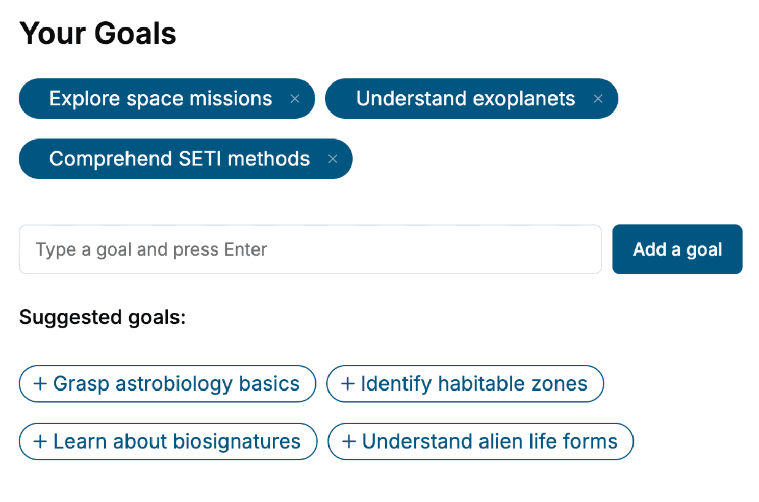
Tell us your goals and background, and get your own version of this book, tailored by AI to you.


Benefits of AI-tailored books
- Read one book, not ten:
- all the Geography knowledge you need, gathered into a single book.
- Save days of learning:
- tell us your goals, choose your topics, and the whole book is built around them.
- Learn effortlessly:
- Geography book written for your specific background and expertise.
- Understand at a glance:
- includes charts, tables, timelines, checklists, decision trees, and more.
- Stay current:
- written the day you order it, not years ago.
- Trust what you read:
- every book is checked for accuracy, with real research when your subject needs it.
Create your unique book in 3 steps
- 1. Select your focus
Select the focus of your Geography book and share your background
- 2. Personalize your book
Specify your goals and choose sub-topics to include
- 3. Get your tailored book
Your book is ready in 10 minutes. Read it online, download as EPUB or PDF, or send to Kindle.

Frequently asked questions
- What is TailoredRead?
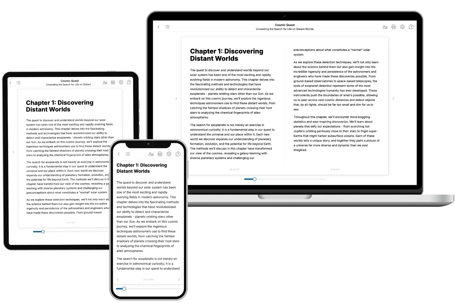
TailoredRead creates complete, full-length nonfiction ebooks, written specifically for you. Tell us what you want to learn and why, and TailoredRead writes you a complete ebook on it, with charts, tables, and diagrams throughout. Read it online, on Kindle, or on any e-reader, or download it as a PDF or EPUB. Every book is written fresh the day you order it.
- How is the book tailored to me?
Before anything is written, you answer a few short questions about your goals, your background, and the topics you care about. Your book is then planned around your answers: written at your level, focused on your goals, and covering the topics you chose, instead of the one-size-fits-all book a store sells everyone.
- Will it read like generic AI content?
No. Your book isn't a chat transcript: it's planned chapter by chapter before a single word is written, told in a clear book voice, and explains ideas visually with charts, tables, and diagrams. After writing, every book goes through an editorial pass that polishes chapters so the book reads consistent from start to finish. Judge for yourself: browse thousands of sample books on our Explore Books page.
- How accurate is the content?
Our AI first checks whether your subject needs live research. Niche and fast-moving subjects are researched before writing, and the book plan and chapters are grounded in what it finds. After writing, every book goes through a quality pass that checks its facts and consistency, and researched books list their sources in a Notes section at the back.
- How long is the book?
You choose the length: Comprehensive (250-300 pages), Detailed (150-200 pages), Essential (70-100 pages), or Short (30-50 pages).
- Does the book include visuals?
Yes. Every book includes charts, tables, and diagrams: timelines, checklists, step-by-step guides, decision trees, comparison tables, matrices, and bar charts. A typical book includes dozens of these visual elements.
- Can I read it on Kindle? What formats can I download?
Yes. Every book can be read in our online reader or downloaded as a PDF or EPUB. The EPUB can be opened with Kindle, Apple Books, Kobo, and any e-reader. The Commercial and Author licenses also include an editable Word (DOCX) and Markdown download.
- How much does it cost?
About the price of a regular ebook. The exact price depends on your book's length and complexity, from $2 for the shortest books to $35 for the most comprehensive, and it's shown when you review your book, before you commit to anything. Each book is a one-time purchase, yours to keep, no subscription. Licenses that let you share, teach, or publish your book range from $35.99 to $49.99.
- Can I preview the book before purchasing?
Before you pay, you'll see what your book will cover: the title, a detailed description, the estimated length, and the complete chapter-by-chapter table of contents, so you know what you're getting before you decide. The full text itself is written after you purchase.
- How long does it take to create a book?
About 10 minutes. You can start reading the opening chapters while the rest is still being written.